|
Kote Sangi
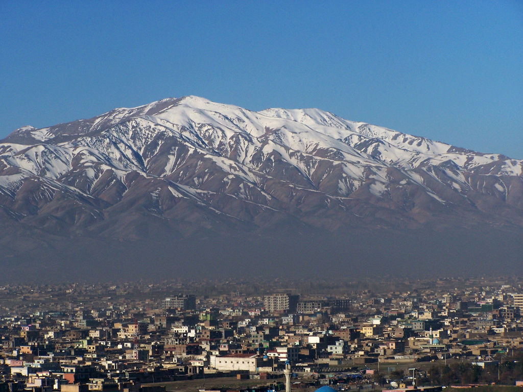
Kote Sangi ( prs, کوته سنگی) is a neighborhood and major intersection in western Kabul, Afghanistan, part of District 5. It is one of the city's most populated urban areas, located south of the Silo Road and west of Deh Bori and Kabul University. The roads link it to Afshar, Darulaman, Paghman and downtown Kabul. To the south-west are shanty areas nearby Dashte Barchi. In 2011 the country's first skyway A skyway, skybridge, skywalk, or sky walkway is an elevated type of pedway connecting two or more buildings in an urban area, or connecting elevated points within mountainous recreational zones. Urban skyways very often take the form of enclo ..., Kote Sangi Bridge, was built there which is 650 m long and 14 m high.http://www.afghanzariza.com/2014/11/04/kote-sangi-bridge-a-prime-example-of-mismanagement-and-corruption Its location is centered on Mirwais Maidan. See also * Neighborhoods of Kabul * Mirwais Maidan References Neighborhoods of Kabul ... [...More Info...] [...Related Items...] OR: [Wikipedia] [Google] [Baidu] |
Neighborhoods Of Kabul
A neighbourhood (British English, Irish English, Australian English and Canadian English) or neighborhood (American English; see spelling differences) is a geographically localised community within a larger city, town, suburb or rural area, sometimes consisting of a single street and the buildings lining it. Neighbourhoods are often social communities with considerable face-to-face interaction among members. Researchers have not agreed on an exact definition, but the following may serve as a starting point: "Neighbourhood is generally defined spatially as a specific geographic area and functionally as a set of social networks. Neighbourhoods, then, are the spatial units in which face-to-face social interactions occur—the personal settings and situations where residents seek to realise common values, socialise youth, and maintain effective social control." Preindustrial cities In the words of the urban scholar Lewis Mumford, "Neighbourhoods, in some annoying, inchoate ... [...More Info...] [...Related Items...] OR: [Wikipedia] [Google] [Baidu] |
Provinces Of Afghanistan
Afghanistan is divided into 34 provinces (, '' wilåyat''). The provinces of Afghanistan are the primary administrative divisions. Each province encompasses a number of districts or usually over 1,000 villages. Provincial governors played a critical role in the reconstruction of the Afghan state following the creation of the new government under Hamid Karzai. According to international security scholar Dipali Mukhopadhyay, many of the provincial governors of the western-backed government were former warlords who were incorporated into the political system. Provinces of Afghanistan Regions of Afghanistan UN Regions Former provinces of Afghanistan During Afghanistan's history it had a number of provinces in it. It started out as just Kabul, Herat, Qandahar, and Balkh but the number of provinces increased and by 1880 the provinces consisted of Balkh, Herat, Qandahar, Ghazni, Jalalabad, and Kabul. * Southern Province – dissolved in 1964 to create Paktia Prov ... [...More Info...] [...Related Items...] OR: [Wikipedia] [Google] [Baidu] |
Kabul Province
Kabul (Persian: ), situated in the east of the country, is one of the thirty-four provinces of Afghanistan. The capital of the province is Kabul city, which is also Afghanistan's capital and largest city. The population of the Kabul Province is over 5 million people as of 2020, of which over 85 percent live in urban areas. The current governor of the province is Qari Baryal. It borders the provinces of Parwan to the north, Kapisa to the north-east, Laghman to the east, Nangarhar to the south-east, Logar to the south, and Wardak to the west. Geography Kabul is located between Latitude 34-31' North and Longitude 69-12' East at an altitude of 1800 m (6000 feet) above sea level, which makes it one of the world's highest capital cities. Kabul is strategically situated in a valley surrounded by high mountains at crossroads of north-south and east-west trade routes. One million years ago the Kabul region was surrounded from south-east between Lowgar and Paghman Mountains ... [...More Info...] [...Related Items...] OR: [Wikipedia] [Google] [Baidu] |
Kabul
Kabul (; ps, , ; , ) is the capital and largest city of Afghanistan. Located in the eastern half of the country, it is also a municipality, forming part of the Kabul Province; it is administratively divided into 22 municipal districts. According to late 2022 estimates, the population of Kabul was 13.5 million people. In contemporary times, the city has served as Afghanistan's political, cultural, and economical centre, and rapid urbanisation has made Kabul the 75th-largest city in the world and the country's primate city. The modern-day city of Kabul is located high up in a narrow valley between the Hindu Kush, and is bounded by the Kabul River. At an elevation of , it is one of the highest capital cities in the world. Kabul is said to be over 3,500 years old, mentioned since at least the time of the Achaemenid Persian Empire. Located at a crossroads in Asia—roughly halfway between Istanbul, Turkey, in the west and Hanoi, Vietnam, in the east—it is situated in a stra ... [...More Info...] [...Related Items...] OR: [Wikipedia] [Google] [Baidu] |
Afghanistan
Afghanistan, officially the Islamic Emirate of Afghanistan,; prs, امارت اسلامی افغانستان is a landlocked country located at the crossroads of Central Asia and South Asia. Referred to as the Heart of Asia, it is bordered by Pakistan to the east and south, Iran to the west, Turkmenistan to the northwest, Uzbekistan to the north, Tajikistan to the northeast, and China to the northeast and east. Occupying of land, the country is predominantly mountainous with plains in the north and the southwest, which are separated by the Hindu Kush mountain range. , its population is 40.2 million (officially estimated to be 32.9 million), composed mostly of ethnic Pashtuns, Tajiks, Hazaras, and Uzbeks. Kabul is the country's largest city and serves as its capital. Human habitation in Afghanistan dates back to the Middle Paleolithic era, and the country's strategic location along the historic Silk Road has led it to being described, picturesquely, as the ‘rounda ... [...More Info...] [...Related Items...] OR: [Wikipedia] [Google] [Baidu] |
Silo
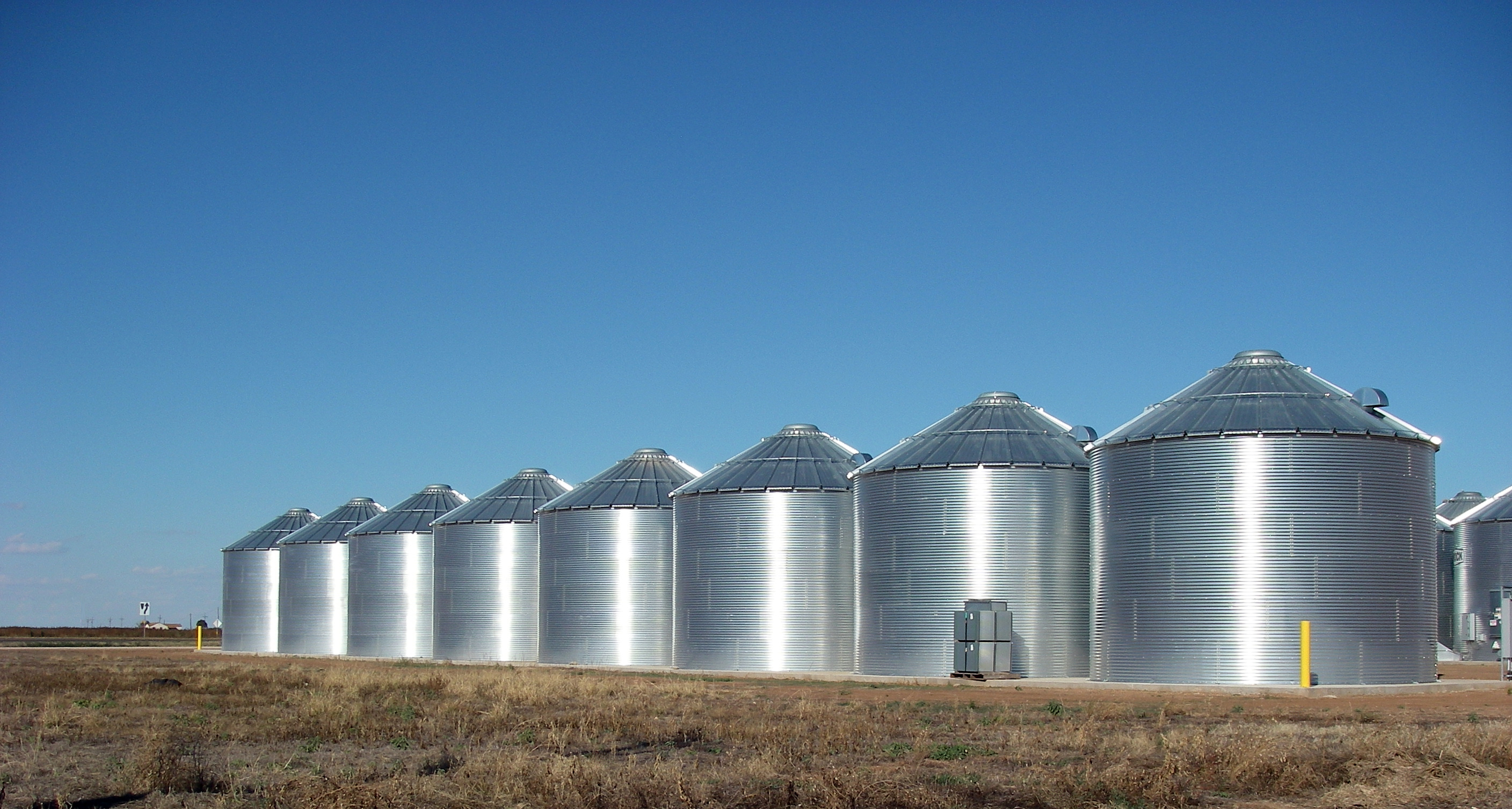
A silo (from the Greek σιρός – ''siros'', "pit for holding grain") is a structure for storing bulk materials. Silos are used in agriculture to store fermented feed known as silage, not to be confused with a grain bin, which is used to store grains. Silos are commonly used for bulk storage of grain, coal, cement, carbon black, woodchips, food products and sawdust. Three types of silos are in widespread use today: tower silos, bunker silos, and bag silos. Types of silos Tower silo Storage silos are cylindrical structures, typically 10 to 90 ft (3 to 27 m) in diameter and 30 to 275 ft (10 to 90 m) in height with the slipform and Jumpform concrete silos being the larger diameter and taller silos. They can be made of many materials. Wood staves, concrete staves, cast concrete, and steel panels have all been used, and have varying cost, durability, and airtightness tradeoffs. Silos storing grain, cement and woodchips are typically unloaded wit ... [...More Info...] [...Related Items...] OR: [Wikipedia] [Google] [Baidu] |
Deh Bori
Deh or DEH may refer to: *Deh (Pakistan), a type of administrative unit of Pakistan *Deh, India, a village in Nagaur, Rajasthan, India * Deh, Cambodia, a village in Bar Kham, Cambodia *''Dear Evan Hansen'', a 2015/2016 Broadway musical by Pasek and Paul ** ''Dear Evan Hansen'' (film), a 2021 film adaptation of the musical *Decorah Municipal Airport (IATA and FAA code: DEH), an airport near Decorah, in Winneshiek County, Iowa, U.S. *deh, the ISO 639-3 code of the Dehwari language Dehwari (, Dehwārī) is a southwestern Persian language spoken by c. 14,000 Dehwar people in Balochistan, Pakistan. Most of the Dehwari speakers are concentrated in Mastung, Khuzdar, Nushk, Kharan, Sarlath District, Dalbandin, and Kalat. I ... See also * {{Disambiguation, geo ... [...More Info...] [...Related Items...] OR: [Wikipedia] [Google] [Baidu] |
Kabul University
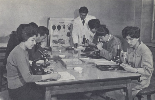
Kabul University (KU; prs, دانشگاه کابل, translit= Dāneshgāh-e-Kābul; ps, د کابل پوهنتون, translit=Da Kābul Pohantūn) is one of the major and oldest institutions of higher education in Afghanistan. It is in the 3rd District of the capital Kabul, near the Ministry of Higher Education (Afghanistan), Ministry of Higher Education. It was founded in 1931 by Mohammed Nadir Shah, King Mohammed Nadir Shah, whose Prime Minister of Afghanistan, prime minister at the time was his younger brother, ''Sardar'' Mohammad Hashim Khan. Approximately 22,000 students attend Kabul University. In August 2021, before the 2021 Taliban offensive, Taliban takeover, nearly half were female. The university reopened in February 2022, with classes separated by sex but relatively few changes to the curriculum. History Early history Kabul University was established in 1932 during the reign of Mohammed Nadir Shah , King Mohammed Nadir Shah and during the government of Prime M ... [...More Info...] [...Related Items...] OR: [Wikipedia] [Google] [Baidu] |
Afshar District
Afshar District ( fa, بخش افشار) is a district (bakhsh) in Khodabandeh County, Zanjan Province, Iran. At the 2006 census, its population was 16,304, in 3,545 families. The District has one city: Garmab. The District has two rural districts (''dehestan''): Qeshlaqat-e Afshar Rural District and Shivanat Rural District. The majority population is Azeri followed by Persians The Persians are an Iranian ethnic group who comprise over half of the population of Iran. They share a common cultural system and are native speakers of the Persian language as well as of the languages that are closely related to Persian. .... References Districts of Zanjan Province Khodabandeh County {{Khodabandeh-geo-stub ... [...More Info...] [...Related Items...] OR: [Wikipedia] [Google] [Baidu] |
Darulaman
Darulaman ( fa, دارالامان) is a locality in the south-western fringes of Kabul, Afghanistan, forming part of District 6. The suburb was a planned city built in the 1920s under King Amanullah Khan. Amanullah Khan sought to turn Darulaman into a new modern capital city, and hired German companies and engineers to build roads, bridges and other infrastructure. The area is connected to Kabul some 16 km away via Darulaman Road, a long straight boulevard, which has been described by one analyst as "perhaps the most exquisite street of the capital Kabul". A narrow-gauge railway, the Kabul-Darulaman Tramway, was also built and operated through this boulevard. Numerous buildings and palaces were built there, including the Darul Aman Palace, National Museum of Afghanistan, and Tajbeg Palace. However, in 1929, Amanullah Khan abdicated after Habibullah Kalakani took over authority. As a result, his planned city was never fully completed and it never became a capital city. In su ... [...More Info...] [...Related Items...] OR: [Wikipedia] [Google] [Baidu] |
Paghman
Paghman (Persian/Pashto: پغمان) is a town in the hills near Afghanistan's capital of Kabul. It is the seat of the Paghman District (in the western part of Kabul Province) which has a population of about 120,000 (2002 official UNHCR est.), mainly Tajiks and Pashtuns. The gardens of Paghman is a major tourist attraction, and is why the city is also known as the garden capital of Afghanistan. History 20th century After King Amanullah Khan and Queen Soraya Tarzi's return from Europe in 1928, Amanullah brought in foreign experts to redesign Kabul. At that time, at the entrance of Paghman, they created a European-style monumental gate similar to but smaller than the Arc de Triomphe in Paris, France, called the Taq-e Zafar ( fa, طاق ظفر ''Arch of Victory''). Originally a small village at the bottom of the Hindu Kush, Paghman turned into a holiday retreat with villas and chalets as well as the summer capital. Its wide avenues contained fir, poplar and nut trees which flew ... [...More Info...] [...Related Items...] OR: [Wikipedia] [Google] [Baidu] |
Downtown
''Downtown'' is a term primarily used in North America by English speakers to refer to a city's sometimes commercial, cultural and often the historical, political and geographic heart. It is often synonymous with its central business district (CBD). Downtowns typically contain a small percentage of a city’s employment. In some metropolitan areas it is marked by a cluster of tall buildings, cultural institutions and the convergence of rail transit and bus lines. In British English, the term "city centre" is most often used instead. History Origins The Oxford English Dictionary's first citation for "down town" or "downtown" dates to 1770, in reference to the center of Boston. Some have posited that the term "downtown" was coined in New York City, where it was in use by the 1830s to refer to the original town at the southern tip of the island of Manhattan.Fogelson, p. 10. As the town of New York grew into a city, the only direction it could grow on the island was toward the nor ... [...More Info...] [...Related Items...] OR: [Wikipedia] [Google] [Baidu] |


