|
Kroppach Switzerland
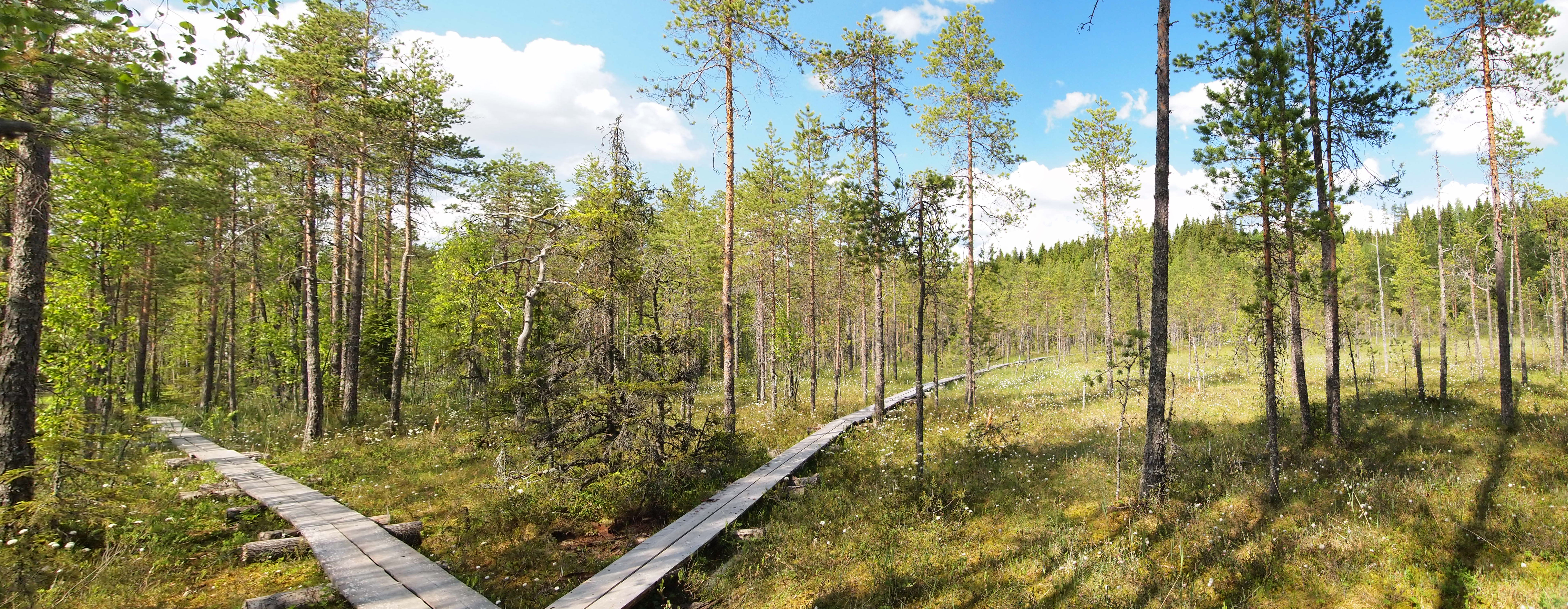
Kroppach Switzerland (german: Kroppacher Schweiz) is a region in the collective municipalities of Verbandsgemeinde Hachenburg, Hachenburg, Altenkirchen-Flammersfeld and Verbandsgemeinde Wissen, Wissen in the Rhineland-Palatinate part of the Westerwald. It lies on the lower courses of the Nister (Sieg), Nister and takes the first part of its name from the village of Kroppach, which is located above the Nister valley, and the second part thanks to its characteristic rock faces. Kroppach Switzerland is part of the natural region of the Nister Upland (''Nisterbergland'') and thus the Mittelsieg Uplands.Landschaftssteckbrief "Nisterbergland" Umweltministerium RP Villages The village of Astert, Limbach (Westerwald), Limbach, Heuzert, Heimborn, Stein-Winge ...[...More Info...] [...Related Items...] OR: [Wikipedia] [Google] [Baidu] |
Nistertal 006
Nistertal is an ''Ortsgemeinde'' – a community belonging to a ''Verbandsgemeinde'' – in the Westerwaldkreis in Rhineland-Palatinate, Germany. Geography Location The community lies in the Westerwald between Limburg an der Lahn, Limburg and Siegen. Nistertal belongs to the Bad Marienberg (Verbandsgemeinde), ''Verbandsgemeinde'' of Bad Marienberg, a kind of collective municipality. Its seat is in the Bad Marienberg, like-named town. Constituent communities Nistertal's ''Ortsteile'' are Büdingen and Erbach. History In 1274, Büdingen had its first documentary mention. Erbach's first documentary mention followed in 1353. Amalgamations The community of Nistertal came into being in 1969 in the course of administrative reform through the merger of the communities of Büdingen and Erbach. For centuries before this, the Große Nister, flowing between the two places, marked not only a political boundary, but a dialectal and religious one, too. Politics Municipal council The municipa ... [...More Info...] [...Related Items...] OR: [Wikipedia] [Google] [Baidu] |
Helmeroth
Helmeroth is a municipality in the district of Altenkirchen, in Rhineland-Palatinate, in western Germany Germany,, officially the Federal Republic of Germany, is a country in Central Europe. It is the second most populous country in Europe after Russia, and the most populous member state of the European Union. Germany is situated betwe .... References Altenkirchen (district) Kroppach Switzerland {{Altenkirchen-geo-stub ... [...More Info...] [...Related Items...] OR: [Wikipedia] [Google] [Baidu] |
Regions Of The Westerwald
In geography, regions, otherwise referred to as zones, lands or territories, are areas that are broadly divided by physical characteristics (physical geography), human impact characteristics (human geography), and the interaction of humanity and the environment (environmental geography). Geographic regions and sub-regions are mostly described by their imprecisely defined, and sometimes transitory boundaries, except in human geography, where jurisdiction areas such as national borders are defined in law. Apart from the global continental regions, there are also hydrospheric and atmospheric regions that cover the oceans, and discrete climates above the land and water masses of the planet. The land and water global regions are divided into subregions geographically bounded by large geological features that influence large-scale ecologies, such as plains and features. As a way of describing spatial areas, the concept of regions is important and widely used among the many branches of ... [...More Info...] [...Related Items...] OR: [Wikipedia] [Google] [Baidu] |
Kroppach Switzerland
Kroppach Switzerland (german: Kroppacher Schweiz) is a region in the collective municipalities of Verbandsgemeinde Hachenburg, Hachenburg, Altenkirchen-Flammersfeld and Verbandsgemeinde Wissen, Wissen in the Rhineland-Palatinate part of the Westerwald. It lies on the lower courses of the Nister (Sieg), Nister and takes the first part of its name from the village of Kroppach, which is located above the Nister valley, and the second part thanks to its characteristic rock faces. Kroppach Switzerland is part of the natural region of the Nister Upland (''Nisterbergland'') and thus the Mittelsieg Uplands.Landschaftssteckbrief "Nisterbergland" Umweltministerium RP Villages The village of Astert, Limbach (Westerwald), Limbach, Heuzert, Heimborn, Stein-Winge ...[...More Info...] [...Related Items...] OR: [Wikipedia] [Google] [Baidu] |
Wissen
Wissen is a town in the district of Altenkirchen, in Rhineland-Palatinate, Germany. It is situated on the river Sieg, approximately 12 km northeast of Altenkirchen. Wissen is the seat of the ''Verbandsgemeinde'' ("collective municipality") Wissen. History The name Wissen was first appeared in the records in 1013 in a document now in the State Archives of Hanover. The original settlement was founded in 1048 during the second period of settlement in the woodland clearings on the perimeter of the Archbishopric of Cologne and was called "Wisnerofanc". The lords of Arenberg, burgraves of Electoral Cologne, were given territorial lordship in 1176. After the family died out in 1280, the Archbishopric of Cologne acquired the parish of Wissen on the left bank of the river Sieg as a redeemed fief. That part of the parish on the right hand side of the Sieg remained in the hands of the lords of Wildenburg, whose Werther line of the House of Hatzfeld later also gained that part of Wis ... [...More Info...] [...Related Items...] OR: [Wikipedia] [Google] [Baidu] |
Ingelbach
Ingelbach is a municipality in the district of Altenkirchen, in Rhineland-Palatinate, in western Germany Germany, officially the Federal Republic of Germany (FRG),, is a country in Central Europe. It is the most populous member state of the European Union. Germany lies between the Baltic and North Sea to the north and the Alps to the sou .... References Altenkirchen (district) {{Altenkirchen-geo-stub ... [...More Info...] [...Related Items...] OR: [Wikipedia] [Google] [Baidu] |
Hachenburg
Hachenburg is a town in the Westerwaldkreis in Rhineland-Palatinate, Germany. Geography The town lies in the Westerwald between Koblenz and Siegen, roughly 10 km west of Bad Marienberg on the river Nister. Hachenburg is the administrative seat of the ''Verbandsgemeinde'' of Hachenburg, a kind of collective municipality (See ''Verbandsgemeinde''). History The castle and the town The castle (''Schloss''), former seat of the Counts of Sayn, was founded about 1180 by Count Heinrich II of Sayn. Building was finished in 1212 under Count Heinrich III, the founder's son, who was also mentioned as the town's and the castle's first owner. At the same time, under the Count's overlordship, came the building of the neighbouring Marienstatt Cistercian Monastery. In 1314, Hachenburg, whose name comes from a castle hill protected by thornbushes, was granted town rights. The original settlement lay not on the 390-m-high castle hill, but rather some 1.5 km away in the dale about 100 ... [...More Info...] [...Related Items...] OR: [Wikipedia] [Google] [Baidu] |
Educational Path
An educational trail (or sometimes educational path), nature trail or nature walk is a specially developed hiking trail or footpath that runs through the countryside, along which there are marked stations or stops next to points of natural, technological or cultural interest. These may convey information about, for example, flora and fauna, soil science, geology, mining, ecology or cultural history. Longer trails, that link more widely spaced natural phenomena or structures together, may be referred to as themed trails or paths. In order to give a clearer explanation of the objects located at each station, display boards or other exhibits are usually erected, in keeping with the purpose of the trail. These may include: information boards, photographs and pictures, maps or plans, display cases and models, slides, sound or multimedia devices, facilities to enable experimentation and so on. The routes are regularly maintained. Educational trails with a strong thematic content may al ... [...More Info...] [...Related Items...] OR: [Wikipedia] [Google] [Baidu] |
Marienthal Abbey (Westerwald)
Marienthal Abbey (german: Kloster Marienthal) was a Franziscan monastery in the Westerwald in the present-day county of Altenkirchen in the German state of Rhineland-Palatinate. Today Marienthal is a village in the municipality of Seelbach bei Hamm (Sieg). On 30 June 2011 it had a population of 55.Statistisches Landesamt Rheinland-Pfalz – Amtliches Verzeichnis der Gemeinden und Gemeindeteile Literature * ''Andachtsbüchlein für Pilger zum Gnadenort Marienthal nebst einer gedrängten Geschichte der Kirche des Klosters u. des Gnadenbildes : Maria, du schmerzhafte Mutter, ... bitt für uns! ; mit e. Stahlstich''. - Linz a. Rh. : Krumscheid, nicht vor 1853digitalised publicationof the University and State Library Düsseldorf The University and State Library Düsseldorf (german: Universitäts- und Landesbibliothek Düsseldorf, abbreviated ULB Düsseldorf) is a central service institution of Heinrich Heine University. Along with Bonn and Münster, it is also one of th ... * ... [...More Info...] [...Related Items...] OR: [Wikipedia] [Google] [Baidu] |
Marienstatt Abbey
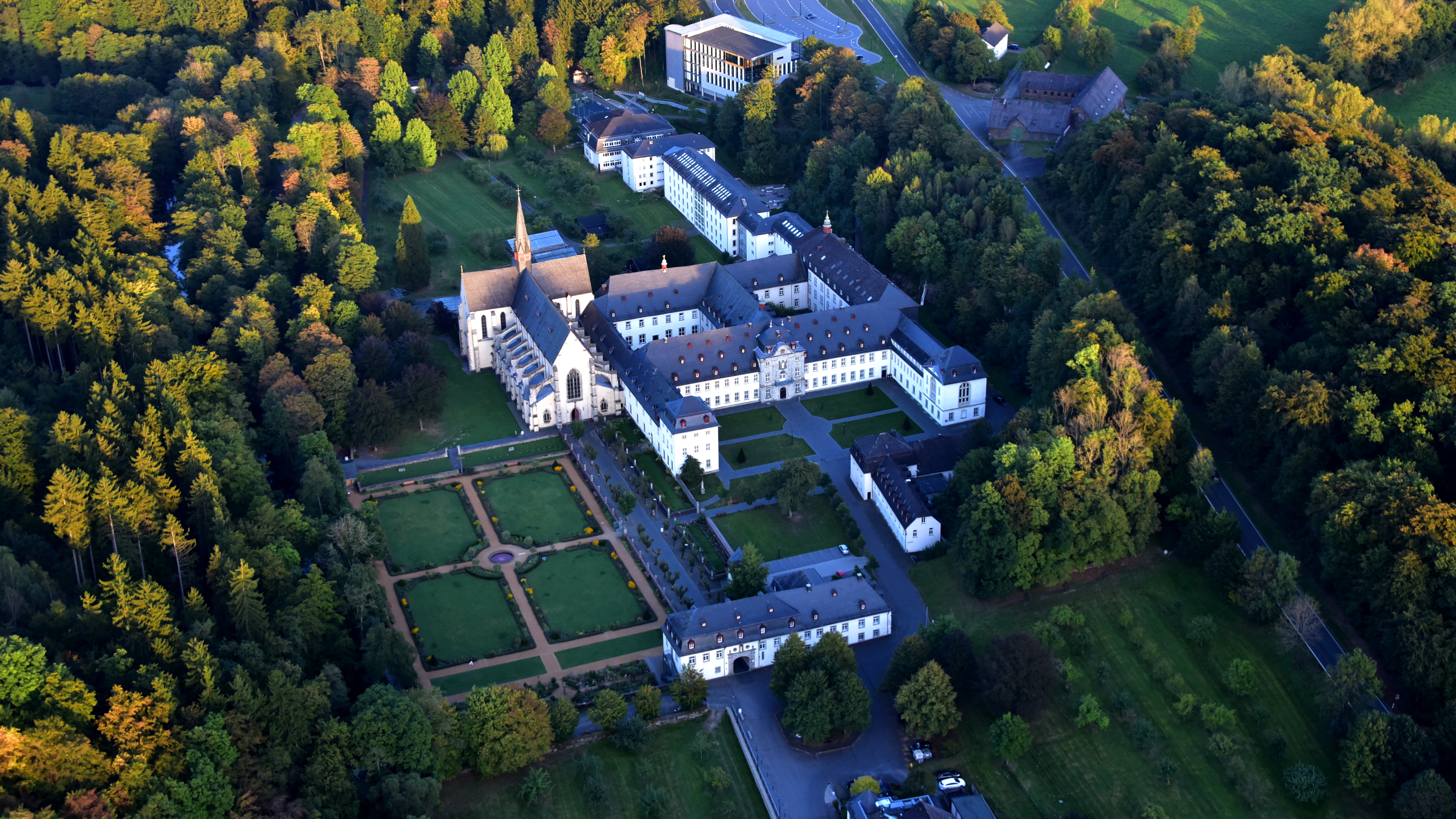
Marienstatt Abbey (German: Abtei Marienstatt, Latin: ''Abbatia Loci Sanctae Mariæ'') is a Cistercian monastery and a pilgrimage site in Streithausen, Westerwaldkreis, Rhineland-Palatinate, in the Nister valley near Hachenburg. The abbey has an early-Gothic Basilica with the largest organ in the Westerwald, a library, a brewery with restaurant, a shop for books and art, a guest house, and a privately supported secondary school, the Privates Gymnasium Marienstatt. History The abbey was established by Heisterbach Abbey, which was created by Himmerod Abbey, which in turn was founded from Clairvaux Abbey in 1134, in a direct succession. In 1212, it was first founded in Neunkhausen, made possible by a donation from Eberhard of Arenberg and his wife Adelheid von Molsberg. The site was abandoned because of the climate and soil, and the monastery was transferred to the present location in 1222. According to legend, the abbot had a dream of a hawthorn bush that flowered in winter, whi ... [...More Info...] [...Related Items...] OR: [Wikipedia] [Google] [Baidu] |
Pilgrims' Way
The Pilgrims' Way (also Pilgrim's Way or Pilgrims Way) is the historical route supposedly taken by pilgrims from Winchester in Hampshire, England, to the shrine of Thomas Becket at Canterbury in Kent. This name, of comparatively recent coinage, is applied to a pre-existing ancient trackway dated by archaeological finds to 600–450 BC, but probably in existence since the Stone Age. The prehistoric route followed the "natural causeway" east to west on the southern slopes of the North Downs. The course was dictated by the natural geography: it took advantage of the contours, avoided the sticky clay of the land below but also the thinner, overlying "clay with flints" of the summits.Wright, Christopher John (1971). ''A Guide to the Pilgrims' Way.'' Constable and Co, London. In places a coexisting ridgeway and terrace way can be identified; the route followed would have varied with the season, but it would not drop below the upper line of cultivation. The trackway ran th ... [...More Info...] [...Related Items...] OR: [Wikipedia] [Google] [Baidu] |


