|
Kraljevo
Kraljevo ( sr-Cyrl, –ö—Ä–į—ô–Ķ–≤–ĺ, ) is a city and the administrative center of the RaŇ°ka District in central Serbia. It is situated on the confluence of West Morava and Ibar, in the geographical region of ҆umadija, between the mountains of Kotlenik in the north, and Stolovi in the south. In 2022 the city urban area has a population of 57,432 inhabitants, while the city administrative area has 110,196 inhabitants. With an area of 1530 km2, it is the largest municipality (after Belgrade) in Serbia by area. Name Formerly known as Rudo Polje (–†—É–ī–ĺ –ü–ĺ—ô–Ķ), Karanovac (–ö–į—Ä–į–Ĺ–ĺ–≤–į—Ü) and Rankovińáevo (–†–į–Ĺ–ļ–ĺ–≤–ł—õ–Ķ–≤–ĺ), Kraljevo received its present name, meaning "the King's Town", from King Milan I of Serbia in honor of his own coronation and six Serbian kings that had been crowned in that area. The modern coat of arms of the city features seven crowns symbolizing the seven kings. History and sights The "lower" Ibar region is thought to be the first area wh ... [...More Info...] [...Related Items...] OR: [Wikipedia] [Google] [Baidu] |
List Of Cities In Serbia
This is the list of cities and towns in Serbia, according to the criteria used by Statistical Office of the Republic of Serbia, which classifies the settlements into ''urban'' and ''other'', depending not only on size, but also on other administrative and legal criteria. Also villages with the municipal rights have been added to the list. Organization ;Cities ''City, Cities'' in administrative sense are defined by the Law on Territorial Organization. The territory with the ''city'' status usually has more than 100,000 inhabitants, but is otherwise very similar to a municipality. They enjoy a special status of autonomy and self-government, as they have their own civic parliaments and executive branches, as well as mayor (, plural: ) is elected through popular vote, elected by their citizens in local elections. Also, the presidents of the municipalities are often referred to as "mayors" in everyday usage. There are 28 cities (, singular: ), each having an assembly and budget of its ... [...More Info...] [...Related Items...] OR: [Wikipedia] [Google] [Baidu] |
Vehicle Registration Plates Of Serbia
Vehicle registration plates of Serbia display black alphanumeric characters on a white background with blue field placed along the left side edge. Issuance of current registration plates started on 1 January 2011 and they were used alongside the old ones during the transitional period until the end of 2011. Standard plates The two-letter regional code is followed by three or four-digit numeric code separated by the Serbian cross, Serbian cross shield and a Cyrillic letter combination for the region below, and then followed by a two-letter alpha code, separated by a hyphen. A blue field is placed along the left side edge, as in European Union countries, bearing SRB (the ISO 3166-1 alpha-3 country code for Serbia). Numeric code contains combination of three or four digits (0-9), while two letter alpha code is made of combination of letters using Serbian Latin alphabet, with addition of letter X (e.g., BG 123-AA or BG 1234-AA). Since 2017 plates with the special "hooked" letters ... [...More Info...] [...Related Items...] OR: [Wikipedia] [Google] [Baidu] |
Gradac Monastery
The Gradac Monastery (, ) is a Serbian Orthodox Monastery. It lies on the elevated plateau above the river Gradańćka, at the edge of the forested slopes Golija. It is an endowment of queen Helen which was built from 1277 to 1282 during the reign of her son king Stefan Dragutin. Gradac Monastery was declared a Monument of Culture of Exceptional Importance in 1979, and it is protected by Serbia. History The monastery was built from 1277 to 1282 and is an endowment of Helen of Anjou, the wife of king UroŇ° I. The monastery is situated in Stara RaŇ°ka region, on the wooded and secluded slopes of Golija mountain on the place called by locals Petrov KrŇ°. It is located west of the medieval fortress Brvenik. The monastery complex was included the large building Church of The Entry of the Most Holy Theotokos into the Temple, the smaller temple St. Nicholas, a dining room, quarters and the economic building. The monastery church is a single-nave structure with a dome, a tripartite a ... [...More Info...] [...Related Items...] OR: [Wikipedia] [Google] [Baidu] |
Novi Pazar
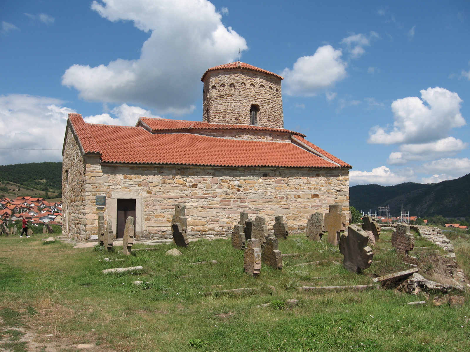
Novi Pazar ( sr-cyr, –Ě–ĺ–≤–ł –ü–į–∑–į—Ä) is a List of cities in Serbia, city located in the RaŇ°ka District of southwestern Serbia. As of the 2022 census, the urban area has 71,462 inhabitants, while the city administrative area has 106,720 inhabitants. The city is the cultural center of the Bosniaks in Serbia and of SandŇĺak. A multicultural area of Muslims and Eastern Orthodox, Orthodox Christians, many monuments of both religions, like the Altun-Alem Mosque and the Church of Saint Apostles Peter and Paul (Novi Pazar), Church of the Holy Apostles Peter and Paul, are located in the region which has a total of 30 protected monuments of culture. Name During the 14th century under the old Serbian fortress of Stari Ras, an important market-place named ''TrgoviŇ°te'' started to develop. By the middle of the 15th century, in the time of the final Ottoman Empire conquest of Old Serbia, another market-place was developing some 11 km to the east. The older place became known as ''St ... [...More Info...] [...Related Items...] OR: [Wikipedia] [Google] [Baidu] |
Stari Ras
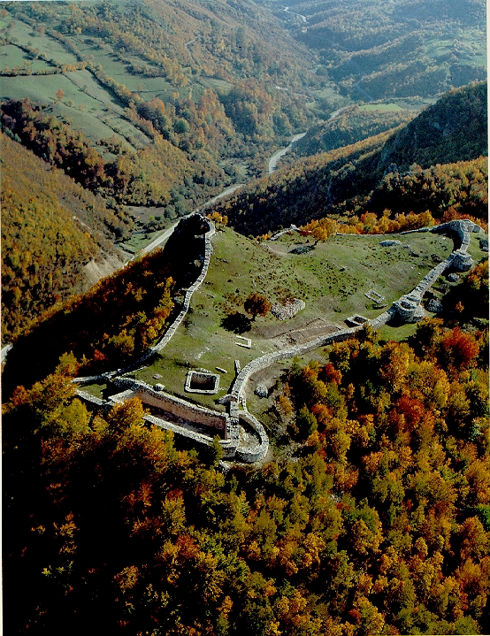
Ras ( sr-Cyrl, –†–į—Ā; ), known in modern Serbian historiography as Stari Ras ( sr-Cyrl, –°—ā–į—Ä–ł –†–į—Ā, "Old Ras"), is a medieval fortress and area located in the vicinity of former market-place of ''Staro TrgoviŇ°te'', some west of modern-day city of Novi Pazar in Serbia. Old Ras was initially part of the First Bulgarian Empire (until the 10th century), then Byzantine Empire (mid-10th until mid-12th century), in the end becoming one of the first and main capitals of the Grand Principality and Kingdom of Serbia (from mid-12th until early 14th century). Located in today's region of RaŇ°ka, its favorable position in the area known as Old Serbia, along the RaŇ°ka gorge at PeŇ°ter plateau, on the crossroads and trading routes between neighbouring regions of Zeta and Bosnia in the west and Kosovo in the south, added to its importance as a city. Two fortifications (''gradina'') exist around the site, Gradina-PazariŇ°te and Gradina-Postenje, while the urban place ''Staro Trgo ... [...More Info...] [...Related Items...] OR: [Wikipedia] [Google] [Baidu] |
RaŇ°ka (region)
RaŇ°ka ( sr-Cyrl, –†–į—ą–ļ–į; ) is a geographical and historical region of Serbia. Initially a small borderline district between early medieval Serbia and Bulgaria (city/area of Stari Ras, Ras), and the Byzantine Empire, it became the center of the Grand Principality of Serbia and of the Kingdom of Serbia (medieval), Serbian Kingdom in the mid-12th century. From that period on, the name of RaŇ°ka became associated with the state of Serbia, eventually covering the south-western parts of modern Serbia, and historically also including north-eastern parts of modern Montenegro, and some of the most eastern parts of modern Bosnia and Herzegovina, and its southern part covering the modern region of SandŇĺak. Name The name is derived from the name of the region's most important fort of Stari Ras, Ras, which first appears in the 6th century sources as ''Arsa'', recorded under that name in the work ''De aedificiis'' of Byzantine historian Procopius. By the 10th century, the variant ''Ra ... [...More Info...] [...Related Items...] OR: [Wikipedia] [Google] [Baidu] |
Grand Principality Of Serbia
The Grand Principality of Serbia ( sr-Cyrl-Latn, –í–Ķ–Ľ–ł–ļ–ĺ–∂—É–Ņ–į–Ĺ—Ā–ļ–į –°—Ä–Ī–ł—ė–į, VelikoŇĺupanska Srbija, separator=" / "), also known by the anachronistic exonym RaŇ°ka (region), Rascia ( sr-Cyrl-Latn, –†–į—ą–ļ–į, RaŇ°ka, separator=" / ", link=no), was a medieval Serbs, Serbian state that existed from the second half of the 11th century up until 1217, when it was transformed into the Kingdom of Serbia (1217‚Äď1346), Kingdom of Serbia. After the Grand Principality of Serbia emerged, it gradually expanded during the 12th century, encompassing various neighbouring regions, including territories of RaŇ°ka (region), RaŇ°ka ( sr-Cyrl, –†–į—ą–ļ–į; ), modern Montenegro, Herzegovina, and southern Dalmatia. It was founded by Grand Prince Vukan, Grand Prince of Serbia, Vukan, who initially served as the regional governor of the principality ( 1082), appointed by King Constantine Bodin. During the Byzantine‚ÄďSerbian wars ( 1090), Vukan gained prominence and became a self-governing ... [...More Info...] [...Related Items...] OR: [Wikipedia] [Google] [Baidu] |
Milan I Of Serbia
Milan Obrenovińá IV ( sr-cyr, –ú–ł–Ľ–į–Ĺ –ě–Ī—Ä–Ķ–Ĺ–ĺ–≤–ł—õ, Milan Obrenovińá; 22 August 1854 – 11 February 1901) reigned as the Prince of Serbia from 10 June 1868 until 1882, when he became King of Serbia, a title he held until his abdication on 6 March 1889. His son, Alexander I of Serbia, became the second King of Serbia. Early years Birth and infancy in exile Milan Obrenovińá was born in 1854 in MńÉrńÉ»ôe»ôti in Moldavia, where his family had lived in exile ever since the return of the rival House of KarańĎorńĎevińá to the Principality of Serbia, Serbian throne in 1842 when they managed to depose Milan's cousin Prince Mihailo Obrenovińá III, Prince of Serbia, Mihailo Obrenovińá III. Milan was the son of and of his Moldavian wife Marija Obrenovińá, n√©e Elena Maria Catargiu (1831‚Äď1879). Milan's paternal grandfather (MiloŇ°'s father) was Jevrem Obrenovińá (1790‚Äď1856), brother of MiloŇ° Obrenovińá I, Prince of Serbia from 1815 to 1839 and from 1858 to 1860. Milan w ... [...More Info...] [...Related Items...] OR: [Wikipedia] [Google] [Baidu] |
Stolovi
Stolovi (Serbian Cyrillic: –°—ā–ĺ–Ľ–ĺ–≤–ł) is a mountain in central Serbia, near the city of Kraljevo Kraljevo ( sr-Cyrl, –ö—Ä–į—ô–Ķ–≤–ĺ, ) is a List of cities in Serbia, city and the administrative center of the RaŇ°ka District in central Serbia. It is situated on the confluence of West Morava and Ibar River, Ibar, in the geographical region of .... Its highest peak ''Usovica'' has an elevation of 1,356 meters above sea level. References Mountains of Serbia {{Serbia-geo-stub ... [...More Info...] [...Related Items...] OR: [Wikipedia] [Google] [Baidu] |
Kotlenik
Kotlenik (Serbian Cyrillic: –ö–ĺ—ā–Ľ–Ķ–Ĺ–ł–ļ) is a mountain in central Serbia, near the town of Kraljevo Kraljevo ( sr-Cyrl, –ö—Ä–į—ô–Ķ–≤–ĺ, ) is a List of cities in Serbia, city and the administrative center of the RaŇ°ka District in central Serbia. It is situated on the confluence of West Morava and Ibar River, Ibar, in the geographical region of .... Its highest peak ''Veliki vrh'' has an elevation of 749 meters above sea level. References External links Biking tour over Kotlenik Staze i Bogaze. Mountains of Serbia Rhodope mountain range {{serbia-geo-stub ... [...More Info...] [...Related Items...] OR: [Wikipedia] [Google] [Baidu] |
҆umadija
҆umadija ( sr-Cyrl, –®—É–ľ–į–ī–ł—ė–į, ) is a geographical region in the central part of Serbia. The area used to be heavily covered with forests, hence the name (from ''Ň°uma'' 'forest'). The city of Kragujevac is the administrative center of the ҆umadija District in the ҆umadija and Western Serbia statistical region. This very fertile region is known for its extensive fruit production (apples, grapes, plums, etc.). Name ''҆umadija'' was named for the dense, impassable forests that covered the region. These forests were preserved until the early 19th century; they are mentioned in literature and tradition. Bertrandon de la Broqui√®re (1400‚Äď1459) passed through Serbia; on the road from Palanka to Belgrade he "passed through very large forests." During the reign of Prince MiloŇ° (1817‚Äď1839), it was said of the dense forests that covered Serbia, "no one could walk through (them), let alone with horse." When Alphonse de Lamartine visited Serbia in 1833, he wrote that h ... [...More Info...] [...Related Items...] OR: [Wikipedia] [Google] [Baidu] |


