|
Kleines Meer
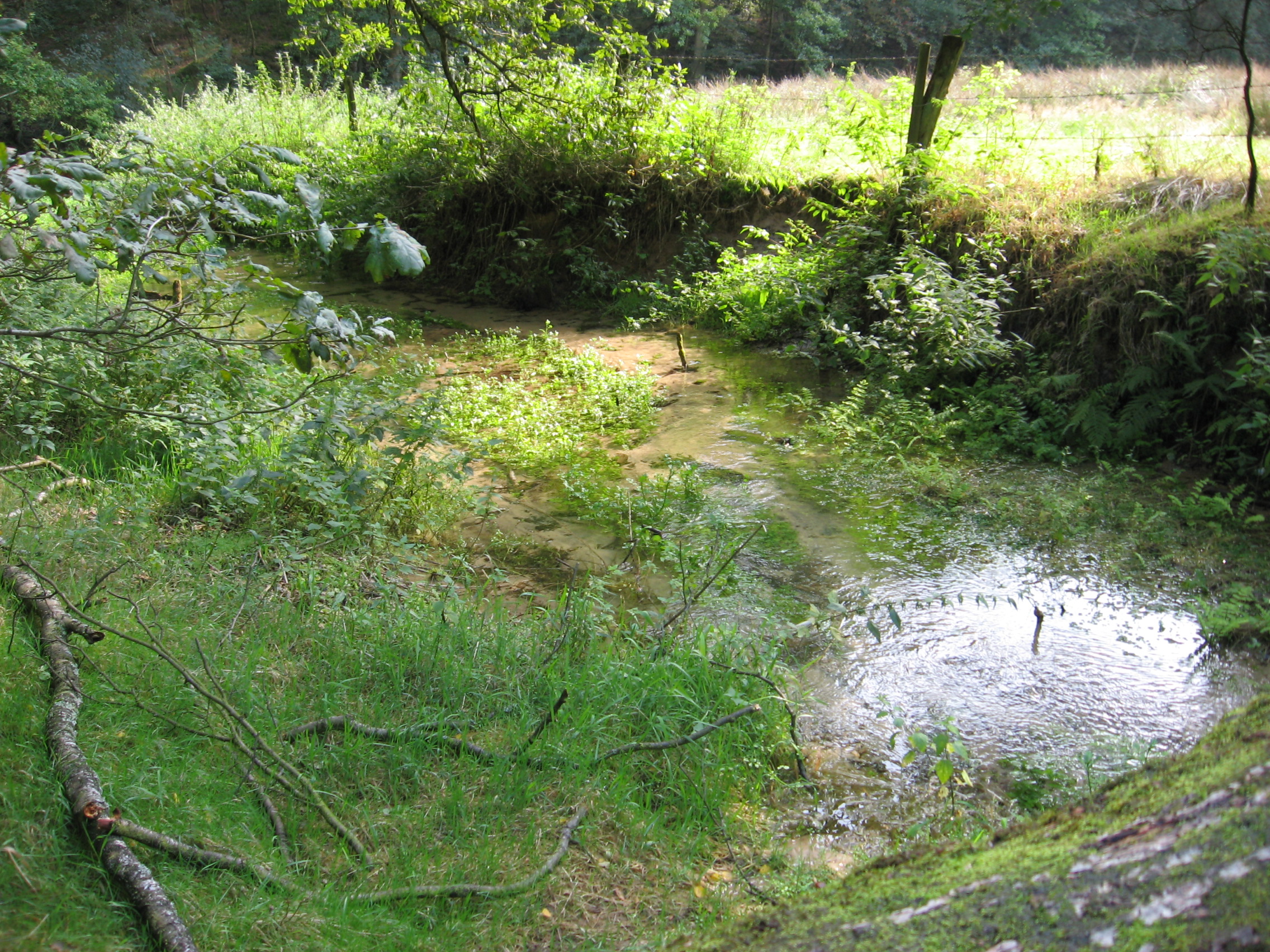
The Kleines Meer ("Little Lake"), also called the ''Hieve'', is a lake in East Frisia. It lies northeast of Emden on the territory of the municipality of Hinte; its southwestern shore borders on the Uphusen- Marienwehr borough of Emden, its southeastern and eastern shores on the municipality of Südbrookmerland. The Kleines Meer has an area of and is thus significantly smaller than the neighbouring '' Großes Meer'' ("Great Lake"), which lies within the municipality of Südbrookmerland. After sand was removed in the late 1970s, the formerly shallow lake had a maximum depth of . In July 2006 it was still up to deep, albeit in the middle of the dredged basin. The Kleines Meer is popular as a leisure and recreation spot, especially with dinghy sailors, surfers, anglers and weekenders. Little holiday chalets, the so-called '' Meerbuden'', have been built along the Emden, Hinte and Südbrookmerland shores. Unlike the Großes Meer, motor boats are allowed on the shortest route on t ... [...More Info...] [...Related Items...] OR: [Wikipedia] [Google] [Baidu] |
Hinte
Hinte is a village and a municipality in the Aurich (district), district of Aurich, in Lower Saxony, Germany. It is situated approximately 20 km south of Norden, Lower Saxony, Norden, and 6 km north of Emden. References Hinte Towns and villages in East Frisia Aurich (district) {{Aurich-geo-stub ... [...More Info...] [...Related Items...] OR: [Wikipedia] [Google] [Baidu] |
Uphusen
Uphusen is a village in Lower Saxony, Germany. The East Frisian village is currently a borough () of the city of Emden together with Marienwehr. Uphusen was originally a village built on a ''warft''. The current warft, with the church on it, was created from three smaller mounds. The current church dates from the fifteenth century. This replaced an earlier church from the thirteenth century that was said to have been demolished and rebuilt in Veenhusen Veenhusen is a village in the region of East Frisia, in Lower Saxony, Germany. Administratively, it is an ''Ortsteil'' of the municipality of Moormerland. Veenhusen is located just to the south of Warsingsfehn and is approximately 8 kilometers to .... The name of the place is a combination of ''up'' ('higher') and ''husen'' ('houses'), therefore meaning “higher located houses”. Gallery J38 485 Ems-Jade-Kanal, Klappbrücke Uphusen.jpg, Bridge near Uphusen EJK Uphuser Klappe 4710.jpg, Bridge near Uphusen Kerk van Uphusen 2. ... [...More Info...] [...Related Items...] OR: [Wikipedia] [Google] [Baidu] |
Lakes Of Lower Saxony
A lake is often a naturally occurring, relatively large and fixed body of water on or near the Earth's surface. It is localized in a basin or interconnected basins surrounded by dry land. Lakes lie completely on land and are separate from the ocean, although they may be connected with the ocean by rivers. Lakes, as with other bodies of water, are part of the water cycle, the processes by which water moves around the Earth. Most lakes are fresh water and account for almost all the world's surface freshwater, but some are salt lakes with salinities even higher than that of seawater. Lakes vary significantly in surface area and volume of water. Lakes are typically larger and deeper than ponds, which are also water-filled basins on land, although there are no official definitions or scientific criteria distinguishing the two. Lakes are also distinct from lagoons, which are generally shallow tidal pools dammed by sandbars or other material at coastal regions of oceans or large la ... [...More Info...] [...Related Items...] OR: [Wikipedia] [Google] [Baidu] |
List Of Lakes Of Germany
The largest lake on Germany, German territory is Lake Constance, while Müritz, Lake Müritz is the largest lake located entirely within German territory. List This is an incomplete list of lakes in Germany. See also * List of dams and reservoirs in Germany * List of lakes in Bavaria * List of lakes of Hesse * List of lakes in Mecklenburg-Vorpommern * List of lakes of Rhineland-Palatinate * List of lakes in Schleswig-Holstein {{Europe topic, List of lakes of Lakes of Germany, * Lists of lakes of Germany, ... [...More Info...] [...Related Items...] OR: [Wikipedia] [Google] [Baidu] |
Ems (river)
The Ems ( ; ) is a river in northwestern Germany. It runs through the states of North Rhine-Westphalia and Lower Saxony, and discharges into the Dollart Bay which is part of the Wadden Sea. Its total length is . The state border between the Lower Saxon area of East Friesland (Germany) and the province of Groningen (Netherlands), whose exact course was the subject of a border dispute between Germany and the Netherlands (settled in 2014), runs through the Ems estuary. Course The source of the river is in the southern Teutoburg Forest in North Rhine-Westphalia. In Lower Saxony, the brook becomes a comparatively large river. Here the swampy region of Emsland is named after the river. In Meppen the Ems is joined by its largest tributary, the Hase River. It then flows northwards, close to the Dutch border, into East Frisia. Near Emden, it flows into the Dollard bay (a national park) and then continues as a tidal river towards the Dutch city of Delfzijl. Between Emden and Delf ... [...More Info...] [...Related Items...] OR: [Wikipedia] [Google] [Baidu] |
Südbrookmerland
Südbrookmerland is a municipality in the Aurich (district), district of Aurich, in Lower Saxony, Germany. It is situated approximately 7 km west of Aurich. Its seat is in the village Victorbur. Subdivisions Südbrookmerland is divided into ten districts (''Ortsteile''), namely: *Bedekaspel *Forlitz-Blaukirchen *Moordorf, Lower Saxony, Moordorf *Moorhusen, Südbrookmerland, Moorhusen *Münkeboe *Oldeborg *Theene *Uthwerdum *Victorbur *Wiegboldsbur References Towns and villages in East Frisia Aurich (district) Südbrookmerland {{Aurich-geo-stub ... [...More Info...] [...Related Items...] OR: [Wikipedia] [Google] [Baidu] |
Marienwehr
Marienwehr is a small village in Lower Saxony, Germany. The East Frisian village is currently a borough () of the city of Emden together with Uphusen. The village is located on a ''warft'' Shortly before the start of the Second World War and especially in the years immediately afterwards, new settlement houses were built northeast of the village center, on the shore of the lake called ''Kleines Meer The Kleines Meer ("Little Lake"), also called the ''Hieve'', is a lake in East Frisia. It lies northeast of Emden on the territory of the municipality of Hinte; its southwestern shore borders on the Uphusen- Marienwehr borough of Emden, its sout ...'' ('Little Lake'). References External links {{Emden-geo-stub Emden Populated places in Lower Saxony Towns and villages in East Frisia ... [...More Info...] [...Related Items...] OR: [Wikipedia] [Google] [Baidu] |
Emden
Emden () is an Independent city (Germany), independent town and seaport in Lower Saxony in the north-west of Germany and lies on the River Ems (river), Ems, close to the Germany–Netherlands border, Netherlands border. It is the main town in the region of East Frisia and had a total population of 50,535 in 2022. History The exact date when Emden was founded is unknown, but it has existed since at least the 8th century. Older names for Emden were Setutanda, Amuthon, Embda, Emda, Embden and Embderland. Its town privilege and coat of arms, the ''Engelke up de Muer'' (The Little Angel on the Wall), were granted by Emperor Maximilian I, Holy Roman Emperor, Maximilian I in 1495. In the 16th century, Emden briefly became an important centre for the Protestant Reformation under the rule of Countess Anna von Oldenburg, who was determined to find a religious "third way" between Lutheranism and Catholicism. In 1542 she invited the Polish noble John Laski (or ''Johannes a Lasco'') to ... [...More Info...] [...Related Items...] OR: [Wikipedia] [Google] [Baidu] |
East Frisia
East Frisia () or East Friesland (; ; ; ) is a historic region in the northwest of Lower Saxony, Germany. It is primarily located on the western half of the East Frisia (peninsula), East Frisian peninsula, to the east of West Frisia and to the west of Friesland (district), Landkreis Friesland. Administratively, East Frisia consists of the districts Aurich (district), Aurich, Leer (district), Leer and Wittmund (district), Wittmund and the city of Emden. It has a population of approximately 469,000 people and an area of . There is a chain of islands off the coast, called the East Frisian Islands (). From west to east, these islands are Borkum, Juist, Norderney, Baltrum, Langeoog and Spiekeroog. History The geographical region of East Frisia was inhabited in Paleolithic times by reindeer hunters of the Hamburg culture. Later there were Mesolithic and Neolithic settlements of various cultures. The period after prehistory can only be reconstructed from archaeological evidence. A ... [...More Info...] [...Related Items...] OR: [Wikipedia] [Google] [Baidu] |
Lake
A lake is often a naturally occurring, relatively large and fixed body of water on or near the Earth's surface. It is localized in a basin or interconnected basins surrounded by dry land. Lakes lie completely on land and are separate from the ocean, although they may be connected with the ocean by rivers. Lakes, as with other bodies of water, are part of the water cycle, the processes by which water moves around the Earth. Most lakes are fresh water and account for almost all the world's surface freshwater, but some are salt lakes with salinities even higher than that of seawater. Lakes vary significantly in surface area and volume of water. Lakes are typically larger and deeper than ponds, which are also water-filled basins on land, although there are no official definitions or scientific criteria distinguishing the two. Lakes are also distinct from lagoons, which are generally shallow tidal pools dammed by sandbars or other material at coastal regions of ocean ... [...More Info...] [...Related Items...] OR: [Wikipedia] [Google] [Baidu] |
Dollart
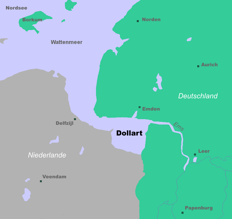
The Dollart (German name, ) or Dollard (Dutch name, ) is a bay in the Wadden Sea between the northern Netherlands and Germany, on the west side of the estuary of the Ems river. Most of it dries at low tide. Many water birds feed there. Gaining from and losing to the sea According to legend, the Dollart Bay was created by a catastrophic storm surge in 1277, covering the district of Rheiderland and large parts of the Oldambt district. The flood was rumoured to have caused 80,000 deaths. The story, however, is not true and based on legend instead of facts. The Dollart was created as a slow inundation over many centuries which accumulated in a storm surge in 1509. The 1509 surge extended the Dollart, and flooded 30 more villages, and by 1520 the Dollart had its largest extension. Between the 16th and the 20th centuries, two thirds of the drowned area was reclaimed. Nowadays the unembanked forelands have been declared world natural heritage, as they are a paradise for all k ... [...More Info...] [...Related Items...] OR: [Wikipedia] [Google] [Baidu] |


