|
Kirkjubæjarklaustur
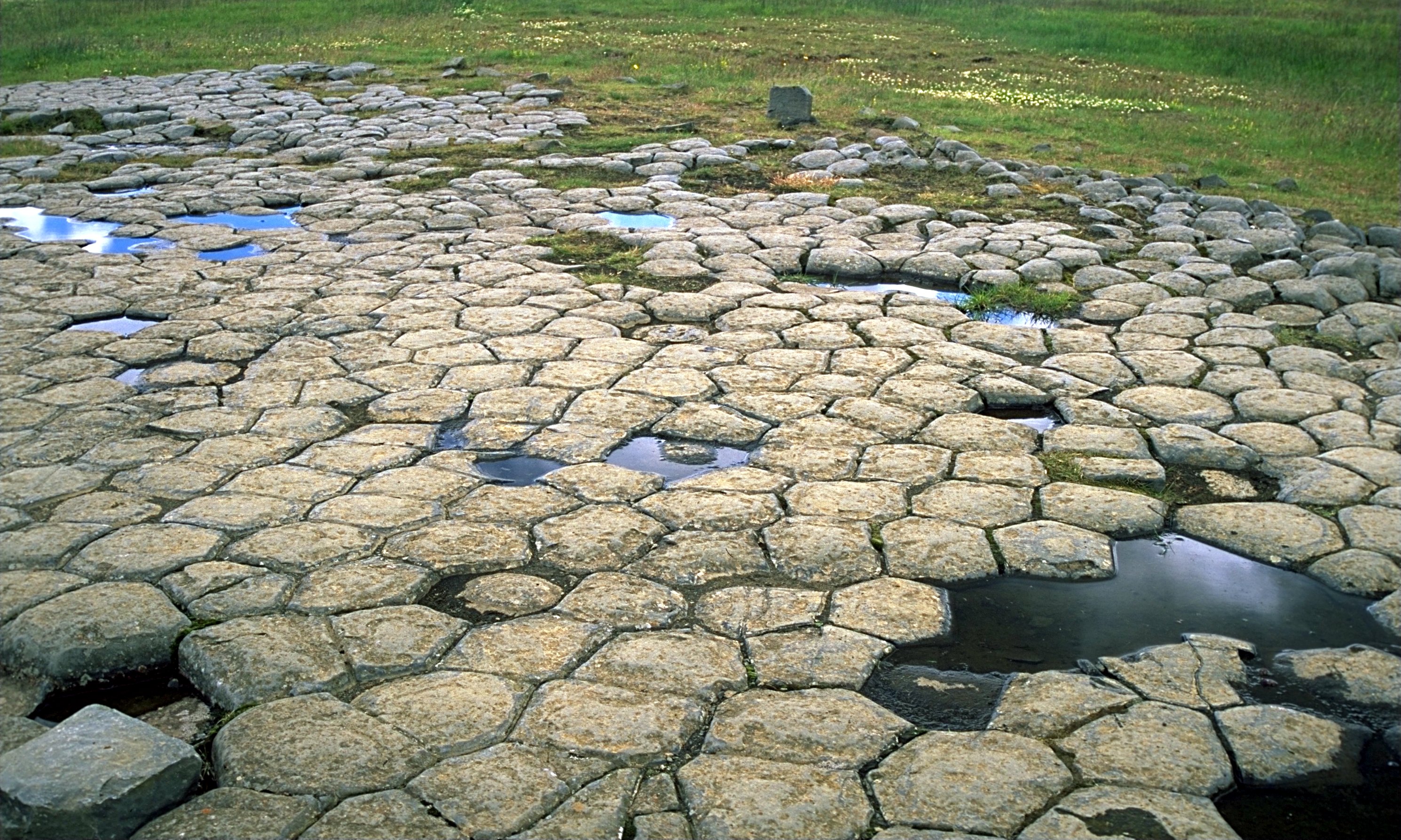
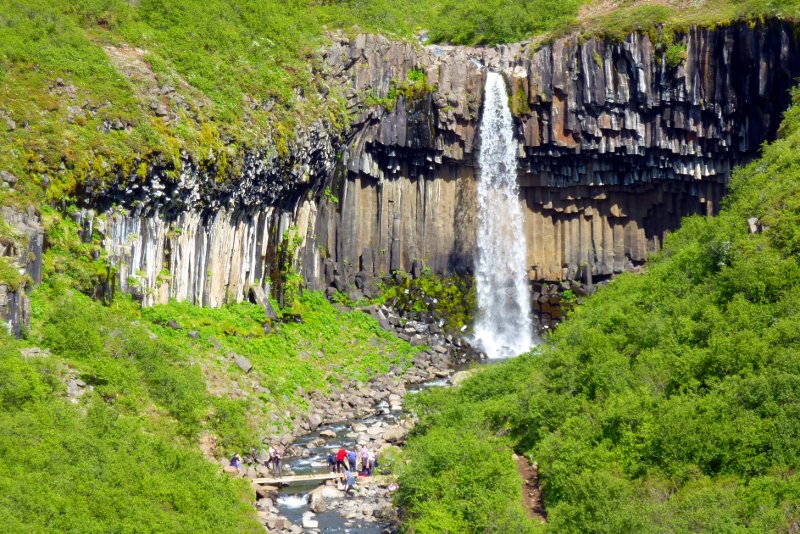
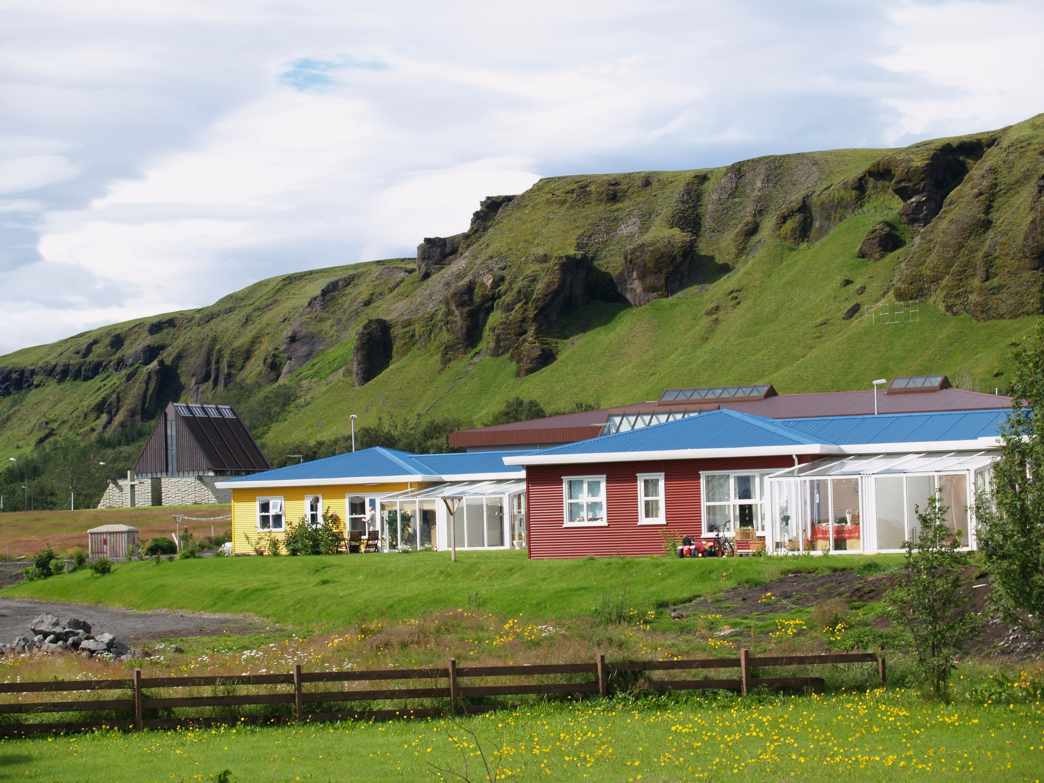
Kirkjubæjarklaustur ( Icelandic for "church farm cloister", pronounced ; often referred to locally as just Klaustur) is a village in the south of Iceland on the hringvegur (road no. 1 or Ring Road) between Vík í Mýrdal and Höfn. It is part of the municipality of Skaftárhreppur and has about 500 inhabitants. It is surrounded by hills and plateaus to the north. Kirkjubæjarklaustur is roughly east of the capital city of Reykjavik. Location Kirkjubæjarklaustur is the only place between Vík and Höfn which offers services, which includes a fuel station, a bank, a post office and a supermarket. Nearby tourist attractions include the Laki craters, the Eldgjá and Skaftafell, all in Vatnajökull National Park. An attraction close to the village is '' Kirkjugólf'' ("Church floor"), a natural pavement of basalt. These are basalt columns in the earth, the visible tops of which have the appearance of a paved church floor. This lava formation has similar origins to the Giant ... [...More Info...] [...Related Items...] OR: [Wikipedia] [Google] [Baidu] |
Kirkjubæjar Abbey
Kirkjubæjar Abbey (Icelandic: ''Kirkjubæjarklaustur''), in operation from 1186 until the Icelandic Reformation, was a monastery in Iceland of nuns of the Order of St. Benedict. It was located at Kirkjubæjarklaustur. Iceland had nine religious communities before the Reformation, two of which were monasteries of nuns, of which this is the first and oldest. In contrast to the other women's monastery in Iceland, Reynistaðarklaustur (1295–1563), which was placed under the authority of the Bishop of Hólar, at Kirkjubæjar Abbey the Abbess was left in full authority over the community, free of Bishop, episcopal oversight. History The Abbey was founded in 1186. The first abbess was Halldóra Eyjólfsdóttir, who died in 1210. The abbey was regarded as a center of culture and literature. In the mid-14th-century, the abbey was given a name of being in opposition to the Pope. A nun named Karin or Kristin held what was heretic sermons in the convent. She was put on trial on charges of ... [...More Info...] [...Related Items...] OR: [Wikipedia] [Google] [Baidu] |
Skaftafell
Skaftafell () is a preservation area in Öræfi, southeast Iceland. It was once a major farm, later being named a national park. Originally known as Skaftafell National Park, it was subsequently joined together with other nearby regions to form the larger Vatnajökull National Park. Skaftafell National Park Skaftafell National Park was a national park between Kirkjubæjarklaustur, typically referred to as Klaustur, and Höfn in the south of Iceland. On 7 June 2008, it became a part of the larger Vatnajökull National Park. It was founded on September 15, 1967, and enlarged twice afterwards. Before its inclusion into Vatnajökull National Park, it measured about 4807 km2 (2884 mi2), making it Iceland's second largest national park. It contains the valley ''Morsárdalur'' , the mountain ''Kristínartindar'' and the glacier ''Skaftafellsjökull'' (a spur of the Vatnajökull ice cap). The landscape is very similar to some of the Alps. Still, it has been formed over tho ... [...More Info...] [...Related Items...] OR: [Wikipedia] [Google] [Baidu] |
Laki (volcano)
Laki () or Lakagígar (, ''Craters of Laki'') is a volcanic fissure in the western part of Vatnajökull National Park, Iceland, not far from the volcanic fissure of Eldgjá and the small village of Kirkjubæjarklaustur. The fissure is properly referred to as Lakagígar, while Laki is a mountain that the fissure bisects. Lakagígar is part of a volcanic system centered on the volcano Grímsvötn and including the volcano Þórðarhyrna. It lies between the glaciers of Mýrdalsjökull and Vatnajökull, in an area of fissures that run in a southwest to northeast direction. The system erupted violently over an eight-month period between June 1783 and February 1784 from the Laki fissure and the adjoining volcano Grímsvötn. It poured out an estimated 42 billion tonnes or of basalt lava as well as clouds of poisonous hydrofluoric acid and sulfur dioxide compounds that contaminated the soil, leading to the death of over 50% of Iceland's livestock population, and the destruction ... [...More Info...] [...Related Items...] OR: [Wikipedia] [Google] [Baidu] |
Laki
Laki () or Lakagígar (, ''Craters of Laki'') is a volcanic fissure in the western part of Vatnajökull National Park, Iceland, not far from the volcanic fissure of Eldgjá and the small village of Kirkjubæjarklaustur. The fissure is properly referred to as Lakagígar, while Laki is a mountain that the fissure bisects. Lakagígar is part of a volcanic system centered on the volcano Grímsvötn and including the volcano Þórðarhyrna. It lies between the glaciers of Mýrdalsjökull and Vatnajökull, in an area of fissures that run in a southwest to northeast direction. The system erupted violently over an eight-month period between June 1783 and February 1784 from the Laki fissure and the adjoining volcano Grímsvötn. It poured out an estimated 42 billion tonnes or of basalt lava as well as clouds of poisonous hydrofluoric acid and sulfur dioxide compounds that contaminated the soil, leading to the death of over 50% of Iceland's livestock population, and the destru ... [...More Info...] [...Related Items...] OR: [Wikipedia] [Google] [Baidu] |
Hringvegur
Route 1 or the Ring Road ( or ) is a national road in Iceland that circles the entire country. As a major trunk route, it is considered to be the most important piece of transport infrastructure in Iceland as it connects the majority of towns together in the most densely populated areas of the country. Economically, it carries a large proportion of goods traffic as well as tourist traffic. The total length of the road is , making it the longest ring road in Europe. The road was completed in 1974, coinciding with the 1,100th anniversary of the country's settlement when the longest bridge in Iceland, crossing the Skeiðará river in the southeast, was opened. Previously, vehicles intending to travel between southern settlements, e.g. Vík to Höfn, had to travel north of the country through Akureyri, making the opening a major transport improvement to the country. Many popular tourist attractions in Iceland, such as the Seljalandsfoss and Skógafoss waterfalls, Dyrhólaey cl ... [...More Info...] [...Related Items...] OR: [Wikipedia] [Google] [Baidu] |
Vatnajökull National Park
Vatnajökull National Park ( ) is one of three national parks in Iceland, and is the largest one. It encompasses all of Vatnajökull glacier and extensive surrounding areas. These include the national parks previously existing at Skaftafell in the southwest and Jökulsárgljúfur in the north. The unique qualities of Vatnajökull National Park are primarily its great variety of landscape features, created by the combined forces of rivers, glacial ice, and volcanic and geothermal activity. The park spans 14% of the country's area and is Europe's second largest national park in terms of area after Yugyd Va in the Ural Mountains of Russia. The glacier itself is the largest in Europe at . In 2019 the park was enlarged to the north. On 5 July 2019 Vatnajökull National Park was inscribed as a World Heritage Site. History Vatnajökull National Park was established on 7 June 2008. When established, the park covered an area of 12,000 km2, but with later additions of Lakagíga ... [...More Info...] [...Related Items...] OR: [Wikipedia] [Google] [Baidu] |
Eldgjá
Eldgjá (, "fire canyon") is a volcano and a canyon in Iceland. Eldgjá is part of the Katla volcano; it is a segment of a long chain of volcanic craters and fissure vents that extends northeast away from Katla volcano almost to the Vatnajökull ice cap. This fissure experienced a major eruption around 939 CE, which was the largest effusive eruption in recent history. It covered about of land with of lava from two major lava flows. While Icelandic records about the effects of the eruption are sparse, paleoclimate proxies and historical records from China, Europe and the Islamic world describe widespread impacts on the Northern Hemisphere’s climate. The Eldgjá eruption produced a noticeable cooling of the climate, with resulting cold winters and food crises across Eurasia. Geology The interaction between the Mid-Atlantic Ridge and the Iceland hotspot has given rise to the stack of volcanic rocks that forms Iceland. Volcanoes on Iceland occur in four volcanic zones; th ... [...More Info...] [...Related Items...] OR: [Wikipedia] [Google] [Baidu] |
Iceland
Iceland is a Nordic countries, Nordic island country between the Atlantic Ocean, North Atlantic and Arctic Oceans, on the Mid-Atlantic Ridge between North America and Europe. It is culturally and politically linked with Europe and is the region's westernmost and most list of countries and dependencies by population density, sparsely populated country. Its Capital city, capital and largest city is Reykjavík, which is home to about 36% of the country's roughly 380,000 residents (excluding nearby towns/suburbs, which are separate municipalities). The official language of the country is Icelandic language, Icelandic. Iceland is on a rift between Plate tectonics, tectonic plates, and its geologic activity includes geysers and frequent Types of volcanic eruptions, volcanic eruptions. The interior consists of a volcanic plateau with sand and lava fields, mountains and glaciers, and many Glacial stream, glacial rivers flow to the sea through the Upland and lowland, lowlands. Iceland i ... [...More Info...] [...Related Items...] OR: [Wikipedia] [Google] [Baidu] |
Systrafoss
Systrafoss (, "sisters' waterfall") is a waterfall in Iceland, found at Kirkjubæjarklaustur in Skaftárhreppur in the Suðurland region. Geography The waterfall is part of the river Fossá, which runs south from its source Systravatn. To the south of Systrafoss runs the glacial river Skaftá. Name Both the waterfall and Systravatn take their name from the sisters of the nearby Kirkjubæjar Abbey. See also * List of waterfalls * List of waterfalls of Iceland Iceland is well suited for waterfalls (Icelandic: s. ''foss,'' pl. ''fossar''). This Nordic island country lies along the Mid-Atlantic Ridge which separates North America and Europe near where the North Atlantic and Arctic Oceans meet. Frequen ... Sources * Jens Willhardt, Christine Sadler: ''Island''. 3rd edn. Michael Müller, Erlangen 2003, , p. 346f. * Borowski, Birgit (ed.): Lonely Planet Publications Ltd. Melbourne: ''Island''. 3rd German edn, Sept. 2013, , p. 285 References External links Systra ... [...More Info...] [...Related Items...] OR: [Wikipedia] [Google] [Baidu] |
Skaftárhreppur
Skaftárhreppur () is a municipality in southern Iceland. The largest settlement is Kirkjubæjarklaustur Kirkjubæjarklaustur ( Icelandic for "church farm cloister", pronounced ; often referred to locally as just Klaustur) is a village in the south of Iceland on the hringvegur (road no. 1 or Ring Road) between Vík í Mýrdal and Höfn. It is pa .... References Municipalities of Iceland {{Iceland-geo-stub ... [...More Info...] [...Related Items...] OR: [Wikipedia] [Google] [Baidu] |
Protestant Reformation
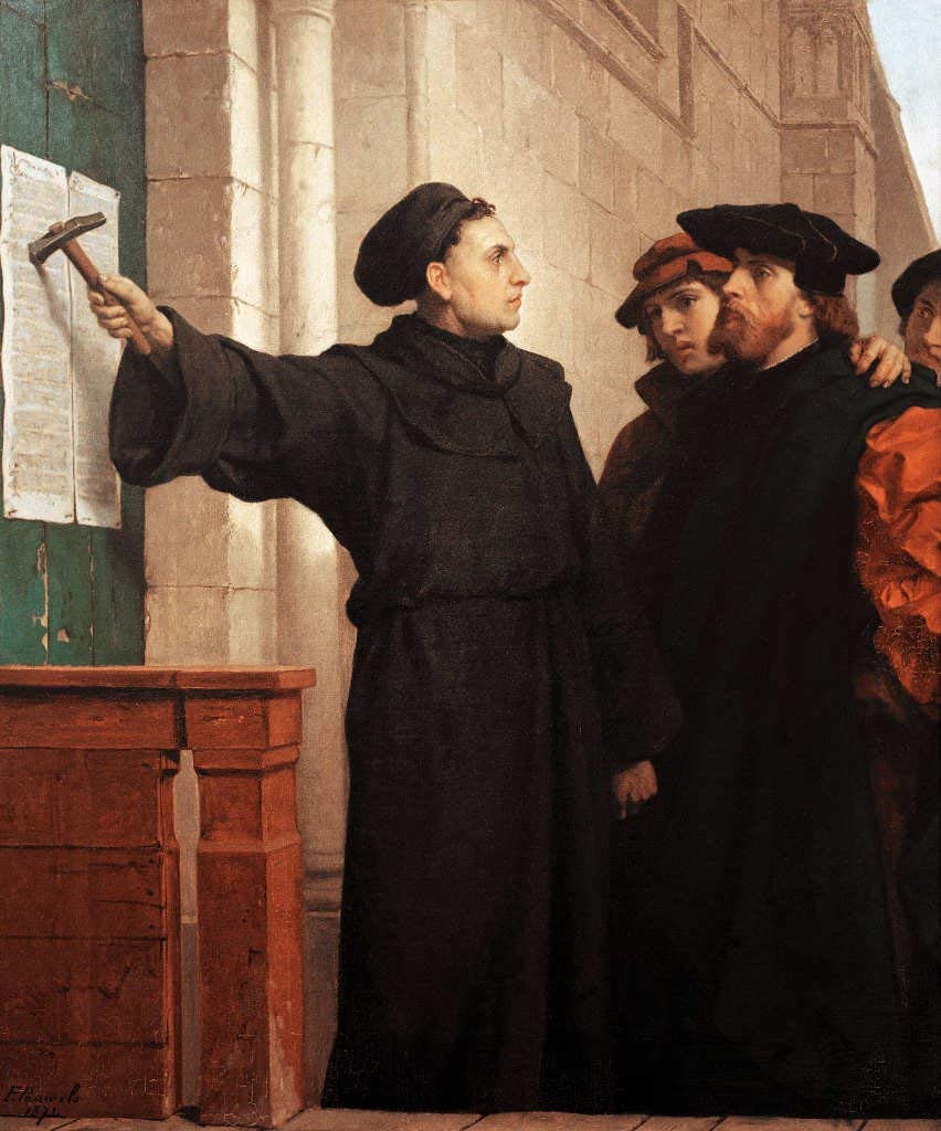
The Reformation, also known as the Protestant Reformation or the European Reformation, was a time of major theological movement in Western Christianity in 16th-century Europe that posed a religious and political challenge to the papacy and the authority of the Catholic Church. Towards the end of the Renaissance, the Reformation marked the beginning of Protestantism. It is considered one of the events that signified the end of the Middle Ages and the beginning of the early modern period in Europe. The Reformation is usually dated from Martin Luther's publication of the '' Ninety-five Theses'' in 1517, which gave birth to Lutheranism. Prior to Martin Luther and other Protestant Reformers, there were earlier reform movements within Western Christianity. The end of the Reformation era is disputed among modern scholars. In general, the Reformers argued that justification was based on faith in Jesus alone and not both faith and good works, as in the Catholic view. In the ... [...More Info...] [...Related Items...] OR: [Wikipedia] [Google] [Baidu] |
Giant's Causeway
The Giant's Causeway () is an area of approximately 40,000 interlocking basalt columns, the result of an ancient volcano, volcanic fissure eruption, part of the North Atlantic Igneous Province active in the region during the Paleogene period. It is located in County Antrim on the north coast of Northern Ireland, about northeast of the town of Bushmills, County Antrim, Bushmills. It was declared a World Heritage Site by UNESCO in 1986 and a national nature reserve (United Kingdom), national nature reserve by the Department of the Environment (Northern Ireland), Department of the Environment for Northern Ireland in 1987. In a 2005 poll of ''Radio Times'' readers, the Giant's Causeway was named the fourth-greatest Wonders of the World, natural wonder in the United Kingdom. The tops of the columns form stepping stones that lead from the cliff foot and disappear under the sea. Most of the columns are hexagonal, although some have four, five, seven, or eight sides. The tallest are ... [...More Info...] [...Related Items...] OR: [Wikipedia] [Google] [Baidu] |


