|
Kingston Upon Thames (parish)
Kingston upon Thames was an ancient parish in the county of Surrey, England. By 1839 it contained these chapelries, curacies or ecclesiastical parishes which eventually became civil parishes in their own right: It follows from the above list of chapelries and the hamlet of Hook, frequently listed in the medieval age that, well before the Conquest, the ancient parish was the Kingston hundred (of Surrey). There soon was a southern exception to this. By the 1086 snapshot of the Domesday Book, Long Ditton (which included exclave Tolworth east of Hook hamlet) had a fully-fledged church likely gaining its independence around that time as recorded throughout the high medieval age and onwards. Thus, in the grant of Kingston church and Long Ditton church to Merton Priory, soon after its foundation in 1117, Long Ditton does not appear as a chapelry of Kingston. The residual Church of England The Church of England (C of E) is the State religion#State churches, established List of ... [...More Info...] [...Related Items...] OR: [Wikipedia] [Google] [Baidu] |
Civil Parishes In England
In England, a civil parish is a type of administrative parish used for local government. It is a territorial designation which is the lowest tier of local government. Civil parishes can trace their origin to the ancient system of parishes, which for centuries were the principal unit of secular and religious administration in most of England and Wales. Civil and religious parishes were formally split into two types in the 19th century and are now entirely separate. Civil parishes in their modern form came into being through the Local Government Act 1894 ( 56 & 57 Vict. c. 73), which established elected parish councils to take on the secular functions of the parish vestry. A civil parish can range in size from a sparsely populated rural area with fewer than a hundred inhabitants, to a large town with a population in excess of 100,000. This scope is similar to that of municipalities in continental Europe, such as the communes of France. However, unlike their continental Europ ... [...More Info...] [...Related Items...] OR: [Wikipedia] [Google] [Baidu] |
New Malden
New Malden is a suburban area in southwest London, England. It is within the Royal Borough of Kingston upon Thames and the London Borough of Merton, and is from Charing Cross. Neighbouring localities include Kingston upon Thames, Kingston, Norbiton, Raynes Park, Coombe, Kingston upon Thames, Coombe, Tolworth, Motspur Park, Old Malden, and Worcester Park. Before the creation of Greater London in 1965, New Malden was in the Administrative counties of England, administrative county of Surrey. History New Malden was established as a result of the arrival of the railway. What is now New Malden railway station was opened on 1 December 1846 on the main line from London Waterloo railway station, London Waterloo. Building started slowly in the area just to the north of the station, gathering pace in the late nineteenth and early twentieth centuries with two- and three-bedroom terrace (architecture), terraced houses. Further out towards Coombe, Kingston upon Thames, Coombe Hill are large ... [...More Info...] [...Related Items...] OR: [Wikipedia] [Google] [Baidu] |
Merton Priory
Merton Priory was an English Augustinian priory founded in 1114 by Gilbert Norman, Sheriff of Surrey under King Henry I (1100–1135). It was situated within the manor of Merton in the county of Surrey, in what is today the Colliers Wood area in the London Borough of Merton. Buildings and holdings The priory buildings were situated within the Diocese of Winchester (now in the Diocese of Southwark) and at the point where the River Wandle was crossed by Stane Street (the Roman road to Chichester), about outside the City of London. It held cultivated land and pastures there and at other places in Surrey and held manors and other lands elsewhere, as well as the patronage of churches, in England. Merton canons are the canons in Canons' Teign, Devon. History By 1117 the foundation had been colonised by Canons Regular from the Augustinian priory at Huntingdon and re-sited in Merton, close to the Wandle. [...More Info...] [...Related Items...] OR: [Wikipedia] [Google] [Baidu] |
Exclave
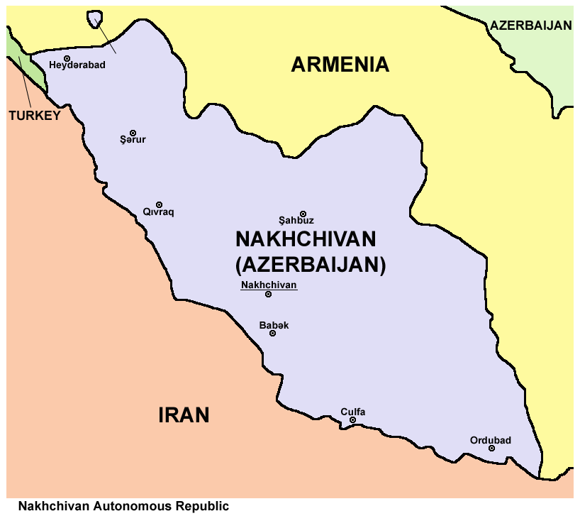
An enclave is a territory that is entirely surrounded by the territory of only one other state or entity. An enclave can be an independent territory or part of a larger one. Enclaves may also exist within territorial waters. ''Enclave'' is sometimes used improperly to denote a territory that is only partly surrounded by another state. Enclaves that are not part of a larger territory are not exclaves, for example Lesotho (enclaved by South Africa), and San Marino and Vatican City (both enclaved by Italy) are enclaved sovereign states. An exclave is a portion of a state or district geographically separated from the main part, by some surrounding alien territory. Many exclaves are also enclaves, but an exclave surrounded by the territory of more than one state is not an enclave. The Azerbaijani exclave of Nakhchivan is an example of an exclave that is not an enclave, as it borders Armenia, Iran, and Turkey. Semi-enclaves and semi-exclaves are areas that, except for possessing ... [...More Info...] [...Related Items...] OR: [Wikipedia] [Google] [Baidu] |
Long Ditton
Long Ditton is a residential suburb in the borough of Borough of Elmbridge, Elmbridge, Surrey, England on the boundary with the Royal Borough of Kingston upon Thames, Greater London, London. In medieval times it was a villages in the United Kingdom, village, occupying a narrow strip parish, strip of land. Neighbouring settlements include Hinchley Wood, Thames Ditton and Surbiton. Its northernmost part is south-west of central Kingston upon Thames, 11.3 miles from Charing Cross, and north-east of Guildford. It is divided in two by the South West Main Line and is bordered by a straight east–west spur road to meet the A3 road (Great Britain), A3 in a cutting (transportation), cutting to the south. The old Portsmouth Road passes by the River Thames in the northern end of the village, and the riverbank here is privately owned. In both local economy and public transport, the high street and railway stations at Hinchley Wood railway station, Hinchley Wood and Surbiton railway stat ... [...More Info...] [...Related Items...] OR: [Wikipedia] [Google] [Baidu] |
Domesday Book
Domesday Book ( ; the Middle English spelling of "Doomsday Book") is a manuscript record of the Great Survey of much of England and parts of Wales completed in 1086 at the behest of William the Conqueror. The manuscript was originally known by the Latin name , meaning "Book of Winchester, Hampshire, Winchester", where it was originally kept in the royal treasury. The ''Anglo-Saxon Chronicle'' states that in 1085 the king sent his agents to survey every shire in England, to list his holdings and dues owed to him. Written in Medieval Latin, it was Scribal abbreviation, highly abbreviated and included some vernacular native terms without Latin equivalents. The survey's main purpose was to record the annual value of every piece of landed property to its lord, and the resources in land, labour force, and livestock from which the value derived. The name "Domesday Book" came into use in the 12th century. Richard FitzNeal wrote in the ( 1179) that the book was so called because its de ... [...More Info...] [...Related Items...] OR: [Wikipedia] [Google] [Baidu] |
Kingston (hundred)
The Hundred of Kingston or Kingston Hundred was an ancient hundred in the north east of the county of Surrey, England. Its area has been mostly absorbed by the growth of London and its name currently refers to both the suburban town of Kingston upon Thames and the larger Royal Borough of Kingston upon Thames. Its former area now corresponds to that borough and part of the London Borough of Richmond upon Thames in Greater London and part of the borough of Elmbridge in Surrey. It bordered the Hundred of Brixton to the east, the Hundred of Elmbridge to the south, and to the west and north by the River Thames. It contained the following parishes: *Chessington (until 1610) *Esher (part)Remainder in Elmbridge * Ham with Hatch (created in 1866 from part of Kingston upon Thames) *Hook (created in 1866 from part of Kingston upon Thames) *Kew *Kingston upon Thames *Long Ditton * Malden * Petersham *Richmond *Thames Ditton (part, from 1769) In ''Domesday Book Domesday Book ( ; the ... [...More Info...] [...Related Items...] OR: [Wikipedia] [Google] [Baidu] |
Thames Ditton
Thames Ditton is a suburban village on the River Thames, in the Elmbridge borough of Surrey, England. Apart from a large inhabited island in the river, it lies on the southern bank, centred south-west of Charing Cross in central London. Thames Ditton is just outside Greater London but within the Greater London Urban Area, as defined by the Office for National Statistics. Its clustered village centre and shopping area on a winding High Street is surrounded by housing, schools and sports areas. Its riverside faces the Thames Path and Hampton Court Palace Gardens and golf course in the London Borough of Richmond upon Thames. Its most commercial area is spread throughout its conservation area and contains restaurants, cafés, shops and businesses. Thames Ditton joins Long Ditton and Weston Green in occupying the land between Surbiton, Esher and East Molesey. Although reduced to less than , it formerly covered more than . History Pre–1800 The first written record of Tham ... [...More Info...] [...Related Items...] OR: [Wikipedia] [Google] [Baidu] |
Surbiton
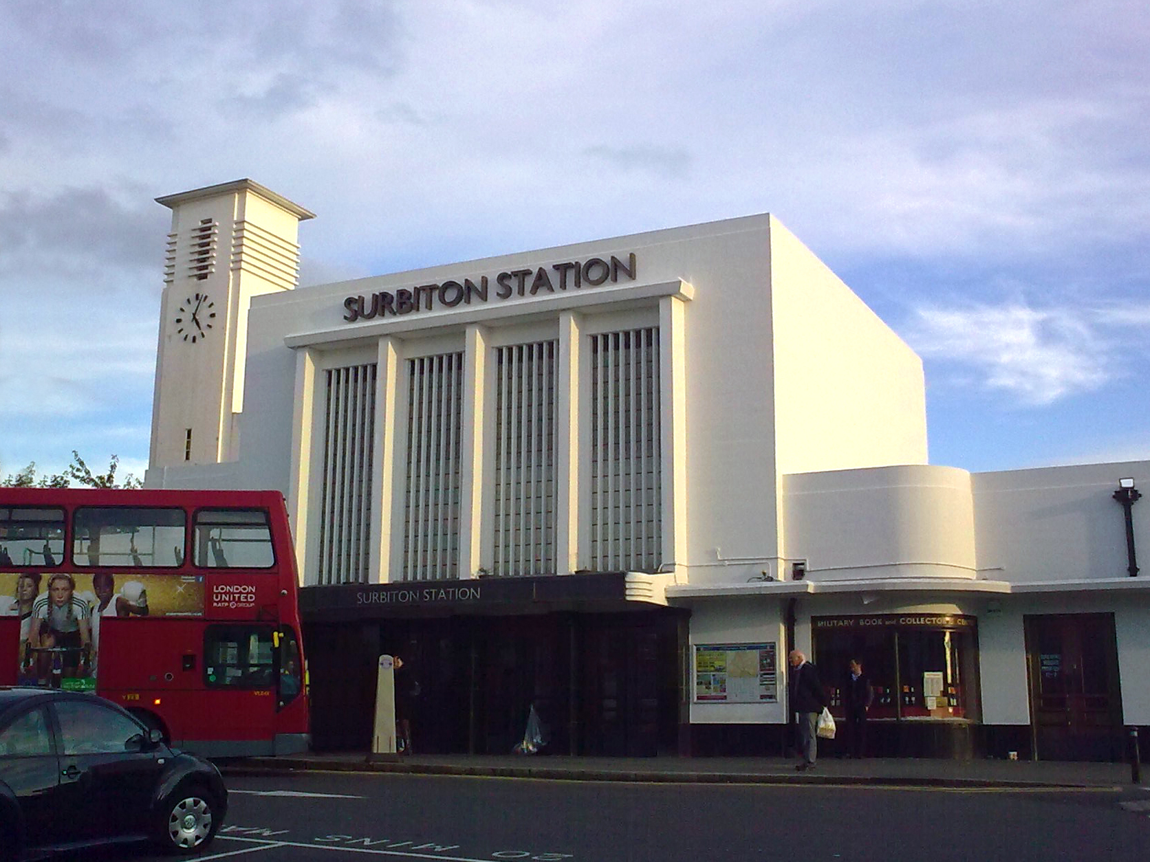
Surbiton is a suburban neighbourhood in South West London, within the Royal Borough of Kingston upon Thames (RBK). It is next to the River Thames, southwest of Charing Cross. Surbiton was in the Historic counties of England, historic county of Surrey and since 1965 it has been in Greater London. Surbiton comprises five of the RBK's wards: Alexandra, Berrylands, St. Mark's, Surbiton Hill, and Tolworth. Founded originally as Kingston-upon-Railway when the area was first developed in the 1840s, Surbiton possesses a mixture of grand 19th-century townhouses, Art Deco Quadrangle (architecture), courts, and more recent residential blocks blending in with semi-detached 20th-century housing estates. With a population of 45,132 in 2016, it accounts for approximately 25% of the total population of the Royal Borough of Kingston upon Thames. Surbiton extends over an area of . Etymology Though Surbiton only received its current name in 1869, the name is attested as ''Suberton'' in 1179, ''S ... [...More Info...] [...Related Items...] OR: [Wikipedia] [Google] [Baidu] |
Richmond, London
Richmond is a town in south-west London,The London Government Act 1963 (c.33) (as amended) categorises the London Borough of Richmond upon Thames as an Outer London borough. Although it is on both sides of the River Thames, the Boundary Commission for England defines it as being in South London or the South Thames sub-region, pairing it with Royal Borough of Kingston upon Thames, Kingston upon Thames for the purposes of devising constituencies. However, for the purposes of the London Plan, Richmond now lies within the West London (sub region), West London region. west-south-west of Charing Cross. It stands on the River Thames, and features many Richmond upon Thames parks and open spaces, parks and open spaces, including Richmond Park, and many protected conservation areas, which include much of Richmond Hill, London, Richmond Hill. A specific Richmond, Petersham and Ham Open Spaces Act 1902, Act of Parliament protects the scenic view of the River Thames from Richmond. Rich ... [...More Info...] [...Related Items...] OR: [Wikipedia] [Google] [Baidu] |
Petersham, London
Petersham is a village in the London Borough of Richmond upon Thames on the east of the bend in the River Thames south of Richmond, London, Richmond, which it shares with neighbouring Ham, London, Ham. It provides the foreground of the scenic view from Richmond, London, Richmond Hill across Petersham Meadows, with Ham House further along the river. Other nearby places include Twickenham, Isleworth, Teddington, Mortlake, and Roehampton. History Petersham appears in Domesday Book (1086) as ''Patricesham''. It was held by Chertsey Abbey. Its assets were: 4 hide (unit), hides; 1 church, 5 ploughs, 1 fishery worth 1,000 eels and 1000 lampreys, of meadow. It rendered £6 10s 0d. Archibald Campbell, 3rd Duke of Argyll, Archibald Campbell, later 3rd Duke of Argyll and Earl of Islay, was born at Ham House in 1682. He went on to found the Royal Bank of Scotland in Edinburgh in 1727. The explorer George Vancouver retired to Petersham, where he wrote George Vancouver#Works by Geor ... [...More Info...] [...Related Items...] OR: [Wikipedia] [Google] [Baidu] |
Municipal Borough Of Kingston-upon-Thames
Kingston-upon-Thames (spelt with hyphens) was a local government district in north east Surrey, England from 1835 to 1965 around the town now known as Kingston upon Thames. It was alternatively known as Kingston on Thames (spelt with or without hyphens).On the question of hyphenation, see official documents and other publications from before 1 April 1965. It was a Borough status in the United Kingdom, municipal borough and also held the rarer status of Royal borough. The district was abolished in 1965 and was replaced with the larger Royal Borough of Kingston upon Thames, London Borough of Kingston upon Thames in Greater London, with the Royal borough status passed to the new district. History The ancient borough of Kingston upon Thames, Kingston-upon-Thames received its charter in 1200 from John, King of England, King John. The borough corporation was reformed by the Municipal Corporations Act 1835. The ancient Kingston upon Thames (parish), parish of Kingston-upon-Thames wa ... [...More Info...] [...Related Items...] OR: [Wikipedia] [Google] [Baidu] |


