|
Kindrochit Castle
Kindrochit Castle () is a ruined 14th-century fortification in Aberdeenshire, Scotland. It is located at Braemar, in a strategic position on the banks of the Clunie Water, a tributary of the River Dee. The ruins are protected as a scheduled monument. History Kindrochit was a hunting seat of King Robert II, who issued charters here most years between 1371 and 1388. In 1390, Robert III granted a licence to Malcolm Drummond to build a new tower on the site.The site of the earlier royal lodge was excavated in the 1920s and included a hall around , with square towers at each corner. John Erskine, Earl of Mar showed the ruined castle at Kindrochit to John Taylor when the poet made his ''Pennyles Pilgrimage'' to Scotland in 1618. Taylor, who rode with the Earl from Braemar Castle, was told that Malcolm Canmore had built the castle in the 11th century. He thought it remarkable because he did not see another house in the next 12 days of their ride. C. Michael Hogan has suggeste ... [...More Info...] [...Related Items...] OR: [Wikipedia] [Google] [Baidu] |
Braemar
Braemar is a village in Aberdeenshire, Scotland, around west of Aberdeen in the Highlands. It is the closest significantly-sized settlement to the upper course of the River Dee, sitting at an elevation of . The Gaelic ''Bràigh Mhàrr'' properly refers to the area of upper Marr (as it literally means), i.e. the area of Marr to the west of Aboyne, the village itself being Castleton of Braemar (''Baile a' Chaisteil'' in Scottish Gaelic). The village used to be known as ''Cinn Drochaid'' ('bridge end'); ''Baile a' Chaisteil'' referred to only the part of the village on the east bank of the river, the part on the west bank being known as ''Ach an Droighinn'' ('thorn field'). Geography Braemar is approached from the south on the A93 from Glen Clunie and the Cairnwell Pass and from the East also on the A93 from Deeside. Braemar can be approached on foot from the west through Glen Tilt, Glen Feshie, Glen Dee (by the Lairig Ghru), and Glen Derry (by the Lairig an Laoigh) ... [...More Info...] [...Related Items...] OR: [Wikipedia] [Google] [Baidu] |
Malcolm Canmore
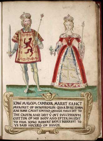
Malcolm III (; ; –13 November 1093) was King of Alba from 1058 to 1093. He was later nicknamed "Canmore" (, , understood as "great chief"). Malcolm's long reign of 35 years preceded the beginning of the Scoto-Norman age. Henry I of England and Eustace III, Count of Boulogne were his sons-in-law, making him the maternal grandfather of Empress Matilda, William Adelin and Matilda I, Countess of Boulogne. All three of them were prominent in English politics during the 12th century. Malcolm's kingdom did not extend over the full territory of modern Scotland: many of the islands and the land north of the River Oykel were Scandinavian, and south of the Firth of Forth there were numerous independent or semi-independent realms, including the kingdom of Strathclyde and Bamburgh, and it is not certain what if any power the Scots exerted there on Malcolm's accession. Throughout his reign Malcolm III led at least five invasions into English territory. One of Malcolm's primary achieve ... [...More Info...] [...Related Items...] OR: [Wikipedia] [Google] [Baidu] |
Castles In Aberdeenshire
A castle is a type of fortified structure built during the Middle Ages predominantly by the nobility or royalty and by military orders. Scholars usually consider a ''castle'' to be the private fortified residence of a lord or noble. This is distinct from a mansion, palace, and villa, whose main purpose was exclusively for ''pleasance'' and are not primarily fortresses but may be fortified. Use of the term has varied over time and, sometimes, has also been applied to structures such as hill forts and 19th- and 20th-century homes built to resemble castles. Over the Middle Ages, when genuine castles were built, they took on a great many forms with many different features, although some, such as curtain walls, arrowslits, and portcullises, were commonplace. European-style castles originated in the 9th and 10th centuries after the fall of the Carolingian Empire, which resulted in its territory being divided among individual lords and princes. These nobles built castles ... [...More Info...] [...Related Items...] OR: [Wikipedia] [Google] [Baidu] |
Grampian Mountains
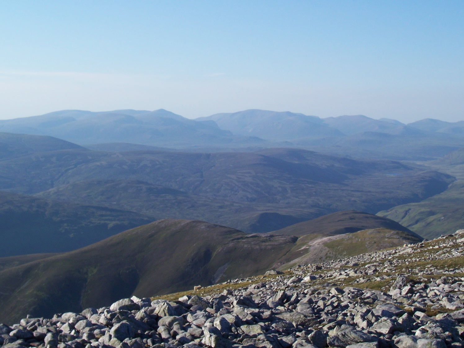
The Grampian Mountains () is one of the three major mountain ranges in Scotland, that together occupy about half of Scotland. The other two ranges are the Northwest Highlands and the Southern Uplands. The Grampian range extends northeast to southwest between the Highland Boundary Fault and the Great Glen. The range includes many of the highest mountains in the British Isles, including Ben Nevis (whose peak contains the highest point in the British Isles at above sea level) and Ben Macdhui (Scotland), Ben Macdui (whose peak contains second-highest at ). A number of rivers and streams rise in the Grampians, including the River Tay, Tay, River Spey, Spey, Cowie Water, Burn of Muchalls, Burn of Pheppie, Burn of Elsick, Cairnie Burn, River Don, Aberdeenshire, Don, River Dee, Aberdeenshire, Dee and River South Esk, Esk. The area is generally sparsely populated. There is some ambiguity about the extent of the range, and until the nineteenth century, they were generally considered to ... [...More Info...] [...Related Items...] OR: [Wikipedia] [Google] [Baidu] |
Mounth
The Mounth ( ) is the broad upland in northeast Scotland between the Highland Boundary and the River Dee, at the eastern end of the Grampians. Name and etymology The name ''Mounth'' is ultimately of Pictish origin. The name is derived from ''*monɪð'', meaning "mountain" (cf. Welsh ''mynydd''). It is invariably referred to as "the Mounth" and pronounced "munth". Details The ranges to the north-west are known as the Monadh Liath and the Monadh Ruadh (called the Cairngorms in English), meaning the ''Grey Mounth'' and the ''Red Mounth''. Some sources regard the Mounth as extending as far west as Drumochter Pass ( A9), but it is now generally agreed to start at the Cairnwell Pass ( A93 – highest main road pass in Britain, Glen Shee ski centre). Here, a high undulating plateau invaded by deep glacial troughs (Glen Isla, Glen Callater, Glen Muick, Glen Clova) culminates in Glas Maol () on the main watershed, with the outlying granite Lochnagar () and its surroundi ... [...More Info...] [...Related Items...] OR: [Wikipedia] [Google] [Baidu] |
Trackway
Historic roads (or historic trails in the US and Canada) are paths or routes that have historical importance due to their use over a period of time. Examples exist from prehistoric times until the early 20th century. They include ancient trackways, long-lasting roads, important trade routes, and migration trails. Many historic routes, such as the Silk Road, the Amber Road, and the Royal Road of the Persian Empire, covered great distances and their impact on human settlements remain today. The Post Track, a prehistoric causeway in the valley of the River Brue in the Somerset Levels, England, is one of the oldest known constructed trackways and dates from around 3800 BCE. The world's oldest known paved road was constructed in Egypt some time between 2600 and 2200 BC. The Roman roads, Romans were the most significant road builders of the ancient world. At the peak of the Roman Empire there were more than of roads, of which over were stone-paved. Another empire, that of the Inca ... [...More Info...] [...Related Items...] OR: [Wikipedia] [Google] [Baidu] |
Elsick Mounth
The Elsick Mounth is an ancient trackway crossing the Grampian Mountains in the vicinity of Netherley, Scotland. This trackway was one of the few means of traversing the Grampian Mounth area in prehistoric and medieval times. The highest pass of the route occurs within the Durris Forest. Notable historical structures in the vicinity are Maryculter House, Lairhillock Inn and Muchalls Castle. Most of the lands through which the Elsick Mounth passes are within the Durris Forest; this forest would have been a mixed deciduous forest in ancient times, but currently it is managed as a coniferous monoculture with extensive amounts of clearfelling and subsequent replanting. History Roman legions marched from Raedykes to Normandykes Roman Camp (now just south of Peterculter) as they sought higher ground so as to avoid the bogs of Red Moss, Aberdeenshire, Red Moss and other low-lying mosses associated with the Burn of Muchalls. That march used the Elsick Mounth, one of the ancient trackway ... [...More Info...] [...Related Items...] OR: [Wikipedia] [Google] [Baidu] |
Durris Castle
Durris Castle or the House of Dores was an early royal residence on the southern bank of the River Dee in Aberdeenshire, Scotland. The castle controlled the northern end of the Crynes Corse Mounth trackway. Dating from at least the 13th century, the castle, a motte and bailey A motte-and-bailey castle is a European fortification with a wooden or stone keep situated on a raised area of ground called a motte, accompanied by a walled courtyard, or bailey, surrounded by a protective ditch and palisade. Relatively easy ..., was occupied by Alexander III of Scotland, Alexander III and is mentioned in the Great Chamberlain, Chamberlain Rolls of the time as the subject of repairs. King Edward I of England stayed one night in 1296 at the castle, during his English invasion of Scotland (1296), invasion of Scotland. Durris was granted to the Clan Fraser, Fraser family by King Robert I of Scotland and created into a barony by King David II of Scotland. It was burned by the Marquis o ... [...More Info...] [...Related Items...] OR: [Wikipedia] [Google] [Baidu] |
Kildrummy Castle
Kildrummy Castle is a ruined castle near Kildrummy, in Aberdeenshire, Scotland. Though ruined, it is one of the most extensive castles dating from the 13th century to survive in eastern Scotland, and was the seat of the Earls of Mar. It is owned today by Historic Environment Scotland and is open to the public as a scheduled monument with gardens that are included in the Inventory of Gardens and Designed Landscapes in Scotland. History The castle was probably built in the mid-13th century under Gilbert de Moravia. It has been posited that siting of Kildrummy Castle was influenced by the location of the Grampian Mounth trackway crossings, particularly the Elsick Mounth and Cryne Corse Mounth. Kildrummy Castle underwent siege numerous times in its history, first in defence of the family of Robert the Bruce in August–September 1306 (leading to the executions of Nigel de Brus, Nigel Bruce and many other Scots), and again in 1335 by David of Strathbogie. On this occasion Christina ... [...More Info...] [...Related Items...] OR: [Wikipedia] [Google] [Baidu] |
Braemar Castle
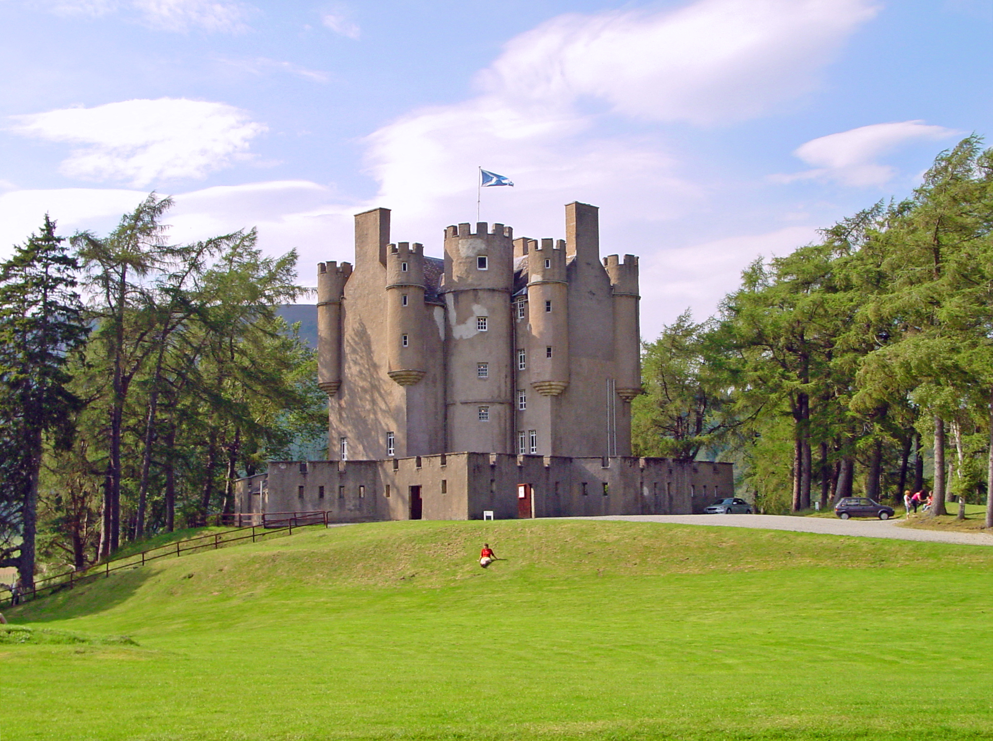
Braemar Castle is situated near the village of Braemar in Aberdeenshire, Scotland. It is a possession of the chief of Clan Farquharson and is leased to a local charitable foundation. It is open to the public. History From the Late Middle Ages, the castle was a stronghold of the Earls of Mar. The present Braemar Castle was constructed in 1628 by John Erskine, Earl of Mar (1558–1634), John Erskine, Earl of Mar, as a hunting lodge and to counter the rising power of the Farquharsons,''Braemar Castle'', Nevisprint Ltd, Fort William, 20 pages, replacing an older building, which was the successor of nearby Kindrochit Castle, which dates from the 11th century AD. The siting of Kindrochit Castle was based upon the strategic location of this site relative to historic crossings of the Grampian Mountains, Grampian Mounth. An important garrison after the 1745 Jacobite rising, Braemar Castle had been attacked and burned by Inverey#John Farquharson, 3rd of Inverey, John Farquharson, the ... [...More Info...] [...Related Items...] OR: [Wikipedia] [Google] [Baidu] |
Aberdeenshire
Aberdeenshire (; ) is one of the 32 Subdivisions of Scotland#council areas of Scotland, council areas of Scotland. It takes its name from the Shires of Scotland, historic county of Aberdeenshire (historic), Aberdeenshire, which had substantially different boundaries. The Aberdeenshire Council area includes all of the areas of the historic counties of Aberdeenshire and Kincardineshire except the area making up Aberdeen City Council area, as well as part of Banffshire. The historic county boundaries are still officially used for a few purposes, namely land registration and Lieutenancy areas of Scotland, lieutenancy. Aberdeenshire Council is headquartered at Woodhill House in Aberdeen, making it the only Scottish council whose headquarters are located outside its jurisdiction. Aberdeen itself forms a different council area (Aberdeen City). Aberdeenshire borders onto Angus, Scotland, Angus and Perth and Kinross to the south, Highland (council area), Highland and Moray to the west a ... [...More Info...] [...Related Items...] OR: [Wikipedia] [Google] [Baidu] |
John Taylor (poet)
John Taylor (24 August 1578 – December 1653) was an English poet who dubbed himself "The Water Poet". Biography John Taylor was born in the parish of St. Ewen's, near South Gate, Gloucester on 24 August 1578. His parentage is unknown, as the parish registers did not survive the Civil War. He did, however, attend elementary school and grammar school there. His grammar school education may have taken place at the Crypt School in Gloucester, however Taylor never finished his formal education due to difficulties with his Latin studies. In the early 1590s, after his attempt at grammar school he moved from his home to south London, probably Southwark, to begin an apprenticeship as a waterman. His occupation was one deemed unpopular by the literary elite of London. Watermen were known to be drunkards, and often gossips and liars, who attempted to cheat patrons into a higher wage for their service. This occupation would be crafted into an image for Taylor later in his career. After h ... [...More Info...] [...Related Items...] OR: [Wikipedia] [Google] [Baidu] |


