|
Kharghar
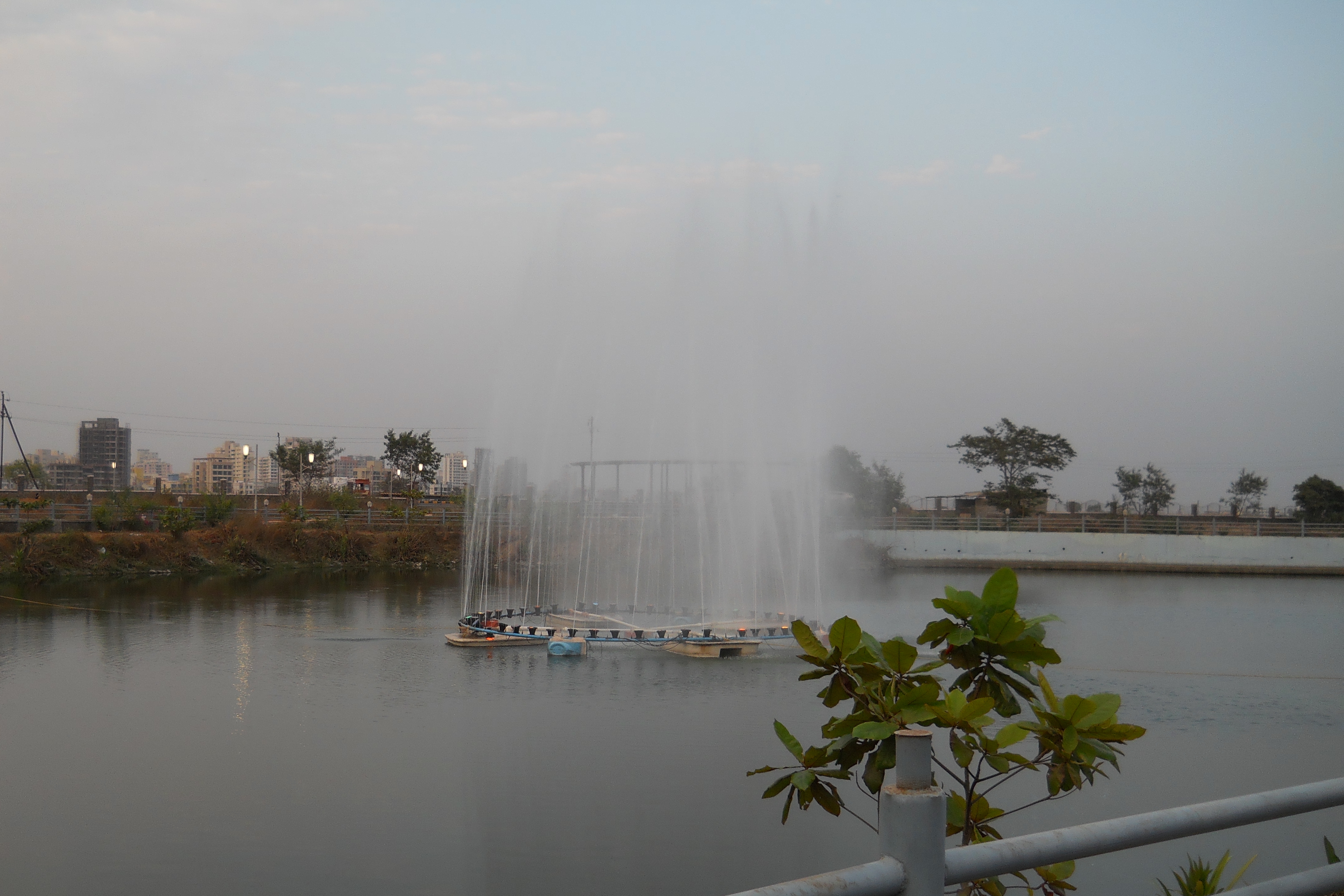
Kharghar is a node of Raigad District's Navi Mumbai and it is a suburb under Panvel Municipal Corporation. It is situated at the northernmost tip of Raigad district. It was developed by the City and Industrial Development Corporation (CIDCO). Kharghar is administered by Panvel Municipal Corporation after its elevation from Municipal Council in 2016, However CIDCO continues to function as the New Town Development Authority for the region. Prashant Thakur, MLA represents Kharghar in the State Legislative Assembly as part of Panvel constituency. Kharghar is also developed as Education Hub of Navi Mumbai as many prominent schools and colleges are present in Kharghar Node and is also one of the posh areas of Navi Mumbai. Transportation Navi Mumbai Metro The Taloja-Belapur part of metro has started functioning and metro service in this part has commenced from 17 November 2023. There had been significant delay in this metro project and earlier CIDCO issued a press release stat ... [...More Info...] [...Related Items...] OR: [Wikipedia] [Google] [Baidu] |
Navi Mumbai
Navi Mumbai (; also known as New Bombay, its official name until 1995) is a large city next to Mumbai, located in the Konkan division of the western Indian state of Maharashtra, on the mainland of India. Navi Mumbai is situated in Thane district. It is a part of the Mumbai Metropolitan Area. The area within the Navi Mumbai Municipal Corporation has been ranked third among 73 cities surveyed for cleanliness and hygiene by the Union Ministry of Urban Development and Quality Council of India as a part of Swachh Bharat Abhiyan and is being modified with various projects and formation. Navi Mumbai has for two consecutive years (2022 and 2023) held on to third rank in the Indian Commonwealth Cleanliness Survey (Swachh Survekshan) — a nationwide sanitation survey of cities — while Mumbai's ranking slipped to 37 in 2023 from 31 in 2022. Navi Mumbai is home to various educational institutions. Various multinational corporations have their head offices/branches across the city, m ... [...More Info...] [...Related Items...] OR: [Wikipedia] [Google] [Baidu] |
Kharghar Railway Station
 Kharghar is the fourth railway station from on the Harbour Line of the Mumbai Suburban Railway network. Local trains of the Harbour line in the Central Railway ply between and Chhatrapati Shivaji Maharaj Terminus stations and the Western line is connected through the Wadala Road railway station, Wadala Road station.
It takes about 65 minutes to reach Kharghar by suburban train from Chhatrapati Shivaji Maharaj Terminus. A new broad-gauge line will connect Kharghar to via . The line connecting to Karjat will be completed in 2019. Station code of Kharghar Railway Station is KHAG. The Kharghar station has a roof that also functions as a full-fledged parking lot which helps create an elevation statement. This idea, an effort to create value from the original brief, acco ...
[...More Info...] [...Related Items...] OR: [Wikipedia] [Google] [Baidu] |
Utsav Chowk
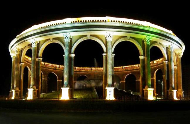
Utsav Chowk is one of the famous landmarks of Kharghar, Navi Mumbai, in the Indian state of Maharashtra Maharashtra () is a state in the western peninsular region of India occupying a substantial portion of the Deccan Plateau. It is bordered by the Arabian Sea to the west, the Indian states of Karnataka and Goa to the south, Telangana to th .... Kharghar is one of the towns in Raigad district of Navi Mumbai area. It is a well planned town and Utsav Chowk is a prominent landmark just between Sector-4, Sector-7 and Sector-5 of Kharghar town. Utsav Chowk stands out for its eye catching architecture which is a humble reflection of the Roman and Greek architecture. Earlier Utsav Chowk was known for the eateries that came up in the evening here and people enjoyed different types of snacks and food here but due to issues related to upkeep of this area they were removed from here. Utsav Chowk is at the crossing of raintree road and pravesh marg (entry road) in Kharghar. Near ... [...More Info...] [...Related Items...] OR: [Wikipedia] [Google] [Baidu] |
Central Park, Kharghar
The Central Park of Kharghar is an urban park in Navi Mumbai, India that covers an area of around spread across the city's sectors 23,24 and 25. Overview Open to the public since 2010, it includes theme parks, morning walk-trails, jogging tracks, watersports, cricket and Association football, football grounds, sports clubs, botanical gardens, amphitheaters along with active and passive recreation areas. The main walking track is of 1.5 kilometers length. It is expected to be one of the largest gardens in Asia when fully developed. It is near to Sector 20, Jalvayu Vihar, and opposite the well known Pandavkada cave and waterfall. An 18-hole golf course is also open to the public. As per CIDCO it will be largest park in Asia and third largest in the world. It also houses many dance sculptures, musical sculptures, and was rated one of the most 'Beautiful Gardens of The World', more beautiful than Lodhi Gardens in New Delhi. There are more than 1000 picnic places for families. T ... [...More Info...] [...Related Items...] OR: [Wikipedia] [Google] [Baidu] |
Panvel Municipal Corporation
Municipal Corporation of The City of Panvel is the governing body of the city of Panvel and 29 revenue villages including Taloje Pachnand, Kharghar, Kamothe in Raigad district. Panvel Municipal Corporation is headed by Mayor of city and governed by Commissioner. Panvel Municipal Corporation has been formed with functions to improve the infrastructure of town. In 2016 Maharashtra State cabinet decided to elevate Panvel Municipal Council to Municipal Corporation under Maharashtra Regional and Town Planning Act, 1966. The mismanagement of the Panvel Municipal Corporation has led to illegal encroachments in many municipal areas, such as New Township Navde near NH4, Kharghar near D-Mart, and the area near Panvel bus depot. The Municipal Corporation does not have its own transportation system and is entirely dependent on Navi Mumbai Municipal Transport (NMMT). The internal roads in nodal areas, such as Kopar, Navde, and Taloja, are currently in poor condition. The city is laggin ... [...More Info...] [...Related Items...] OR: [Wikipedia] [Google] [Baidu] |
Navi Mumbai Metro
The Navi Mumbai Metro is a rapid transit system in the city of Navi Mumbai, Maharashtra, India. The planning and construction of the Navi Mumbai Metro was overseen by the City and Industrial Development Corporation (CIDCO). The system is planned to consist of five rail lines covering a total distance of , out of which one is operational and the other four are being planned. The foundation stone for the project was laid on 1 May 2011, with a target completion date of 2014. After over 9 years of delays, due to slowdowns in construction caused by lack of labour and adequate funding, along with land acquisition issues, the Line-1 of the metro commenced operations on 17 November 2023. History The Navi Mumbai Metro projects received formal approval on 29 April 2010, and a public hearing on 21 May 2010 reported no major objections to the plan. CIDCO was named as the implementing agency of the Belapur–Pendhar–Kalamboli–Khandeshwar line, under the Indian Tramway Act 1886, by the G ... [...More Info...] [...Related Items...] OR: [Wikipedia] [Google] [Baidu] |
Raigad District
Raigad district (), previously Colaba fort, Colaba district, is a district in the Konkan division of Maharashtra, India. The headquarters of the district is Alibag. Other major cities in the district are Panvel, Karjat, Navi Mumbai, Khopoli, Shrivardhan and Mahad. The district was renamed to Raigad fort, Raigad after the fort that was the first capital of the former Maratha Empire, which in turn was renamed from its earlier name - Rairi. The fort is located in the interior regions of the district, in dense forests on a west-facing spur of the Western Ghats of Sahyadri Range. In 2011 the district had a population of 2,634,200, compared to 2,207,929 in 2001. The name was changed in the regime of Chief Minister A. R. Antulay on 1 January 1981. In 2011 urban dwellers had increased to 36.91% from 24.22% in 2001. Alibag is the headquarters of Raigad district. Raigad district's neighbouring districts are Mumbai, Thane districts on North, Pune district on East, Satara district on South ... [...More Info...] [...Related Items...] OR: [Wikipedia] [Google] [Baidu] |
Navi Mumbai International Airport
Navi Mumbai International Airport is an international airport being constructed in Ulwe, Navi Mumbai, Raigad district, Maharashtra, India. When completed, it will become the second airport of the Mumbai Metropolitan Region, serving alongside Mumbai's existing Chhatrapati Shivaji Maharaj International Airport. The development and construction of the airport is being overseen by Navi Mumbai International Airport Limited (NMIAL), which was established as a special-purpose vehicle by Adani Group, Adani Airports Holdings Limited and Mumbai's City and Industrial Development Corporation (CIDCO), the agency responsible for such projects in Maharashtra. The project, estimated to cost , is being executed under a Public–private partnership framework on a Design, Build, Finance, Operate and Transfer (DBFOT) basis. NMIAL will also operate and maintain the airport. As of May 2025, the opening was delayed until at least August 2025. A formal opening date has not been announced. Histo ... [...More Info...] [...Related Items...] OR: [Wikipedia] [Google] [Baidu] |
Kamothe
Kamothe is a node of Navi Mumbai in the Raigad district, Raigad District, developed and maintained by CIDCO. It is located on the Sion Panvel Highway and is the third node towards Mumbai after Panvel and Kalamboli. Location The site of Kamothe adjoins the Central Business District of Belapur (CBD Belapur) of Navi Mumbai and is surrounded by Kharghar in its north, Taloja in north-east, Kalamboli in its east and Panvel in its south. The western region of Kamothe is a wet land area with enormous mangroves and towards the western side, this bed of mangroves will end thus giving way to the upcoming Navi Mumbai International Airport, which is estimated to be finished by 2024. Which can be viewed from the edges of the town due to its elevated position. Kamothe is nustled between the NH548 (connecting to JNPT road) and the Mumbai-Satara Highway. The site is also connected to the small village- Jui Gaav. Characteristics Kamothe is a spacious node, as it is evenly divided into 48 s ... [...More Info...] [...Related Items...] OR: [Wikipedia] [Google] [Baidu] |
Thane
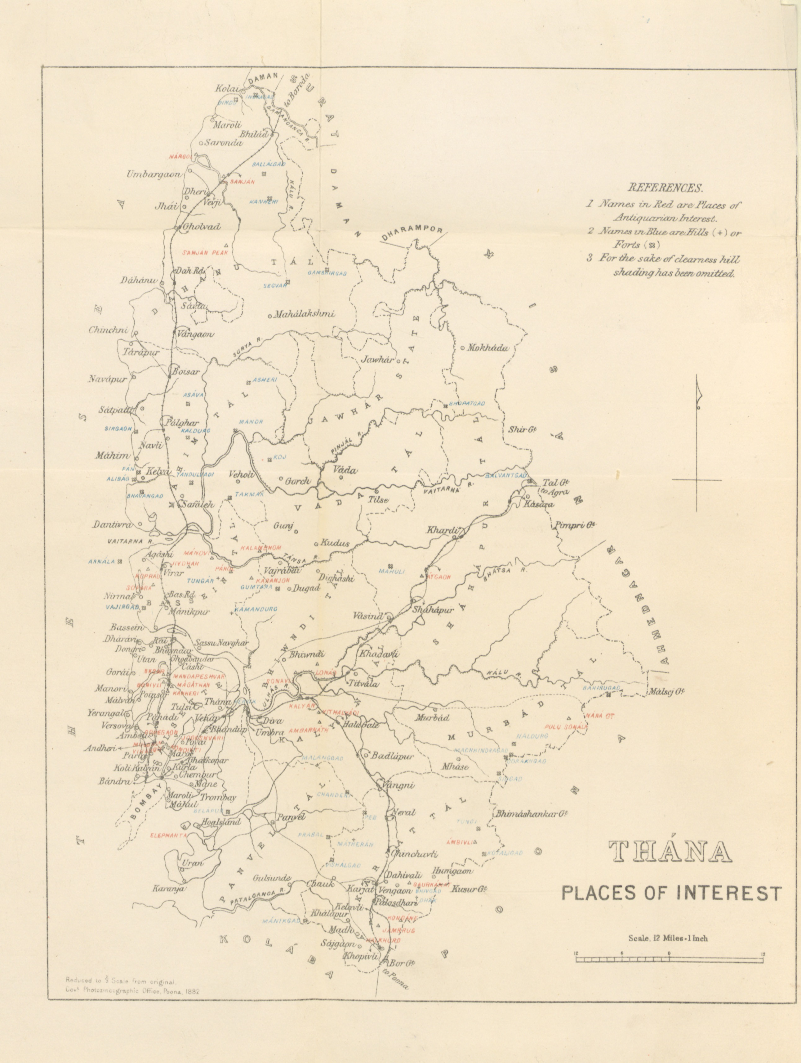
Thane (; previously known as Thana, List of renamed Indian cities and states#Maharashtra, the official name until 1996) is a metropolitan city located on the northwestern side of the list of Indian states, state of Maharashtra in India and on the northeastern side of Mumbai. It is an immediate neighbour of Mumbai city proper, and a part of the Mumbai Metropolitan Region. It is situated in the north-eastern portion of the Salsette Island. Thane city is situated entirely within Thane taluka, one of the seven talukas of Thane district. It serves as the headquarters of the district. Thane city ranks as the 15th most populous city in India, with a population of 1,890,000 according to the 2011 census. Etymology and other names The ancient name of Thana was . It appears as in early medieval Arab sources. The name Thane has been variously Romanised as Tana, Thana, Thâṇâ, and Thame. Ibn Battuta and Abulfeda knew it as KukinTana; Duarte Barbosa as TanaMayambu. Before Renaming of ... [...More Info...] [...Related Items...] OR: [Wikipedia] [Google] [Baidu] |
Maharashtra
Maharashtra () is a state in the western peninsular region of India occupying a substantial portion of the Deccan Plateau. It is bordered by the Arabian Sea to the west, the Indian states of Karnataka and Goa to the south, Telangana to the southeast and Chhattisgarh to the east, Gujarat and Madhya Pradesh to the north, and the Indian union territory of Dadra and Nagar Haveli and Daman and Diu to the northwest. Maharashtra is the second-most populous state in India, the third most populous country subdivision in South Asia and the fourth-most populous in the world. The state is divided into 6 divisions and 36 districts. Mumbai is the capital of Maharashtra due to its historical significance as a major trading port and its status as India's financial hub, housing key institutions and a diverse economy. Additionally, Mumbai's well-developed infrastructure and cultural diversity make it a suitable administrative center for the state, and the most populous urban are ... [...More Info...] [...Related Items...] OR: [Wikipedia] [Google] [Baidu] |
Central Park Kharghar Plan
Central is an adjective usually referring to being in the center of some place or (mathematical) object. Central may also refer to: Directions and generalised locations * Central Africa, a region in the centre of Africa continent, also known as Middle Africa * Central America, a region in the centre of America continent * Central Asia, a region in the centre of Eurasian continent * Central Australia, a region of the Australian continent * Central Belt, an area in the centre of Scotland * Central Europe, a region of the European continent * Central London, the centre of London * Central Region (other) * Central United States, a region of the United States of America Specific locations Countries * Central African Republic, a country in Africa States and provinces * Blue Nile (state) or Central, a state in Sudan * Central Department, Paraguay * Central Province (Kenya) * Central Province (Papua New Guinea) * Central Province (Solomon Islands) * Central Province, Sri Lanka ... [...More Info...] [...Related Items...] OR: [Wikipedia] [Google] [Baidu] |


