|
Kattinahole
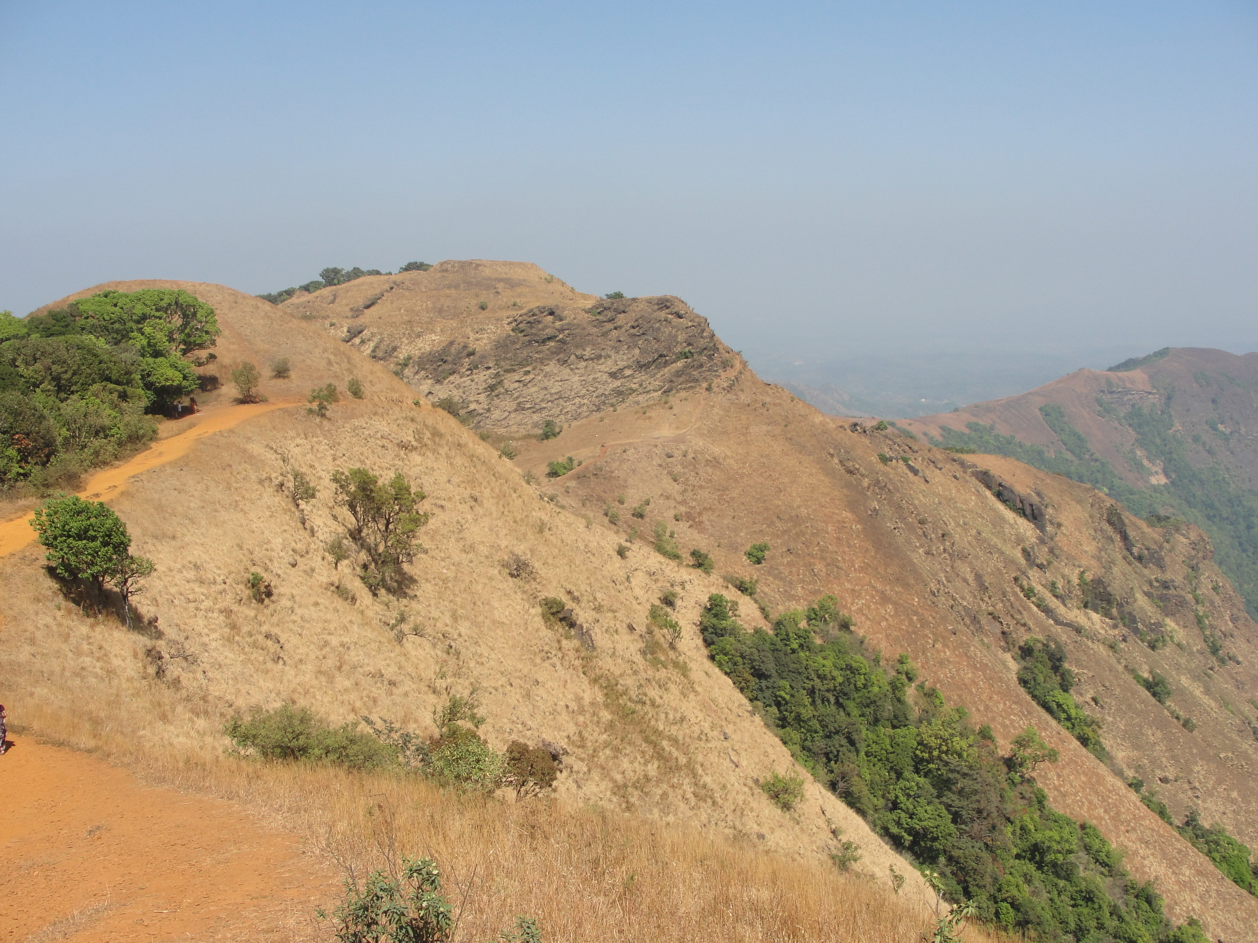
Kattinahole ಕಟ್ಟಿನಹೊಳೆ is a small village in Hosanagara Taluk, Shimoga district of the Indian state of Karnataka. The local language of Kattinahole is Kannada. Geography It is situated in Mookambika National Park, close to the Kodachadri hilltop. The surrounding forest and hills are typical of the tropical rain forest seen along India's Western Ghats. Kattinahole is surrounded by Sagar Taluk to the North, Thirthahalli taluk to the South, Hosanagara Taluk to the East, and Byndoor Taluk to the West. Its elevation is 644 meters. Economy It has homestays for tourists. Education Local colleges are Sharavathi First Grade College, Sagar Gangotri College of Law, Sahyadri Science College, Shravathi Dental College And Hospital and National Evening College of Commerce. Its primary schools are Glps Kattinahole and Glps Kattinahole Cross. Transportation Talaguppa Railway Station (near to Sagar), Sagar Jambagaru Railway Station (near to Sagar), Shimoga Railw ... [...More Info...] [...Related Items...] OR: [Wikipedia] [Google] [Baidu] |
Kodachadri
Kodachadri ( kn, ಕೊಡಚಾದ್ರಿ) is a mountain peak with dense forests (elevation - 1,343 metres above sea level) in the Western Ghats in South India (Shivamogga District, Karnataka), 78 km from Shimoga. It is declared as natural heritage site by the Karnataka Government. and it is 13th highest peak of Karnataka. Etymology The name comes from native word "Kodacha" or "Kodashi", which means Kutaja flowers, and "Adri", a Sanskrit word for mountain, both combined to coin the word Kodachadri. " Kuţaja" in Sanskrit means ''Girimallika'' or ''Jasmine of the hill'' ('' Wrightia antidysenterica''). The hilly region that is full of "Jasmine of the hills" plants is "Kutajagiri". It is also called "Kutachadri" and "Kodashi Parvatha". Location Kodachadri forms a background to the temple of Mookambika in Kollur. It is located at a distance of 21 km from Kollur and 15 km from Nagodi village, in Hosanagara taluk. 78 km and 42 km from Sagara, Karna ... [...More Info...] [...Related Items...] OR: [Wikipedia] [Google] [Baidu] |
Hosanagara
Hosanagara is a panchayat town in Shimoga district in the Indian state of Karnataka. It is nested in western ghats of India. The World Cattle Conference with main emphasis on cow was held in month of April 2007 in Hosanagar. The different uses of cow (not the meat) were exhibited. Near Hosanagar there is a mutt named Sri Ramachandrapura Math, 6 km from the town. Geography Hosanagar is located at . It has an average elevation of 585 metres (1919 feet). Hosanagar Taluk is full of forested areas. A sizable area of the Taluk is covered by the backwaters of Linganamakki Dam, built across Sharavati River. This Taluk receives heavy rainfall during monsoon season (June–October). Hosanagar is a taluk with 30 gram panchayats. A megalithic site has been discovered at the Byse village in the Hosanagar taluka. Climate As this taluk is in the windward side of western ghats, this place gets heavy to heavy rainfall during June–September in the monsoon season. Th ... [...More Info...] [...Related Items...] OR: [Wikipedia] [Google] [Baidu] |
Shimoga District
Shimoga district, officially known as Shivamogga district, is a district in the Karnataka state of India. A major part of Shimoga district lies in the Malnad region or the Sahyadri. Shimoga city is its administrative centre. Jog Falls view point is a major tourist attraction. As of 2011 Shimoga district has a population of 17,52,753. There are seven taluks: Soraba, Sagara, Hosanagar, Shimoga, Shikaripura, Thirthahalli, and Bhadravathi. Channagiri and Honnali were part of Shimoga district until 1997 when they became part of the newly formed Davanagere district. Origin of name ''Shivamogga'' was previously known as Mandli. There are legends about how the name ''Shivamogga'' has evolved. According to one, the name ''Shivamogga'' is related to the Hindu God Shiva. ''Shiva-Mukha'' (Face of Shiva), ''Shivana-Moogu'' (Nose of Shiva) or ''Shivana-Mogge'' (Flowers to be offered to Shiva) can be the origins of the name "Shivamogga". Another legend indicates that the name ... [...More Info...] [...Related Items...] OR: [Wikipedia] [Google] [Baidu] |
Karnataka
Karnataka (; ISO: , , also known as Karunāḍu) is a state in the southwestern region of India. It was formed on 1 November 1956, with the passage of the States Reorganisation Act. Originally known as Mysore State , it was renamed ''Karnataka'' in 1973. The state corresponds to the Carnatic region. Its capital and largest city is Bengaluru. Karnataka is bordered by the Lakshadweep Sea to the west, Goa to the northwest, Maharashtra to the north, Telangana to the northeast, Andhra Pradesh to the east, Tamil Nadu to the southeast, and Kerala to the southwest. It is the only southern state to have land borders with all of the other four southern Indian sister states. The state covers an area of , or 5.83 percent of the total geographical area of India. It is the sixth-largest Indian state by area. With 61,130,704 inhabitants at the 2011 census, Karnataka is the eighth-largest state by population, comprising 31 districts. Kannada, one of the classical languages of In ... [...More Info...] [...Related Items...] OR: [Wikipedia] [Google] [Baidu] |
Mookambika National Park
Mookambika (, Kannada: ಶ್ರೀ ಮೂಕಾಂಬಿಕಾ) is a Hindu goddess, an aspect of Adi Parashakti, the supreme goddess of Hinduism. She is regarded to be the form of shakti, the divine feminine energy, that represents creativity and ingenuity. Since she is a form of Adi Parashakti, her adherents regard her to be a form of Saraswati, Lakshmi, as well as Parvati. Legend Once, an asura named Kamasura attempted to appease the deity Shiva through penance to become invincible. He had previously received a boon to be killed by only a woman, but because of the death of Mahishasura, Kamasura was alarmed. In order to prevent this, the goddess Saraswati thwarted his speech at the request of the devas, causing him to be incapable of requesting a boon from Shiva. This made Kamasura (now named Mookasura, ''mooka'' meaning dumb) livid with rage. He defeated Indra and took over his kingdom, and subjected the three worlds to chaos. In order to restore the cosmic balance, the ... [...More Info...] [...Related Items...] OR: [Wikipedia] [Google] [Baidu] |
Sagar, Yadgir District
Sagar is a village in the Shahapur taluk of Yadgir district in Karnataka state, India. Sagar is ten kilometres south-southwest (SSW) of the town of Shahapur and 6 km from the Shahapur-Bangalore highway. Sagar is specifically known as Dodda Sagar to differentiate it from Halisagar (the village near by Shahapur city)The nearest railhead is in Yadgir Yadgir is a city and the administrative headquarters of Yadgir district in the Indian state of Karnataka. It is also the administrative headquarters of Yadgir Taluka, one of the six taluks of Yadgir. Geography Yadgir town covers an area .... Demographics census, Sagar had 10,515 inhabitants, with 5,303 males and 5,212 females.Village code= 375400 Notes External links * Villages in Yadgir district {{Yadgir-geo-stub ... [...More Info...] [...Related Items...] OR: [Wikipedia] [Google] [Baidu] |
Thirthahalli
Thirthahalli is a panchayat town located in the Shimoga district of the state of Karnataka, India. It lies on the bank of the river Tunga and is also the headquarters of the Thirthahalli Taluk of Shimoga district. Geography Thirthahalli is located at . It has an average elevation of 591 metres (1938 feet). The Tirthahalli Town Panchayat has population of 14,528 of which 7,093 are males while 7,435 are females as per report released by Census India 2011. Languages The majority of people speak Kannada. There are also a sizeable number of Tulu speakers in this region. Notable people * Kuvempu - Kannada author and poet, Jnanapeetha and Padma Vibhushan awardee * Shantaveri Gopala Gowda - Socialist Leader and Politician. * U. R. Ananthamurthy- Contemporary writer, Novelist and critic, Jnanapeetha and Padma Bhushan awardee. * Kadidal Manjappa- Politician and former Chief Minister of Karnataka * Justice. M Rama Jois - Advocate and Chief Justice, Former Governor ... [...More Info...] [...Related Items...] OR: [Wikipedia] [Google] [Baidu] |
Byndoor
Byndoor is an Coastal Town and the Headquarters of Byndoor Taluk in the Udupi District of Karnataka state, India. It is situated at a distance of about from the state capital Bengaluru and at about from the Udupi district headquarters, area of and has a population of 24,957 as per the census held in 2011. It lies in the foothills of Western Ghats on one side and a beautiful virgin, Someshwar Beach on the other side.The Mookambika Road Byndoor railway station focuses mainly on the pilgrims visiting the Kollur Mookambika Temple which is 28 km from Byndoor. Someshwara beach The beach near Byndoor is called Someshwara beach, because of a temple there. Demographics According to the 2011 census Byndoor Town had a population of 24,957. Byndoor Town Panchayat contains 4 Areas: Yedthare, Paduvari, Taggarse and Byndoor. Byndoor is also called as "Bindupura Chief town during Hoysala Empire". Administration The Byndoor Town Panchayat(ಬೈಂದೂರು ಪಟ್ಟ ... [...More Info...] [...Related Items...] OR: [Wikipedia] [Google] [Baidu] |
Talaguppa
Talaguppa is a village located in Sagara Taluk in Karnataka State, India. The National Highway No.206 (Bengaluru - Honnavara) passes through Talaguppa village. The village is 14.37 km from the taluk's center Sagara, 77.68 km from Shivamogga, and 373 km from Bengaluru. It is located at a distance of 14 km from Jog Falls, the highest waterfall in India and Talaguppa is the linking Railway terminus for Jog falls. Areca nut and paddy are the most grown crops. Shrines There are three major temples in this village. * Shree Kadambeshwar temple * Shree Veerabhadreshwar temple * Shree Ranganath temple * Shree Chaudeshwari Temple Yadavakeri There is a mosque as well as a church near Travellers Bungalow. Nearby villages are Kanle (5.294 km), Shiravanthe (7.201 km), Syduru (7.446 km), Masuru (11.78 km), Keladi (11.82 km), Sagara city (14.37 km), Malve (15.26 km). Transport Talaguppa is connected by Rail from Bengaluru and ... [...More Info...] [...Related Items...] OR: [Wikipedia] [Google] [Baidu] |
Shimoga
Shimoga, officially known as Shivamogga, is a city and the district headquarters of Shimoga district in the central part of the state of Karnataka, India. The city lies on the banks of the Tunga River. Being the gateway for the hilly region of the Western Ghats, the city is popularly nicknamed the "Gateway of Malnad". The population of Shimoga city is 322,650 as per 2011 census. The city has been selected for the Smart Cities project, standing in the fourth position in the state and 25th in the country as of November 2020. The city is 569 m above sea level and is surrounded by lush green paddy fields, arecanut and coconut groves. It is located 267 km from the state capital Bangalore and 195 km from the port city Mangalore. History The name of the city is derived from the term "''shivmoga''". A version of the etymology is the story that Shiva drank the Tunga River water using "''Mogge''", hence the name Shiva-mogga". Another version of the etymology is that the name ... [...More Info...] [...Related Items...] OR: [Wikipedia] [Google] [Baidu] |
Mangalore
Mangalore (), officially known as Mangaluru, is a major port city of the Indian state of Karnataka. It is located between the Arabian Sea and the Western Ghats about west of Bangalore, the state capital, 20 km north of Karnataka– Kerala border, 297 km south of Goa. Mangalore is the state's only city to have all four modes of transport—air, road, rail and sea. The population of the urban agglomeration was 619,664 national census of India. It is known for being one of the locations of the Indian strategic petroleum reserves. The city developed as a port in the Arabian Sea during ancient times, and has since become a major port of India that handles 75 percent of India's coffee and cashew exports. It is also the country's seventh largest container port. Mangalore has been ruled by several major powers, including the Kadambas, Alupas, Vijayanagar Empire, Keladi Nayaks, and the Portuguese. The city was a source of contention between the ... [...More Info...] [...Related Items...] OR: [Wikipedia] [Google] [Baidu] |


