|
Kato Pyrgos
Kato Pyrgos () is a village in Cyprus. Kato Pyrgos is the only Greek Cypriot village located on Morphou Bay and controlled by the Republic of Cyprus. Due to its location, being surrounded by the Troodos Mountains, the Turkish controlled exclave of Kokkina, and the Green Line, it is rather isolated and difficult to reach, and gets significant numbers of visitors only in August during summer vacation. A Green Line crossing point was opened near Kato Pyrgos on 18 October 2010 to facilitate travel from there to Nicosia Nicosia, also known as Lefkosia and Lefkoşa, is the capital and largest city of Cyprus. It is the southeasternmost of all EU member states' capital cities. Nicosia has been continuously inhabited for over 5,500 years and has been the capi .... Notable Places * Church Panagia Galoktistis References External linksAwarded "EDEN - European Destinations of Excellence" non traditional tourist destination 2010 Communities in Nicosia District { ... [...More Info...] [...Related Items...] OR: [Wikipedia] [Google] [Baidu] |
Greek Language
Greek (, ; , ) is an Indo-European languages, Indo-European language, constituting an independent Hellenic languages, Hellenic branch within the Indo-European language family. It is native to Greece, Cyprus, Italy (in Calabria and Salento), southern Albania, and other regions of the Balkans, Caucasus, the Black Sea coast, Asia Minor, and the Eastern Mediterranean. It has the list of languages by first written accounts, longest documented history of any Indo-European language, spanning at least 3,400 years of written records. Its writing system is the Greek alphabet, which has been used for approximately 2,800 years; previously, Greek was recorded in writing systems such as Linear B and the Cypriot syllabary. The Greek language holds a very important place in the history of the Western world. Beginning with the epics of Homer, ancient Greek literature includes many works of lasting importance in the European canon. Greek is also the language in which many of the foundational texts ... [...More Info...] [...Related Items...] OR: [Wikipedia] [Google] [Baidu] |
Troodos Mountains
Troodos or Trodos is the largest mountain range in Cyprus, located in roughly the center of the island. Its highest peak is Mount Olympusalso known in Greek as at . Covering a third of Cyprus's area, the Troodos mountain range stretches across most of the western side of Cyprus. The mountains form a significant rainshadow on the island. There are many mountain resorts, Byzantine monasteries, and churches on mountain peaks, and, nestling in its valleys and mountains, villages which cling to terraced hills. The area has been known since antiquity for its mines, which for centuries supplied copper to the entire Mediterranean. In the Byzantine period it became a centre of Byzantine art, as churches and monasteries were built in the mountains, away from the threatened coastline. The mountains are home to Troodos Station, a listening post for both the American National Security Agency and the British GCHQ. The name ''Troodos'' probably comes from one of two sources: either + ... [...More Info...] [...Related Items...] OR: [Wikipedia] [Google] [Baidu] |
Nicosia
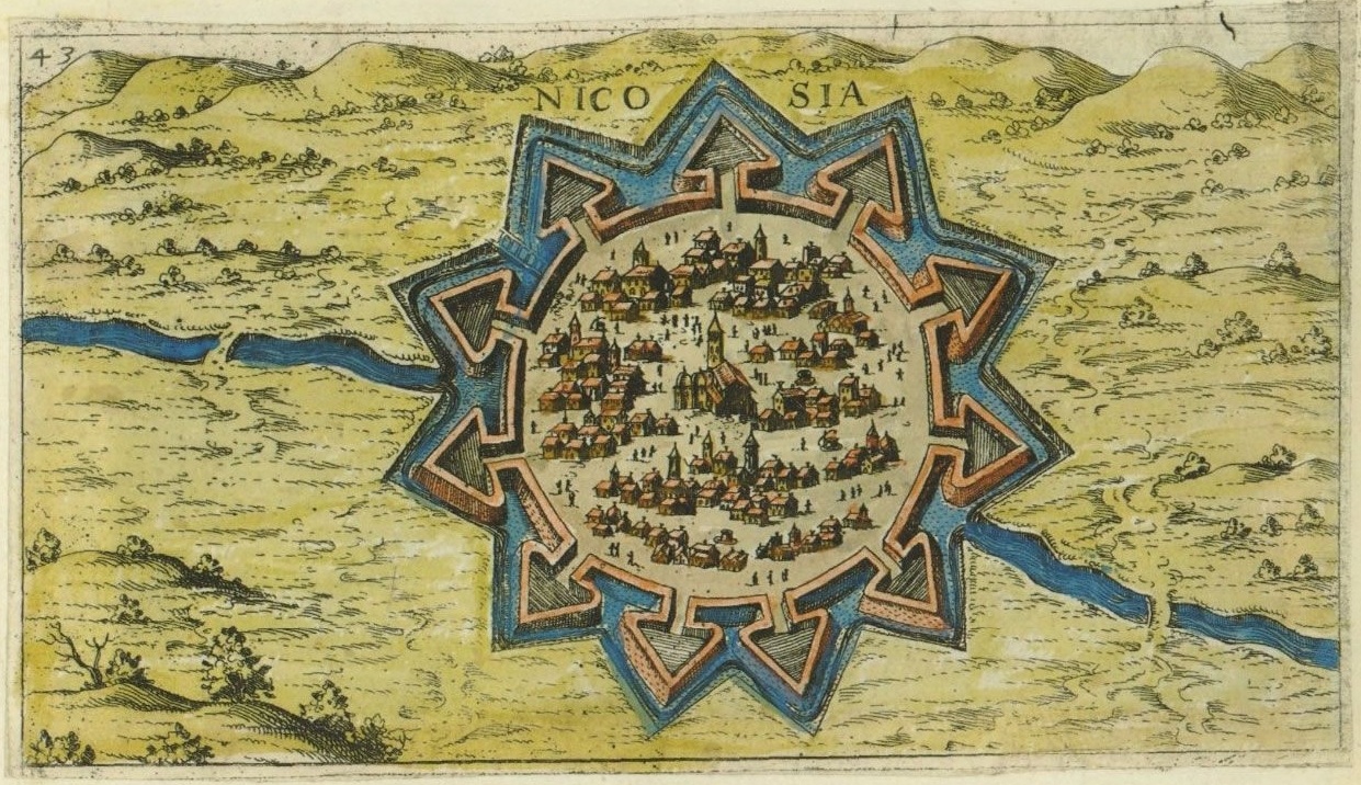
Nicosia, also known as Lefkosia and Lefkoşa, is the capital and largest city of Cyprus. It is the southeasternmost of all EU member states' capital cities. Nicosia has been continuously inhabited for over 5,500 years and has been the capital of Cyprus since the 10th century. It is the last divided capital in Europe; three years after Cyprus gained independence from British rule in 1960, the Bloody Christmas conflict between Greek Cypriots and Turkish Cypriots triggered intercommunal violence, and Nicosia's Greek Cypriot and Turkish Cypriot communities segregated into its south and north respectively in 1964. A decade later, Turkey invaded Cyprus following Greece's successful attempt to take over the island. The leaders of the takeover would later step down, but the dividing line running through Nicosia (and the rest of the island, interrupted only briefly by British military bases) became a demilitarised zone that remains under the control of Cyprus while heavil ... [...More Info...] [...Related Items...] OR: [Wikipedia] [Google] [Baidu] |
Security Checkpoint
Civilian checkpoints or security checkpoints are distinguishable from border or frontier checkpoints in that they are erected and enforced within contiguous areas under military or paramilitary control. Civilian checkpoints have been employed within conflict-ridden areas all over the world to monitor and control the movement of people and materials in order to prevent violence. They have also been used by police during peacetime to help counter terrorism. Contemporary examples Though practices and enforcement vary, checkpoints have been used in: * Airports and other transportation hubs across the world, including those managed by the TSA in the United States. * Post World War II checkpoints in Germany * The former Yugoslavia during the Yugoslav Wars. * Northern Ireland by the Official IRA, Provisional IRA, Irish National Liberation Army, and Real IRA as well as by the British Army, Royal Ulster Constabulary, Police Service of Northern Ireland and also by the Ulster Defense ... [...More Info...] [...Related Items...] OR: [Wikipedia] [Google] [Baidu] |
Summer Vacation
The term summer vacation or summer break refers to a school break in the summer between school years and the break in the school academic year. Students are off anywhere between two weeks to three and a half months. Depending on the country and district, staff might be partially or fully excluded. In Spain, Portugal, the Republic of Ireland, Italy, Greece, Georgia, Lithuania, Latvia, Lebanon, Romania and Russia, the summer break is normally three months, compared to two to six weeks (sometimes 3 months) in Australia, Brazil, the United Kingdom, Pakistan, Bangladesh, India, the Netherlands, Germany and Mexico. Criticisms and support The research around the impact of summer vacation is mixed. " Summer learning loss" (or "summer slide") is the perceived loss of learning students experience due to interrupted education, but the exact consequences of extended breaks is unclear. Some research highlights that school holidays can be stressful periods for children from low-income fam ... [...More Info...] [...Related Items...] OR: [Wikipedia] [Google] [Baidu] |
Green Line (Cyprus)
The United Nations Buffer Zone in Cyprus is a demilitarized zone, patrolled by the United Nations Peacekeeping Force in Cyprus (UNFICYP), that was established on 4 March 1964. It was extended on 9 August after the Battle of Tillyria and extended again in 1974 after the ceasefire of 16 August 1974, following the Turkish invasion of Cyprus and the ''de facto'' partition of the island into the area controlled by the Republic of Cyprus (excluding the British Sovereign Base Areas) and the largely unrecognized Turkish Republic of Northern Cyprus in the north. The zone, also known as the Green Line (, ''Prasini Grammi''; ), stretches for from Paralimni in the east to Kato Pyrgos in the west, where a separate section surrounds Kokkina. The dividing line is also referred to as the Attila Line, named after Turkey's 1974 military invasion, codenamed ''Operation Attila''. The Turkish army has built a barrier on the zone's northern side, consisting mainly of barbed-wire fencing, co ... [...More Info...] [...Related Items...] OR: [Wikipedia] [Google] [Baidu] |
Kokkina Exclave
Kokkina (, ; or ) is a coastal exclave (pene-exclave) of the ''de facto'' Northern Cyprus, and a former Turkish Cypriot enclave in Cyprus. It is surrounded by mountainous territory, with the Morphou Bay on its northern flank. Kokkina sits several kilometres west of mainland Northern Cyprus and is a place with symbolic significance to Turkish Cypriots, because of the events of August 1964 (cf. Battle of Tillyria). In 1976, all Kokkina inhabitants were transferred to Yialousa (renamed ''Yeni Erenköy'' or "New Erenköy" in Turkish) and the enclave has since functioned as a North Cyprus Defence Force military camp for the Turkish forces. History The Tylliria/Dillirga region, where Kokkina is situated, had been a place of intense confrontation between Greek Cypriot and Turkish Cypriot communities during the inter-communal struggle of 1963–1964. On 4 April 1964, armed groups originating from both communities had fought over a strategic location overlooking the region's only ... [...More Info...] [...Related Items...] OR: [Wikipedia] [Google] [Baidu] |
Enclave And Exclave
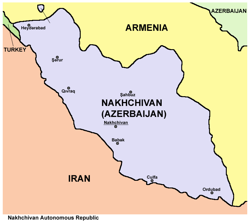
An enclave is a territory that is entirely surrounded by the territory of only one other state or entity. An enclave can be an independent territory or part of a larger one. Enclaves may also exist within territorial waters. ''Enclave'' is sometimes used improperly to denote a territory that is only partly surrounded by another state. Enclaves that are not part of a larger territory are not exclaves, for example Lesotho (enclaved by South Africa), and San Marino and Vatican City (both enclaved by Italy) are enclaved sovereign states. An exclave is a portion of a state or district geographically separated from the main part, by some surrounding alien territory. Many exclaves are also enclaves, but an exclave surrounded by the territory of more than one state is not an enclave. The Azerbaijani exclave of Nakhchivan is an example of an exclave that is not an enclave, as it borders Armenia, Iran, and Turkey. Semi-enclaves and semi-exclaves are areas that, except for possessing ... [...More Info...] [...Related Items...] OR: [Wikipedia] [Google] [Baidu] |
Republic Of Cyprus
Cyprus (), officially the Republic of Cyprus, is an island country in the eastern Mediterranean Sea. Situated in West Asia, its cultural identity and geopolitical orientation are overwhelmingly Southeast European. Cyprus is the third largest and third most populous island in the Mediterranean, after Sicily and Sardinia. It is located southeast of Greece, south of Turkey, west of Syria and Lebanon, northwest of Israel and Palestine, and north of Egypt. Its capital and largest city is Nicosia. Cyprus hosts the British military bases Akrotiri and Dhekelia, whilst the northeast portion of the island is '' de facto'' governed by the self-declared Turkish Republic of Northern Cyprus, which is separated from the Republic of Cyprus by the United Nations Buffer Zone. Cyprus was first settled by hunter-gatherers around 13,000 years ago, with farming communities emerging by 8500 BC. The late Bronze Age saw the emergence of Alashiya, an urbanised society closely connected to the w ... [...More Info...] [...Related Items...] OR: [Wikipedia] [Google] [Baidu] |
Districts Of Cyprus
Cyprus is Administrative division, divided into six districts (; ), whose Capital (political), capitals share the same name. The districts are subdivided into Municipalities of Cyprus, municipalities and communities. The districts of Cyprus are listed in the table below. Note: Northern Cyprus-controlled lands are included in the area figures, but population was not enumerated there. The United Nations Buffer Zone in Cyprus, UN Buffer Zone is included in both population and area figures. Akrotiri and Dhekelia are not included in the area figures, but non-military Cypriot citizens residing there were enumerated. See also * List of cities, towns and villages in Cyprus * Telephone numbers in Cyprus * Postal codes in Cyprus * ISO 3166-2:CY * Districts of Northern Cyprus References External links CityMayors article at ''geo.webnabor.com'' Districts of Cyprus, Subdivisions of Cyprus Lists of administrative divisions, Cyprus, Districts First-level administrative divi ... [...More Info...] [...Related Items...] OR: [Wikipedia] [Google] [Baidu] |
Morphou Bay
Morphou Bay (, ''Kolpos Morfou''; ), is a part of the Mediterranean Sea, located on the north-western side of the island of Cyprus. It is named after the nearby inland town of Morphou (; ). The Morphou Bay region is home to a couple of historical sites, the ancient Greek city of Soli and the ruins known as Vouni Palace. The bay forms the westernmost seaboard of the break-away Turkish Republic of Northern Cyprus, which claims the bay as its own territorial waters. The Turkish Republic of Northern Cyprus has received diplomatic recognition only from Turkey, on which it is dependent economically, politically and militarily. The rest of the international community, including the United Nations and European Union, recognises the sovereignty of the Republic of Cyprus over the entire island, including Morphou Bay. It was here that Turkey began landing supplies and volunteers to assist the Turkish Cypriots Turkish Cypriots or Cypriot Turks ( or ; ) are so called ethnic Turks origi ... [...More Info...] [...Related Items...] OR: [Wikipedia] [Google] [Baidu] |
Greek Cypriot
Greek Cypriots (, ) are the ethnic Greek population of Cyprus, forming the island's largest ethnolinguistic community. According to the 2023 census, 719,252 respondents recorded their ethnicity as Greek, forming almost 99% of the 737,196 Cypriot citizens and over 77.9% of the 923,381 total residents of the area controlled by the Republic of Cyprus. These figures do not include the 29,321 citizens of Greece residing in Cyprus, ethnic Greeks recorded as citizens of other countries, or the population of illegally occupied Northern Cyprus. The majority of Greek Cypriots are members of the Church of Cyprus, an autocephalous Greek Orthodox Church within the wider communion of Orthodox Christianity. In regard to the 1960 Constitution of Cyprus, the term also includes Maronites, Armenians, and Catholics of the Latin Church ("Latins"), who were given the option of being included in either the Greek or Turkish communities and voted to join the former due to a shared religion. His ... [...More Info...] [...Related Items...] OR: [Wikipedia] [Google] [Baidu] |


