|
Kasselaid
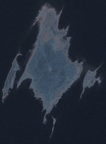
Kasselaid is a uninhabited Estonian islet in the Gulf of Riga, about east of the island of Abruka. Administratively, it belongs to the Abruka village in Saaremaa Parish, Saare County. The island is part of the Abruka Nature Reserve. See also * List of islands of Estonia This is an incomplete list of islands of Estonia. There are 2355 islands in total. Largest islands Incomplete list See also *List of islands in the Baltic Sea *List of islands Notes References {{Authority control Islands of E ... References Uninhabited islands of Estonia Saaremaa Parish Estonian islands in the Baltic {{saare-geo-stub ... [...More Info...] [...Related Items...] OR: [Wikipedia] [Google] [Baidu] |
Abruka
Abruka () is a village in Estonia, primarily composed of the island of Abruka in the Gulf of Riga, 4 km south of the island of Saaremaa. The village includes the smaller adjacent islands of Vahase, Kasselaid, Linnusitamaa and Kirjurahu, resulting in a total area of . Abruka is part of Saaremaa Parish, Saare County. (retrieved 28 July 2021) The village has a population of 33 (as of 1 January 2011). The first records about the population on Abruka originate from the Middle Ages, when the area was ruled by the Prussian State of the Teutonic Order; the Bishop of Ösel-Wiek founded a horse breeding manor on the largest island, named Abro in the Teutonic Order's Low German language. Permanent population developed in the 18th century. From 1881–1972, an elementary school operated on Abruka. Abruka is the site of a Central European-type broadleaf forest, which is rare in the region. To protect this a nature reserve was created in 1937. There's a library (located in the ha ... [...More Info...] [...Related Items...] OR: [Wikipedia] [Google] [Baidu] |
Abruka Nature Reserve
Abruka Nature Reserve is a nature reserve which is located in Saare County, Estonia. It covers the islands of Abruka, Kasselaid and Linnusitamaa Linnusitamaa (also known as Linnusita saar) is a uninhabited Estonian islet in the Gulf of Riga. It is located about south of the island of Abruka. Administratively Linnusitamaa belongs to the Abruka village in Saaremaa Parish, Saare County. Th .... The area of the nature reserve is 414 ha. The protected area was founded in 1937 to protect forests in Abruka. In 2007 the protected area was designated to the nature reserve. References Nature reserves in Estonia Geography of Saare County Saaremaa Parish {{Estonia-geo-stub ... [...More Info...] [...Related Items...] OR: [Wikipedia] [Google] [Baidu] |
List Of Islands Of Estonia
This is an incomplete list of islands of Estonia. There are 2355 islands in total. Largest islands Incomplete list See also *List of islands in the Baltic Sea *List of islands Notes References {{Authority control Islands of Estonia, Lists of islands by country, Estonia Lists of landforms of Estonia, Islands ... [...More Info...] [...Related Items...] OR: [Wikipedia] [Google] [Baidu] |
Gulf Of Riga
The Gulf of Riga, Bay of Riga, or Gulf of Livonia (, , ) is a bay of the Baltic Sea between Latvia and Estonia. The island of Saaremaa (Estonia) partially separates it from the rest of the Baltic Sea. The main connection between the gulf and the Baltic Sea is the Irbe Strait. The Gulf of Riga, as a sub-basin of the Baltic, also includes the Väinameri Sea in the West Estonian archipelago. Geography Extent The International Hydrographic Organization defines the Gulf of Riga's western limit as "A line running from Lyser Ort (57°34'N), in Latvia, to the South extreme of Saaremaa, through this island to Pammana (22°34'E), thence to Emmaste Point, the S extreme of Hiiumaa, through Hiiumaa to Tahkuna Point, the North extreme thereof, and on to Spithamn Point in Estonia". Islands Major islands in the gulf include Saaremaa, Kihnu, and Ruhnu, which are all in Estonian territory. Kihnu covers an area of . Saaremaa island is responsible for the brackish water of the ... [...More Info...] [...Related Items...] OR: [Wikipedia] [Google] [Baidu] |
Counties Of Estonia
The counties of Estonia () are the state administrative subdivisions of Estonia. Estonian territory is composed of 15 counties, including 13 on the mainland and 2 on islands. County governments () were abolished at the end of 2017, with their duties split between state authorities and local governments, and nowadays counties have no noteworthy independent competences. Counties are composed of Municipalities of Estonia, municipalities of two types: urban municipalities or towns (), and rural municipalities or parishes (), which are by law required to cooperate in development of their county. List As of 2023, the sum total of the figures in the table below is 42,644 km2, of which the land area is 42,388 km2, so that 256 km2 of water is included in the figures. History In the first centuries AD, political and administrative subdivisions began to emerge in Estonia. Two larger subdivisions appeared: the parish (kihelkond) and the county (maakond). The parish consisted of ... [...More Info...] [...Related Items...] OR: [Wikipedia] [Google] [Baidu] |
Saare County
Saare County ( or ''Saaremaa''; ; ; ; ) is one of 15 counties of Estonia. It consists of Saaremaa, the largest island of Estonia, and several smaller islands near it, most notably Muhu, Ruhnu, Abruka and Vilsandi. The county borders Lääne County to the east, Hiiu County to the north, and Latvia to the south. In 2022, Saare County had a population of 31,292, which was 2.4% of the population of Estonia. Municipalities The county is subdivided into Municipalities of Estonia, municipalities. There are 3 rural municipalities ( – parishes) in Saare County. Geography The largest islands of the county are Saaremaa, Muhu, Ruhnu, Abruka and Vilsandi. Arable land is and it has a mild maritime climate. The mean annual air temperature is and the mean annual precipitation is . Religion The largest number of congregations in the county are of the Estonian Evangelical Lutheran Church (EELC) and there are 15 congregations in the county, which are administered by the EELC's Saarte ... [...More Info...] [...Related Items...] OR: [Wikipedia] [Google] [Baidu] |
Municipalities Of Estonia
A municipality (, plural ) is the smallest administrative subdivision of Estonia. Each municipality is a unit of self-government with its representative and executive bodies. The municipalities in Estonia cover the entire territory of the country. Municipalities in Estonia are of two types: *Urban municipalities or towns (, singular ) *Rural municipalities or Parish (administrative division), parishes (, singular ). There is no other status distinction between them. Municipalities may contain one or several Populated places in Estonia, settlements. All but 5 urban municipalities (Haapsalu (urban municipality), Haapsalu, Narva-Jõesuu (urban municipality), Narva-Jõesuu, Paide (urban municipality), Paide, Pärnu (urban municipality), Pärnu and Tartu (urban municipality), Tartu) plus 1 rural municipality (Ruhnu Parish, Ruhnu) contain only one settlement. As of 2017, there are no longer any "borough-parishes", i.e. rural municipalities with only one borough-type settlement. Ru ... [...More Info...] [...Related Items...] OR: [Wikipedia] [Google] [Baidu] |
Saaremaa Parish
Saaremaa Parish, also known as Saaremaa Municipality (), is a municipality in Saare County in western Estonia Estonia, officially the Republic of Estonia, is a country in Northern Europe. It is bordered to the north by the Gulf of Finland across from Finland, to the west by the Baltic Sea across from Sweden, to the south by Latvia, and to the east by Ru .... It is the largest municipality by land area and largest rural municipality – or parish – by population in Estonia. The administrative centre of the municipality is its only town Kuressaare. It is one of three parishes comprising the county, along with Muhu and Ruhnu Parish. It was formed following the 2017 Estonian municipal reform on 21 October 2017 on the basis of all twelve former Saaremaa municipalities: Kuressaare town and Kihelkonna, Laimjala, Leisi, Lääne-Saare, Mustjala, Orissaare, Pihtla, Pöide, Salme, Torgu and Valjala parishes. History Saaremaa Municipality was formed following the 20 ... [...More Info...] [...Related Items...] OR: [Wikipedia] [Google] [Baidu] |
Populated Places In Estonia
Populated places in Estonia (officially: settlement units), are cities or settlement units of rural municipality, municipalities, but only cities have administrative functions. Settlement units are divided into settlements and urban regions (subdivisions of cities). Officially there are four types of settlement unit in Estonia: * village () - a sparsely populated settlement or a densely populated settlement with fewer than 300 permanent inhabitants * township () - a densely populated settlement with at least 300 permanent inhabitants * town () - a densely populated settlement with at least 1000 permanent inhabitants * city () As of 2024, there were 47 cities, 13 towns, 186 hamlets and 4457 villages in Estonia. See also *Municipalities of Estonia *List of cities and towns in Estonia *Counties of Estonia Notes References External links Place Names Board of Estonia [...More Info...] [...Related Items...] OR: [Wikipedia] [Google] [Baidu] |
Estonia
Estonia, officially the Republic of Estonia, is a country in Northern Europe. It is bordered to the north by the Gulf of Finland across from Finland, to the west by the Baltic Sea across from Sweden, to the south by Latvia, and to the east by Russia. The territory of Estonia consists of the mainland, the larger islands of Saaremaa and Hiiumaa, and over 2,300 other islands and islets on the east coast of the Baltic Sea. Its capital Tallinn and Tartu are the two largest List of cities and towns in Estonia, urban areas. The Estonian language is the official language and the first language of the Estonians, majority of its population of nearly 1.4 million. Estonia is one of the least populous members of the European Union and NATO. Present-day Estonia has been inhabited since at least 9,000 BC. The Ancient Estonia#Early Middle Ages, medieval indigenous population of Estonia was one of the last pagan civilisations in Europe to adopt Christianity following the Northern Crusades in the ... [...More Info...] [...Related Items...] OR: [Wikipedia] [Google] [Baidu] |
Uninhabited Islands Of Estonia
The list of uninhabited regions includes a number of places around the globe. The list changes year over year as human beings migrate into formerly uninhabited regions, or migrate out of formerly inhabited regions. Definitions The exact definition of what makes a place "uninhabited" is not simple. Nomadic hunter-gather and pastoral societies live in extremely low population densities and range across large territories where they camp, rather than staying in any one place year-round. During the height of settler colonialism many European governments declared huge areas of the New World and Australia to be ''Terra nullius'' (land belonging to no one), but this was done to create a legal pretext to annex them to European empires; these lands were not, and are not uninhabited. While some communities are still nomadic, there are many remote and isolated communities in the less populated parts of the world that are separated from each other by hundreds or thousands kilometres ... [...More Info...] [...Related Items...] OR: [Wikipedia] [Google] [Baidu] |


