|
Karategin
The Rasht Valley (; ) is located in Tajikistan and composes a significant portion of the Region of Republican Subordination, including the five districts of Lakhsh, Rasht, Tavildara now Sangvor, Tajikobod and Nurabad. Historically the Rasht Valley has been called Karotegin or Karategin. During the 1992-1997 Tajikistan Civil War, the region was a stronghold for forces opposed to the government of Emomalii Rahmon and became the site of numerous battles. Notably, four members of the United Nations Mission of Observers in Tajikistan were murdered in the Garm district in 1998. From the 1920s until 1955 the Rasht Valley was within the Gharm Oblast. History Karotegin is the historic name of the Rasht Valley and a historic political region in pre-Soviet Central Asia that is today part of Tajikistan. The Karotegin region was also named Garm, though Garm is also the name of a city and a regional group of Garmi Tajiks. Karotegin frequently appears in its alternative spellings, ... [...More Info...] [...Related Items...] OR: [Wikipedia] [Google] [Baidu] |
Darvaz (region)
Darvaz (, Romanized: ''Darvāz'' ), alternatively Darwaz, Darvoz, or Darwoz, or the Darvaz Khanate () was an independent Tajik principality until 1878, ruled by a Mir and its capital was at Qal'ai Khumb. The principality controlled territory on the left and right banks of the Oxus River. The major settlements of Darvaz were Qal'ai Khumb and Kham. History Traditionally it was able to maintain its independence against its more powerful neighbors. At the beginning of the 16th century, the region was caught up in the conflict between the Timurids and the Uzbeks. Despite the Uzbek conquest of Badakhshan, it seems the northern part of Darvaz was able to maintain independence. During the 17th century, the ruler of Darvaz was Shah Qirghiz. Information regarding the length of his reign was disputed. Barthold writes that in 1638 the Uzbeks conquered Darvaz and executed the ruler, his brother Shah Gharib. In his stead, Shah Qirghiz became an independent ruler and reigned from 1638 to ... [...More Info...] [...Related Items...] OR: [Wikipedia] [Google] [Baidu] |
Emirate Of Bukhara
The Emirate of Bukhara (, ) was a Muslims, Muslim-Uzbeks, Uzbek polity in Central Asia that existed from 1785 to 1920 in what is now Tajikistan, Uzbekistan, Turkmenistan and Kazakhstan. It occupied the land between the Amu Darya and Syr Darya rivers, known formerly as Transoxiana. Its core territory was the fertile land along the lower Zarafshon (river), Zarafshon river, and its urban centres were the ancient cities of Samarqand and the emirate's capital, Bukhara. It was contemporaneous with the Khanate of Khiva to the west, in Khwarazm, and the Khanate of Kokand to the east, in Fergana Valley, Fergana. In 1920, it ceased to exist with the establishment of the Bukharan People's Soviet Republic. History The Emirate of Bukhara was officially created in 1785, upon the assumption of rulership by the Manghit emir, Shah Murad. Shahmurad, formalized the family's dynastic rule (Manghit, Manghit dynasty), and the khanate became the Emirate of Bukhara. As one of the few states in Central A ... [...More Info...] [...Related Items...] OR: [Wikipedia] [Google] [Baidu] |
Vakhsh River - Panoramio
Vakhsh may refer to the following, all in southern Tajikistan : ;places and jurisdictions * Vakhsh, Tajikistan city * Vakhsh District, surrounding it * Vakhsh, Jayhun District, a village in Jayhun District * Vakhsh Range * Vakhsh (river) ;other * Vakhsh Qurghonteppa, football club from Qurghonteppa {{disambig ... [...More Info...] [...Related Items...] OR: [Wikipedia] [Google] [Baidu] |
Kokand
Kokand ( ) is a city in Fergana Region in eastern Uzbekistan, at the southwestern edge of the Fergana Valley. Administratively, Kokand is a district-level city, that includes the urban-type settlement Muqimiy. The population of Kokand was approximately 259,700. The city lies southeast of Tashkent, west of Andijan, and west of Fergana. It is nicknamed "City of Winds". Kokand is at the crossroads of the two main ancient trade routes into the Fergana Valley, one leading northwest over the mountains to Tashkent, and the other west through Khujand. As a result, Kokand is the main transportation junction in the Fergana Valley. Etymology The city's name is in conformity with other Central Asian cities that sport the element ''kand/kent/qand/jand'', meaning "a city" in Sogdian as well as other Iranic languages. The Khwarazmian version was ''kath'', which is still found in the name of the old city of Akhsikath/ Akhsikat in the Fergana Valley of Uzbekistan. The prefix ''khu ... [...More Info...] [...Related Items...] OR: [Wikipedia] [Google] [Baidu] |
Karakorum
Karakorum (Khalkha Mongolian: Хархорум, ''Kharkhorum''; Mongolian script:, ''Qaraqorum'') was the capital city, capital of the Mongol Empire between 1235 and 1260 and of the Northern Yuan, Northern Yuan dynasty in the late 14th and 15th centuries. Its ruins lie in the northwestern corner of the Övörkhangai Province of modern-day Mongolia, near the present town of Kharkhorin and adjacent to the Erdene Zuu Monastery, which is likely the oldest surviving Buddhist monastery in Mongolia. They are located in the upper part of the World Heritage Site Orkhon Valley. History Founding The Orkhon valley was a center of the Xiongnu, Göktürks, Göktürk, and Uyghur Empire, Uyghur empires. To the Göktürks, the nearby Khangai Mountains had been the location of the Ötüken (the locus of power), and the Uyghur capital Karabalgasun was located close to where later Karakorum would be erected (downstream the Orkhon River 27 km north–west from Karakorum). This area is ... [...More Info...] [...Related Items...] OR: [Wikipedia] [Google] [Baidu] |
Khait Landslide
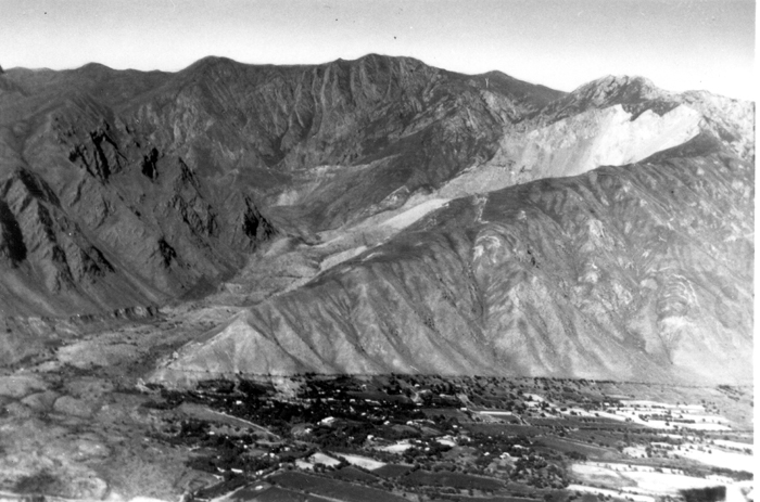
The Khait or Hoit landslide occurred on July 10, 1949, in the Hoit district in the Gharm Oblast in the Tajik Soviet Socialist Republic, then part of the Soviet Union. 'Khait' is a transliteration from ; the local modern spelling is ''Hoit'' (). The landslide was triggered by the 1949 Khait earthquake and buried 33 villages and has by some estimates killed 28,000 people. News of the landslide was not publicly revealed by the government and details of the disaster were not revealed until after the fall of the Soviet Union. A marble statue of a woman with her head and hands lowered and an expression of grief was later erected at the site. Earthquake The earthquake occurred at 09:45 local time on 10 July 1949. It had an estimated magnitude of 7.5 . It triggered hundreds of landslides throughout the epicentral area. Most of the landslides occurred along the sides of the Yasman River valley, a tributary of the Surkhob River, caused by the failure of unconsolidated loess deposits. The l ... [...More Info...] [...Related Items...] OR: [Wikipedia] [Google] [Baidu] |
1949 Khait Earthquake
The 1949 Khait (Hoit) earthquake (; ) occurred at 09:45 local time (03:53 UTC) on 10 July in Gharm Oblast of the Tajik SSR of the Soviet Union (within the modern boundary of Tajikistan). It had a magnitude of 7.5 and triggered a series of landslides that together led to 7,200 deaths. Tectonic setting The earthquake occurred in a tectonically complex region at the southern edge of the Tien Shan. The southern margin of the Tien Shan is characterised by combination of dextral strike-slip faulting and southward thrusting over the Tajik Basin to the south along the Gissar-Kokshaal fault zone. At the same time the Tajik Basin is being shortened in response to oblique collision with the Pamirs, forming a series of north–south to SW-NE trending thrust faults, the earthquake is thought to have been caused by movement on the Vakhsh thrust, one of these faults. Damage In the area of maximum felt intensity (>IX) most kishlaks were completely destroyed. Most of the fatalities were cause ... [...More Info...] [...Related Items...] OR: [Wikipedia] [Google] [Baidu] |
Jirgatol District
Lakhsh District (, , before 2016: ''Jirgatol District'') is a district in Tajikistan. It lies in the extreme north-east corner of the Districts of Republican Subordination. Its northern boundary is the international boundary with Kyrgyzstan; on the south it borders with Sangvor and Tojikobod districts, and its western border is with Rasht District. Its capital is the town Vahdat Vahdat () is a city in western Tajikistan, on the bank of the Kofarnihon River, 21 km east of Dushanbe. It was previously called Yangi-Bozor (1927–1936), Orjonikidzeobod (1936–1993, after Grigoriy Ordzhonikidze) and Kofarnihon (1993–200 ... (formerly: ''Jirgatol''). The population of Lakhsh district is 64,400 (1 January 2020 estimate). Administrative divisions The district has an area of about and is divided administratively into one town and nine jamoats. They are as follows: [...More Info...] [...Related Items...] OR: [Wikipedia] [Google] [Baidu] |
Kyrgyz People
The Kyrgyz people (also spelled Kyrghyz, Kirgiz, and Kirghiz; or ) are a Turkic peoples, Turkic ethnic group native to Central Asia. They primarily reside in Kyrgyzstan, Uzbekistan, and China. A Kyrgyz diaspora is also found in Russia, Tajikistan, and Kazakhstan. They speak the Kyrgyz language, which is the official language of Kyrgyzstan. The earliest people known as "Kyrgyz" were the descendants of several Central Asian tribes, first emerging in western Mongolia around 201 BC. Modern Kyrgyz people are descended in part from the Yenisei Kyrgyz that lived in the Yenisey river valley in Siberia. The Kyrgyz people were constituents of the Tiele people, the Göktürks, and the Uyghur Khaganate before establishing the Yenisei Kyrgyz Khaganate in the 9th century, and later a Kyrgyz khanate in the 15th century. Etymology There are several theories on the origin of ethnonym ''Kyrgyz''. It is often said to be derived from the Turkic languages, Turkic word ''kyrk'' ("forty"), ... [...More Info...] [...Related Items...] OR: [Wikipedia] [Google] [Baidu] |
Tajik People
Tajik, Tajikistan or Tajikistani may refer to. Someone or something related to Tajikistan: Tajik * Tajiks, an ethnic group in Tajikistan, Afghanistan and Uzbekistan * Tajik language, the official language of Tajikistan * Tajik alphabet, Alphabet used to write the Tajik language * Tajik Air, Airline in Tajikistan * Tajik Internal Troops, are the internal security force of Tajikistan * Tajik Soviet Socialist Republic, 1929–1991 republic of the Soviet Union * Tajik (surname) * Tajik cuisine * Tajik music * Tajik, Iran, a village in North Khorasan Province, Iran Tajikistan * Flag of Tajikistan, National flag of Tajikistan * Culture of Tajikistan, Pattern of human activity and symbolism * Demographics of Tajikistan * Geography of Tajikistan, Overview of the geography of Tajikistan * Economy of Tajikistan, National economy * Politics of Tajikistan, Political system of Tajikistan * Tajikistan Independence Day Military Parade * Tajikistan Higher League, Football league National teams * ... [...More Info...] [...Related Items...] OR: [Wikipedia] [Google] [Baidu] |
Vakhsh River
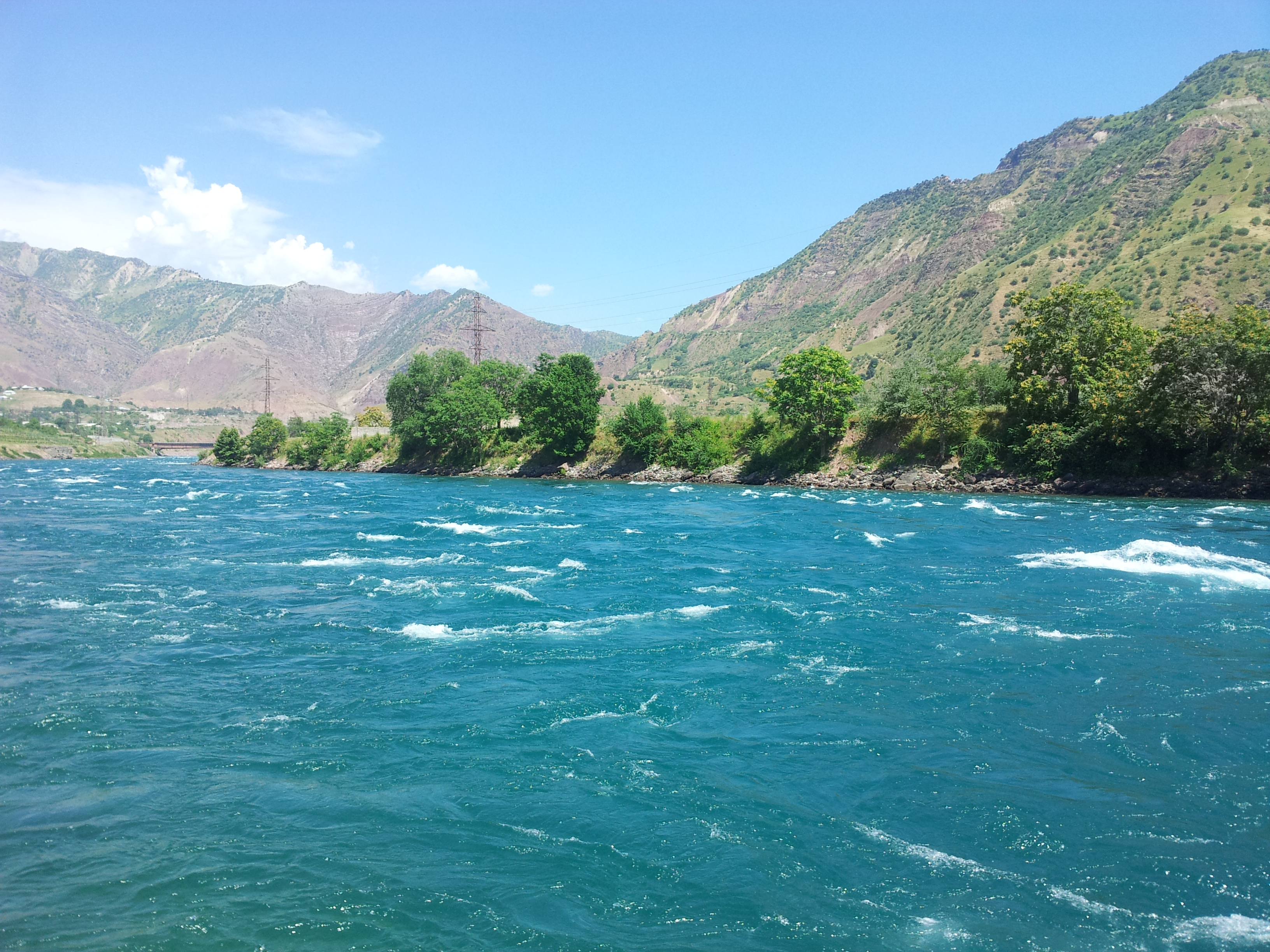
The Vakhsh ( ; Tajik and ), also known as the Surkhob () in north-central Tajikistan and as the Kyzyl-Suu () in Kyrgyzstan, is a Central Asian river and one of the main rivers of Tajikistan. It is a tributary of the Amu Darya river."Tajikistan - Topography and Drainage" in Tajikistan: a Country Study (Washington: Library of Congress, 1996) Geography The Vakhsh flows through the , passing through very mountainous territory that frequently restricts its flow to narrow channels within deep gorges. Some of the largest glaciers in Tajikistan, including the[...More Info...] [...Related Items...] OR: [Wikipedia] [Google] [Baidu] |


