|
Kankrala
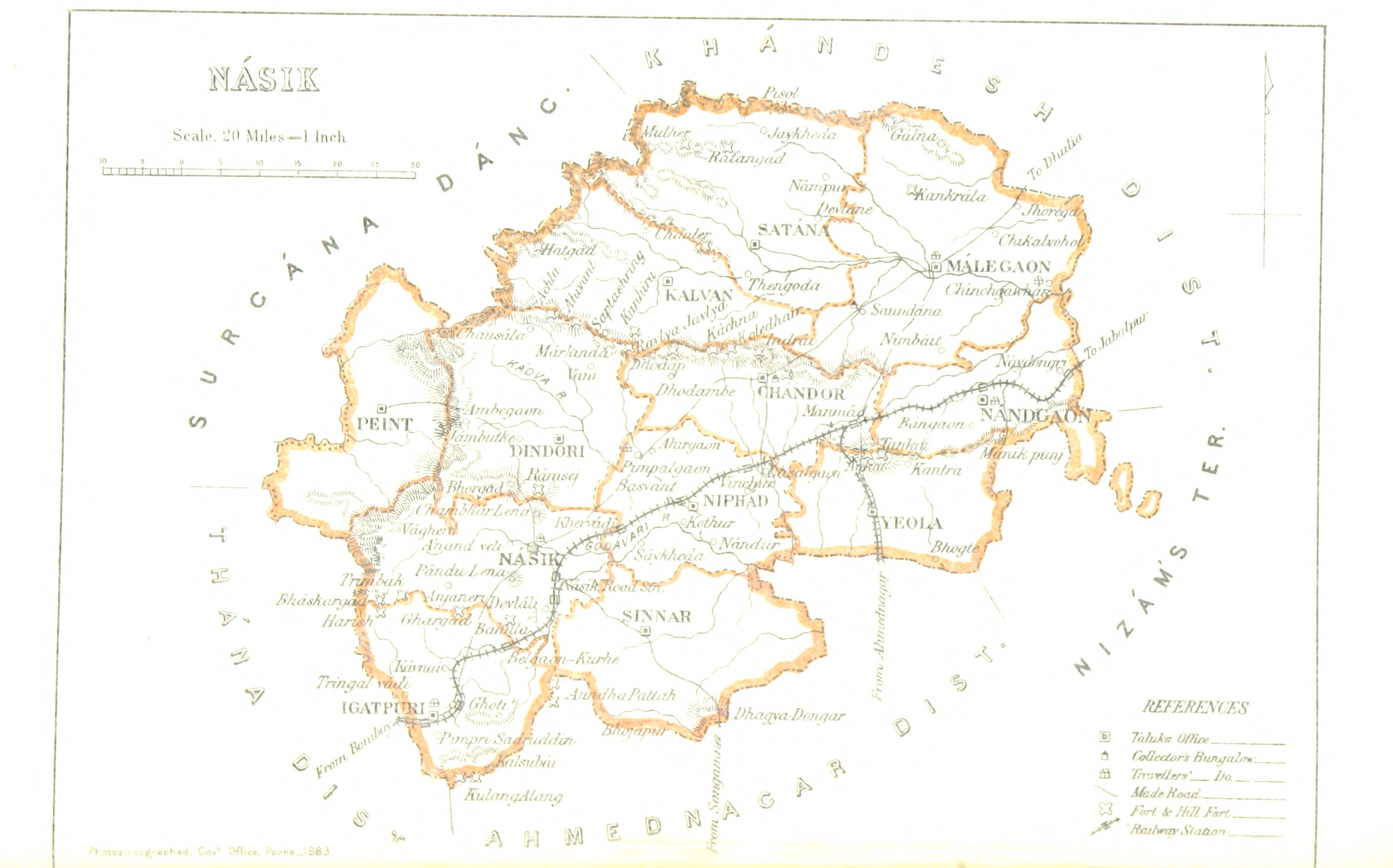
Kankrala ( mr, कंक्राळा ) is an ancient hill fort that occupies two hills in the Malegaon taluka of Nashik district. History This fort is situated south of Galna It is a fort located in malegaon taluka ''Galna'' ( mr, गाळणा किल्ला) was a major fort in the south Khandesh area of Maharashtra, India. This fort was an important fort on the Burhanpur -Surat trade route. This is one of ... fort. Very little history is known about this fort. It was captured by the British under Colonel Wallace in 1818. Places to see There are many rock cut water cisterns on the top of the fort as well as in the rocks near the gate. The water near the gate is potable. There are few caves near the entrance. The entrance is in dilapidated condition. There are no structures on the fort except few ruins. How to reach The village Karanjgavhan is situated near the village Kankrala. There is a direct road from Malegaon via Vadgaon and Lendhane villages to Karanjga ... [...More Info...] [...Related Items...] OR: [Wikipedia] [Google] [Baidu] |
Nashik District
Nashik district, also known as Nasik district, is a district in Maharashtra, India. The city of Nashik is the administrative headquarters of the district. Nashik is well known for the production of wine. Nashik is also known as Mini Maharashtra, because the climate and soil conditions of Surgana, Peth, Igatpuri resembles with Konkan. Niphad, Sinnar, Dindori, Baglan blocks are like Western Maharashtra and Yeola, Nandgaon, Chandwad blocks are like Vidarbha Region. Nashik is the biggest city in the district while Malegaon is the second biggest city. Manmad, Igatpuri, sinnar are some of the big cities situated in the Nashik District. Manmad is one of the biggest railway junction in india while the city of Malegaon is famous for its powerloom. Nashik district is the third largest district in Maharashtra state in terms of population of 8,107,187 and occupying an area of 15,582 square kilometres in the north Maharashtra region. It is bounded by Dhule District to the north, Jalgao ... [...More Info...] [...Related Items...] OR: [Wikipedia] [Google] [Baidu] |
Maharashtra
Maharashtra (; , abbr. MH or Maha) is a state in the western peninsular region of India occupying a substantial portion of the Deccan Plateau. Maharashtra is the second-most populous state in India and the second-most populous country subdivision globally. It was formed on 1 May 1960 by splitting the bilingual Bombay State, which had existed since 1956, into majority Marathi-speaking Maharashtra and Gujarati-speaking Gujarat. Maharashtra is home to the Marathi people, the predominant ethno-linguistic group, who speak the Marathi language, the official language of the state. The state is divided into 6 divisions and 36 districts, with the state capital being Mumbai, the most populous urban area in India, and Nagpur serving as the winter capital, which also hosts the winter session of the state legislature. Godavari and Krishna are the two major rivers in the state. Forests cover 16.47 per cent of the state's geographical area. Out of the total cultivable land in the s ... [...More Info...] [...Related Items...] OR: [Wikipedia] [Google] [Baidu] |
Hill Fort
A hillfort is a type of earthwork used as a fortified refuge or defended settlement, located to exploit a rise in elevation for defensive advantage. They are typically European and of the Bronze Age or Iron Age. Some were used in the post- Roman period. The fortification usually follows the contours of a hill and consists of one or more lines of earthworks, with stockades or defensive walls, and external ditches. Hillforts developed in the Late Bronze and Early Iron Age, roughly the start of the first millennium BC, and were used in many Celtic areas of central and western Europe until the Roman conquest. Nomenclature The spellings "hill fort", "hill-fort" and "hillfort" are all used in the archaeological literature. The ''Monument Type Thesaurus'' published by the Forum on Information Standards in Heritage lists ''hillfort'' as the preferred term. They all refer to an elevated site with one or more ramparts made of earth, stone and/or wood, with an external dit ... [...More Info...] [...Related Items...] OR: [Wikipedia] [Google] [Baidu] |
Galna
It is a fort located in malegaon taluka ''Galna'' ( mr, गाळणा किल्ला) was a major fort in the south Khandesh area of Maharashtra, India. This fort was an important fort on the Burhanpur -Surat trade route. This is one of the forts in Maharashtra with the bastion and the entrance in good condition. This fort is located on hills between Malegaon Malegaon is a city and a municipal corporation in Nashik District in the Indian state of Maharashtra. It is situated on the bank of Mosam River. History Malegaon (previously Maligaon G.N. Wright, 1837. See entry for MULLIGAUM, p216.) at the co ... and Dhule. How to reach This fort is located in Malegaon taluka of Nashik district. The base village Galna is well connected by motorable road to Malegaon and Dhule. Regular buses ply from Malegaon to Dongarale village. Dongarale village is 30-15 km from Malegaon as well as Dhule. Dongarale to Galna distance is 4 km. History Galna was an important place at ... [...More Info...] [...Related Items...] OR: [Wikipedia] [Google] [Baidu] |


