|
Kalinga-Apayao
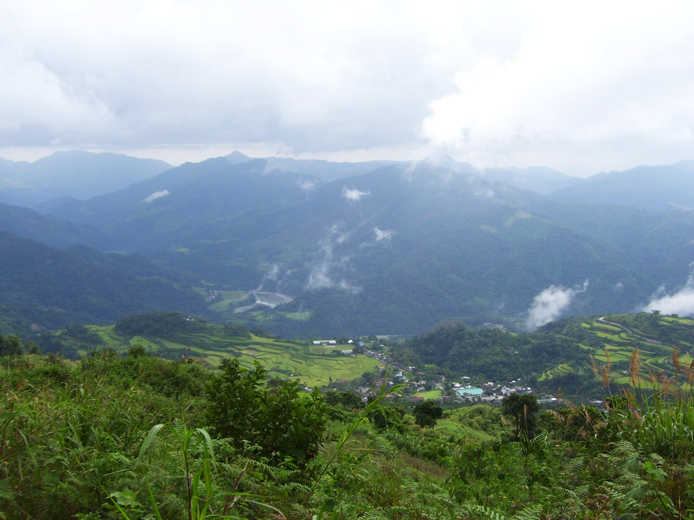
Kalinga-Apayao () was a province of the Philippines in the Cordillera Administrative Region in the island of Luzon. It was formed, along with Benguet, Ifugao, and the new Mountain Province, from the earlier Mountain Province, with the passage of ''Republic Act No. 4695'' in 1966. The said law was amended by ''RA No. 7878'' in 1995, which partitioned the province into modern Kalinga and Apayao. As part of a cult of personality, longtime President Ferdinand Marcos, Sr made gradual changes to the borders of Kalinga-Apayao over the course of his dictatorship, with the aim of making the outline of the province on a map resemble the silhouette of his own head facing towards his own native Ilocos Norte. The “Great Profile” was unfinished when Marcos was overthrown in 1986. History Before Mountain Province Prior to the establishment of the province, the sub-provinces of Kalinga and Apayao, upon their establishment through ''Act No. 1642'' in 1907, were used to be part of ... [...More Info...] [...Related Items...] OR: [Wikipedia] [Google] [Baidu] |
Apayao
Apayao, officially the Province of Apayao (; ; isnag language, Isnag: ''Provinsia nga Apayao''; ), is a landlocked Provinces of the Philippines, province in the Philippines in the Cordillera Administrative Region in Luzon. Kabugao, Apayao, Kabugao serves as its capital. The provincial capitol and its associated offices are located at the New Government Center in Luna, Apayao, Luna. The province borders Cagayan to the north and east, Abra (province), Abra and Ilocos Norte to the west, and Kalinga (province), Kalinga to the south. Prior to 1995, Kalinga and Apayao comprised a single province named ''Kalinga-Apayao'', which was partition (politics), partitioned to better service the needs of individual ethnic groups. With a population of 124,366 (as of the 2020 census) covering an area of , Apayao is the least Population density, densely-populated province in the Philippines, the least developed province in Luzon and one of the poorest. History By the 20th century, Apayao is p ... [...More Info...] [...Related Items...] OR: [Wikipedia] [Google] [Baidu] |
Apayao Province
Apayao, officially the Province of Apayao (; ; Isnag: ''Provinsia nga Apayao''; ), is a landlocked province in the Philippines in the Cordillera Administrative Region in Luzon. Kabugao serves as its capital. The provincial capitol and its associated offices are located at the New Government Center in Luna. The province borders Cagayan to the north and east, Abra and Ilocos Norte to the west, and Kalinga to the south. Prior to 1995, Kalinga and Apayao comprised a single province named ''Kalinga-Apayao'', which was partitioned to better service the needs of individual ethnic groups. With a population of 124,366 (as of the 2020 census) covering an area of , Apayao is the least densely-populated province in the Philippines, the least developed province in Luzon and one of the poorest. History By the 20th century, Apayao is predominated by the Isneg people. They are located primarily in the highland municipalities of Kabugao and Calanasan. Majority of them live in scattered ... [...More Info...] [...Related Items...] OR: [Wikipedia] [Google] [Baidu] |
Kalinga (province)
Kalinga (), officially the Province of Kalinga (; ), is a landlocked province in the Philippines situated within the Cordillera Administrative Region in Luzon. Its capital (and largest city) is Tabuk and borders Mountain Province to the south, Abra to the west, Isabela to the east, Cagayan to the northeast, and Apayao to the north. Kalinga and Apayao are the result of the 1995 partitioning of the former province of Kalinga-Apayao which was seen to better service the respective needs of the various indigenous peoples in the area. President Emilio Aguinaldo proclaimed Lubuagan town the seat of government for 73 days from March 6, 1900, to May 18, 1900, before finally fleeing to his last hideout in Palanan. Etymology The province's name is derived from the Ibanag and Gaddang noun "kalinga", which means "enemy", "fighter", or " headtaker". History American occupation Kalinga was taken from Cagayan and Isabela provinces and established by the US Government throug ... [...More Info...] [...Related Items...] OR: [Wikipedia] [Google] [Baidu] |
Kalinga Province
Kalinga (), officially the Province of Kalinga (; ), is a landlocked province in the Philippines situated within the Cordillera Administrative Region in Luzon. Its capital (and largest city) is Tabuk and borders Mountain Province to the south, Abra to the west, Isabela to the east, Cagayan to the northeast, and Apayao to the north. Kalinga and Apayao are the result of the 1995 partitioning of the former province of Kalinga-Apayao which was seen to better service the respective needs of the various indigenous peoples in the area. President Emilio Aguinaldo proclaimed Lubuagan town the seat of government for 73 days from March 6, 1900, to May 18, 1900, before finally fleeing to his last hideout in Palanan. Etymology The province's name is derived from the Ibanag and Gaddang noun "kalinga", which means "enemy", "fighter", or " headtaker". History American occupation Kalinga was taken from Cagayan and Isabela provinces and established by the US Government through '' ... [...More Info...] [...Related Items...] OR: [Wikipedia] [Google] [Baidu] |
Cordillera Administrative Region
The Cordillera Administrative Region (CAR; ; ), also known as the Cordillera Region and Cordillera (), is an Regions of the Philippines, administrative region in the Philippines, situated within the island of Luzon. It is the only Landlocked country, landlocked region in the archipelago, bordered by the Ilocos Region to the west and southwest, and by the Cagayan Valley, Cagayan Valley Region to the north, east, and southeast. The region comprises six Provinces of the Philippines, provinces: Abra (Philippines), Abra, Apayao Province, Apayao, Benguet, Ifugao, Kalinga Province, Kalinga and Mountain Province. The regional center is the highly urbanized city of Baguio, which is the largest city in the region. The region was officially created on July 15, 1987, covering most of the Cordillera Central (Luzon), Cordillera Mountain Range of Luzon that is home to numerous Ethnic groups in the Philippines, ethnic groups. Nueva Vizcaya province has a majority Igorot people, Igorot populat ... [...More Info...] [...Related Items...] OR: [Wikipedia] [Google] [Baidu] |
Provinces Of The Philippines
In the Philippines, provinces ( or ) are one of its primary political and administrative divisions of the Philippines, administrative divisions. There are 82 provinces at present, which are further subdivided into Cities of the Philippines, component cities and Municipalities of the Philippines, municipalities. The local government units in the Metro Manila, National Capital Region, as well as Cities of the Philippines#Independent cities, independent cities, are independent of any provincial government. Each province is governed by an elected legislature called the Sangguniang Panlalawigan and an elected governor. The provinces are grouped into Regions of the Philippines, eighteen regions based on geographical, cultural, and ethnological characteristics. Thirteen of these regions are numerically designated from north to south, while the National Capital Region, the Cordillera Administrative Region, the Southwestern Tagalog Region (Mimaropa), the Negros Island Region, and the Ba ... [...More Info...] [...Related Items...] OR: [Wikipedia] [Google] [Baidu] |
Republic Acts Of The Philippines
This article contains a partial list of Philippine laws. Sources of Philippine laws ;Notes : *Customs may be considered as supplementary source of law, however, customs which are contrary to law, public order or public policy shall not be countenanced Abbreviations Philippine laws have had various nomenclature designations at different periods in the history of the Philippines, as shown in the following table: Notable laws The following table lists Philippine laws that have been mentioned in Wikipedia or are otherwise notable. Only laws passed by Congress and its preceding bodies are listed here; presidential decrees and other executive issuances which may otherwise carry the force of law are excluded for the purpose of this table. Lists of laws by year 2020 2019 2018 (10967–11166) 2017 (10925–10966) 2016 (10740–10924) 2015 (10653–10739) 2014 (10635–10652) 2013 (10355–10634) 2012 (10157–10354) 2011 (10148–101 ... [...More Info...] [...Related Items...] OR: [Wikipedia] [Google] [Baidu] |
Mountain Province
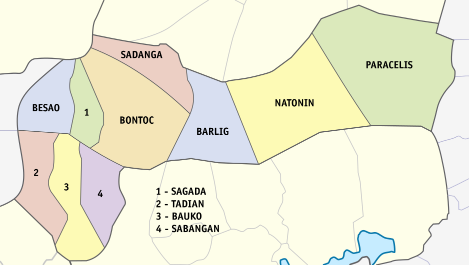
Mountain Province (; ; ; ; ; ) is a landlocked province of the Philippines in the Cordillera Administrative Region in Luzon. Its capital is Bontoc while Bauko is the largest municipality. Mountain Province was formerly referred to as Mountain in some foreign references. The name is usually shortened by locals to Mt. Province. The province was named so for being in the Cordillera Central mountain range found in the upper realms of Luzon island. Mountain Province was also the name of the historical province that included most of the current Cordillera provinces. This old province was established by the Philippine Commission in 1908, and was later split in 1966 into Mountain Province, Benguet, Kalinga-Apayao and Ifugao. The province is also known for its mummy caves, which contain naturally mummified bodies, and for its hanging coffins. History Spanish colonial era The area of the Cordillera mountains proved difficult to control by the Spaniards. During the long Spanish ... [...More Info...] [...Related Items...] OR: [Wikipedia] [Google] [Baidu] |
Benguet
Benguet (), officially the Province of Benguet ('';'' ; ; ; ), is a landlocked Provinces of the Philippines, province of the Philippines located in the southern tip of the Cordillera Administrative Region in the island of Luzon. Its capital city, capital is La Trinidad, Benguet, La Trinidad. The highland province is known as the ''Salad Bowl of the Philippines'' due to its huge production of upland vegetables. Situated within the interior of Benguet is the Cities of the Philippines#Classification, highly urbanized city of Baguio, which is administered independent from the province and also its largest city. History Early history The Highland, mountainous area now covered by Benguet is generally presumed to have been settled from at least the 14th century by tribes coming from the surrounding lowlands, lured by the abundance of natural resources such as gold, hides, and wax. Two of these groups, the Ibaloi and the Kankanaey people, Kankanaey, are dominant ethnolinguistic gro ... [...More Info...] [...Related Items...] OR: [Wikipedia] [Google] [Baidu] |
Ifugao
Ifugao, officially the Province of Ifugao (; ), is a landlocked province of the Philippines in the Cordillera Administrative Region in Luzon. Its capital is Lagawe and it borders Benguet to the west, Mountain Province to the north, Isabela to the east, and Nueva Vizcaya to the south. The Rice Terraces of the Philippine Cordilleras and Banaue Rice Terraces are the main tourist attractions in the province. These terraces are believed to have been hand-carved into the mountains 2,000 years ago to plant rice. However, recent research by carbon dating suggests that they were built much later. In 1995, the Rice Terraces of the Philippine Cordilleras were declared as a UNESCO World Heritage Site. In 2008 and 2015, the ''Hudhud chants of the Ifugao'' and the '' Punnuk ( Tugging rituals and games)'' were inscribed in the UNESCO Intangible Cultural Heritage Lists. Etymology Ifugao is named after the term ''i-pugo'' (''"i"'' rom/peopleand ''pugo'' ill, which translates to ''pe ... [...More Info...] [...Related Items...] OR: [Wikipedia] [Google] [Baidu] |
US Government Printing Office
The United States Government Publishing Office (USGPO or GPO), formerly the United States Government Printing Office, is an agency of the legislative branch of the United States federal government. The office produces and distributes information products and services for all three branches of the Federal Government, including U.S. passports for the Department of State as well as the official publications of the Supreme Court, the Congress, the Executive Office of the President, executive departments, and independent agencies. An act of Congress changed the office's name to its current form in 2014. History Establishment of the Government Printing Office The Government Printing Office was created by congressional joint resolution () on June 23, 1860. It began operations March 4, 1861, with 350 employees and reached a peak employment of 8,500 in 1972. The agency began transformation to computer technology in the 1980s; along with the gradual replacement of paper with elect ... [...More Info...] [...Related Items...] OR: [Wikipedia] [Google] [Baidu] |
Supreme Court Of The Philippines
The Supreme Court (; colloquially referred to as the ' (also used in formal writing), is the highest court in the Philippines. It was established by the Taft Commission on June 11, 1901, through the enactment of Act No. 136, which abolished the Real Audiencia of Manila, the predecessor of the Supreme Court. The Supreme Court compound is located in what was formerly a part of the University of the Philippines Manila campus. It occupies the corner of Padre Faura Street and Taft Avenue in Ermita, Manila, with the main building sited directly in front of Philippine General Hospital's cancer institute. History Early history Prior to the conquest of Spain, the islands of the Philippines were composed of independent barangay state, barangays, each of which is a community composed of 30 to 100 families. Typically, a barangay is headed by a ''datu'' or a local chief who exercises all functions of government: executive, legislative and judicial; he is also the commander-in-chief in time ... [...More Info...] [...Related Items...] OR: [Wikipedia] [Google] [Baidu] |


