|
KT Postcode Area
The KT postcode area, also known as the Kingston upon Thames postcode area,Royal Mail, ''Address Management Guide'', (2004) is a group of 24 postcode districts in England, within 19 post towns. These cover boroughs in south-west Greater London and several boroughs in north-east Surrey. Mail for this area is sorted at the Jubilee Mail Centre in Hounslow. In Greater London the area covers most of the Royal Borough of Kingston upon Thames and small parts of the boroughs of Merton, Richmond upon Thames and Sutton, while in Surrey it covers virtually all of the borough of Elmbridge, most of the borough of Epsom and Ewell, the northwestern part of the borough of Reigate and Banstead, the northern part of the Mole Valley district, the northeastern parts of the boroughs of Guildford and Woking and the southern part of the borough of Runnymede, as well as a very small part of the borough of Spelthorne. __TOC__ Coverage The approximate coverage of the postcode districts: ! KT1 , KI ... [...More Info...] [...Related Items...] OR: [Wikipedia] [Google] [Baidu] |
England
England is a Countries of the United Kingdom, country that is part of the United Kingdom. It is located on the island of Great Britain, of which it covers about 62%, and List of islands of England, more than 100 smaller adjacent islands. It shares Anglo-Scottish border, a land border with Scotland to the north and England–Wales border, another land border with Wales to the west, and is otherwise surrounded by the North Sea to the east, the English Channel to the south, the Celtic Sea to the south-west, and the Irish Sea to the west. Continental Europe lies to the south-east, and Ireland to the west. At the 2021 United Kingdom census, 2021 census, the population was 56,490,048. London is both List of urban areas in the United Kingdom, the largest city and the Capital city, capital. The area now called England was first inhabited by modern humans during the Upper Paleolithic. It takes its name from the Angles (tribe), Angles, a Germanic peoples, Germanic tribe who settled du ... [...More Info...] [...Related Items...] OR: [Wikipedia] [Google] [Baidu] |
Kingston Upon Thames
Kingston upon Thames, colloquially known as Kingston, is a town in the Royal Borough of Kingston upon Thames, south-west London, England. It is situated on the River Thames, south-west of Charing Cross. It is an ancient market town, notable as the place where some History of Anglo-Saxon England, Saxon kings were crowned. Historic counties of England, Historically in the county of Surrey, the ancient Kingston upon Thames (parish), parish of Kingston covered both the town itself and a large surrounding area. The town was an ancient borough, having been formally incorporated in 1441, with a long history prior to that as a royal manor. From 1836 until 1965 the town formed the Municipal Borough of Kingston-upon-Thames. From 1893 to 2020 Kingston was the seat of Surrey County Council. The town became part of Greater London in 1965, when the modern borough was also created as one of the 32 London boroughs. Kingston is identified as a metropolitan centre in the London Plan and is one o ... [...More Info...] [...Related Items...] OR: [Wikipedia] [Google] [Baidu] |
Berrylands
Berrylands is a residential neighbourhood in Surbiton, London, originally forming part of the Municipal Borough of Surbiton, and since 1965 is part of the Royal Borough of Kingston upon Thames. It is a suburban development situated south west of Charing Cross. Nearby places include Surbiton, New Malden, Old Malden, Tolworth and Chessington. Berrylands railway station is 24 minutes from London Waterloo by train. History Berrylands is a settlement of Anglo-Saxon origin that is close to the Thames. Berrylands originally formed part of the Municipal Borough of Surbiton, but in 1965 it was incorporated as part of the Royal Borough of Kingston upon Thames. Most of the present housing development took place in the 1930s on the former Berrylands Farm. Old maps from the 1860s show the western banks of the Hogsmill River and everything around them to be mostly empty apart from a few small trails and farm buildings with no evidence of real human settlement. The area had absol ... [...More Info...] [...Related Items...] OR: [Wikipedia] [Google] [Baidu] |
Stoneleigh, Surrey
Stoneleigh is a suburban area southwest of London, situated in the north of the Epsom and Ewell borough in the county of Surrey, England. It is situated approximately from centre of London, central London. In the 2011 United Kingdom census, 2011 Census, the population was 8,741. The area was formerly part of the Great Park and Little Park of Nonsuch in the Tudor era. Nonsuch Park today is situated on the site of the Little Park in the east of the suburb, extending into East Ewell and Cheam. The construction of the Stoneleigh railway station, railway station, in 1932, was responsible for initiating the development of most of Stoneleigh, which was largely completed by the onset of World War II in late 1939. History Early history The Roman road Stane Street (Chichester), Stane Street passed through the eastern area of what is now Stoneleigh (along the modern day London Road/A24 road (England), A24) on its way from London to Chichester via the nearby spring at Ewell. Between t ... [...More Info...] [...Related Items...] OR: [Wikipedia] [Google] [Baidu] |
Cuddington, Surrey
Cuddington was a village in Surrey, England which was demolished to make way for Henry VIII's Nonsuch Palace near Cheam. Cuddington lay within the Copthorne hundred. There remains a small rise of land to mark the northern side of the old Cuddington parish church. The parish of Cuddington was part of Epsom Rural District and became part of the borough of Epsom and Ewell in 1933, with portions to the northeast and south becoming part of Cheam. In 1951 the parish had a population of 11,433. On 1 April 1974 the parish was abolished. History Cuddington lay within the Copthorne hundred, a strategic and judicial division predominantly used in Anglo Saxon England to supplement the county and parish (see vestry). In the Middle Ages the estates of Cuddington extended over , the southern part being upon the chalk downs, the centre on the Woolwich and Thanet beds, the rest upon the London clay. There was no ecclesiastical parish; the land was taxed with Ewell, but separately rated, ... [...More Info...] [...Related Items...] OR: [Wikipedia] [Google] [Baidu] |
Worcester Park
Worcester Park is a suburban town in South London, England. It lies in the London boroughs of Sutton and Kingston, and partly in the Surrey borough of Epsom and Ewell. The area is southwest of Charing Cross. The suburb's population was 16,031 at the time of the 2001 census. The suburb comprises the Worcester Park ward, an electoral area of the London Borough of Sutton with a population in of , as well as the Cuddington ward, an electoral area of Epsom and Ewell, which had a population of 5,791 at the time of the 2001 census. The Worcester Park post town, which is coterminous with the KT4 postcode district, covers all of the suburb and also extends into Old Malden. Other neighbouring localites include Kingston, Sutton, New Malden, Motspur Park, Lower Morden, Stoneleigh, Tolworth and West Ewell. Worcester Park railway station (London Zone 4, South Western Railway), runs trains into London Waterloo and many residents commute into central London. Many maps and po ... [...More Info...] [...Related Items...] OR: [Wikipedia] [Google] [Baidu] |
Raynes Park
Raynes Park is a residential suburb, railway station and local centre near Wimbledon, London, and is within the London Borough of Merton. It is situated southwest of Wimbledon Common, to the northwest of Wimbledon Chase and to the east of New Malden, in South West London. It is 7.8 miles (12.5 km) southwest of Charing Cross. Towards the north and west, either side of the borough boundary with the Royal Borough of Kingston upon Thames are the areas of Copse Hill and Coombe with their large detached houses, golf courses and gated lands. Raynes Park had a population of 19,619 in 2011, which refers to the populations of the wards of Raynes Park and West Barnes. The district of Raynes Park is composed of the neighbourhoods Motspur Park (West Barnes), Raynes Park itself, Shannon Corner and Grand Drive. Nearby settlements include New Malden, Kingston, South Wimbledon, Colliers Wood, Worcester Park, Morden and Lower Morden. Geography Raynes Park is 7.8 miles f ... [...More Info...] [...Related Items...] OR: [Wikipedia] [Google] [Baidu] |
Old Malden
Old Malden is a ward of the Royal Borough of Kingston upon Thames in south London, south west of Charing Cross. It is between New Malden and Worcester Park, along the A2043 road, here named Malden Road. Malden Manor is an alternative name for part of Old Malden, popularised by the name made up by Southern Railway for its local station built in 1938. History The area has a long history as the ancient parish of Malden, derived from the Old English ''mæl duna'', meaning 'the cross on the hill'. Malden appears in ''Domesday Book'' of 1086 as ''Meldone'', held partly by William de Wateville and partly by Robert de Wateville. Its domesday assets were: 4 hides and 3 virgates; 1 chapel, 1 mill worth 12s, 6½ ploughs, of meadow, woodland worth 1 hog out of 7 hogs. It rendered £7 12s 0d. St John the Baptist Church, close to the Hogsmill, is a Grade II listed building. The medieval church was built by Walter de Merton, Bishop of Rochester. It comprised nave, chancel and west to ... [...More Info...] [...Related Items...] OR: [Wikipedia] [Google] [Baidu] |
New Malden
New Malden is a suburban area in southwest London, England. It is within the Royal Borough of Kingston upon Thames and the London Borough of Merton, and is from Charing Cross. Neighbouring localities include Kingston upon Thames, Kingston, Norbiton, Raynes Park, Coombe, Kingston upon Thames, Coombe, Tolworth, Motspur Park, Old Malden, and Worcester Park. Before the creation of Greater London in 1965, New Malden was in the Administrative counties of England, administrative county of Surrey. History New Malden was established as a result of the arrival of the railway. What is now New Malden railway station was opened on 1 December 1846 on the main line from London Waterloo railway station, London Waterloo. Building started slowly in the area just to the north of the station, gathering pace in the late nineteenth and early twentieth centuries with two- and three-bedroom terrace (architecture), terraced houses. Further out towards Coombe, Kingston upon Thames, Coombe Hill are large ... [...More Info...] [...Related Items...] OR: [Wikipedia] [Google] [Baidu] |
Motspur Park
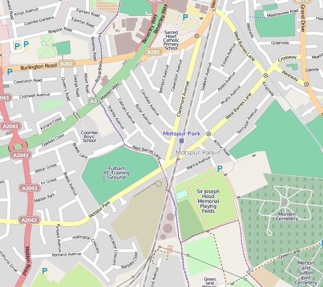
Motspur Park, also known locally as West Barnes, is a residential suburb in south-west London, in the New Malden (Kingston) and Raynes Park (Merton) districts. It straddles the boroughs of Kingston upon Thames and Merton. Motspur Park owes its identity to the railway station of the same name, opened in 1925, which has train services to London Waterloo, and to the adjacent parade of small shops. Three prominent gas holders, which were used to store the consumer gas supply for south-west London, stand just south of the shopping parade and can be seen from a wide area. Two of London's minor natural watercourses flow through Motspur Park: Beverley Brook runs south to north through the centre and its tributary the Pyl Brook runs parallel to the east in shallow depressions in the land. The Motspur Park athletics stadium was built by the University of London in 1928 and achieved fame when the world mile record was set there in 1938. It was sold to Fulham Football Club as their ... [...More Info...] [...Related Items...] OR: [Wikipedia] [Google] [Baidu] |
Richmond Park
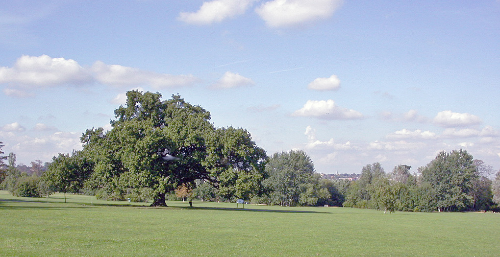
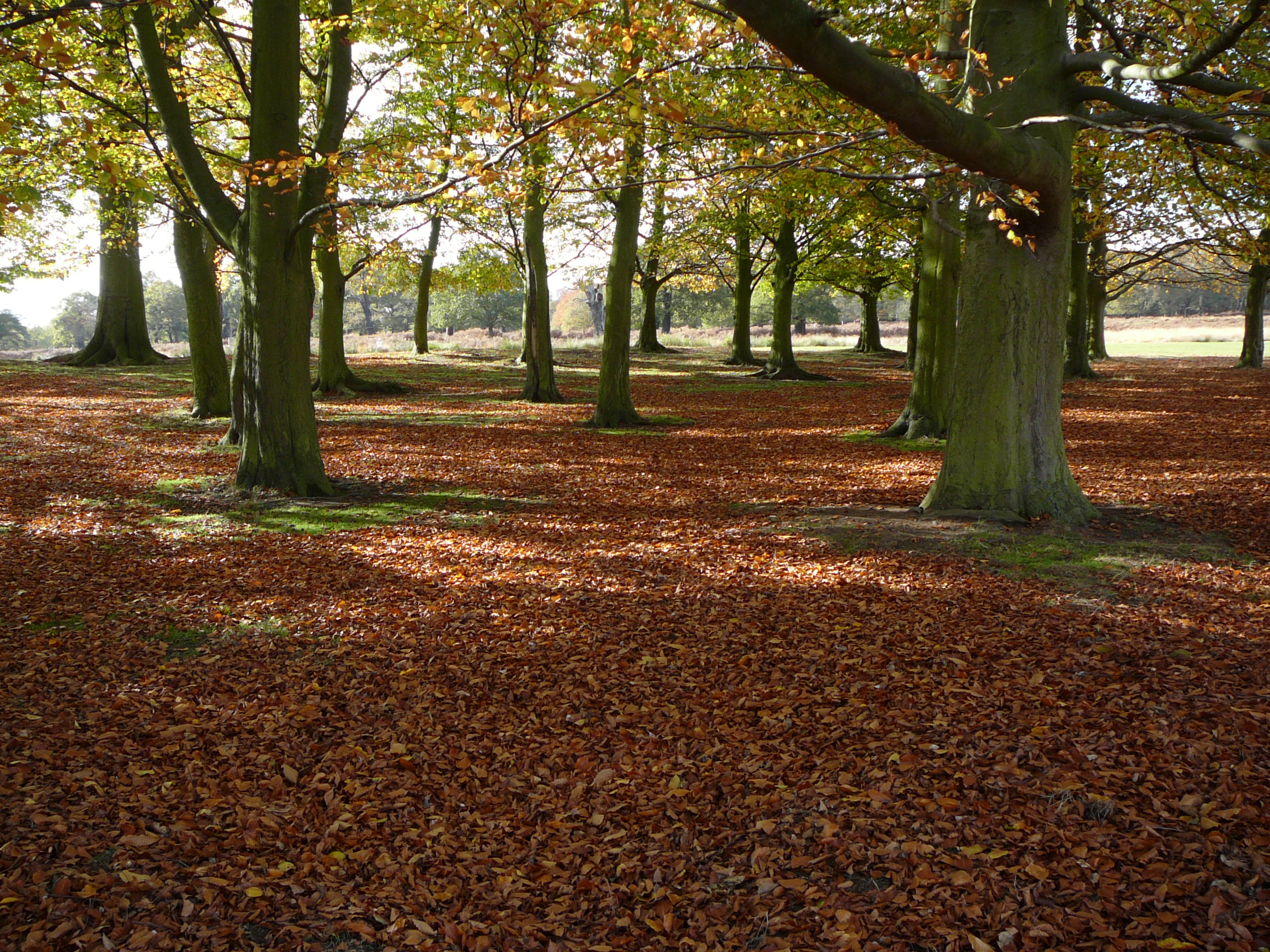
Richmond Park, in the London Borough of Richmond upon Thames, is the largest of Royal Parks of London, London's Royal Parks and is of national and international importance for wildlife conservation. It was created by Charles I of England, Charles I in the 17th century as a Deer park (England), deer park. It is now a national nature reserves in England, national nature reserve, a Site of Special Scientific Interest and a Special Area of Conservation and is included, at Grade I, on Historic England's Register of Historic Parks and Gardens of special historic interest in England. Its landscapes have inspired many famous artists and it has been a location for several films and TV series. Richmond Park includes many buildings of architectural or historic interest. The Listed building, Grade I-listed White Lodge was List of British royal residences#Current royal residences, formerly a royal residence and is now home to the Royal Ballet School#White Lodge, Royal Ballet School. T ... [...More Info...] [...Related Items...] OR: [Wikipedia] [Google] [Baidu] |
Coombe, Kingston Upon Thames
Coombe is a historic neighbourhood in the Royal Borough of Kingston upon Thames in south west London, England. It sits on high ground, east of Norbiton. Most of the area was part of the former Municipal Borough of Malden and Coombe before local government re-organisation in 1965. It now shares borders with the boroughs of London Borough of Merton, Merton and London Borough of Sutton, Sutton with, to the north, the small, inter-related neighbourhoods of Kingston Vale, Kingston Hill and Kingston Vale, beyond which is Richmond Park in London Borough of Richmond upon Thames, Richmond; and Roehampton/Putney Vale in London Borough of Wandsworth, Wandsworth. To the east are public playing fields and Wimbledon Common. History Coombe centres on what was originally Coombe House, a large residence built in the 1750s. The house, now demolished, was located at the southwest corner of the junction of Coombe Lane (A238) and Traps Lane. Its red brick boundary walls can still be seen on the west ... [...More Info...] [...Related Items...] OR: [Wikipedia] [Google] [Baidu] |


