|
June 15–16 Events (Turkey)
The June 15-16 events () of 1970 began in Istanbul and soon became one of the largest actions of organised labor in Turkey's history. Changes in union law In 1970, the Grand National Assembly of Turkey and the Senate passed a bill amending two paces of legislation, the Collective Bargaining Agreement, Strike and Lockout Law No. 274, which regulated working life and basic union legislation, and the Law on Trade Unions No. 275. The bill as supported both by the governing Justice Party and the opposition Republican People's Party (CHP). The amendment significantly restricted the freedom of workers to choose unions and made it difficult to change unions. The law entered into force on 11 June 1970 with the approval of President Cevdet Sunay. The bill was mainly aimed at preventing the flow of workers from Türk-İş to DİSK. DISK and its affiliated unions responded angrily to the new law and the Workers' Party of Turkey announced that it would take the controversial amendments to t ... [...More Info...] [...Related Items...] OR: [Wikipedia] [Google] [Baidu] |
Istanbul
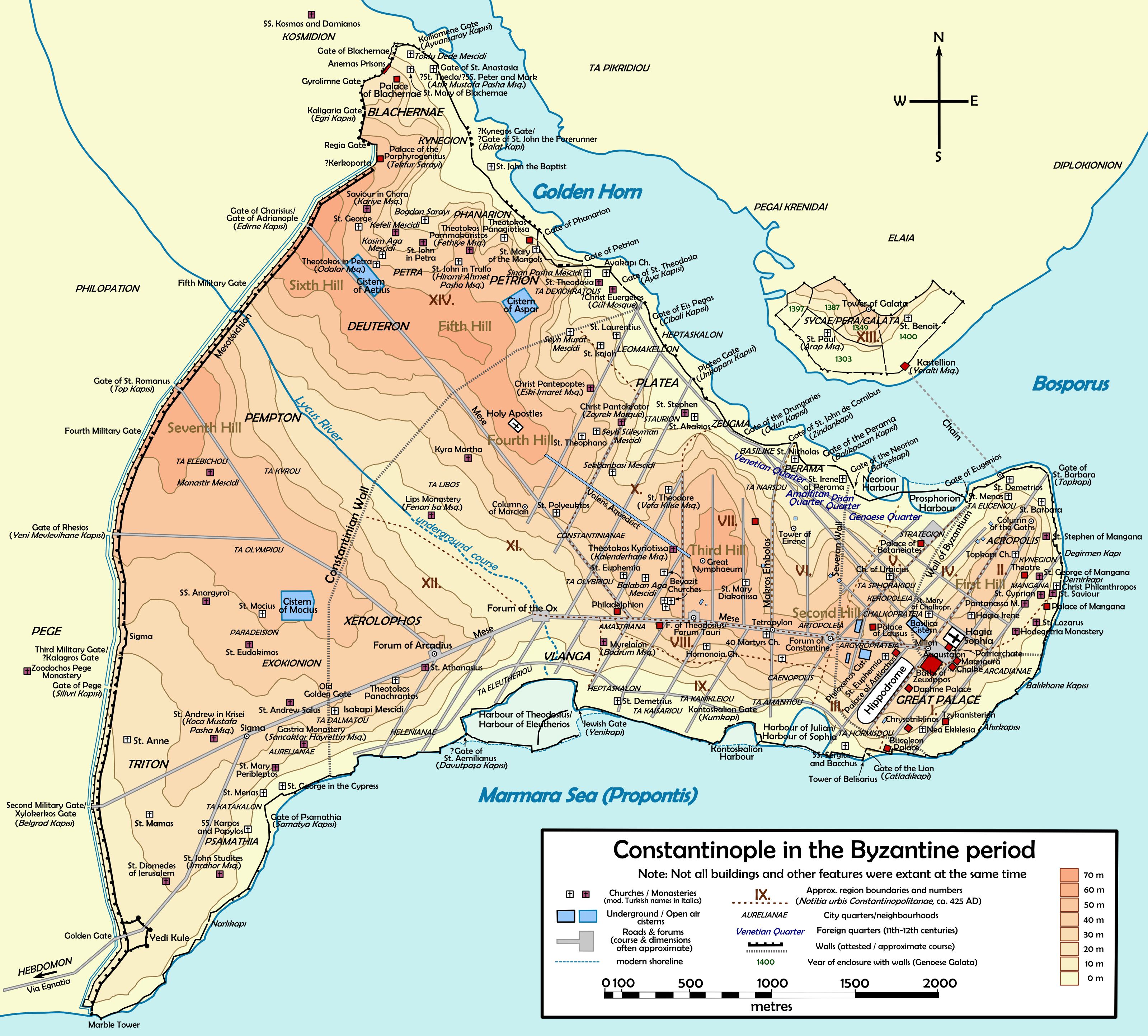
Istanbul is the List of largest cities and towns in Turkey, largest city in Turkey, constituting the country's economic, cultural, and historical heart. With Demographics of Istanbul, a population over , it is home to 18% of the Demographics of Turkey, population of Turkey. Istanbul is among the List of European cities by population within city limits, largest cities in Europe and List of cities proper by population, in the world by population. It is a city on two continents; about two-thirds of its population live in Europe and the rest in Asia. Istanbul straddles the Bosphorus—one of the world's busiest waterways—in northwestern Turkey, between the Sea of Marmara and the Black Sea. Its area of is coterminous with Istanbul Province. Istanbul's climate is Mediterranean climate, Mediterranean. The city now known as Istanbul developed to become one of the most significant cities in history. Byzantium was founded on the Sarayburnu promontory by Greek colonisation, Greek col ... [...More Info...] [...Related Items...] OR: [Wikipedia] [Google] [Baidu] |
Kartal
Kartal () is a municipality and district of Istanbul Province, Turkey. Its area is 38 km2, and its population is 483,418 (2022). It is located on the Asian side of the city, on the coast of the Marmara Sea between Maltepe and Pendik. Despite being far from the city centre, Kartal is heavily populated (total population nearly 500,000). The district's neighbours are Maltepe to the west, Sultanbeyli and Sancaktepe to the north and Pendik to the east. Inland from the coast, the land rises sharply up to the hills Yakacık and Aydos, the latter of which is the highest point in Istanbul. History Kartal ('eagle' in Turkish, by folk etymology) was a fishing village on the shore of the Marmara Sea during the Byzantine Empire, called Kartalimen or Kartalimin in Greek, and was founded at the beginning of the 6th century. In the 11th century, the town was conquered by the ruler of the Seljuks, Suleyman Shah. In 1329, Kartal became part of the Ottoman Empire, the Byzantines re- ... [...More Info...] [...Related Items...] OR: [Wikipedia] [Google] [Baidu] |
Süleyman Demirel
Sami Süleyman Gündoğdu Demirel (; 1 November 1924 – 17 June 2015) was a Turkish people, Turkish politician, engineer, and statesman who served as the List of Presidents of Turkey, 9th President of Turkey from 1993 to 2000. He previously served as the Prime Minister of Turkey seven times between the years 1965 and 1993. He was the leader of the Justice Party (Turkey), Justice Party (AP) from 1964 to 1980 and the leader of the True Path Party (DYP) from 1987 to 1993. Having been identified as a potential future prime minister by Adnan Menderes, Demirel was elected leader of the Justice Party in 1964 and managed to bring down the government of İsmet İnönü in 1965 despite not being a Member of Parliament. He supported the government of Suat Hayri Ürgüplü until his party won a parliamentary majority in 1965 Turkish general election, 1965. He became the first prime minister born in the Republic of Turkey. Claiming that his Justice Party was the successor of the banned Democr ... [...More Info...] [...Related Items...] OR: [Wikipedia] [Google] [Baidu] |
Beyoğlu
Beyoğlu (; ) is a municipality and Districts of Turkey, district of Istanbul Province, Istanbul Province, Turkey. Its area is 9 km2, and its population is 225,920 (2022). It is on the European side of Istanbul, Turkey, separated from the old city (historic peninsula of Constantinople) by the Golden Horn. It was known as the region of Pera (Πέρα, meaning "Beyond" in Greek language, Greek) surrounding the ancient coastal town Galata which faced Constantinople across the Horn. As the Ottoman capital of Constantinople grew during the 19th century, Pera/Beyoğlu became the Modernism, modern Western influenced quarter of the city, across from the old town, Fatih. It was the center of the empire's politics, finance, diplomacy, culture, and commerce. Centered on the Grande Rue de Péra (today İstiklâl Avenue), it was a predominantly Christianity in Turkey, Christian (Armenians in Istanbul, Armenians, Greeks in Turkey, Greeks, Turkish Levantine, Levantine, and Expatriate, Euro ... [...More Info...] [...Related Items...] OR: [Wikipedia] [Google] [Baidu] |
Golden Horn
The Golden Horn ( or ) is a major urban waterway and the primary inlet of the Bosphorus in Istanbul, Turkey. As a natural estuary that connects with the Bosphorus Strait at the point where the strait meets the Sea of Marmara, the waters of the Golden Horn help define the northern boundary of the peninsula constituting "Old Istanbul" (ancient Byzantium and Constantinople), the tip of which is the promontory of Sarayburnu, or Seraglio Point. This estuarial inlet geographically separates the historic center of Istanbul from the rest of the city, and forms a Horn (anatomy), horn shape, sheltered harbor that in the course of history has protected Greeks, Greek, Ancient Rome, Roman, Byzantine Empire, Byzantine, Ottoman Empire, Ottoman and other maritime trade ships for thousandsBBC: "Istanbul's ancient past unearthed"< ... [...More Info...] [...Related Items...] OR: [Wikipedia] [Google] [Baidu] |
Eminönü
Eminönü, historically known as Pérama, is a predominantly commercial waterfront area of Istanbul within the Fatih district near the confluence of the Golden Horn with the southern entrance of the Bosphorus strait and the Sea of Marmara. It is located in the part of Istanbul known as the historical peninsula, connected to Karaköy (historic Galata) via the Galata Bridge across the Golden Horn. It was administered as part of the Sultanahmet district from 1928 to 2009 when Sultanahmet was absorbed into Fatih. Eminönü, which was a district municipality until March 7, 2008, was abolished on this date and connected to Fatih district by law. It is completely located within the city wall, the historical core of the city, and forms one of the most vibrant areas of the central area. Eminönü's busy main square is overlooked by the New Mosque (Yeni Cami in Turkish) and the Spice Bazaar (Mısır Çarşısı in Turkish). Eminönü is an important transport hub. Several ferries have te ... [...More Info...] [...Related Items...] OR: [Wikipedia] [Google] [Baidu] |
Topkapı Palace
The Topkapı Palace (; ), or the Seraglio, is a large museum and library in the east of the Fatih List of districts of Istanbul, district of Istanbul in Turkey. From the 1460s to the completion of Dolmabahçe Palace in 1856, it served as the administrative center of the Ottoman Empire, and was the main residence of its sultans. Construction, ordered by the Sultan Mehmed the Conqueror, began in 1459, six years after the Fall of Constantinople, conquest of Constantinople. Topkapı was originally called the "New Palace" ( or ) to distinguish it from the Eski Saray, Old Palace ( or ) in Beyazıt Square. It was given the name , meaning Cannon Gate, in the 19th century. The complex expanded over the centuries, with major renovations after the 1509 Constantinople earthquake, 1509 earthquake and the 1665 fire. The palace complex consists of four main courtyards and many smaller buildings. Female members of the Sultan's family lived in the harem, and leading state officials, including th ... [...More Info...] [...Related Items...] OR: [Wikipedia] [Google] [Baidu] |
Bakırköy
Bakırköy is a municipality and Districts of Turkey, district in the European part of Istanbul Province, Turkey. Its area is 29 km2, and its population is 226,685 (2022). Bakırköy lies between the State road D.100 (Turkey), D.100 highway (locally known as E-5) and the coast of the Sea of Marmara. Bakırköy houses a large Bakırköy Psychiatric Hospital, psychiatric hospital, and is an important shopping and commercial center. Geography Bakırköy, which was one of the largest districts of Istanbul with an area of 275 km² until 1989 and was bounded by Çatalca to the west, Eyüpsultan and Gaziosmanpaşa to the north, shrunk both in terms of population and area with the local elections of 1989 and 1992, first with the separation of Küçükçekmece and then Bahçelievler, Bağcılar and Güngören districts. Nowadays Bakırköy has a surface area of 29.22 km² with its new borders. While the average elevation is 20-30 meters throughout Bakırköy, this value rises to 70 m ... [...More Info...] [...Related Items...] OR: [Wikipedia] [Google] [Baidu] |
Gebze
Gebze (), formerly known as Libyssa, is a municipality and district of Kocaeli Province, Turkey. Its area is 418 km2, and its population is 407,019 (2022). It is situated 65 km (30 mi) southeast of Istanbul, on the Gulf of Izmit, the eastern arm of the Sea of Marmara. Gebze is the largest district by population size in the province as of 2022, exceeding İzmit, the provincial capital. Geography The district of Gebze is located in the western portion of Kocaeli Province; with neighbors Körfez to the east; Pendik, Tuzla and Şile in Istanbul to the northwest, west and north respectively; Çayırova and Darıca to the southwest and Dilovası to the southeast. Composition There are 40 neighbourhoods in Gebze District: * Adem Yavuz * Ahatlı * Arapçeşme * Balçık * Barış * Beylikbağı * Cumaköy * Cumhuriyet * Denizli * Duraklı * Elbizli * Eskihisar * Gaziler * Güzeller * Hacı Halil * Hatipler * Hürriyet * İnönü * İstasyon * Kadıllı * Kargalı * ... [...More Info...] [...Related Items...] OR: [Wikipedia] [Google] [Baidu] |
Üsküdar
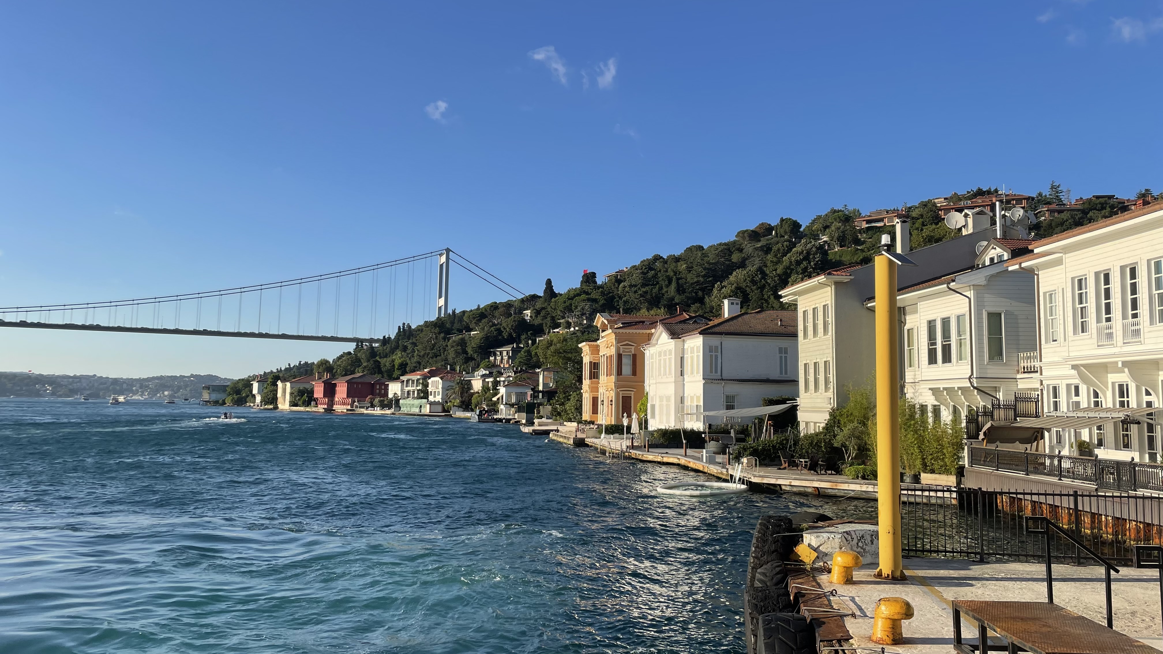
Üsküdar () is a municipality and district of Istanbul Province, Turkey. Its area is 35 km2, and its population is 524,452 (2022). It is a large and densely populated district on the Anatolian (Asian) shore of the Bosphorus. It is bordered to the north by Beykoz, to the east by Ümraniye, to the southeast by Ataşehir and to the south by Kadıköy; with Karaköy, Kabataş, Beşiktaş, and the historic Sarayburnu quarter of Fatih facing it on the opposite shore to the west. Üsküdar has been a conservative cultural center of the Anatolian side of Istanbul since Ottoman times with its landmark as well as numerous tiny mosques and dergahs. Üsküdar is a major transport hub, with ferries to Eminönü, Karaköy, Kabataş, Beşiktaş and some of the Bosphorus suburbs. Üsküdar is a stop on the Marmaray rail service at the point where it starts its journey under the Bosphorus, re-emerging on the European side at Sirkeci. Via Marmaray, Üsküdar is linked to Gebz ... [...More Info...] [...Related Items...] OR: [Wikipedia] [Google] [Baidu] |
Beykoz
Beykoz () is a municipality and Districts of Turkey, district of Istanbul Province, Istanbul Province, Turkey. Its area is 310 km2, and its population is 247,875 (2022). It lies at the northern end of the Bosphorus on the Anatolian side. The name is believed to be a combination of the words bey and ''kos'', which means "village" in Farsi. Beykoz includes an area from the streams of Küçüksu and Göksu (just before Anadoluhisarı) to the opening of the Bosphorus into the Black Sea, and the villages in the hinterland as far as the Riva, Istanbul, Riva creek. Before the Turkish alphabet reform of 1928, it was sometimes Latinized variously as ''Beicos'' or ''Beikos''. History The mouth of the Bosphorus in ancient times was used as a place of sacrifice, specifically to petition the Twelve Olympians, including Zeus and Poseidon, for a safe journey across the Black Sea, without which no one would venture into those stormy waters. The first people to settle the upper Bosphorus were Thrac ... [...More Info...] [...Related Items...] OR: [Wikipedia] [Google] [Baidu] |


