|
Junction Gate
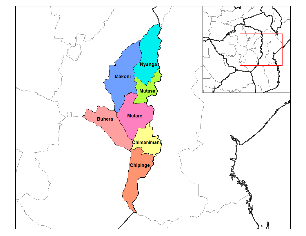
Junction Gate is a small community in the province of Manicaland, Zimbabwe located 6 km west from the Mozambique border and about 20 km east of Chipinge Chipinge, formerly known as Chipinga, is a town in Zimbabwe, located in Chipinge District, in Manicaland Province, in southeastern Zimbabwe, close to the border with Mozambique. Location The town lies approximately , by road, south of Mutare .... There is a school called Junction Gate Primary School which was established in The school's moto is "It's the little things we do that make us big" The school is next to a Tanganda Tea Estate farm called Petronella populary known as Mabheka. Tanganda Tea Estates built a Tea Processing Factory adjacent to the school around 1999 called Tingamira and a dam that is supplied by two small rivers, Chipita and Pondabuwe. It then went on to start a bottled still water brand named after the dam, Tingamira Still Water. At Junction Gate, there is also a clinic and a police statio ... [...More Info...] [...Related Items...] OR: [Wikipedia] [Google] [Baidu] |
Manicaland
Manicaland is a province in eastern Zimbabwe. After Harare Province, it is the country's second-most populous province, with a population of 2.037 million, as of the 2022 census. Making it the third most densely populated province after Harare and Bulawayo provinces. Manicaland was one of five original provinces established in Southern Rhodesia in the early colonial period. The province endowed with country's major tourist attractions, the likes of Mutarazi Falls, Nyanga National Park and Zimbabwe's top three highest peaks. The province is divided into ten administrative subdivisions of seven rural districts and three towns/councils, including the provincial capital, Mutare. The name Manicaland is derived from one of the province's largest ethnic groups, the Manyika, who originate from the area north of the Manicaland province and as well as western Mozambique, who speak a distinct language called ChiManyika in Shona (one of the dialect of the Shona language). Manicaland is bo ... [...More Info...] [...Related Items...] OR: [Wikipedia] [Google] [Baidu] |
Zimbabwe
file:Zimbabwe, relief map.jpg, upright=1.22, Zimbabwe, relief map Zimbabwe, officially the Republic of Zimbabwe, is a landlocked country in Southeast Africa, between the Zambezi and Limpopo Rivers, bordered by South Africa to the south, Botswana to the southwest, Zambia to the north, and Mozambique to the east. The capital and largest city is Harare, and the second largest is Bulawayo. A country of roughly 16.6 million people as per 2024 census, Zimbabwe's largest ethnic group are the Shona people, Shona, who make up 80% of the population, followed by the Northern Ndebele people, Northern Ndebele and other #Demographics, smaller minorities. Zimbabwe has 16 official languages, with English, Shona language, Shona, and Northern Ndebele language, Ndebele the most common. Zimbabwe is a member of the United Nations, the Southern African Development Community, the African Union, and the Common Market for Eastern and Southern Africa. The region was long inhabited by the San people, ... [...More Info...] [...Related Items...] OR: [Wikipedia] [Google] [Baidu] |
Mozambique
Mozambique, officially the Republic of Mozambique, is a country located in Southeast Africa bordered by the Indian Ocean to the east, Tanzania to the north, Malawi and Zambia to the northwest, Zimbabwe to the west, and Eswatini and South Africa to the south and southwest. The sovereign state is separated from the Comoros, Mayotte, and Madagascar by the Mozambique Channel to the east. The capital and largest city is Maputo. Between the 7th and 11th centuries, a series of Swahili port towns developed on that area, which contributed to the development of a distinct Swahili culture and dialect. In the late medieval period, these towns were frequented by traders from Somalia, Ethiopia, Egypt, Arabia, Persia, and India. The voyage of Vasco da Gama in 1498 marked the arrival of the Portuguese Empire, Portuguese, who began a gradual process of colonisation and settlement in 1505. After over four centuries of Portuguese Mozambique, Portuguese rule, Mozambique Mozambican War of Indepen ... [...More Info...] [...Related Items...] OR: [Wikipedia] [Google] [Baidu] |
Chipinge
Chipinge, formerly known as Chipinga, is a town in Zimbabwe, located in Chipinge District, in Manicaland Province, in southeastern Zimbabwe, close to the border with Mozambique. Location The town lies approximately , by road, south of Mutare, the nearest large city. This location lies about , by road, east of Masvingo, on the road (Highway A-9) to Bulawayo, Zimbabwe's second-largest city, approximately , further west of Masvingo. The coordinates of the town are: 20° 12' 0.00"S, 32° 37' 12.00"E (Latitude:20.2000; Longitude:32.6200). Chipinge sits at an elevation of , above sea level. Overview The average annual rainfall in Chipinge is about . The warm climate and high rainfall are well suited to agriculture. The local farmers grow tea, coffee, macadamia nuts and rear dairy cattle. The surrounding mountain slopes are covered with pine and acacia plantations. One of Zimbabwe's most famous landmarks, the Birchenough Bridge is located on the Sabi River about , northwest of C ... [...More Info...] [...Related Items...] OR: [Wikipedia] [Google] [Baidu] |

