|
Juktas
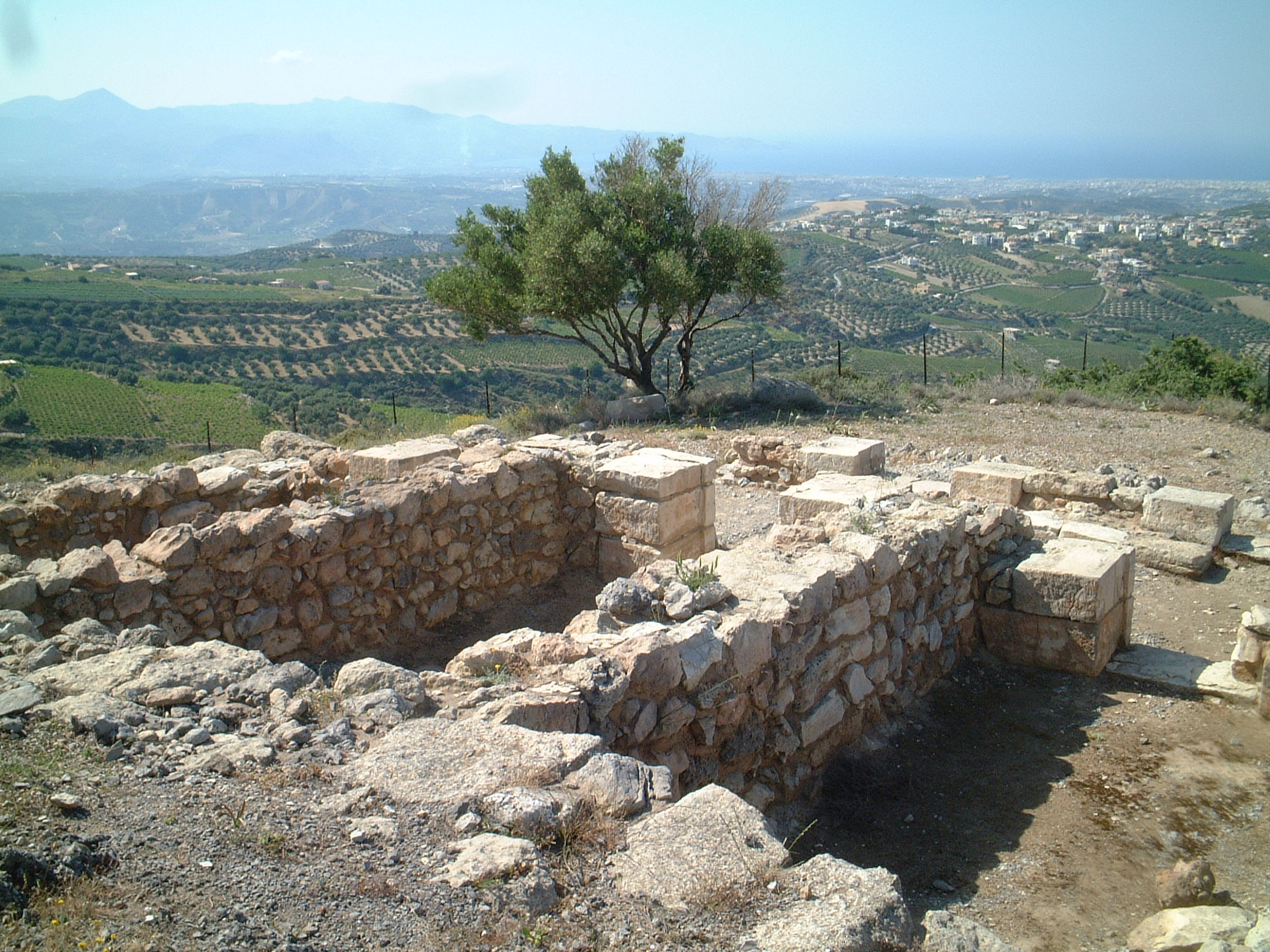
A mountain in north-central Crete, Mount Juktas ( el, Γιούχτας - ''Giouchtas''), also spelled Iuktas, Iouktas, or Ioukhtas, was an important religious site for the Minoan civilization. Located a few kilometers from the palaces of Knossos and Fourni and the megaron at Vathypetro, Mount Juktas was the site of an important peak sanctuary in the Minoan world. At the base of Juktas, at Anemospilia, is a site that has suggested to some that the Minoans practiced human sacrifice, but the evidence is currently somewhat in question. Peak Sanctuary Mount Juktas is the site of one of the most important peak sanctuaries in the Minoan world, and probably the first of them. Archaeologial importance Archaeologists have studied the site over an extensive period, examining fragments of pottery, remains of walls, and some unique kinds of stone that must have been hauled up the mountain because they do not otherwise occur there. Religious importance The mountain remains important in ... [...More Info...] [...Related Items...] OR: [Wikipedia] [Google] [Baidu] |
Minoan Civilization
The Minoan civilization was a Bronze Age Aegean civilization on the island of Crete and other Aegean Islands, whose earliest beginnings were from 3500BC, with the complex urban civilization beginning around 2000BC, and then declining from 1450BC until it ended around 1100BC, during the early Greek Dark Ages, part of a wider bronze age collapse around the Mediterranean. It represents the first advanced civilization in Europe, leaving behind a number of massive building complexes, Minoan art, sophisticated art, and writing systems. Its economy benefited from a network of trade around much of the Mediterranean. The civilization was rediscovered at the beginning of the 20th century through the work of British archaeologist Sir Arthur Evans. The name "Minoan" derives from the mythical Minos, King Minos and was coined by Evans, who identified the site at Knossos with the labyrinth of the Minotaur. The Minoan civilization has been described as the earliest of its kind in Europe, and his ... [...More Info...] [...Related Items...] OR: [Wikipedia] [Google] [Baidu] |
Anemospilia
Anemospilia ( ell, τα Ανεμόσπηλια) is the archaeological site of an ancient Minoan temple on Crete. Geography The temple is located on the northern end of Mount Juktas. Modern Heraklion can be seen from the site. The site is in the country side near Arkhanes, about 7 kilometers from Knossos on the Island of Crete. It was on a hillside facing north towards the palace complexes of Knossos. Various factors made archaeologists conclude that it was a temple. The site is in the countryside, Anemospilia means 'caves of the wind'. It is in the foothills of Mount Juktas, the legendary burial place of Zeus. Archaeology Anemospilia was first excavated in 1979 by the Greek archaeologist Yannis Sakellarakis. The temple was destroyed by earthquake and fire around 1700 BC, about the same time as the destruction of the first palaces. The temple was found in a ruined state with stone walls only reaching hip height. Traces of ash and charcoal were found on the ground, and from th ... [...More Info...] [...Related Items...] OR: [Wikipedia] [Google] [Baidu] |
Horns Of Consecration
"Horns of Consecration" is a term coined by Sir Arthur Evans for the symbol, ubiquitous in Minoan civilization, that is usually thought to represent the horns of the sacred bull. Sir Arthur Evans concluded, after noting numerous examples in Minoan and Mycenaean contexts, that the Horns of Consecration were "a more or less conventionalised article of ritual furniture derived from the actual horns of the sacrificial oxen" The much-photographed porous limestone horns of consecration on the East Propyleia at Knossos (''illustration, right'') are restorations, but horns of consecration in stone or clay were placed on the roofs of buildings in Neopalatial Crete, or on tombs or shrines, probably as signs of sanctity of the structure. The symbol also appears on Minoan sealstones, often accompanied by double axes and bucrania, which are part of the iconography of Minoan bull sacrifice. Horns of consecration are among the cultic images painted on the Minoan coffins called ''larnakes ... [...More Info...] [...Related Items...] OR: [Wikipedia] [Google] [Baidu] |
Phourni
Phourni ( el, Φουρνί, also Fourni) is the archaeological site of an ancient Minoan cemetery in Crete, established in 2400 BC and lasted until 1200 BC. ''Phourni'' is Greek for "furnace, oven" and the name of the hill on which the cemetery is located. Phourni is located at 70100 Epano Archanes, Heraklion, Greece—located on a hill in north-central Crete. Phourni can be seen from Mount Juktas. It is a small hill situated northwest of Archanes, between Archanes and Kato Archanes. Phourni is reachable from a signed scenic path that starts at Archanes. It was crucial for Minoan burials as many successful ones happened at this site. The burials consistently and proactively engaged the community of the Minoans. The largest cemetery in the Archanes area was discovered in 1957 and excavated for 25 years by Yiannis Sakellarakis, beginning in 1965. The 6600 sq m cemetery includes 26 funerary buildings of varying shapes and sizes. Funerary practices People were buried in either “Hous ... [...More Info...] [...Related Items...] OR: [Wikipedia] [Google] [Baidu] |
Peak Sanctuaries
Minoan peak sanctuaries are widespread throughout the island of Crete (Greece). Most scholars agree that peak sanctuaries were used for religious rites. In all peak sanctuaries human and animal clay figurines have been found. Clay body parts, also called votive body parts, are also found in most peak sanctuaries. These open-air sanctuaries are found high in the mountains of Crete. Eastern and east-central peak sanctuaries Most peak sanctuaries are found in east and east-central Crete. * Petsofas is the only Minoan site with clay weasel and tortoise figurines * Traostalos * Kalamafki (also Kalamaki) * Ziros Korphi tou Mare * Xykephalo * Vigla (also Viglos) * Zou Prinias * Plagia * Etiani Kephala * Modi * Thylakas * Maza * Karfi Central Crete peak sanctuaries * Iouktas is probably the earliest of the peak sanctuaries. * Tylissos Tylisos (also Pyrgos-Tylissos or Tylissos; el, Τύλισος; Linear B: ''Tu-li-so'') [...More Info...] [...Related Items...] OR: [Wikipedia] [Google] [Baidu] |
Linear A
Linear A is a writing system that was used by the Minoans of Crete from 1800 to 1450 BC to write the hypothesized Minoan language or languages. Linear A was the primary script used in palace and religious writings of the Minoan civilization. It was succeeded by Linear B, which was used by the Mycenaeans to write an early form of Greek. It was discovered by archaeologist Sir Arthur Evans. No texts in Linear A have yet been deciphered. The term ''linear'' refers to the fact that the script was written using a stylus to cut ''lines'' into a tablet of clay, as opposed to cuneiform, which was written by using a stylus to press ''wedges'' into the clay. Linear A belongs to the group of scripts that evolved independently of the Egyptian and Mesopotamian systems. During the second millennium BC, there were four major branches: Linear A, Linear B, Cypro-Minoan, and Cretan hieroglyphic. In the 1950s, Linear B was deciphered as Mycenaean Greek. Linear B shares ma ... [...More Info...] [...Related Items...] OR: [Wikipedia] [Google] [Baidu] |
Island Of Crete, Greece
Crete ( el, Κρήτη, translit=, Modern: , Ancient: ) is the largest and most populous of the Greek islands, the 88th largest island in the world and the fifth largest island in the Mediterranean Sea, after Sicily, Sardinia, Cyprus, and Corsica. Crete rests about south of the Greek mainland, and about southwest of Anatolia. Crete has an area of and a coastline of 1,046 km (650 mi). It bounds the southern border of the Aegean Sea, with the Sea of Crete (or North Cretan Sea) to the north and the Libyan Sea (or South Cretan Sea) to the south. Crete and a number of islands and islets that surround it constitute the Region of Crete ( el, Περιφέρεια Κρήτης, links=no), which is the southernmost of the 13 top-level administrative units of Greece, and the fifth most populous of Greece's regions. Its capital and largest city is Heraklion, on the north shore of the island. , the region had a population of 636,504. The Dodecanese are located to the no ... [...More Info...] [...Related Items...] OR: [Wikipedia] [Google] [Baidu] |
Geography Of Ancient Crete
Geography (from Ancient Greek, Greek: , ''geographia''. Combination of Greek words ‘Geo’ (The Earth) and ‘Graphien’ (to describe), literally "earth description") is a field of science devoted to the study of the lands, features, inhabitants, and phenomena of Earth. The first recorded use of the word γεωγραφία was as a title of a book by Greek scholar Eratosthenes (276–194 BC). Geography is an all-encompassing discipline that seeks an understanding of Earth and world, its human and natural complexities—not merely where objects are, but also how they have changed and come to be. While geography is specific to Earth, many concepts can be applied more broadly to other celestial bodies in the field of planetary science. One such concept, the Tobler's first law of geography, first law of geography, proposed by Waldo Tobler, is "everything is related to everything else, but near things are more related than distant things." Geography has been called "the worl ... [...More Info...] [...Related Items...] OR: [Wikipedia] [Google] [Baidu] |
Landforms Of Heraklion (regional Unit)
A landform is a natural or anthropogenic land feature on the solid surface of the Earth or other planetary body. Landforms together make up a given terrain, and their arrangement in the landscape is known as topography. Landforms include hills, mountains, canyons, and valleys, as well as shoreline features such as bays, peninsulas, and seas, including submerged features such as mid-ocean ridges, volcanoes, and the great ocean basins. Physical characteristics Landforms are categorized by characteristic physical attributes such as elevation, slope, orientation, stratification, rock exposure and soil type. Gross physical features or landforms include intuitive elements such as berms, mounds, hills, ridges, cliffs, valleys, rivers, peninsulas, volcanoes, and numerous other structural and size-scaled (e.g. ponds vs. lakes, hills vs. mountains) elements including various kinds of inland and oceanic waterbodies and sub-surface features. Mountains, hills, plateaux, and plains are the f ... [...More Info...] [...Related Items...] OR: [Wikipedia] [Google] [Baidu] |
Minoan Pottery
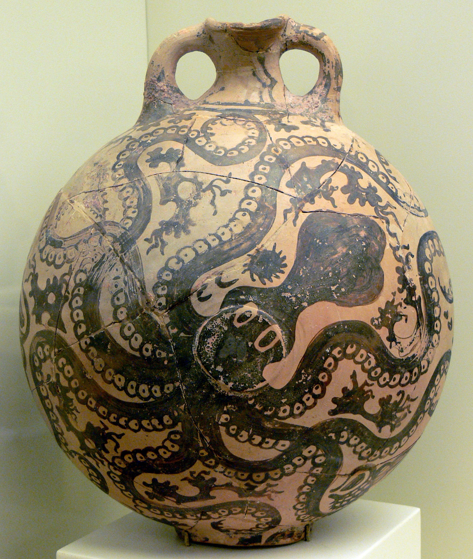
Minoan pottery has been used as a tool for dating the mute Minoan civilization. Its restless sequence of quirky maturing artistic styles reveals something of Minoan patrons' pleasure in novelty while they assist archaeologists in assigning relative dates to the strata of their sites. Pots that contained oils and ointments, exported from 18th century BC Crete, have been found at sites through the Aegean islands and mainland Greece, on Cyprus, along coastal Syria and in Egypt, showing the wide trading contacts of the Minoans. The pottery consists of vessels of various shapes, which as with other types of Ancient Greek pottery may be collectively referred to as "vases", and also "terracottas", small ceramic figurines, models of buildings and some other types. Some pieces, especially the cups of rhyton shape, overlap the two categories, being both vessels for liquids but essentially sculptural objects. Several pottery shapes, especially the rhyton cup, were also produced in soft ... [...More Info...] [...Related Items...] OR: [Wikipedia] [Google] [Baidu] |
Labrys
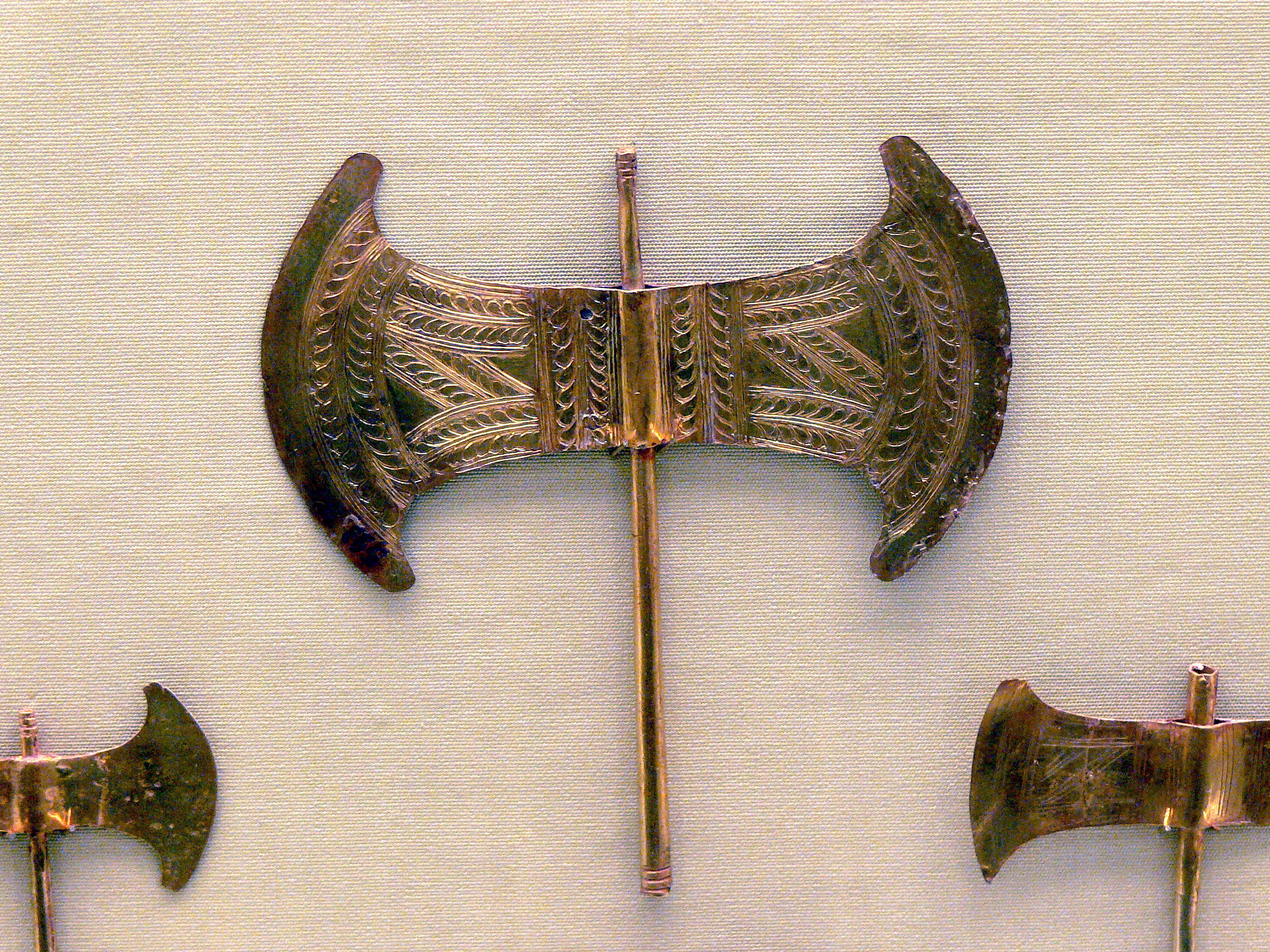
''Labrys'' ( gr, , lábrus) is, according to Plutarch (''Quaestiones Graecae'' 2.302a), the Lydian word for the double-bitted axe. In Greek it was called (''pélekus''). The Ancient Greek plural of ''labrys'' is ''labryes'' (). Etymology Plutarch relates that the word was a Lydian word for 'axe': . Many scholars including Evans assert that the word '' labyrinth'' is derived from ''labrys'' and thus, would imply 'house of the double axe'. A priestly corporation in Delphi was named ''Labyades''; the original name was probably ''Labryades'', servants of the double axe. In Roman times at Patrai and Messene, a goddess Laphria was worshipped, commonly identified with Artemis. Her name was said to be derived from the region around Delphi. In Crete the "double axe" is not a weapon, however, and it always accompanies women, not a male god. Beekes regards the relation of ''labyrinth'' with ''labrys'' as speculative, and rather proposes a relation with (), 'narrow street', ... [...More Info...] [...Related Items...] OR: [Wikipedia] [Google] [Baidu] |
.jpg)


.jpg)

