|
Jodenbuurt (Amsterdam)
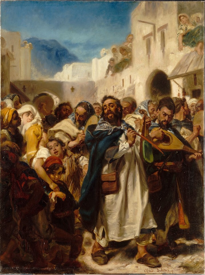
The Jodenbuurt (Dutch: ''Jewish neighbourhood'') is a neighbourhood of Amsterdam, Netherlands. For centuries before World War II, it was the center of the Dutch Jews of Amsterdam — hence, its name (literally '' Jewish quarter''). It is best known as the birthplace of Baruch Spinoza, the home of Rembrandt, and the Jewish ghetto of Nazi occupation of the Netherlands. Boundaries Traditionally, the boundaries of the Jodenbuurt, east of the city center, are the Amstel River in the southwest, the Zwanenburgwal "Swans City Wall" and Oudeschans "Old Rampart" canals in the northwest, Rapenburg, a street in the northeast and the Nieuwe Herengracht "New Patricians Canal" in the southeast. But it grew to include parts of Nieuwmarkt "New Market", Sint Antoniesbreestraat "St. Anthony's Broad Street", the Plantage "Plantation", and Weesperzijde "Weesp Side", especially after 1882, when two canals, the Leprozengracht "Lepers Canal" and the Houtgracht "Wood Canal", were filled in. History ... [...More Info...] [...Related Items...] OR: [Wikipedia] [Google] [Baidu] |
Provinces Of The Netherlands
There are twelve provinces of the Netherlands (), representing the administrative layer between the national government and the local municipalities, with responsibility for matters of subnational or regional importance. The most populous province is South Holland, with just over 3.7 million inhabitants as of January 2020, and also the most densely populated province with . With 383,488 inhabitants, Zeeland has the smallest population. However Drenthe is the least densely populated province with . In terms of area, Friesland is the largest province with a total area of . If water is excluded, Gelderland is the largest province by land area at . The province of Utrecht is the smallest with a total area of , while Flevoland is the smallest by land area at . In total about 10,000 people were employed by the provincial administrations in 2018. The provinces of the Netherlands are joined in the Association of Provinces of the Netherlands (IPO). This organisation promotes the co ... [...More Info...] [...Related Items...] OR: [Wikipedia] [Google] [Baidu] |
Rapenburg (Amsterdam)
Rapenburg is a neighbourhood in Amsterdam, Netherlands. The main street is also called Rapenburg. Rapenburg is located in the centre of Amsterdam, on the northeastern side, close to the IJ. Rapenburg was first built in the sixteenth century and was home to many shipmakers, due to its location near to the IJ and the River Amstel. {{NorthHolland-geo-stub Streets in Amsterdam Neighbourhoods of Amsterdam ... [...More Info...] [...Related Items...] OR: [Wikipedia] [Google] [Baidu] |
Amsterdam-Centrum
Amsterdam-Centrum is the inner-most borough and historical city centre of Amsterdam, Netherlands, containing the majority of the city's landmarks. Established in 2002, Amsterdam-Centrum was the last area in the city to be granted the status of self-governing borough. The borough is only 8.04 km2 large and covers the old innercity and the UNESCO-listed Amsterdam canal belt. In 2013, the borough had approximately 85,000 inhabitants, who on average had the second-highest income per household in the city (after Amsterdam-Zuid) and one of the highest in the country. Neighborhoods Amsterdam-Centrum consists of fourteen neighborhoods: Binnenstad (comprising the Burgwallen Oude Zijde and Burgwallen Nieuwe Zijde areas), Grachtengordel (including the Negen Straatjes district), Haarlemmerbuurt, Jodenbuurt, Jordaan, Kadijken, Lastage, Oosterdokseiland, Oostelijke Eilanden (including the Czaar Peterbuurt), Plantage, Rapenburg, Uilenburg, Westelijke Eilanden and Weteringschans ... [...More Info...] [...Related Items...] OR: [Wikipedia] [Google] [Baidu] |
Germany
Germany, officially the Federal Republic of Germany (FRG),, is a country in Central Europe. It is the most populous member state of the European Union. Germany lies between the Baltic and North Sea to the north and the Alps to the south. Its 16 constituent states have a total population of over 84 million in an area of . It borders Denmark to the north, Poland and Czechia to the east, Austria and Switzerland to the south, and France, Luxembourg, Belgium, and the Netherlands to the west. The nation's capital and most populous city is Berlin and its main financial centre is Frankfurt; the largest urban area is the Ruhr. Settlement in what is now Germany began in the Lower Paleolithic, with various tribes inhabiting it from the Neolithic onward, chiefly the Celts. Various Germanic tribes have inhabited the northern parts of modern Germany since classical antiquity. A region named Germania was documented before AD 100. In 962, the Kingdom of Germany formed the ... [...More Info...] [...Related Items...] OR: [Wikipedia] [Google] [Baidu] |
Spain
, image_flag = Bandera de España.svg , image_coat = Escudo de España (mazonado).svg , national_motto = '' Plus ultra'' ( Latin)(English: "Further Beyond") , national_anthem = (English: "Royal March") , image_map = , map_caption = , image_map2 = , capital = Madrid , coordinates = , largest_city = Madrid , languages_type = Official language , languages = Spanish , ethnic_groups = , ethnic_groups_year = , ethnic_groups_ref = , religion = , religion_ref = , religion_year = 2020 , demonym = , government_type = Unitary parliamentary constitutional monarchy , leader_title1 = Monarch , leader_name1 = Felipe VI , leader_title2 = Prime Minister , leader_name2 = Pedro Sánchez , legislature = ... [...More Info...] [...Related Items...] OR: [Wikipedia] [Google] [Baidu] |
Portugal
Portugal, officially the Portuguese Republic, In recognized minority languages of Portugal: :* mwl, República Pertuesa is a country located on the Iberian Peninsula, in Southwestern Europe, and whose territory also includes the Macaronesian archipelagos of the Azores and Madeira. It features the westernmost point in continental Europe, its mainland west and south border with the North Atlantic Ocean and in the north and east, the Portugal-Spain border, constitutes the longest uninterrupted border-line in the European Union. Its archipelagos form two autonomous regions with their own regional governments. On the mainland, Alentejo region occupies the biggest area but is one of the least densely populated regions of Europe. Lisbon is the capital and largest city by population, being also the main spot for tourists alongside Porto, the Algarve and Madeira. One of the oldest countries in Europe, its territory has been continuously settled and fought over since prehistoric tim ... [...More Info...] [...Related Items...] OR: [Wikipedia] [Google] [Baidu] |
Sephardi Jews
Sephardic (or Sephardi) Jews (, ; lad, Djudíos Sefardíes), also ''Sepharadim'' , Modern Hebrew: ''Sfaradim'', Tiberian Hebrew, Tiberian: Səp̄āraddîm, also , ''Ye'hude Sepharad'', lit. "The Jews of Spain", es, Judíos sefardíes (or ), pt, Judeus sefarditas or Hispanic Jews, are a Jewish diaspora population associated with the Iberian Peninsula. The term, which is derived from the Hebrew ''Sepharad'' (), can also refer to the Mizrahi Jews of Western Asia and North Africa, who were also influenced by Sephardic law and customs. Many Iberian Jewish exiles also later sought refuge in Mizrahi Jewish communities, resulting in integration with those communities. The Jewish communities of the Iberian Peninsula prospered for centuries under the Muslim reign of Al-Andalus following the Umayyad conquest of Hispania, but their fortunes began to decline with the Christians, Christian ''Reconquista'' campaign to retake Spain. In 1492, the Alhambra Decree by the Catholic Monarchs of ... [...More Info...] [...Related Items...] OR: [Wikipedia] [Google] [Baidu] |
Portugees-Israëlietische Synagoge
The Portuguese Synagogue, also known as the Esnoga, or Snoge, is a late 17th-century Sephardic synagogue in Amsterdam, completed in 1675. ''Esnoga'' is the word for synagogue in Judaeo-Spanish, the traditional Judaeo-Spanish language of Sephardi Jews. The Amsterdam Sephardic community was one of the largest and richest Jewish communities in Europe during the Dutch Golden Age, and their very large synagogue reflected this. The synagogue remains an active place of worship and is also a popular tourist attraction. Background The Sephardim (Hebrew for "Jews of the Iberian Peninsula") were issued with the Spanish royal Alhambra Decree in 1492, whereby they were given the choice of exile from Spain, or conversion to Catholicism, or failing to do either, execution. Of Spain's estimated 200,000 Jews at that time, around half converted; many by coercion, others because of social and financial pressures preventing their departure, and a few out of genuine religious conviction. They be ... [...More Info...] [...Related Items...] OR: [Wikipedia] [Google] [Baidu] |
Houtgracht
The Houtgracht (; Wood Canal) was a canal in Amsterdam that defined one side of Vlooyenburg island. Houtgracht and the connected Leprozengracht canal were filled in 1882 to form the Waterlooplein. History In the late 16th century it was decided to expand the old city of Amsterdam by creating a new island on the land between Sint Anthoniesdijk and the Amstel. Vlooienburg was raised up during the second expansion of Amsterdam between 1592 and 1596 as a place for lumberyards, which gave the Houtgracht canal its name. Blocks of houses were soon added. The new island was called Vlooyenburg in a reference to the regular flooding from the Amstel that the area had previously experienced. It was surrounded by the Amstel, Leprozengracht, Houtgracht and Verwerfsgracht ( Zwanenburgwal). In a 1597 map by Pieter Bast the island is shown without any trees, buildings or roads, connected to the mainland by a bridge over the east end of the Houtgracht. Three Portuguese Jewish congregations ... [...More Info...] [...Related Items...] OR: [Wikipedia] [Google] [Baidu] |
Leprozengracht
The Leprozengracht was a canal in Amsterdam that defined one side of the Vlooyenburg island. Leprozengracht and the connected Houtgracht canal were filled in 1882 to form the Waterlooplein. History The Sint Anthoniusgasthuis, or Sint Nicolaasgasthuis, a leper house, was established on the land between Sint Anthoniesdijk and Amstel in the 14th century. In the late 16th century it was decided to expand the old city of Amsterdam by creating a new island in this area. The new island was called Vlooyenburg, a reference to the regular flooding of the area from the Amstel, and was surrounded by the Amstel, Leprozengracht, Houtgracht and Verwerfsgracht ( Zwanenburgwal). With the expansion, the leper house came to be within the city, and gave its name to the canal. The canal was also known as the Leprozen Graft, Leprozenburgwal and Turfgracht. It was crossed by the Muiderbrug along the Amstel bank. Vlooienburg was raised up during the second expansion of Amsterdam between 1592 and 159 ... [...More Info...] [...Related Items...] OR: [Wikipedia] [Google] [Baidu] |
Weesperzijde (Amsterdam)
Weesperzijde (Amsterdam) is a neighbourhood of Amsterdam, Netherlands, aligned along the east side of Amstelriver. It is a well-to-do residential area with a familial atmosphere, characterised by houses built during the last turn of centuries, some by famous Dutch architects like Dolf van Gendt and Abraham Salm. Neighbourhoods of Amsterdam Amsterdam-Oost {{NorthHolland-geo-stub ... [...More Info...] [...Related Items...] OR: [Wikipedia] [Google] [Baidu] |
Plantage
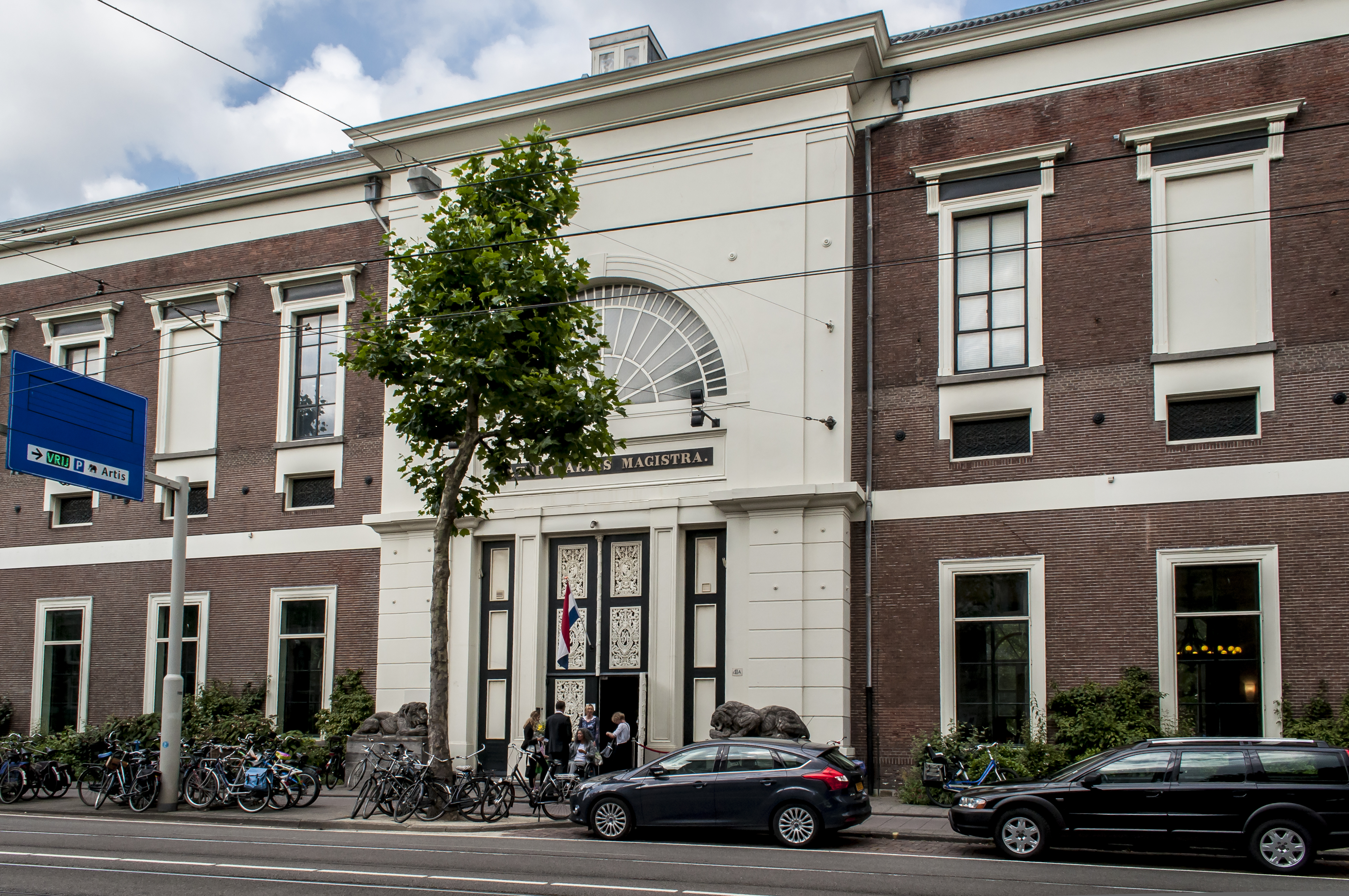
Plantage is a neighbourhood of Amsterdam, Netherlands located in its Centrum borough. It is bordered by the Entrepotdok to the north, Plantage Muidergracht to the east and south and Nieuwe Herengracht to the west. In the centre of the neighbourhood lies the Natura Artis Magistra zoo. It had a population of 1,980 in 2017. History Early years The area came within Amsterdam city limits after the completion of the fourth large urban expansion of 1663. Due to an economic crisis caused by the Rampjaar events, the city government could not find enough buyers for the land. Construction in the area, which was then called ''Plantagie'' or ''Plantaadje'', stagnated as a result. Instead, pleasure gardens and orchards were built where Amsterdam's citizens could go and relax in green surroundings. The plots of land in the neighbourhood were leased by the city for a period of 20 years (with the possibility of a 10-year extension). This was because the city council intended to sell the parcel ... [...More Info...] [...Related Items...] OR: [Wikipedia] [Google] [Baidu] |


_Vlooyenburg.jpg)
_2-1.jpg)
