|
Jericho Pipe
The Jericho pipe is a diamondiferous diatreme in the Slave craton of Nunavut, Canada, located northeast of Yellowknife near the northern end of Contwoyto Lake. It is home to the now closed Jericho Diamond Mine. See also *List of volcanoes in Canada List of volcanoes in Canada is an incomplete list of volcanoes found in Mainland Canada, in the Canadian islands and in Canadian waters. All but one province, Prince Edward Island, have at least one volcano. Alberta British Columbia Ne ... * Volcanology of Canada * Volcanology of Northern Canada References Diatremes of Nunavut Pre-Holocene volcanoes {{Nunavut-geo-stub ... [...More Info...] [...Related Items...] OR: [Wikipedia] [Google] [Baidu] |
Diamond
Diamond is a solid form of the element carbon with its atoms arranged in a crystal structure called diamond cubic. Another solid form of carbon known as graphite is the chemically stable form of carbon at room temperature and pressure, but diamond is metastable and converts to it at a negligible rate under those conditions. Diamond has the highest hardness and thermal conductivity of any natural material, properties that are used in major industrial applications such as cutting and polishing tools. They are also the reason that diamond anvil cells can subject materials to pressures found deep in the Earth. Because the arrangement of atoms in diamond is extremely rigid, few types of impurity can contaminate it (two exceptions are boron and nitrogen). Small numbers of defects or impurities (about one per million of lattice atoms) color diamond blue (boron), yellow (nitrogen), brown (defects), green (radiation exposure), purple, pink, orange, or red. Diamond also has a ... [...More Info...] [...Related Items...] OR: [Wikipedia] [Google] [Baidu] |
Diatreme
A diatreme, sometimes known as a maar-diatreme volcano, is a volcanic pipe formed by a gaseous explosion. When magma rises up through a crack in Earth's crust and makes contact with a shallow body of groundwater, rapid expansion of heated water vapor and volcanic gases can cause a series of explosions. A relatively shallow crater (known as a ''maar'') is left, and a rock-filled fracture (the actual diatreme) in the crust. Diatremes breach the surface and produce a steep, inverted cone shape. The term ''diatreme'' has been applied more generally to any concave body of broken rock formed by explosive or hydrostatic forces, whether or not it is related to volcanism. The word comes . Global distribution Maar-diatreme volcanoes are not uncommon, reported as the second most common type of volcano on continents and islands. Igneous intrusions cause the formation of a diatreme only in the specific setting where groundwater exists; thus most igneous intrusions do not produce diatrem ... [...More Info...] [...Related Items...] OR: [Wikipedia] [Google] [Baidu] |
Slave Craton
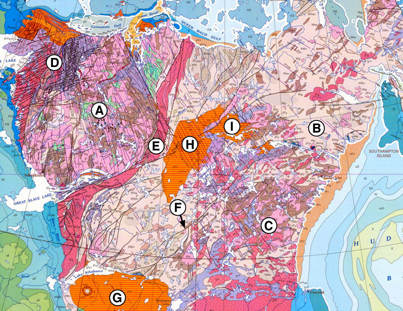
The Slave Craton is an Archaean craton in the north-western Canadian Shield, in Northwest Territories and Nunavut. The Slave Craton includes the 4.03 Ga-old Acasta Gneiss which is one of the oldest dated rocks on Earth. Covering about , it is a relatively small but well-exposed craton dominated by ~2.73–2.63 Ga (billion years-old) greenstones and turbidite sequences and ~2.72–2.58 Ga plutonic rocks, with large parts of the craton underlain by older gneiss and granitoid units. The Slave Craton is one of the blocks that compose the Precambrian core of North America, also known as the palaeocontinent Laurentia. The exposed portion of the craton, called the Slave Province, comprises and has an elliptical shape that stretches NNE from Gros Cap on the Great Slave Lake to Cape Barrow on the Coronation Gulf and EW along latitude 64°N. It covers about and is bounded by Palaeoproterozoic belts to the south, east, and west, while younger rocks cover it to the north ... [...More Info...] [...Related Items...] OR: [Wikipedia] [Google] [Baidu] |
Nunavut
Nunavut ( , ; iu, ᓄᓇᕗᑦ , ; ) is the largest and northernmost territory of Canada. It was separated officially from the Northwest Territories on April 1, 1999, via the '' Nunavut Act'' and the '' Nunavut Land Claims Agreement Act'', which provided this territory to the Inuit for independent government. The boundaries had been drawn in 1993. The creation of Nunavut resulted in the first major change to Canada's political map in half a century since the province of Newfoundland was admitted in 1949. Nunavut comprises a major portion of Northern Canada and most of the Arctic Archipelago. Its vast territory makes it the fifth-largest country subdivision in the world, as well as North America's second-largest (after Greenland). The capital Iqaluit (formerly Frobisher Bay), on Baffin Island in the east, was chosen by a capital plebiscite in 1995. Other major communities include the regional centres of Rankin Inlet and Cambridge Bay. Nunavut also includes Elle ... [...More Info...] [...Related Items...] OR: [Wikipedia] [Google] [Baidu] |
Yellowknife
Yellowknife (; Dogrib: ) is the capital, largest community, and only city in the Northwest Territories, Canada. It is on the northern shore of Great Slave Lake, about south of the Arctic Circle, on the west side of Yellowknife Bay near the outlet of the Yellowknife River. Yellowknife and its surrounding water bodies were named after a local Dene tribe, who were known as the "Copper Indians" or "Yellowknife Indians", today incorporated as the Yellowknives Dene First Nation. They traded tools made from copper deposits near the Arctic Coast. Its population, which is ethnically mixed, was 19,569 per the 2016 Canadian Census. Of the eleven official languages of the Northwest Territories, five are spoken in significant numbers in Yellowknife: Dene Suline, Dogrib, South and North Slavey, English, and French. In the Dogrib language, the city is known as ''Sǫǫ̀mbak’è'' (, "where the money is"). Modern Yellowknives members can be found in the adjoining, primarily Indigenou ... [...More Info...] [...Related Items...] OR: [Wikipedia] [Google] [Baidu] |
Contwoyto Lake
Contwoyto Lake is a lake in the Kitikmeot Region of the Canadian territory of Nunavut, located near the border with the Northwest Territories. With a total area of , it is the territories' tenth largest lake. Lupin Mine is located near Contwoyto Lake. The lake is also the terminus of the Tibbitt to Contwoyto Winter Road from Tibbitt Lake in the Northwest Territories, Nunavut's only currently existing road access to the rest of Canada. In 2005, there was a proposal put forward to extend the winter road to a possible port at Bathurst Inlet. Climate See also *List of lakes of Canada This is a partial list of lakes of Canada. Canada has an extremely large number of lakes, with the number of lakes larger than three square kilometres being estimated at close to 31,752 by the Atlas of Canada. Of these, 561 lakes have a surface ar ... Further reading * Tremblay, Leo Paul. ''Geology of northern Contwoyto Lake area, district of Mackenzie''. Ottawa: Information Canada, 1976. * S ... [...More Info...] [...Related Items...] OR: [Wikipedia] [Google] [Baidu] |
Jericho Diamond Mine
The Jericho Diamond Mine is a dormant diamond mine located in Canada's Nunavut territory. Jericho is Nunavut’s first and only diamond mine. It is located northeast of Yellowknife, Northwest Territories and is accessible by air all year and by winter road from Yellowknife. The project was mined from 2006 to 2008, and produced of diamonds from of kimberlite mined from the open pit operation. Over $200 million was invested in the development of the Jericho operations including the construction of a per day diamond recovery plant, maintenance facility, fuel farm, and offices and accommodation for 225 personnel. On July 19, 2010 Shear Diamonds (née Shear Minerals Ltd) (), a diamond exploration company focused on the Nunavut region, announced its purchase of the Jericho Diamond Mine. In late 2010, Shear announced that it would take about a year to devise a plan to reopen the mine. Shear began processing the existing recovery reject pile in early 2012, selling the recovered ston ... [...More Info...] [...Related Items...] OR: [Wikipedia] [Google] [Baidu] |
List Of Volcanoes In Canada
List of volcanoes in Canada is an incomplete list of volcanoes found in Mainland Canada, in the Canadian islands and in Canadian waters. All but one province, Prince Edward Island, have at least one volcano. Alberta British Columbia British Columbia (commonly abbreviated as BC) is the westernmost Provinces and territories of Canada, province of Canada, situated between the Pacific Ocean and the Rocky Mountains. It has a diverse geography, with rugged landscapes that include ... New Brunswick Newfoundland and Labrador Northwest Territories Nova Scotia Nunavut Ontario Quebec Saskatchewan Yukon See also * Outline of Canada * Bibliography of Canada * Index of Canada-related articles * Volcanism of Canada ** Volcanism of Northern Canada ** Volcanism of Western Canada ** Volcanism of Eastern Canada ** List of Northern Cordilleran volcanoes * List of mountains in Canada * List of Cascade volcanoes External links Catalogue of Canadian Volcanoe ... [...More Info...] [...Related Items...] OR: [Wikipedia] [Google] [Baidu] |
Volcanology Of Canada
Volcanic activity is a major part of the geology of Canada and is characterized by many types of volcanic landform, including lava flows, volcanic plateaus, lava domes, cinder cones, stratovolcanoes, shield volcanoes, submarine volcanoes, calderas, diatremes, and maars, along with less common volcanic forms such as tuyas and subglacial mounds. Though Canada's volcanic history dates back to the Precambrian eon, at least 3.11 billion years ago, when its part of the North American continent began to form, volcanism continues to occur in Western and Northern Canada in modern times, where it forms part of an encircling chain of volcanoes and frequent earthquakes around the Pacific Ocean called the Pacific Ring of Fire. Because volcanoes in Western and Northern Canada are in relatively remote and sparsely populated areas and their activity is less frequent than with other volcanoes around the Pacific Ocean, Canada is commonly thought to occupy a gap in the Ring of Fire between the ... [...More Info...] [...Related Items...] OR: [Wikipedia] [Google] [Baidu] |
Volcanology Of Northern Canada
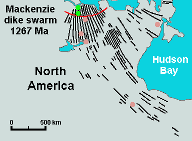
Volcanism of Northern Canada has produced hundreds of volcanic areas and extensive lava formations across Northern Canada. The region's different volcano and lava types originate from different tectonic settings and types of volcanic eruptions, ranging from passive lava eruptions to violent explosive eruptions. Northern Canada has a record of very large volumes of magmatic rock called large igneous provinces. They are represented by deep-level plumbing systems consisting of giant dike swarms, sill provinces and layered intrusions. Plume and rift complexes Vast volumes of basaltic lava covered Northern Canada in the form of a flood basalt event 1,267 million years ago that engulfed the landscape near the Coppermine River southwest of Coronation Gulf in the Canadian Arctic. This volcanic activity built an extensive lava plateau and large igneous province with an area of representing a volume of lavas of at least . With an area of and a volume of , it is larger than the Colum ... [...More Info...] [...Related Items...] OR: [Wikipedia] [Google] [Baidu] |
Diatremes Of Nunavut
A diatreme, sometimes known as a maar-diatreme volcano, is a volcanic pipe formed by a gaseous explosion. When magma rises up through a crack in Earth's crust and makes contact with a shallow body of groundwater, rapid expansion of heated water vapor and volcanic gases can cause a series of explosions. A relatively shallow crater (known as a ''maar'') is left, and a rock-filled fracture (the actual diatreme) in the crust. Diatremes breach the surface and produce a steep, inverted cone shape. The term ''diatreme'' has been applied more generally to any concave body of broken rock formed by explosive or hydrostatic forces, whether or not it is related to volcanism. The word comes . Global distribution Maar-diatreme volcanoes are not uncommon, reported as the second most common type of volcano on continents and islands. Igneous intrusions cause the formation of a diatreme only in the specific setting where groundwater exists; thus most igneous intrusions do not produce diatre ... [...More Info...] [...Related Items...] OR: [Wikipedia] [Google] [Baidu] |


