|
Jaunsar Bawar
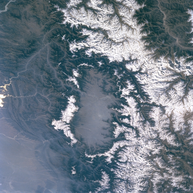
Jaunsar-Bawar is a hilly region in Garhwal division of Uttarakhand, northern India. It is located in the north-west of Dehradun district, along the border with the state of Himachal Pradesh. Ethnically, Jaunsar-Bawar comprises two regions, inhabited by the two predominant groups: Jaunsar, the lower half, while the snow-clad upper region is called Bawar, which includes, the 'Kharamba peak' (). Geographically adjacent, they are not very different from each other. The Bawar lies in the upper regions of the area. They are a unique community because they have remained cut off from the external world for centuries, leading to the retention of their unique culture and traditions, which have attracted historians, anthropologist and studies in ethnopharmacology to this region for over a century. There is a significant cultural shift from other people of Garhwal, living close by. Jaunsar-Bawar region The Jaunsar-Bawar region, is a valley, spread over 1002 km2 and 398 villages(vill ... [...More Info...] [...Related Items...] OR: [Wikipedia] [Google] [Baidu] |
States And Territories Of India
India is a federalism, federal union comprising 28 federated state, states and 8 union territory, union territories, for a total of 36 subnational entities. The states and union territories are further subdivided into 800 List of districts in India, districts and smaller administrative divisions of India, administrative divisions by the respective subnational government. The states of India are self-governing administrative divisions, each having a State governments of India, state government. The governing powers of the states are shared between the state government and the Government of India, union government. On the other hand, the union territories are directly governed by the union government. History 1876–1919 The British Raj was a very complex political entity consisting of various imperial divisions and states and territories of varying autonomy. At the time of its establishment in 1876, it was made up of 584 princely state, constituent states and the prov ... [...More Info...] [...Related Items...] OR: [Wikipedia] [Google] [Baidu] |
The Imperial Gazetteer Of India
''The Imperial Gazetteer of India'' was a gazetteer of the British Indian Empire, and is now a historical reference work. It was first published in 1881. Sir William Wilson Hunter made the original plans of the book, starting in 1869. . ''dutchinkerala.com''. Retrieved 29 August 2021. The 1908, 1909 and 1931 "New Editions" have four encyclopedic volumes covering the geography, history, economics, and administration of India; 20 volumes of the alphabetically arranged gazetteer, listing places' names and providing statistics and summary information; and one volume each comprising the index and atlas. The New Editions were all published by the |
Garhwali Language
Garhwali (, , in native pronunciation) is an Indo-Aryan language of the Central Pahari subgroup. It is primarily spoken by over million Garhwali people in the Garhwal region of the northern Indian state of Uttarakhand in the Indian Himalayas. Garhwali has a number of regional dialects. It is not an endangered language (''Ethnologue'' lists it as "vigorous"), it is nonetheless designated as "vulnerable" in UNESCO's ''Atlas of the World's Languages in Danger'', which indicates that the language requires consistent conservation efforts. Names ''Ethnologue'' has catalogued alternate names by which Garhwali is known such as ''Gadhavali, Gadhawala, Gadwahi, Gashwali, Girwali, Godauli, Gorwali, Gurvali,'' and ''Pahari Garhwali''. These alternate names of the language may have come from the speakers having more than one name for their language, or variant Romanisations of what is essentially the same name. Gadwallis schollar Gadwall's Kukareithi use Gadwallis or Gaddish for al ... [...More Info...] [...Related Items...] OR: [Wikipedia] [Google] [Baidu] |
Shimla District
Shimla district, known as Simla district until 1972, is one of the twelve districts of the state of Himachal Pradesh in northern India. Its headquarters is the state capital of Shimla. Neighbouring districts are Mandi and Kullu in the north, Kinnaur in the east, Uttarakhand in the southeast, Solan to the southwest and Sirmaur in the south. The elevation of the district ranges from to . As of 2011, it is the third most populated district of Himachal Pradesh (out of 12), after Kangra and Mandi. It is the most urbanized district of Himachal Pradesh. Administrative structure History Shimla district was obtained by the British in 1815. Access By road Shimla is connected by road to all the major towns. Distance between the major towns and Shimla: * Kalka - 80 km * Patiala - 172 km * Chandigarh - 119 km * Ambala - 166 km * Delhi - 380 km * Agra - 568 km * Amritsar - 342 km * Jammu (via Pathankot) - 482 km * Srinagar - 7 ... [...More Info...] [...Related Items...] OR: [Wikipedia] [Google] [Baidu] |
Sirmaur District
Sirmaur district is the southernmost district of Himachal Pradesh, northern India. It is largely mountainous and rural, with 90% of its population living in villages. Some of its towns include the capital Nahan, Paonta Sahib, Lana palar, Tuheri, Bhawan, Sirmaur, Shamra, UchaTikker and Suketi, the latter known for Shivalik Fossil Park. Geography There are seven tehsils in this district: Nahan, Renuka, Kamrau, Shillai, Rajgarh, Pachhad, and Paonta Sahib. The Giri River divides the district into two almost equal parts: Giripar and Giriaar. The major towns are Nahan, Paonta Sahib, Rajgarh, and Shillai. Rajgarh is the biggest village of Sirmour district. History Demographics According to the 2011 Census of India, Sirmaur district has a population of 529,855, which placed it 542nd in India (out of a total of 640). The district had a population density of . Its population growth rate over the decade 2001–2011 was 15.61%. Sirmaur had a sex ratio of 915 females for ... [...More Info...] [...Related Items...] OR: [Wikipedia] [Google] [Baidu] |
Jaunsari People
The Jaunsari are a small community found in Uttarakhand Uttarakhand (, ), also known as Uttaranchal ( ; List of renamed places in India, the official name until 2007), is a States and union territories of India, state in North India, northern India. The state is bordered by Himachal Pradesh to the n ..., northern India, more specifically in the Jaunsar-Bawar region of the western portion of the state in Garhwal Division. They speak the Jaunsari language which is an Indo-Aryan language. Culture Jaunsari community reveres ‘ Mahasu Devta’ which is principal deity of Jaunsari community. Dance and music are integral part of Jaunsari culture. During festivals both men and women dance under the intoxication of the folk music. Local people perform folk dances such as Harul, Ghundiya Raso, Jhenta Raso, Jangbazi, Thoude, and many more. Fair like Moroj and Bissu are held which mark the harvesting period. Clothing As a society which resides in the harsh climate of the Hima ... [...More Info...] [...Related Items...] OR: [Wikipedia] [Google] [Baidu] |
Dom (caste)
The Doma (), also known as ''Dom'', ''Domra'', ''Domba'', ''Domaka'', ''Dombara'' and ''Dombari'', are castes, or groups, scattered across India. The Doma/Dom were a caste of drummers. According to Tantra scriptures, the Dom were engaged in the occupations of singing and playing music. Historically, they were considered an untouchable caste called the Dalits and their traditional occupation was the disposal and cremation of dead bodies. The Doma were formerly classified as a criminal tribe under the 1870s Criminal Tribes Acts of the British Raj. They are in the list of Scheduled caste for Reservation in India in the Indian states of Uttar Pradesh, Bihar, Odisha, Andhra Pradesh, Jharkhand and West Bengal. Etymology Individuals who live by singing and music were referred to as Doma in Tantric scriptures. According to historian M.P Joshi, the word Duma is connected to the sound of a drum. Its presumed root, ''ḍom'', which is connected with drumming, is linked to ''damara'' an ... [...More Info...] [...Related Items...] OR: [Wikipedia] [Google] [Baidu] |
Bajgi
The Bajgi are a Hindu caste found in the states of Uttar Pradesh and Uttarakhand in India. They have been granted in both these states. The Bajgi are also known as Auji, Das, Jhumarya and Dholi.People of India Uttar Pradesh Volume XLII Part Three edited by A Hasan & J C Das pages 1334 to 1338 Manohar Publications The community get their name from the Garhwali word ''bajana'' which means to play an instrument. They are said to have acquired this name on account of their traditional occupation which was to act as drummers in the courts of the temples of different village deities. The Bajgi are also called to play on special occasions such as marriages. They are found throughout Garhwal, and speak Garhwali. The Bajgi are a sub-group with the Shilpkar ethnic group of Uttarakhand. A few are also found in the adjoining districts of Uttar Pradesh such as Bijnor Bijnor () is a city and a municipal board in Bijnor district in the state of Uttar Pradesh, India. [...More Info...] [...Related Items...] OR: [Wikipedia] [Google] [Baidu] |
Khasas
Khasas (Sanskrit: खश, ) were an ancient Indo-Aryan tribe and a late Janapada kingdom from Himalayan regions of northern Indian subcontinent mentioned in the various historical Indian inscriptions and ancient Indian Hindu and Tibetan literature. European sources described the Khasa tribe living in the Northwest Himalayas and the Roman geographer Pliny The Elder specifically described them as "Indian people". They were reported to have lived around Gandhara, Trigarta and Madra Kingdom as per the Mahabharata. Origin The Kassites of Mesopotamia, suggesting eastward migrations through Iran and Central Asia. The Khasas became significant early settlers in the Himalayas Names and variants The original spelling for the name in Sanskrit literature is Khaśa (Sanskrit: खश) while variants of the name also used are Khasa (खस), Khaṣa (खष) and Khaśīra (खशीर). There are various theories on how Khasas got their name : # Suggests that they came from the Caucas ... [...More Info...] [...Related Items...] OR: [Wikipedia] [Google] [Baidu] |
Rajput
Rājpūt (, from Sanskrit ''rājaputra'' meaning "son of a king"), also called Thākur (), is a large multi-component cluster of castes, kin bodies, and local groups, sharing social status and ideology of genealogical descent originating from the northern part of the Indian subcontinent. The term ''Rajput'' covers various patrilineal clans historically associated with warriorhood: several clans claim Rajput status, although not all claims are universally accepted. According to modern scholars, almost all Rajput clans originated from peasant or pastoral communities. Over time, the Rajputs emerged as a social class comprising people from a variety of ethnic and geographical backgrounds. From the 12th to 16th centuries, the membership of this class became largely hereditary, although new claims to Rajput status continued to be made in later centuries. Several Rajput-ruled kingdoms played a significant role in many regions of central and northern India from the seventh century ... [...More Info...] [...Related Items...] OR: [Wikipedia] [Google] [Baidu] |
Brahmin
Brahmin (; ) is a ''Varna (Hinduism), varna'' (theoretical social classes) within Hindu society. The other three varnas are the ''Kshatriya'' (rulers and warriors), ''Vaishya'' (traders, merchants, and farmers), and ''Shudra'' (labourers). The traditional occupation of Brahmins is that of priesthood (purohit, pandit, or pujari) at Hindu temples or at socio-religious ceremonies, and the performing of rite of passage rituals, such as solemnising a wedding with hymns and prayers.James Lochtefeld (2002), Brahmin, The Illustrated Encyclopedia of Hinduism, Vol. 1: A–M, Rosen Publishing, , page 125 Traditionally, Brahmins are accorded the supreme ritual status of the four social classes, and they also served as spiritual teachers (guru or acharya). In practice, Indian texts suggest that some Brahmins historically also became agriculturalists, warriors, traders, and had also held other occupations in the Indian subcontinent.GS Ghurye (1969), Caste and Race in India, Popular Prakasha ... [...More Info...] [...Related Items...] OR: [Wikipedia] [Google] [Baidu] |


