|
Japanese Paradise Flycatcher
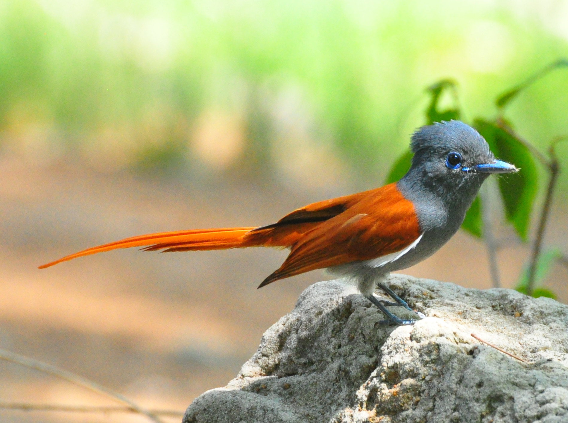
The black paradise flycatcher (''Terpsiphone atrocaudata''), also known as the Japanese paradise flycatcher, is a medium-sized passerine bird native to southeastern Asia. It is a glossy black, chestnut and white bird, slightly smaller than either the Amur paradise flycatcher or Blyth's paradise flycatcher, but similar in appearance. Males have exceptionally long tails. Females are generally duller in appearance and have shorter tails. It is a migratory species, breeding in Japan, South Korea, Taiwan and the far north of the Philippines. Outside the breeding season it migrates to China, Thailand, Laos, Vietnam, other parts of the Philippines, Malaysia, Singapore, and Sumatra, Indonesia. Taxonomy and systematics The black paradise flycatcher was previously classified with the Old World flycatcher family Muscicapidae, but the paradise-flycatchers, monarch flycatchers and Australasian fantails are now normally grouped with the drongos in the family Dicruridae, which has most of ... [...More Info...] [...Related Items...] OR: [Wikipedia] [Google] [Baidu] |
Kyoto
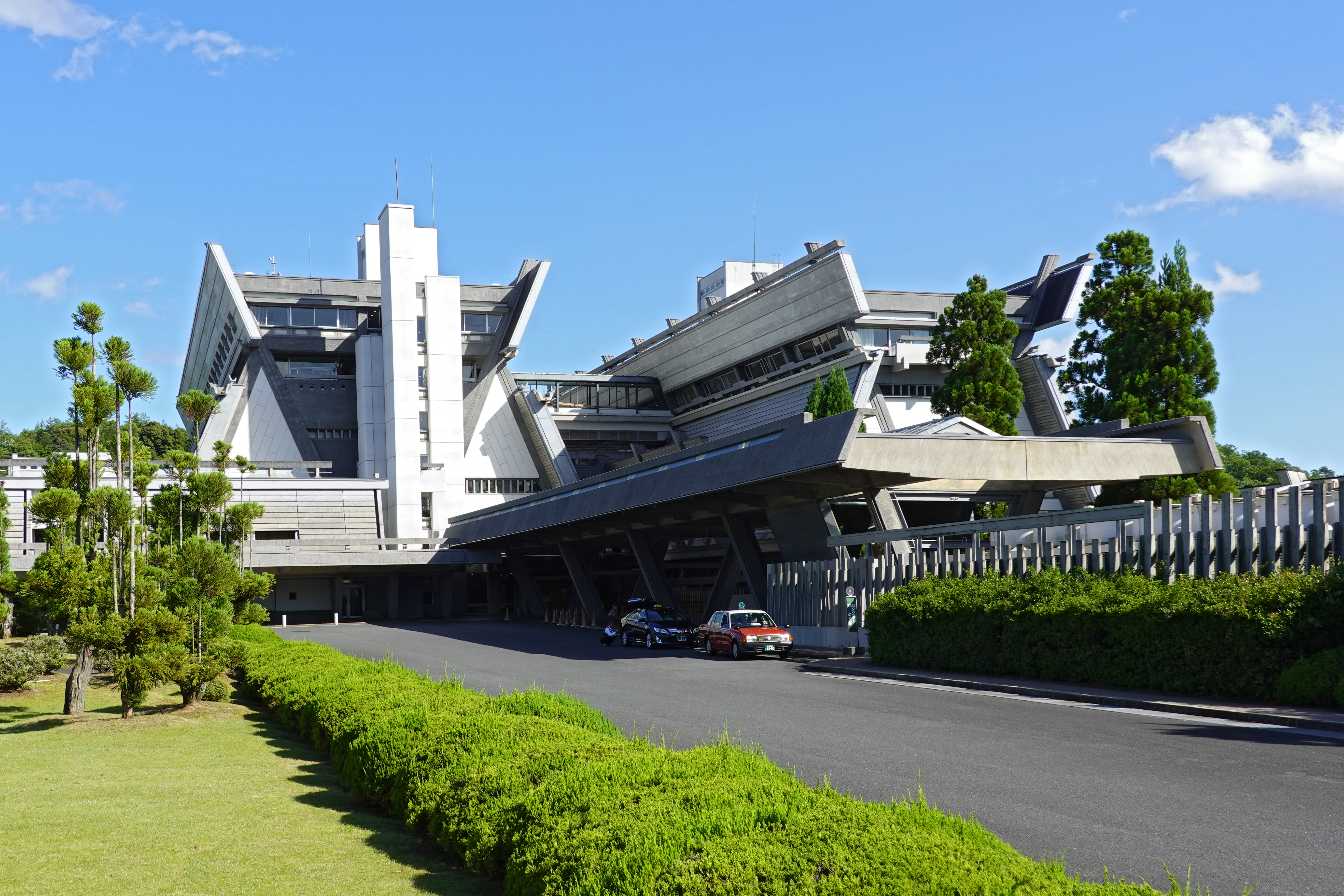
Kyoto ( or ; Japanese language, Japanese: , ''Kyōto'' ), officially , is the capital city of Kyoto Prefecture in the Kansai region of Japan's largest and most populous island of Honshu. , the city had a population of 1.46 million, making it the List of cities in Japan, ninth-most populous city in Japan. More than half (56.8%) of Kyoto Prefecture's population resides in the city. The city is the cultural anchor of the substantially larger Greater Kyoto, a metropolitan statistical area (MSA) home to a census-estimated 3.8 million people. It is also part of the even larger Keihanshin, Keihanshin metropolitan area, along with Osaka and Kobe. Kyoto is one of the oldest municipalities in Japan, having been chosen in 794 as the new seat of Japan's imperial court by Emperor Kanmu. The original city, named Heian-kyō, was arranged in accordance with traditional Chinese feng shui following the model of the ancient Chinese capitals of Chang'an and Luoyang. The emperors of Japan ruled fro ... [...More Info...] [...Related Items...] OR: [Wikipedia] [Google] [Baidu] |
Orchid Island
Orchid Island, known as Pongso no Tao by the indigenous inhabitants, is a volcanic island located off the southeastern coast of Taiwan, the island and the nearby are governed by Taiwan as in Taitung County, which is one of the county's two insular townships (the other being Lyudao Township). It is separated from the Batanes of the Philippines by the Bashi Channel of the Luzon Strait. It is considered a potential World Heritage Site.https://twh.boch.gov.tw/taiwan/index.aspx?lang=en_us Names Orchid Island is known by the Tao people indigenous to the island as Pongso no Tao ("island of human beings"). It was also known by the Tao as Ma'ataw ("floating in the sea") or Irala ("facing the mountain"); the latter being contrasted with the Tao name for the Taiwanese mainland – "Ilaod" ("toward the sea"). In the 17th century, it appeared on Japanese maps as "Tabako", a name borrowed into FrenchA 1654 map. and English as "Tabaco". It is still known by Filipinos as , a name a ... [...More Info...] [...Related Items...] OR: [Wikipedia] [Google] [Baidu] |
Birds Of The Ryukyu Islands
Birds are a group of warm-blooded vertebrates constituting the class Aves (), characterised by feathers, toothless beaked jaws, the laying of hard-shelled eggs, a high metabolic rate, a four-chambered heart, and a strong yet lightweight skeleton. Birds live worldwide and range in size from the bee hummingbird to the common ostrich. There are over 11,000 living species and they are split into 44 orders. More than half are passerine or "perching" birds. Birds have wings whose development varies according to species; the only known groups without wings are the extinct moa and elephant birds. Wings, which are modified forelimbs, gave birds the ability to fly, although further evolution has led to the loss of flight in some birds, including ratites, penguins, and diverse endemic island species. The digestive and respiratory systems of birds are also uniquely adapted for flight. Some bird species of aquatic environments, particularly seabirds and some waterbirds, have fur ... [...More Info...] [...Related Items...] OR: [Wikipedia] [Google] [Baidu] |
Terpsiphone
The paradise flycatchers (''Terpsiphone'') are a genus of birds in the family Monarchidae. The genus ranges across Africa and Asia, as well as a number of islands. A few species are migratory, but the majority are resident. The most telling characteristic of the genus is the long tail streamers of the males of many species. In addition to the long tails the males and females are sexually dimorphic and have rufous, black and white plumage. Taxonomy and systematics The genus ''Terpsiphone'' was introduced by the German zoologist Constantin Gloger in 1827. The type species was subsequently designated as the Indian paradise flycatcher. The name is from the Ancient Greek ''terpsi '' "delighting in" and ''phonos'' "voice". The genus contains 17 species: Former species Formerly, some authorities also considered the following species (or subspecies) as species within the genus ''Terpsiphone'': * Cerulean flycatcher (as ''Zeocephus rowleyi'') * Blue-mantled crested flycatcher (as '' ... [...More Info...] [...Related Items...] OR: [Wikipedia] [Google] [Baidu] |
Forest Loss
Deforestation or forest clearance is the removal and destruction of a forest or stand of trees from land that is then land conversion, converted to non-forest use. Deforestation can involve conversion of forest land to farms, ranches, or urban area, urban use. About 31% of Earth's land surface is covered by forests at present. This is one-third less than the forest cover before the expansion of agriculture, with half of that loss occurring in the last century. Between 15 million to 18 million hectares of forest, an area the size of Bangladesh, are destroyed every year. On average 2,400 trees are cut down each minute. Estimates vary widely as to the extent of deforestation in the tropics. In 2019, nearly a third of the overall tree cover loss, or 3.8 million hectares, occurred within humid tropical primary forests. These are areas of mature rainforest that are especially important for biodiversity and Carbon sequestration, carbon storage. The direct cause of most deforestat ... [...More Info...] [...Related Items...] OR: [Wikipedia] [Google] [Baidu] |
Lava
Lava is molten or partially molten rock (magma) that has been expelled from the interior of a terrestrial planet (such as Earth) or a Natural satellite, moon onto its surface. Lava may be erupted at a volcano or through a Fissure vent, fracture in the Crust (geology), crust, on land or underwater, usually at temperatures from . The volcanic rock resulting from subsequent cooling is often also called ''lava''. A lava flow is an outpouring of lava during an effusive eruption. (An explosive eruption, by contrast, produces a mixture of volcanic ash and other fragments called tephra, not lava flows.) The viscosity of most lava is about that of ketchup, roughly 10,000 to 100,000 times that of water. Even so, lava can flow great distances before cooling causes it to solidify, because lava exposed to air quickly develops a solid crust that insulates the remaining liquid lava, helping to keep it hot and inviscid enough to continue flowing. Etymology The word ''lava'' comes from Ital ... [...More Info...] [...Related Items...] OR: [Wikipedia] [Google] [Baidu] |
Volcanic
A volcano is commonly defined as a vent or fissure in the crust of a planetary-mass object, such as Earth, that allows hot lava, volcanic ash, and gases to escape from a magma chamber below the surface. On Earth, volcanoes are most often found where tectonic plates are diverging or converging, and because most of Earth's plate boundaries are underwater, most volcanoes are found underwater. For example, a mid-ocean ridge, such as the Mid-Atlantic Ridge, has volcanoes caused by divergent tectonic plates whereas the Pacific Ring of Fire has volcanoes caused by convergent tectonic plates. Volcanoes resulting from divergent tectonic activity are usually non-explosive whereas those resulting from convergent tectonic activity cause violent eruptions."Mid-ocean ridge tectonics, volcanism and geomorphology." Geology 26, no. 455 (2001): 458. https://macdonald.faculty.geol.ucsb.edu/papers/Macdonald%20Mid-Ocean%20Ridge%20Tectonics.pdf Volcanoes can also form where there is stretching a ... [...More Info...] [...Related Items...] OR: [Wikipedia] [Google] [Baidu] |
Gotjawal Forest
''Gotjawal'' () is a Jeju language, Jeju-language term for a dense and wild forest. The term is now used to describe the forest biome of Jeju Island, in Jeju Province, South Korea. ''Gotjawal'' are typically found between the island's central mountain Hallasan and the coasts. Etymology ''Gotjawal'' is a Jeju language term. ''Got'' refers to forests, and ''jawal'' refers to a place with shallow, gravely soil (see also ). Distribution There are considered to be four main ''gotjawal'' regions on the island. In order from west to east, they are the Hangyeong–Andeok Gotjawal (), Aewol Gotjawal (), Jocheon–Hamdeok Gotjawal (), and the Gujwa–Seongsan Gotjawal (). Each of these regions are further divided into several parks and individual named ''gotjawal''. These regions are mostly between Hallasan and the western, northern, and eastern coasts of the island, and located at around above sea level. A 2015 news article gave the total area of ''gotjawal'' to be , which accounted ... [...More Info...] [...Related Items...] OR: [Wikipedia] [Google] [Baidu] |
South Korea
South Korea, officially the Republic of Korea (ROK), is a country in East Asia. It constitutes the southern half of the Korea, Korean Peninsula and borders North Korea along the Korean Demilitarized Zone, with the Yellow Sea to the west and the Sea of Japan to the east. Like North Korea, South Korea claims to be the sole legitimate government of the entire peninsula and List of islands of South Korea, adjacent islands. It has Demographics of South Korea, a population of about 52 million, of which half live in the Seoul Metropolitan Area, the List of largest cities, ninth most populous metropolitan area in the world; other major cities include Busan, Daegu, and Incheon. The Korean Peninsula was inhabited as early as the Lower Paleolithic period. Gojoseon, Its first kingdom was noted in Chinese records in the early seventh century BC. From the mid first century BC, various Polity, polities consolidated into the rival Three Kingdoms of Korea, kingdoms of Goguryeo, Baekje, and Sil ... [...More Info...] [...Related Items...] OR: [Wikipedia] [Google] [Baidu] |
Jeju Province
Jeju Province (; ), officially Jeju Special Self-Governing Province (Jeju language, Jeju: ; ), is the southernmost Provinces of South Korea, province of South Korea, consisting of eight inhabited and 55 uninhabited islands, including Marado, Udo (island), Udo, the Chuja Islands, Chuja Archipelago, and the country's largest island, Jeju Island.formerly transliterated as Cheju Island or Cheju Do, the island was also previously known as Quelpart to Europeans and as Saishū during the Korea under Japanese rule, Japanese occupation of Korea. The province is located in the Korea Strait, with the Korea, Korean Peninsula to the northwest, Japan to the east, and China to the west. The province has two cities: the capital Jeju City, on the northern half of the island, and Seogwipo, on the southern half of the island. The island is home to the shield volcano Hallasan, the highest point in South Korea. Jeju language, Jeju and Korean language, Korean are the official languages of the province, ... [...More Info...] [...Related Items...] OR: [Wikipedia] [Google] [Baidu] |


