|
James Thomson (Manitoba Politician)
James Thomson (July 15, 1854 – after 1892) was a Scottish-born miller and political figure in Manitoba. He represented Emerson from 1888 to 1892 in the Legislative Assembly of Manitoba as a Liberal. He was born in St. Ninians, Stirlingshire, the son of Andrew Thomson, and came to Grey County, Canada West with his parents at a young age. Thomson was educated in Arran Township, Bruce County. He went west to Manitoba in 1879, where he was involved in the grain trade The grain trade refers to the local and international trade in cereals and other food grains such as wheat, barley, maize, and rice. Grain is an important trade item because it is easily stored and transported with limited spoilage, unlike othe .... In 1886, Thomson married Janet McKay. He was defeated when he ran for reelection to the Manitoba assembly in 1892. References 1854 births Year of death missing Manitoba Liberal Party MLAs {{Manitoba-politician-stub ... [...More Info...] [...Related Items...] OR: [Wikipedia] [Google] [Baidu] |
Scotland
Scotland (, ) is a country that is part of the United Kingdom. Covering the northern third of the island of Great Britain, mainland Scotland has a border with England to the southeast and is otherwise surrounded by the Atlantic Ocean to the north and west, the North Sea to the northeast and east, and the Irish Sea to the south. It also contains more than 790 islands, principally in the archipelagos of the Hebrides and the Northern Isles. Most of the population, including the capital Edinburgh, is concentrated in the Central Belt—the plain between the Scottish Highlands and the Southern Uplands—in the Scottish Lowlands. Scotland is divided into 32 administrative subdivisions or local authorities, known as council areas. Glasgow City is the largest council area in terms of population, with Highland being the largest in terms of area. Limited self-governing power, covering matters such as education, social services and roads and transportation, is devolved from the ... [...More Info...] [...Related Items...] OR: [Wikipedia] [Google] [Baidu] |
Manitoba
, image_map = Manitoba in Canada 2.svg , map_alt = Map showing Manitoba's location in the centre of Southern Canada , Label_map = yes , coordinates = , capital = Winnipeg , largest_city = Winnipeg , largest_metro = Winnipeg Region , official_lang = English , government_type = Parliamentary constitutional monarchy , Viceroy = Anita Neville , ViceroyType = Lieutenant Governor , Premier = Heather Stefanson , Legislature = Legislative Assembly of Manitoba , area_rank = 8th , area_total_km2 = 649950 , area_land_km2 = 548360 , area_water_km2 = 101593 , PercentWater = 15.6 , population_demonym = Manitoban , population_rank = 5th , population_total = 1342153 , population_as_of = 2021 , population_est = 14 ... [...More Info...] [...Related Items...] OR: [Wikipedia] [Google] [Baidu] |
Emerson (electoral District)
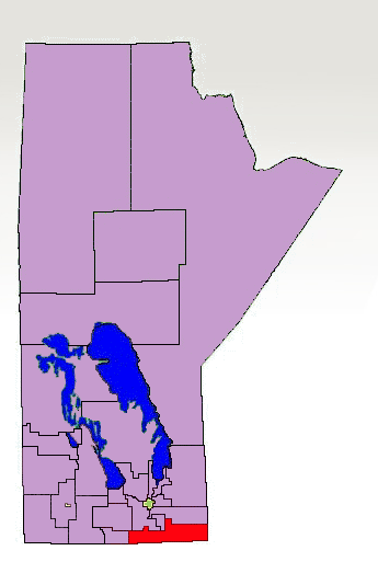
Emerson is a former provincial electoral division in the Canadian province of Manitoba. It was created by redistribution in 1879 and eliminated prior the 2019 general election. Most of its territory was redistributed to the newly created Borderland riding. The eastern part of the former riding was transferred to the La Verendrye riding. It was located in the southeastern corner of the province. It is bordered to the north by Carman, Morris, Steinbach and La Verendrye, to the west by Pembina, to the east by the province of Ontario and to the south by the American state of North Dakota. The riding included the communities/municipalities of Emerson, Altona, Dominion City, Rhineland, Gretna, Woodridge and St. Jean Baptiste. The riding's population in 2008 was 20,370. In 2011, the average family income was $61,951, and the unemployment rate was 2.9%.CBCNews ManitobRiding Profile: Emerson 2011. Agriculture accounted for 24% of the riding's industry, followed by ma ... [...More Info...] [...Related Items...] OR: [Wikipedia] [Google] [Baidu] |
Legislative Assembly Of Manitoba
The Legislative Assembly of Manitoba (french: Assemblée législative du Manitoba) is the deliberative assembly of the Manitoba Legislature in the Provinces and territories of Canada, Canadian province of Manitoba. Fifty-seven members are elected to this assembly at List of Manitoba general elections, provincial general elections, all in single-member constituencies with first-past-the-post voting. Bills passed by the Legislative Assembly are given royal assent by the Monarchy in Manitoba, King of Canada in Right of Manitoba, represented by the Lieutenant Governor of Manitoba. The Manitoba Legislative Building is located in central Winnipeg. The Premier of Manitoba is Heather Stefanson and the current Speaker of the Legislative Assembly of Manitoba is Myrna Driedger; both of whom belong to the Progressive Conservative Party of Manitoba, Progressive Conservative Party. Historically, the Legislature of Manitoba had another chamber, the Legislative Council of Manitoba, but this wa ... [...More Info...] [...Related Items...] OR: [Wikipedia] [Google] [Baidu] |
Manitoba Liberal Party
The Manitoba Liberal Party (french: Parti libéral du Manitoba) is a political party in Manitoba, Canada. Its roots can be traced to the late 19th century, following the province's creation in 1870. Origins and early development (to 1883) Originally, there were no official political parties in Manitoba, although many leading politicians were affiliated with parties that existed at the national level. In Manitoba's first Legislative Assembly, the leader of the opposition was Edward Hay, a Liberal who represented the interests of recent anglophone immigrants from Ontario. Not a party leader as such, he was still a leading voice for the newly transplanted "Ontario Grit" tradition. In 1874, Hay served as Minister of Public Works in the government of Marc-Amable Girard, which included both Conservatives and Liberals. During the 1870s, a Liberal network began to emerge in the city of Winnipeg. One of the key figures in this network was William Luxton, owner of the Manitoba F ... [...More Info...] [...Related Items...] OR: [Wikipedia] [Google] [Baidu] |
Stirlingshire
Stirlingshire or the County of Stirling, gd, Siorrachd Sruighlea) is a historic county and registration countyRegisters of Scotland. Publications, leaflets, Land Register Counties. of Scotland. Its county town is Stirling. It borders Perthshire to the north, Clackmannanshire and West Lothian to the east, Lanarkshire to the south, and Dunbartonshire to the south-east and south-west (this latter boundary is split in two owing to Dunbartonshire's Cumbernauld exclave). Coat of arms The County Council of Stirling was granted a coat of arms by Lord Lyon King of Arms on 29 September 1890. The design of the arms commemorated the Scottish victory at the Battle of Bannockburn in the county. On the silver saltire on blue of St Andrew was placed the rampant red lion from the royal arms of Scotland. Around this were placed two caltraps and two spur-rowels recalling the use of the weapons against the English cavalry. On the abolition of the Local Government council in 1975, the arms ... [...More Info...] [...Related Items...] OR: [Wikipedia] [Google] [Baidu] |
Grey County, Ontario
Grey County is a county of the Canadian province of Ontario. The county seat is in Owen Sound. It is located in the subregion of Southern Ontario named Southwestern Ontario. Grey County is also a part of the Georgian Triangle. At the time of the Canada 2016 Census the population of the county was 93,830. Administrative divisions Grey County consists of the following municipalities (in order of population): History Origin and evolution The first European settlement was in the vicinity of Collingwood or Meaford. Exploring parties arrived from York in 1825 by travelling from Holland Landing and down the Holland River into Lake Simcoe and Shanty Bay. From there they travelled by land to the Nottawasaga River into Georgian Bay and along the thickly wooded shore. In 1837 the village of Sydenham was surveyed by Charles Rankin. In 1856 it was incorporated as the Town of Owen Sound with an estimated population of 2,000. In 1840, the area became part of the new Distric ... [...More Info...] [...Related Items...] OR: [Wikipedia] [Google] [Baidu] |
Canada West
The Province of Canada (or the United Province of Canada or the United Canadas) was a British colony in North America from 1841 to 1867. Its formation reflected recommendations made by John Lambton, 1st Earl of Durham, in the Report on the Affairs of British North America following the Rebellions of 1837–1838. The Act of Union 1840, passed on 23 July 1840 by the British Parliament and proclaimed by the Crown on 10 February 1841, merged the Colonies of Upper Canada and Lower Canada by abolishing their separate parliaments and replacing them with a single one with two houses, a Legislative Council as the upper chamber and the Legislative Assembly as the lower chamber. In the aftermath of the Rebellions of 1837–1838, unification of the two Canadas was driven by two factors. Firstly, Upper Canada was near bankruptcy because it lacked stable tax revenues, and needed the resources of the more populous Lower Canada to fund its internal transportation improvements. Se ... [...More Info...] [...Related Items...] OR: [Wikipedia] [Google] [Baidu] |
Arran–Elderslie
The Municipality of Arran–Elderslie is a township in Bruce County in Western Ontario, Canada. The township is located at the headwaters of the Sauble River, and the Saugeen River forms the northwestern boundary. Communities The township comprises the communities of Allenford, Arkwright, Arranvale, Burgoyne, Chesley, Dobbinton, Dreamland, Dunblane, Ellengowan, Elsinore, Gillies Hill, Invermay, Kelly's Corners, Lockerby, Mount Hope, Paisley, Salem, Salisbury, Tara, Vesta and Williscroft. Demographics In the 2021 Census of Population conducted by Statistics Canada, Arran–Elderslie had a population of living in of its total private dwellings, a change of from its 2016 population of . With a land area of , it had a population density of in 2021. Population trend:Statistics Canada: 1996, 2001, 2006 census * Population in 2016: 6,803 * Population in 2011: 6,810 * Population in 2006: 6,747 * Population in 2001: 6,577 * Population total in 1996: 6,851 ** Arran (towns ... [...More Info...] [...Related Items...] OR: [Wikipedia] [Google] [Baidu] |
Bruce County, Ontario
Bruce County is a county in Southwestern Ontario, Canada comprising eight lower-tier municipalities and with a 2016 population of 66,491. It is named for James Bruce, 8th Earl of Elgin and 12th Earl of Kincardine, sixth Governor General of the Province of Canada. The Bruce name is also linked to the Bruce Trail and the Bruce Peninsula. It has three distinct areas. The Peninsula is part of the Niagara Escarpment and is known for its views, rock formations, cliffs, and hiking trails. The Lakeshore includes nearly 100 km of fresh water and soft sandy beaches. Finally, the Interior Region has a strong history in farming. History Cessions of First Nations lands The territory of the County arose from various surrenders of First Nations lands. The bulk of the land arose from the Queen's Bush, as a result of the 1836 Saugeen Tract Agreement. This was followed by the cession of the Indian Strip in 1851, for a road between Owen Sound and Southampton that was never constructed. F ... [...More Info...] [...Related Items...] OR: [Wikipedia] [Google] [Baidu] |
Grain Trade
The grain trade refers to the local and international trade in cereals and other food grains such as wheat, barley, maize, and rice. Grain is an important trade item because it is easily stored and transported with limited spoilage, unlike other agricultural products. Healthy grain supply and trade is important to many societies, providing a caloric base for most food systems as well as important role in animal feed for animal agriculture. The grain trade is as old as agricultural settlement, identified in many of the early cultures that adopted sedentary farming. Major societal changes have been directly connected to the grain trade, such as the fall of the Roman Empire. From the early modern period onward, grain trade has been an important part of colonial expansion and international power dynamics. The geopolitical dominance of countries like Australia, the United States, Canada and the Soviet Union during the 20th century was connected with their status as grain surpl ... [...More Info...] [...Related Items...] OR: [Wikipedia] [Google] [Baidu] |
1854 Births
Events January–March * January 4 – The McDonald Islands are discovered by Captain William McDonald aboard the ''Samarang''. * January 6 – The fictional detective Sherlock Holmes is perhaps born. * January 9 – The Teutonia Männerchor in Pittsburgh, U.S.A. is founded to promote German culture. * January 20 – The North Carolina General Assembly in the United States charters the Atlantic and North Carolina Railroad, to run from Goldsboro through New Bern, to the newly created seaport of Morehead City, near Beaufort. * January 21 – The iron clipper runs aground off the east coast of Ireland, on her maiden voyage out of Liverpool, bound for Australia, with the loss of at least 300 out of 650 on board. * February 11 – Major streets are lit by coal gas for the first time by the San Francisco Gas Company; 86 such lamps are turned on this evening in San Francisco, California. * February 13 – Mexican troops force William Wa ... [...More Info...] [...Related Items...] OR: [Wikipedia] [Google] [Baidu] |


.jpg)

