|
Jalna (city)
Jalna is a city in Jalna district in the Aurangabad Division, or Marathwada region, of the Indian state of Maharashtra. It was part of Hyderabad State as a tehsil of Aurangabad district, before Jalna district was formed effective 1 May 1981. Jalna become Maharashtra's 29th Municipal Corporation. History Jalna (formerly Jalnapur) is one example. Like Aurangabad's predecessor Khirki, prior to the Mughal conquests Jalna had been ruled by the Nizam Shahs of Ahmadnagar, during whose reign their governor Jamshid Khan built a mosque Kali Masjid, travellers' sara’i, and reservoir in around 1557. The town was taken by the Mughals during the reign of Akbar, and during the reigns of Aurangzeb and Nizam al-Mulk it saw numerous improvements to its civic and military infrastructure, its fort ( Jalna Fort or Mastgad) being constructed in 1725 in response to Maratha incursions. Jalna is home to many religions and people from different backgrounds. One of the main religions being Hinduism ... [...More Info...] [...Related Items...] OR: [Wikipedia] [Google] [Baidu] |
City
A city is a human settlement of a substantial size. The term "city" has different meanings around the world and in some places the settlement can be very small. Even where the term is limited to larger settlements, there is no universally agreed definition of the lower boundary for their size. In a narrower sense, a city can be defined as a permanent and Urban density, densely populated place with administratively defined boundaries whose members work primarily on non-agricultural tasks. Cities generally have extensive systems for housing, transportation, sanitation, Public utilities, utilities, land use, Manufacturing, production of goods, and communication. Their density facilitates interaction between people, government organisations, government organizations, and businesses, sometimes benefiting different parties in the process, such as improving the efficiency of goods and service distribution. Historically, city dwellers have been a small proportion of humanity overall, bu ... [...More Info...] [...Related Items...] OR: [Wikipedia] [Google] [Baidu] |
Marathi Language
Marathi (; , 𑘦𑘨𑘰𑘙𑘲, , ) is a Classical languages of India, classical Indo-Aryan languages, Indo-Aryan language predominantly spoken by Marathi people in the Indian state of Maharashtra and is also spoken in Goa, and parts of Gujarat, Karnataka and the territory of Dadra and Nagar Haveli and Daman and Diu. It is the official language of Maharashtra, and an additional official language in the state of Goa, where it is used for replies, when requests are received in Marathi. It is one of the 22 scheduled languages of India, with 83 million speakers as of 2011. Marathi ranks 13th in the List of languages by number of native speakers, list of languages with most native speakers in the world. Marathi has the List of languages by number of native speakers in India, third largest number of native ... [...More Info...] [...Related Items...] OR: [Wikipedia] [Google] [Baidu] |
Akbar
Akbar (Jalal-ud-din Muhammad Akbar, – ), popularly known as Akbar the Great, was the third Mughal emperor, who reigned from 1556 to 1605. Akbar succeeded his father, Humayun, under a regent, Bairam Khan, who helped the young emperor expand and consolidate Mughal domains in the Indian subcontinent. He is generally considered one of the greatest emperors in Indian history and led a successful campaign to unify the various kingdoms of '' Hindūstān'' or India proper. Quote: "Akbar, The greatest Mughal emperor of India." Akbar gradually enlarged the Mughal Empire to include much of the Indian subcontinent through Mughal military, political, cultural, and economic dominance. To unify the vast Mughal state, Akbar established a centralised system of administration and adopted a policy of conciliating conquered rulers through marriage and diplomacy. To preserve peace and order in a religiously and culturally diverse empire, he adopted policies that won him the support of his no ... [...More Info...] [...Related Items...] OR: [Wikipedia] [Google] [Baidu] |
Ahmadnagar Sultanate
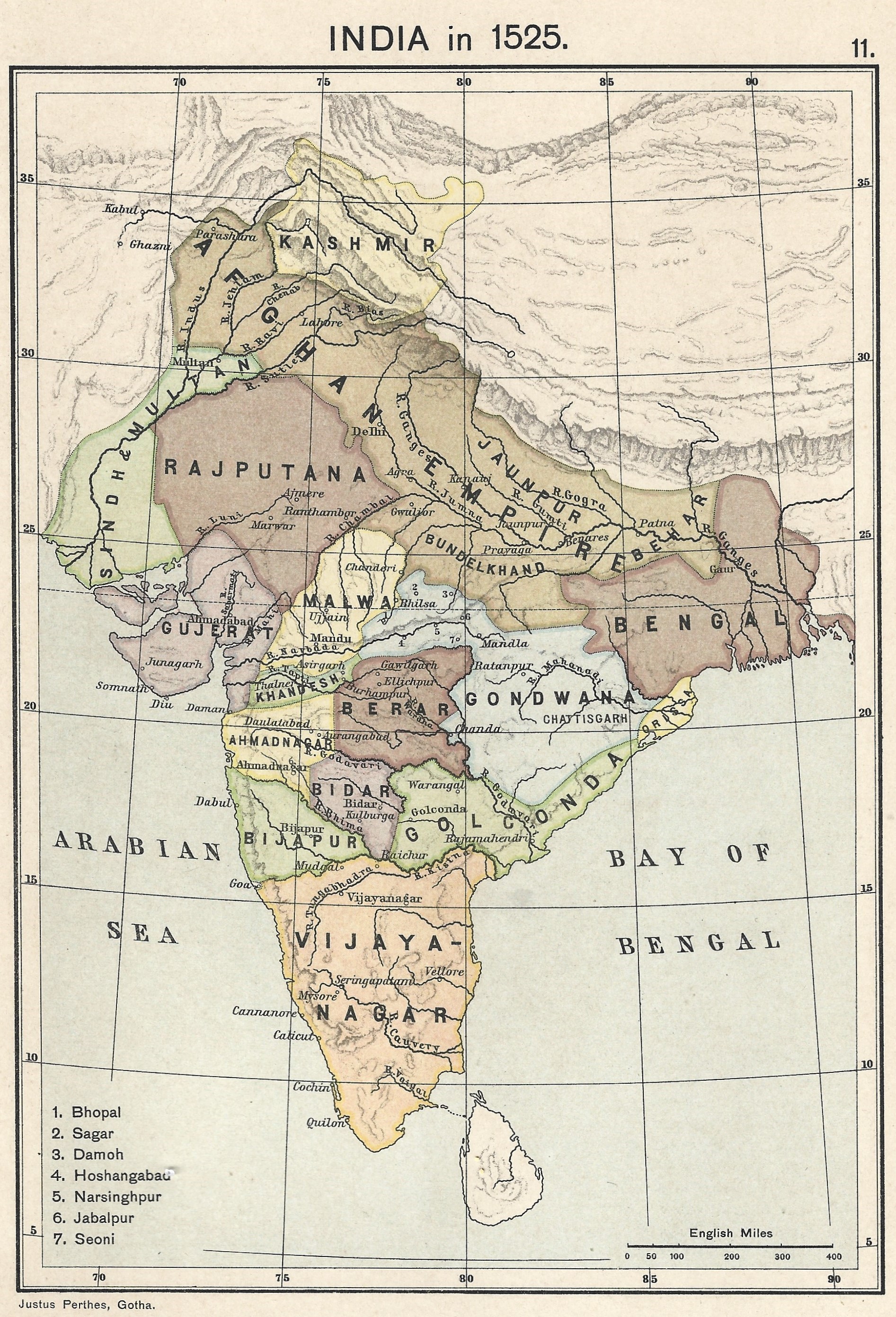
The Ahmadnagar Sultanate was a medieval Marathi Muslim kingdom located in the northwestern Deccan, between the sultanates of Gujarat and Bijapur, ruled by the Nizam Shahi dynasty. It was established when Malik Ahmed, the Bahmani governor of Junnar, after defeating the Bahmani army led by general Jhangir Khan on 28 May 1490, declared independence and established the Ahmadnagar Sultanate. Initially the capital was in the town of Junnar with its fort, later renamed Shivneri. In 1494, the foundation was laid for the new capital Ahmednagar. A land fort called Ahmednagar Qila was the headquarters of the Ahmednagar Sultanate. In 1636 Aurangzeb, then Mughal viceroy of the Deccan, annexed the sultanate to the Mughal Empire. History Establishment Malik Ahmad Nizam Shah I who was the son of Nizam-ul-Mulk Malik Hasan Bahri established the kingdom. His Family were the Kulkarnis of Pathri a town in Marathwada. Either as a result of religious persecution or famine, his ancestors c ... [...More Info...] [...Related Items...] OR: [Wikipedia] [Google] [Baidu] |
Mughal Empire
The Mughal Empire was an Early modern period, early modern empire in South Asia. At its peak, the empire stretched from the outer fringes of the Indus River Basin in the west, northern Afghanistan in the northwest, and Kashmir in the north, to the highlands of present-day Assam and Bangladesh in the east, and the uplands of the Deccan Plateau in South India.. Quote: "The realm so defined and governed was a vast territory of some , ranging from the frontier with Central Asia in northern Afghanistan to the northern uplands of the Deccan plateau, and from the Indus basin on the west to the Assamese highlands in the east." The Mughal Empire is conventionally said to have been founded in 1526 by Babur, a Tribal chief, chieftain from what is today Uzbekistan, who employed aid from the neighboring Safavid Iran, Safavid and Ottoman Empires Quote: "Babur then adroitly gave the Ottomans his promise not to attack them in return for their military aid, which he received in the form of the ... [...More Info...] [...Related Items...] OR: [Wikipedia] [Google] [Baidu] |
Aurangabad
Aurangabad (), officially renamed as Chhatrapati Sambhajinagar in 2023, is a city in the Indian state of Maharashtra. It is the administrative headquarters of Aurangabad district and is the largest city in the Marathwada region. Located on a hilly upland terrain in the Deccan Traps, Aurangabad is the fifth-most populous urban area in Maharashtra, after Mumbai, Pune, Nagpur and Nashik, with a population of 1,175,116. The city is a major production center of cotton textile and artistic silk fabrics. Several prominent educational institutions, including Dr. Babasaheb Ambedkar Marathwada University, are located in the city. The city is also a popular tourism hub, with attractions like the Ajanta and Ellora caves lying on its outskirts, both of which have been designated as UNESCO World Heritage Sites since 1983, the Aurangabad Caves, Devagiri Fort, Grishneshwar Temple, Jama Mosque, Bibi Ka Maqbara, Himayat Bagh, Panchakki and Salim Ali Lake. Historically, there were 52 ... [...More Info...] [...Related Items...] OR: [Wikipedia] [Google] [Baidu] |
Aurangabad District, Maharashtra
Aurangabad district (Marathi pronunciation: Help:IPA/Marathi, [əu̯ɾəŋɡaːbaːd̪]), officially known as Chhatrapati Sambhajinagar district, is one of the 36 Districts of Maharashtra, districts of the state of Maharashtra in western India. It borders the districts of Nashik District, Nashik to the west, Jalgaon District, Jalgaon to the north, Jalna District, Jalna to the east, and Ahmednagar District, Ahmednagar to the south. Aurangabad, The city of Aurangabad houses the district's administrative headquarters. The district has an area of 10,100 km, of which 37.55% is urban and the rest is rural. Aurangabad District is a Tourism in Marathwada, major tourism region in Marathwada, with attractions including the Ajanta Caves and Ellora Caves. Geography Aurangabad District is located mainly in the Godavari River Basin and partly in the Tapti River Basin. The district is located between 19th parallel north, 19 and 20th parallel north, 20 degrees north longitude and between 7 ... [...More Info...] [...Related Items...] OR: [Wikipedia] [Google] [Baidu] |
Tehsil
A tehsil (, also known as tahsil, taluk, or taluka () is a local unit of administrative division in India and Pakistan. It is a subdistrict of the area within a Zila (country subdivision), district including the designated populated place that serves as its administrative centre, with possible additional towns, and usually a number of village#South Asia, villages. The terms in India have replaced earlier terms, such as ''pargana'' (''pergunnah'') and ''thana''. In List of mandals in Andhra Pradesh, Andhra Pradesh and List of mandals in Telangana, Telangana, a newer unit called mandal (circle) has come to replace the tehsil system. A mandal is generally smaller than a tehsil, and is meant for facilitating local self-government in the panchayati raj in India, panchayat system. In West Bengal, Bihar, Jharkhand, community development blocks (CDBs) are the empowered grassroots administrative unit, replacing tehsils. Tehsil office is primarily tasked with land revenue administration, be ... [...More Info...] [...Related Items...] OR: [Wikipedia] [Google] [Baidu] |
Hyderabad State
Hyderabad State () was a princely state in the Deccan region of south-central India with its capital at the city of Hyderabad. It is now divided into the present-day state of Telangana, the Kalyana-Karnataka region of Karnataka, and the Marathwada region of Maharashtra in India. The state was ruled from 1724 to 1948 by the Nizam, who was initially a viceroy of the Mughal empire in the Deccan. Hyderabad gradually became the first princely state to come under British paramountcy signing a subsidiary alliance agreement. During the British rule in 1901, the state had a revenue of 4,17,00,000. The native inhabitants of Hyderabad State, regardless of ethnic origin, are called "Mulki" (countryman), a term still used today. The dynasty declared itself an independent monarchy during the final years of the British Raj. After the Partition of India, Hyderabad signed a standstill agreement with the new dominion of India, continuing all previous arrangements except for the stat ... [...More Info...] [...Related Items...] OR: [Wikipedia] [Google] [Baidu] |
Indian State
India is a federal union comprising 28 states and 8 union territories, for a total of 36 subnational entities. The states and union territories are further subdivided into 800 districts and smaller administrative divisions by the respective subnational government. The states of India are self-governing administrative divisions, each having a state government. The governing powers of the states are shared between the state government and the union government. On the other hand, the union territories are directly governed by the union government. History 1876–1919 The British Raj was a very complex political entity consisting of various imperial divisions and states and territories of varying autonomy. At the time of its establishment in 1876, it was made up of 584 constituent states and the directly ruled territories of the Crown. The entire empire was divided into provinces and agencies. A province consisted of territory under the direct rule of the Empe ... [...More Info...] [...Related Items...] OR: [Wikipedia] [Google] [Baidu] |
Marathwada
Marathwada () is a geographical region of the States and territories of India, Indian state of Maharashtra. It was formed during the Nizam of Hyderabad, Nizam's rule and was part of the then Hyderabad State. The region coincides with the Aurangabad division of Maharashtra. It borders the states of Karnataka and Telangana, and it lies to the west of the Vidarbha and east of North Maharashtra, Uttar Maharashtra regions of Maharashtra. The largest city of Marathwada is Aurangabad. Its people speak Marathi language, Marathi and Deccani language, Deccani Urdu (Hyderabadi Urdu). Marathwada is known for its struggle for merger in the Maharashtra state, which is commemorated on 17 September as Marathwada Liberation Day. Etymology The term ''Marathwada'' means ''the house of Marathi speaking people'', that is land occupied by the Marathi-speaking population of the former Hyderabad state during the period of Nizam's rule. The term can be traced to 18th century state records of the Nizam ... [...More Info...] [...Related Items...] OR: [Wikipedia] [Google] [Baidu] |


