|
Interstate Highways In Arkansas
The list of Interstate Highways in Arkansas encompasses nine members of the Dwight D. Eisenhower National System of Interstate and Defense Highways in the state of Arkansas. Cable median barriers The 2010–2013 Statewide Transportation Improvement Program from the Arkansas State Highway and Transportation Department (AHTD) lists cable median barrier installation projects along segments of Interstate 30 (I-30), I-40, I-55, I-430, Interstate 540, and US 67 to begin as funds become available. The high-tension designs will first be installed in areas with narrow medians (less than wide) that carry an average daily traffic of 15,000 or greater near sites of recent serious crossover collisions. Primary Interstates Auxiliary Interstates See also * * References {{Reflist Interstate The Dwight D. Eisenhower National System of Interstate and Defense Highways, commonly known as the Interstate Highway System, or the Eisenhower Inte ... [...More Info...] [...Related Items...] OR: [Wikipedia] [Google] [Baidu] |
I-40 (AR)
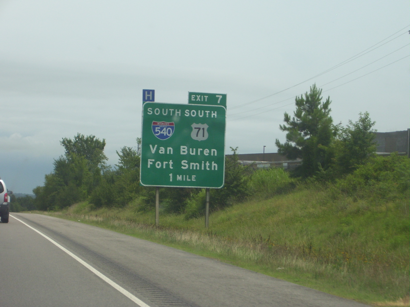
Interstate 40 (I-40) is an east–west Interstate Highway that has a section in the U.S. state of Arkansas, connecting Oklahoma to Tennessee. The route enters Arkansas from the west just north of the Arkansas River near Dora, Arkansas, Dora. It travels eastward across the northern portion of the state, connecting the cities of Fort Smith, Arkansas, Fort Smith, Clarksville, Arkansas, Clarksville, Russellville, Arkansas, Russellville, Morrilton, Arkansas, Morrilton, Conway, Arkansas, Conway, North Little Rock, Arkansas, North Little Rock, Forrest City, Arkansas, Forrest City, and West Memphis, Arkansas, West Memphis. I-40 continues into Tennessee, heading through Memphis, Tennessee, Memphis. The highway has major junctions with Interstate 540 (Arkansas), I-540 at Van Buren, Arkansas, Van Buren (the main highway connecting to Fort Smith, Arkansas, Fort Smith), Interstate 49 in Arkansas, I-49 at Alma, Arkansas, Alma (the main highway connecting to Fayetteville, Arkansas, Fayettev ... [...More Info...] [...Related Items...] OR: [Wikipedia] [Google] [Baidu] |
Arkansas Highway 107
Arkansas Highway 107 (AR 107) is a designation for two List of state highways in Arkansas, state highways in Arkansas."Cleburne County, Arkansas." Arkansas State Highway and Transportation DepartmentAHTD Cleburne County mapRetrieved on August 28, 2010."Faulkner County, Arkansas." Arkansas State Highway and Transportation DepartmentAHTD Faulkner County map Retrieved on August 28, 2010."Pulaski County, Arkansas." Arkansas State Highway and Transportation DepartmentAHTD Pulaski County map Retrieved on August 28, 2010. Section 1 Arkansas Highway 107 is a state highway of that runs in Faulkner County, Arkansas, Faulkner and Cleburne County, Arkansas, Cleburne counties. Route description Highway 107 begins at Arkansas Highway 36, Highway 36 near Holland, Arkansas, Holland. The route runs north to meet Arkansas Highway 25, Highway 25 and Arkansas Highway 225, Highway 225 before entering Quitman, Arkansas, Quitman and Cleburne County, Arkansas, Cleburne County. In Quitman, Highway 25 ... [...More Info...] [...Related Items...] OR: [Wikipedia] [Google] [Baidu] |
Hernando De Soto Bridge
The Hernando de Soto Bridge is a tied-arch bridge carrying Interstate 40 across the Mississippi River between West Memphis, Arkansas, and Memphis, Tennessee. The design is a continuous cantilevered cable-stayed steel through arch, with bedstead endposts. Memphians also call the bridge the "New Bridge", as it is newer than the Memphis & Arkansas Bridge (carrying Interstate 55) downstream, and the "M Bridge", due to its distinctive shape. It is of similar construction to the Sherman Minton Bridge between Louisville, Kentucky, and New Albany, Indiana (except that it consists of a single level deck). History Planning and construction Preliminary planning for the river crossing began in 1960 as part of Interstate 40 alignment studies for the Memphis - Little Rock corridor, which was constructed in segments between 1963 and 1968. Before the Hernando de Soto Bridge was completed, traffic going across the river was carried across the Mississippi River by the Interstate 55/US Highw ... [...More Info...] [...Related Items...] OR: [Wikipedia] [Google] [Baidu] |
Conway, Arkansas
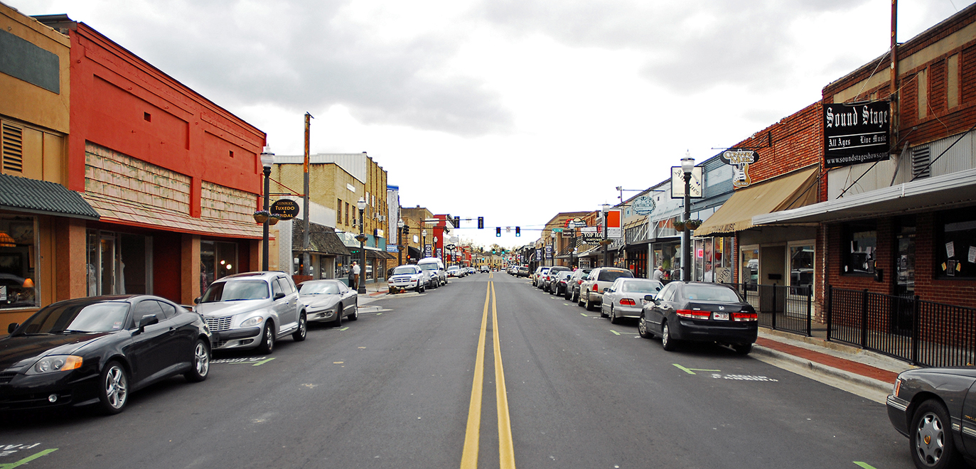
Conway is a city in the U.S. state of Arkansas and the county seat of Faulkner County, Arkansas, Faulkner County, located in the state's most populous Metropolitan Statistical Area, Central Arkansas. The city also serves as a regional shopping, educational, work, healthcare, sports, and cultural hub for Faulkner County and surrounding areas. Conway's growth can be attributed to its jobs in technology and higher education. Conway is home to three post-secondary educational institutions, earning it the nickname "The City of Colleges". As of the 2020 United States census, 2020 Census, the city proper had a total population of 64,134, making Conway the List of municipalities in Arkansas, eighth-most populous city in Arkansas. Central Arkansas, the Central Arkansas, Little Rock–North Little Rock–Conway, AR Metropolitan Statistical Area, is ranked the 76th most populous in the United States with 734,622 people in 2016. Conway is part of the larger Central Arkansas, Little Rock–N ... [...More Info...] [...Related Items...] OR: [Wikipedia] [Google] [Baidu] |
Russellville, Arkansas
Russellville is the county seat of and the largest city in Pope County, Arkansas, United States, with a 2022 estimated population of 29,133. It is home to Arkansas Tech University. Arkansas Nuclear One, Arkansas' only nuclear power plant is nearby. Russellville borders Lake Dardanelle and the Arkansas River. It is the principal city of the Russellville Micropolitan Statistical Area, which includes all of Pope and Yell counties. Under Arkansas Code Title 14, Russellville is a city of the first class. History Settlement Before the town was named Russellville, its vicinity was known as Chactas Prairie, The Prairie, or Cactus Flats. Located on the southern edge of the Ozark Mountains and north of the Arkansas River, this setting was an ideal settlement area. Throughout the 18th century into the early 19th century, seasonal movements of the seminomadic Osage Indians from western Missouri brought them annually into Arkansas, including the valley where Russellville is now locate ... [...More Info...] [...Related Items...] OR: [Wikipedia] [Google] [Baidu] |
Van Buren, Arkansas
Van Buren ( ) is the second-largest city in the Fort Smith metropolitan area, Fort Smith, Arkansas–Oklahoma Metropolitan Statistical Area and the county seat of Crawford County, Arkansas, Crawford County, Arkansas, United States. The city is located directly northeast of Fort Smith, Arkansas, Fort Smith at the Interstate 40 in Arkansas, Interstate 40 – Interstate 540 (Arkansas), Interstate 540 junction. The city was incorporated in 1845 and as of the 2020 United States census, 2020 census had a population of 23,218, ranking it as the state's 21st largest city. According to 2023 population estimates from the U.S. Census Bureau, Van Buren’s population is 24,138. With a 4% growth rate from 2020 to 2023, Van Buren is Arkansas’s eighth-fastest growing city. History Early history The area was settled by David Boyd and Thomas Martin in 1818. After Arkansas became a territory in 1819, Daniel and Thomas Phillips constructed a lumber yard in the community to serve as a ... [...More Info...] [...Related Items...] OR: [Wikipedia] [Google] [Baidu] |
Tennessee
Tennessee (, ), officially the State of Tennessee, is a landlocked U.S. state, state in the Southeastern United States, Southeastern region of the United States. It borders Kentucky to the north, Virginia to the northeast, North Carolina to the east, Georgia (U.S. state), Georgia, Alabama, and Mississippi to the south, Arkansas to the southwest, and Missouri to the northwest. Tennessee is the List of U.S. states and territories by area, 36th-largest by area and the List of U.S. states and territories by population, 15th-most populous of the 50 states. According to the United States Census Bureau, the state's estimated population as of 2024 is 7.22 million. Tennessee is geographically, culturally, and legally divided into three Grand Divisions of Tennessee, Grand Divisions of East Tennessee, East, Middle Tennessee, Middle, and West Tennessee. Nashville, Tennessee, Nashville is the state's capital and largest city, and anchors its largest metropolitan area. Tennessee has dive ... [...More Info...] [...Related Items...] OR: [Wikipedia] [Google] [Baidu] |
Interstate 40 In Tennessee
Interstate 40 (I-40) is part of the Interstate Highway System that runs from Barstow, California, to Wilmington, North Carolina. The highway crosses Tennessee from west to east, from the Mississippi River at the Arkansas border to the Blue Ridge Mountains at the North Carolina border. At , the Tennessee segment of I-40 is the longest of the eight states through which it passes and the state's longest Interstate Highway. I-40 passes through Tennessee's three largest cities— Memphis, Nashville, and Knoxville—and serves the Great Smoky Mountains National Park, the most-visited national park in the United States. It crosses all of Tennessee's physiographic regions and Grand Divisions—the Mississippi embayment and Gulf Coastal Plain in West Tennessee, the Highland Rim and Nashville Basin in Middle Tennessee, and the Cumberland Plateau, Cumberland Mountains, Ridge-and-Valley Appalachians, and Blue Ridge Mountains in East Tennessee. Landscapes on the route vary from fl ... [...More Info...] [...Related Items...] OR: [Wikipedia] [Google] [Baidu] |
Oklahoma
Oklahoma ( ; Choctaw language, Choctaw: , ) is a landlocked U.S. state, state in the South Central United States, South Central region of the United States. It borders Texas to the south and west, Kansas to the north, Missouri to the northeast, Arkansas to the east, New Mexico to the west, and Colorado to the northwest. Partially in the western extreme of the Upland South, it is the List of U.S. states and territories by area, 20th-most extensive and the List of U.S. states and territories by population, 28th-most populous of the 50 United States. Its residents are known as Oklahomans and its capital and largest city is Oklahoma City. The state's name is derived from the Choctaw language, Choctaw words , 'people' and , which translates as 'red'. Oklahoma is also known informally by its List of U.S. state and territory nicknames, nickname, "The Sooner State", in reference to the Sooners, American pioneer, American settlers who staked their claims in formerly American Indian-o ... [...More Info...] [...Related Items...] OR: [Wikipedia] [Google] [Baidu] |
Interstate 40 In Oklahoma
Interstate 40 (I-40) is an Interstate Highway in Oklahoma that runs across the state from Texas to Arkansas. West of Oklahoma City, it parallels and replaces old U.S. Highway 66 (US-66), and, east of Oklahoma City, it parallels US-62, US-266, and US-64. I-40 is the longest Interstate highway in Oklahoma. Cities along the route include Erick, Sayre, Elk City, Clinton, Weatherford, Oklahoma City and its suburbs ( El Reno, Yukon, Del City, and Midwest City), Shawnee, Okemah, Henryetta, Checotah, and Sallisaw. Route description I-40 enters Oklahoma near Texola in Beckham County. It crosses the North Fork of the Red River near Sayre and runs through southern Elk City. It then cuts across northwest Washita County before entering Custer County. There, it passes through Clinton and Weatherford. After leaving Weatherford, I-40 then runs across northern Caddo County. After that, it enters the Oklahoma City metropolitan area at Canadian County. I-40 ... [...More Info...] [...Related Items...] OR: [Wikipedia] [Google] [Baidu] |
Little Rock, Arkansas
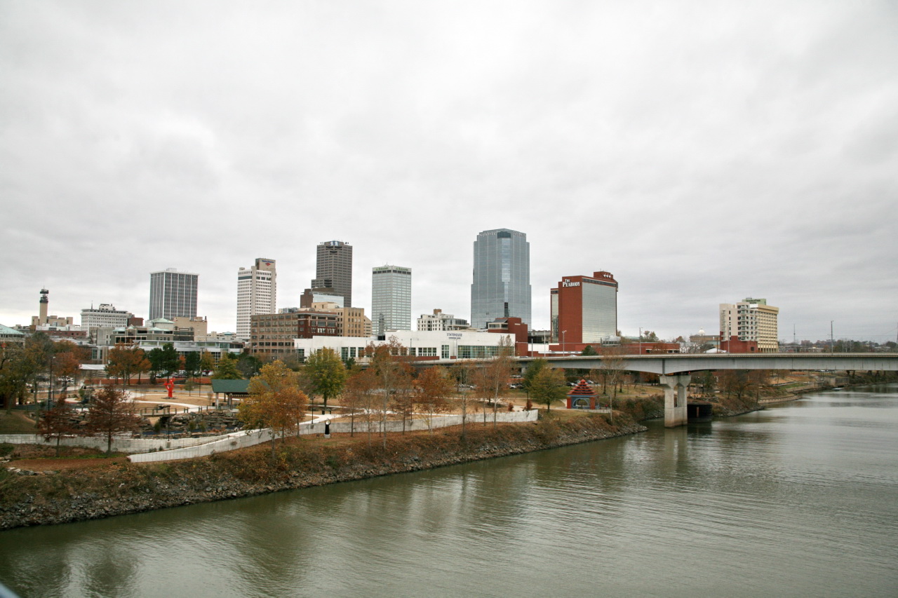
Little Rock is the List of capitals in the United States, capital and List of municipalities in Arkansas, most populous city of the U.S. state of Arkansas. The city's population was 202,591 as of the 2020 census. The six-county Central Arkansas, Little Rock metropolitan area is the Metropolitan statistical area, 81st-most populous in the United States with 748,031 residents according to the 2020 census. As the county seat of Pulaski County, Arkansas, Pulaski County, the city was incorporated on November 7, 1831, on the south bank of the Arkansas River close to the state's geographic center in Central Arkansas. The city derived its name from a rock formation along the river, named The Little Rock, the "Little Rock" by the French explorer Jean-Baptiste Bénard de la Harpe in 1722. The capital of the Arkansas Territory was moved to Little Rock from Arkansas Post, Arkansas, Arkansas Post in 1821. Little Rock is a cultural, economic, government, and transportation center within A ... [...More Info...] [...Related Items...] OR: [Wikipedia] [Google] [Baidu] |
Benton, Arkansas
Benton is a city in and the county seat of Saline County, Arkansas, United States. A suburb of Little Rock, it was established in 1837. At the 2020 census, the city had a population of 35,014, making it the 12th most populous city in Arkansas. It is part of the Little Rock-North Little Rock-Conway metropolitan area. The city of Benton, first settled in 1833 and named after Missouri Senator Thomas Hart Benton, was formally chartered in 1836 when Arkansas became a state. Geography According to the United States Census Bureau, the city has a total area of , of which is land and (2.71%) is water. Climate The climate in this area is characterized by hot, humid summers and generally mild to cool winters. According to the Köppen Climate Classification system, Benton has a humid subtropical climate, abbreviated "Cfa" on climate maps. Demographics 2020 census As of the 2020 United States census, there were 35,014 people, 13,082 households, and 8,913 families residing in ... [...More Info...] [...Related Items...] OR: [Wikipedia] [Google] [Baidu] |


