|
Inkersall Green
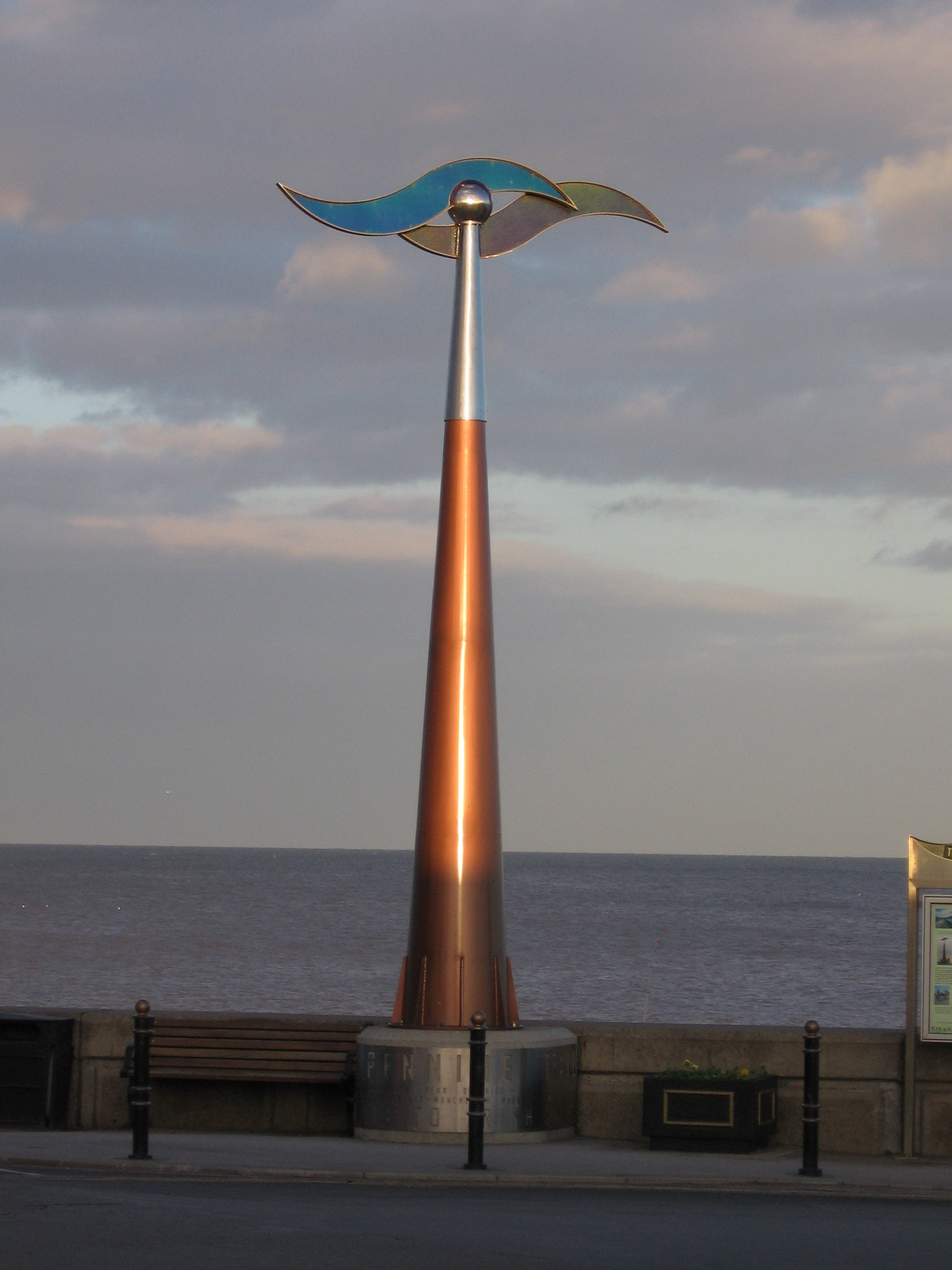
Inkersall and Inkersall Green (informally referred to by local residents as Inky) are areas of settlement in Derbyshire, England. They are located south of the A619 road, east of Chesterfield and close to Junction 29a of the M1 Motorway. Inkersall is a town just outside Staveley, which has seen fast development over the last few years. Recent developments include the creation of a small children's park along with the building of an additional convenience shop. Inkersall has two public houses, the Hop Flower and the Double Top. The village is served by a regular bus service, allowing residents to travel to Staveley, Chesterfield and elsewhere. The Trans Pennine Trail The Trans Pennine Trail is a long-distance path running from coast to coast across Northern England on a mixture of surfaced paths, with some short on-road sections, and with gentle gradients (it runs largely along disused railway lines and c ... passes alongside the village. Education Located on the m ... [...More Info...] [...Related Items...] OR: [Wikipedia] [Google] [Baidu] |
Chesterfield, Derbyshire
Chesterfield is a market town, market and industrial town in the county of Derbyshire, England. It is north of Derby and south of Sheffield at the confluence of the River Rother, South Yorkshire, Rivers Rother and River Hipper, Hipper. In 2011, the built-up-area subdivision had a population of 88,483, making it the second-largest settlement in Derbyshire, after Derby. The wider Borough of Chesterfield had a population of 103,569 in the 2021 Census. In 2021, the town itself had a population of 76,402. It has been traced to a transitory Ancient Roman architecture, Roman fort dated to approximately AD 80-100. The name of the later Anglo-Saxons, Anglo-Saxon village comes from the Old English ''ceaster'' (Roman fort) and ''feld'' (pasture). It has a sizeable street market three days a week. The town sits on an old coalfield, but little visual evidence of mining remains since the closure of the final town centre mine nicknamed “The Green Room”. The main landmark is the crooked sp ... [...More Info...] [...Related Items...] OR: [Wikipedia] [Google] [Baidu] |
Derbyshire
Derbyshire ( ) is a ceremonial county in the East Midlands of England. It borders Greater Manchester, West Yorkshire, and South Yorkshire to the north, Nottinghamshire to the east, Leicestershire to the south-east, Staffordshire to the south and west, and Cheshire to the west. Derby is the largest settlement, and Matlock is the county town. The county has an area of and a population of 1,053,316. The east of the county is more densely populated than the west, and contains the county's largest settlements: Derby (261,400), Chesterfield (88,483), and Swadlincote (45,000). For local government purposes Derbyshire comprises a non-metropolitan county, with eight districts, and the Derby unitary authority area. The East Midlands Combined County Authority includes Derbyshire County Council and Derby City Council. The north and centre of Derbyshire are hilly and contain the southern end of the Pennines, most of which are part of the Peak District National Park. They include Kinde ... [...More Info...] [...Related Items...] OR: [Wikipedia] [Google] [Baidu] |
A619 Road
The A619 is an A road that links Bakewell, Derbyshire to Worksop, Nottinghamshire in England. Route The route begins in Bakewell at Rutland Square, where it crosses the Bakewell Bridge over the River Wye, heading north towards Baslow. The road then heads east through Wadshelf before reaching Chesterfield, Derbyshire, Chesterfield. The road passes through the centre of the city, and briefly merges with the A61 road, A61 before heading west as Rother Way and Chesterfield Road as it passes through Brimington, Hollingwood and Staveley, Derbyshire, Staveley. The road becomes Worksop Road, where it passes over the M1 motorway, M1 into Barlborough. The road continues east through Whitwell Common where it terminates in Worksop. References Roads in Derbyshire {{England-road-stub Roads in Nottinghamshire Streets in Chesterfield Transport in Derbyshire Transport in Nottinghamshire Bakewell ... [...More Info...] [...Related Items...] OR: [Wikipedia] [Google] [Baidu] |
M1 Motorway
The M1 motorway connects London to Leeds, where it joins the A1(M) motorway, A1(M) near Aberford, to connect to Newcastle upon Tyne, Newcastle. It was the first inter-urban motorway to be completed in the UK; the first motorway in the country was the Preston Bypass, which later became part of the M6 motorway, M6. The motorway is long and was constructed in four phases. Most of the motorway was opened between 1959 and 1968. The southern end was extended in 1977 and the northern end was extended in 1999. It is also the second longest motorway in the country with the M6 motorway being the longest at 232 miles (373 km). History There had been plans before the Second World War for a motorway network in the United Kingdom. John Douglas-Scott-Montagu, 2nd Baron Montagu of Beaulieu, Lord Montagu of Beaulieu formed a company to build a 'motorway-like road' from London to Birmingham in 1923, but it was a further 26 years before the Special Roads Act 1949 was passed, which allowed ... [...More Info...] [...Related Items...] OR: [Wikipedia] [Google] [Baidu] |
Staveley, Derbyshire
Staveley is a town and civil parish in the Borough of Chesterfield, Derbyshire, England, along the banks of the River Rother, South Yorkshire, River Rother (5 miles) northeast of Chesterfield, Derbyshire, Chesterfield, (5 miles) west of Clowne, Derbyshire, Clowne, (5 miles) northwest of Bolsover, (11 miles) southwest of Worksop and (13 miles) southeast of Sheffield. History Staveley was formerly a mining town with several large Coal mining, coal mines in and around the area, the closest being Ireland Pit (Ireland Colliery Brass Band is named after the colliery). However, the pit has closed, along with the others in the area. Staveley Miners Welfare on Market Street was built in 1893 as an indoor market hall by Charles Paxton Markham, for a time owner of Markham & Co. At that time, it was called Markham Hall in memory of his father. Markham played a large role in the industrial development of the area around Staveley. Through his company Markham & Co. and its successor Stavele ... [...More Info...] [...Related Items...] OR: [Wikipedia] [Google] [Baidu] |
Trans Pennine Trail
The Trans Pennine Trail is a long-distance path running from coast to coast across Northern England on a mixture of surfaced paths, with some short on-road sections, and with gentle gradients (it runs largely along disused railway lines and canal towpaths). It forms part of European walking route E8 and is part of the National Cycle Network as Route 62 (referencing the M62 motorway which also crosses the Pennines). Most of the surfaces and gradients make it a relatively easy trail, suitable for cyclists, pushchairs and wheelchair users. The section between Stockport and Barnsley is hilly, especially near Woodhead, and not all sections or barriers are accessible for users of wheelchairs or non-standard cycles. Some parts are also open to horse riding. The trail is administered from a central office in Barnsley, which is responsible for promotion and allocation of funding. However, the 27 local authorities whose areas the trail runs through are responsible for management of ... [...More Info...] [...Related Items...] OR: [Wikipedia] [Google] [Baidu] |
Netherthorpe School
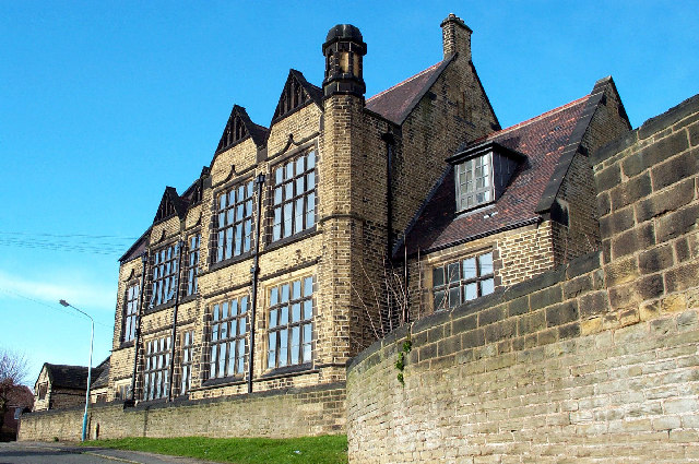
Netherthorpe School is a non-selective secondary school with academy status based in Staveley in the Chesterfield district of Derbyshire, England. History The school was founded in 1572 A quote from an 1857 directory: Netherthorpe School.— Francis Rodes, by will, 29th of Elizabeth, left a yearly rent charge of £20 per annum, to be taken forth of his manor of Elmton; £8 thereof to the Grammar school, at Staveley Netherthorpe, £8 for two scholarships in St. John's, Cambridge, and £4 for the relief of soldiers who should be sent to the wars out of Staveley, Barlborough, and Elmton. Robert Sitwell, by will, 41st Elizabeth, gave a messuage in Killamarsh, on trust, to pay £6 yearly to the schoolmaster. Lord James Cavendish, 1742, left a rent charge of £6, issuing out of closes at Hollingwood, for the maintenance of the schoolmaster. In addition to these, the Rev. Francis Gisborne gave £10, to be invested in stock. The income of the various benefactions amounts to £29 ... [...More Info...] [...Related Items...] OR: [Wikipedia] [Google] [Baidu] |
Springwell Community College
Springwell Community College (formerly Springwell Community School) is a coeducational secondary school located in Staveley, Derbyshire, England. It is a comprehensive school taking pupils from Staveley, Inkersall, Brimington, Hollingwood, Barrow Hill, and other primary schools in the Staveley-Brimington area. History Springwell Community School was formed in 1991 by the amalgamation of two secondary schools, Westwood (which was located in nearby Brimington and Hollingwood) and Middlecroft following a reorganisation of education in Chesterfield. The school was formerly housed in the old Middlecroft School 1960's building. It achieved Specialist Status as an Arts College in September 2005. In November 2010 the school relocated to new buildings as part of the Building Schools for the Future programme. The school was renamed Springwell Community College at this time. In 2014 the school joined a consortium with The Bolsover School, Heritage High School and Shirebrook Academ ... [...More Info...] [...Related Items...] OR: [Wikipedia] [Google] [Baidu] |
Rufford Abbey
Rufford Abbey is a country estate in Rufford, Nottinghamshire, England, two miles (4 km) south of Ollerton. Originally a Cistercian abbey, it was converted to a country house in the 16th century after Henry VIII’s dissolution of the monasteries. Part of the house was demolished in the 20th century, but the remains, standing in 150 acres of park and woodland, are open to the public as Rufford Country Park. Part of the park is a local nature reserve. The remains of the house is owned by English Heritage and the country park is owned by Nottinghamshire County Council and managed by Parkwood Leisure. The house itself is constructed of rubble, brick, dressed stone and ashlar with ashlar dressings and plain tile roofs. Amenities The park is open to visitors and has several cafes, gift and garden shops. And has a range of activities. Lime Walk, Rufford Country Park The Monastic Foundation The abbey itself was founded by Gilbert de Gant, on 12 July 1147, and popu ... [...More Info...] [...Related Items...] OR: [Wikipedia] [Google] [Baidu] |
Adrian IV
Pope Adrian (or Hadrian) IV (; born Nicholas Breakspear (or Brekespear); 1 September 1159) was head of the Catholic Church and ruler of the Papal States from 4 December 1154 until his death in 1159. Born in England, Adrian IV was the first Pope to have been born and raised in an English-speaking country. Adrian was born in Hertfordshire, England, but little is known of his early life. Although he does not appear to have received a great degree of schooling, while still a youth he travelled to the south of France where he was schooled in Arles, studying law. He then travelled to Avignon, where he joined the Abbey of Saint-Ruf. There he became a canon regular and was eventually appointed abbot. He travelled to Rome several times, where he appears to have caught the attention of Pope Eugene III, and was sent on a mission to Catalonia where the Reconquista was attempting to reclaim land from the Muslim Al-Andalus. Around this time his abbey complained to Eugene that Breakspear was t ... [...More Info...] [...Related Items...] OR: [Wikipedia] [Google] [Baidu] |


