|
Indur
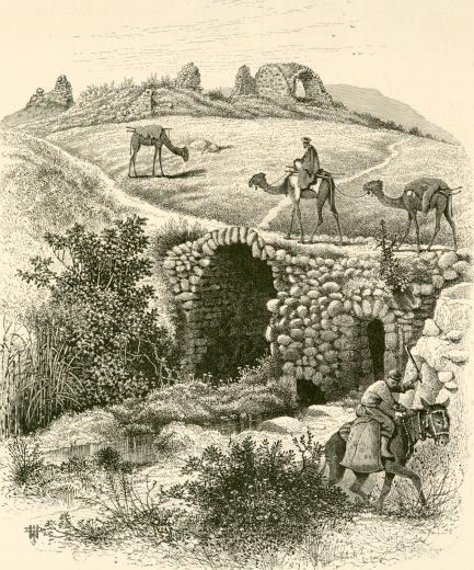
Indur () was a Palestinian village, located southeast of Nazareth. Its name preserves that of ancient Endor, a Canaanite city state thought to have been located to the northeast.Mazar, 1971, p. 318. The village was depopulated during the 1948 Arab–Israeli War and its inhabitants became refugees, some of whom were internally displaced. In Israel today, there are a few thousand internally displaced Palestinians who hail from Indur, and continue to demand their right of return. Etymology The name of this village is thought to preserve that of the ancient Canaanite city of Endor mentioned in the Bible as the place King Saul encountered a known medium. While a few scholars believe that Indur is the actual site of ancient Endor, no ancient remains have been found at the site, and many believe that Khirbet Safsafa, located to the northeast, is a more likely candidate.Negev and Gibson, 2005, p. 166.Freedman, et al., 2006, p 406/ref> History In 1596, Indur was a part of the Ot ... [...More Info...] [...Related Items...] OR: [Wikipedia] [Google] [Baidu] |
Endor (village)
Endor ( or ) was listed in the Book of Joshua () as one of the Canaanite cities the Israelites failed to dispossess, neither the city nor its dependencies.Schmidt, 1994, p. 208. It was located between the Hill of Moreh and Mount Tabor in the Jezreel Valley. It is mentioned twice more in the Hebrew Bible, in 1 Samuel and in Psalm 83. Etymology The original meaning of "Endor" is unknown and its spelling in Hebrew varies.Freedman, et al., 2000, p. 406. It may be connected with the words ''ʿen''"spring" and ''dor'' "generation". In the Bible Endor was first mentioned in , when Endor fell within the allotments of the Tribe of Manasseh. In , Saul consulted the Witch of Endor (),Walton, et al., 2000, p. 318. who lived in the village, on the evening before the Battle of Gilboa, in which he perished. According to , it was the scene of the rout of Jabin and Sisera after being defeated by Barak and Deborah in . Location The location of Endor is widely debated, and many place ... [...More Info...] [...Related Items...] OR: [Wikipedia] [Google] [Baidu] |
Nazareth
Nazareth is the largest Cities in Israel, city in the Northern District (Israel), Northern District of Israel. In its population was . Known as "the Arab capital of Israel", Nazareth serves as a cultural, political, religious, economic and commercial center for the Arab citizens of Israel. The inhabitants are predominantly Arab citizens of Israel, of whom 69% are Muslim and 31% Christianity, Christian. The city also commands immense religious significance, deriving from its status as the hometown of Jesus, the central figure of Christianity and a prophet in Islam and the Baháʼí Faith. Findings unearthed in the neighboring Qafzeh Cave show that the area around Nazareth was populated in the prehistoric period. Nazareth was a Jews, Jewish village during the Roman Empire, Roman and Byzantine Empire, Byzantine periods, and is described in the New Testament as the childhood home of Jesus. It became an important city during the Crusades after Tancred, Prince of Galilee, Tancred ... [...More Info...] [...Related Items...] OR: [Wikipedia] [Google] [Baidu] |
Nazareth Subdistrict, Mandatory Palestine
The Nazareth Subdistrict was one of the subdistricts of Mandatory Palestine. It was located around the city of Nazareth. After the 1948 Arab-Israeli War, the district disintegrated; having fallen entirely within Modern-day Israel, it was merged with the Beisan Subdistrict into the Jezreel Subdistrict. Depopulated towns and villages (current localities in parentheses) * al-Mujaydil ( Migdal HaEmek, Yifat) * Indur * Ma'alul ( Kfar HaHoresh, Migdal HaEmek, Timrat) * Saffuriyya ( HaSolelim, Heftziba Heftziba () is a kibbutz in northern Israel. Located on the boundaries of the Jezreel Valley, Jezreel and Beit She'an Valleys between the cities of Afula and Beit She'an, it falls under the jurisdiction of Gilboa Regional Council. In it had a ..., Sde Nahum, Tzippori) Subdistricts of Mandatory Palestine {{Mandate-Palestine-stub ... [...More Info...] [...Related Items...] OR: [Wikipedia] [Google] [Baidu] |
Akçe
The ''akçe'' or ''akça'' (anglicized as ''akche'', ''akcheh'' or ''aqcha''; ; , , in Europe known as '' asper'') was a silver coin mainly known for being the chief monetary unit of the Ottoman Empire. It was also used in other states including the Anatolian Beyliks, the Aq Qoyunlu, and the Crimean Khanate. The basic meaning of the word is "silver" or "silver money", deriving from the Turkish word () and the diminutive suffix . Three s were equal to one . One-hundred and twenty 's equalled one . Later after 1687 the ' became the main unit of account, replacing the . In 1843, the silver ' was joined by the gold lira in a bimetallic system. Its weight fluctuated; one source estimates it between 1.15 and 1.18 grams. The name ' originally referred to a silver coin but later the meaning changed and it became a synonym for money. The mint in Novo Brdo, a fortified mining town in the Serbian Despotate rich with gold and silver mines, began to strike ' in 1441 when it was captur ... [...More Info...] [...Related Items...] OR: [Wikipedia] [Google] [Baidu] |
Nahiya
A nāḥiyah ( , plural ''nawāḥī'' ), also nahiyeh, nahiya or nahia, is a regional or local type of administrative division that usually consists of a number of villages or sometimes smaller towns. In Tajikistan, it is a second-level division while in Syria, Iraq, Lebanon, Jordan, Xinjiang, and the former administrative divisions of the Ottoman Empire, Ottoman Empire, where it was also called a ''bucak (administrative unit), bucak'', it is a third-level or lower division. It can constitute a division of a ''qadaa'', ''mintaqah'' or other such district-type division and is sometimes translated as "subdistrict". Ottoman Empire The nahiye () was an administrative territorial entity of the Ottoman Empire, smaller than a . The head was a (governor) who was appointed by the Pasha. The was a subdivision of a Selçuk Akşin Somel. "Kazâ". ''The A to Z of the Ottoman Empire''. Volume 152 of A to Z Guides. Rowman & Littlefield, 2010. p. 151. and corresponded roughly to a city w ... [...More Info...] [...Related Items...] OR: [Wikipedia] [Google] [Baidu] |
Liwa (Arabic)
Liwa (, , "ensign" or "banner") has developed various meanings in Arabic: *a banner, in all senses (flag, advertising banner, election publicity banner, etc.) *a district; see also: banner (administrative division) *a level of military unit with its own ensign, now used as the equivalent to brigade *an officer commanding a number of ''liwa'' units, now equivalent to a major general In Turkish, liva (, ''livâ'') was used interchangeably with ''sanjak'' to describe the secondary administrative divisions into which the provinces of the Ottoman Empire were divided. After the fall of the empire, the term was used in the Arab countries formerly under Ottoman rule. It was gradually replaced by other terms like ''qadaa'' and '' mintaqa'' and is now defunct. It is only used occasionally in Syria to refer to the Hatay Province, ceded by the French mandate of Syria to Turkey Turkey, officially the Republic of Türkiye, is a country mainly located in Anatolia in West Asia, with a ... [...More Info...] [...Related Items...] OR: [Wikipedia] [Google] [Baidu] |
Lajjun
Lajjun (, ''al-Lajjūn'') was a large Palestine (region), Palestinian Arab village located northwest of Jenin and south of the remains of the biblical city of Tel Megiddo, Megiddo. The Israeli kibbutz of Megiddo, Israel was built 600 metres north-east of the depopulated village on the hill called Dhahrat ed Dar from 1949. Named after an early Roman legion camp in Syria Palaestina province called "Legio", predating the village at that location, Lajjun's history of habitation spanned some 2,000 years. Under Abbasid rule it was the capital of a subdistrict, during Mamluk rule it served as an important station in the Postal history of Palestine, postal route, and during Ottoman Empire, Ottoman rule it was the capital of a district that bore its name. After the collapse of the Ottoman Empire towards the end of World War I, Lajjun and all of Palestine was placed under the administration of the Mandate for Palestine, British Mandate. The village was depopulated during the 1948 Arab� ... [...More Info...] [...Related Items...] OR: [Wikipedia] [Google] [Baidu] |
Muslim
Muslims () are people who adhere to Islam, a Monotheism, monotheistic religion belonging to the Abrahamic religions, Abrahamic tradition. They consider the Quran, the foundational religious text of Islam, to be the verbatim word of the God in Abrahamic religions, God of Abraham (or ''Allah'') as it was revealed to Muhammad, the last Islamic prophet. Alongside the Quran, Muslims also believe in previous Islamic holy books, revelations, such as the Tawrat (Torah), the Zabur (Psalms), and the Injeel (Gospel). These earlier revelations are associated with Judaism and Christianity, which are regarded by Muslims as earlier versions of Islam. The majority of Muslims also follow the teachings and practices attributed to Muhammad (''sunnah'') as recorded in traditional accounts (hadith). With an estimated population of almost 2 billion followers, Muslims comprise around 26% of the world's total population. In descending order, the percentage of people who identify as Muslims on each ... [...More Info...] [...Related Items...] OR: [Wikipedia] [Google] [Baidu] |
Olive
The olive, botanical name ''Olea europaea'' ("European olive"), is a species of Subtropics, subtropical evergreen tree in the Family (biology), family Oleaceae. Originating in Anatolia, Asia Minor, it is abundant throughout the Mediterranean Basin, with wild subspecies in Africa and western Asia; modern Cultivar, cultivars are traced primarily to the Near East, Aegean Sea, and Strait of Gibraltar. The olive is the type species for its genus, ''Olea'', and lends its name to the Oleaceae plant family, which includes species such as Syringa vulgaris, lilac, jasmine, forsythia, and Fraxinus, ash. The olive fruit is classed botanically as a drupe, similar to the cherry or peach. The term oil—now used to describe any Viscosity, viscous Hydrophobe, water-insoluble liquid—was virtually synonymous with olive oil, the Vegetable oil, liquid fat made from olives. The olive has deep historical, economic, and cultural significance in the Mediterranean; Georges Duhamel (author), George ... [...More Info...] [...Related Items...] OR: [Wikipedia] [Google] [Baidu] |
Mandatory Palestine
Mandatory Palestine was a British Empire, British geopolitical entity that existed between 1920 and 1948 in the Palestine (region), region of Palestine, and after 1922, under the terms of the League of Nations's Mandate for Palestine. After an Arab Revolt, Arab uprising against the Ottoman Empire during the First World War in 1916, British Empire, British Egyptian Expeditionary Force, forces drove Ottoman Empire, Ottoman forces out of the Levant. The United Kingdom had agreed in the McMahon–Hussein Correspondence that it would honour Arab independence in case of a revolt but, in the end, the United Kingdom and French Third Republic, France divided what had been Ottoman Syria under the Sykes–Picot Agreement—an act of betrayal in the eyes of the Arabs. Another issue was the Balfour Declaration of 1917, in which Britain promised its support for the establishment of a Homeland for the Jewish people, Jewish "national home" in Palestine. Mandatory Palestine was then establishe ... [...More Info...] [...Related Items...] OR: [Wikipedia] [Google] [Baidu] |
Pierre Jacotin
Pierre Jacotin (1765–1827) was the director of the Surveying, survey for the ''Carte de l'Égypte (Description de l'Égypte)'', the first triangulation-based map of Egypt, Syria and Palestine. The maps were drafted in 1799–1800 during Napoleon‘s French invasion of Egypt (1798), campaign in Egypt and Palestine. After his return from Egypt, Jacotin worked on preparing the maps for publication, but in 1808 Napoleon formally declared them state secrets, apparently connected to Napoleon's efforts to Franco-Ottoman alliance#A final, but short-lived, alliance, establish an alliance with the Ottomans. The engraved plates were not published until 1828–1830.Khatib, 2003, p211/ref> References Bibliography * Further reference * * * (Pierre Jacotin: pp437652, “Syria”: pp594609 ) External links * Jacotin maps at the David Rumsey Historical Map Collection] {{DEFAULTSORT:Jacotin, Pierre 1765 births 1829 deaths 19th-century French cartographers French geographers 18th-c ... [...More Info...] [...Related Items...] OR: [Wikipedia] [Google] [Baidu] |
Witch Of Endor
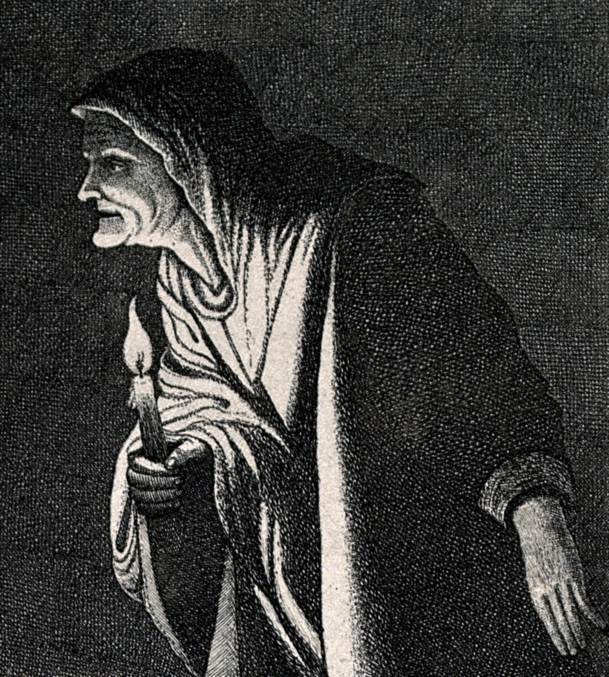
The Witch of Endor (), according to the Hebrew Bible, was consulted by Saul to summon the spirit of the prophet Samuel. Saul wished to receive advice on defeating the Philistines in battle after prior attempts to consult God through sacred lots and other means had failed. However, what was summoned (whether the actual ghost of Samuel or a spirit impersonating him) delivered a prophecy of doom against Saul and his army, who were defeated. This event occurs in 1 Samuel 28:3–25 and is also mentioned in the deuterocanonical Book of Sirach. Etymology The Hebrew Bible calls her "a woman, possessor of an ''ʾōḇ'' at En Dor," apparently a settlement around a spring. The word ''ov'' has been suggested by Harry A. Hoffner to refer to a ritual pit for summoning the dead from the netherworld based on parallels in other Near Eastern and Mediterranean cultures. The word has cognates in other regional languages (cf. Sumerian ''ab'', Akkadian ''âbu'', Hittite ''a-a-bi'', Ugaritic ''i ... [...More Info...] [...Related Items...] OR: [Wikipedia] [Google] [Baidu] |


