|
Imja Khola
The Imja Khola () is a tributary of the Dudh Kosi river in eastern Nepal. It drains the slopes of Mount Everest. The Khumbu Glacier melts into the Lobujya ( Lobuche) River, which flows southward as the Imja Khola to its confluence with the Dudh Kosi at Tengboche. The Imja Khola collects water from the Imja Glacier through the Dingboche Valley. River course The river rises in the lake Imja Tsho, which is mainly formed by the waters of the Imja Glacier, it flows in the direction southwest through the village of Dingboche, then it merges with the river Lobuche, which flows south from the Khumbu Glacier, then flows southward to its confluence with the Dudh Kosi near the village of Tengboche. Trekking The Imja Khola is on the trekking route in the Everest base camp region, between Thyangboche and Dingboche at . During the Everest Base Camp Trek, trekkers cross a suspension bridge, over the Imja Khola, moving towards the village of Dingboche. Dingboche, the 'Summer Valley; of the ... [...More Info...] [...Related Items...] OR: [Wikipedia] [Google] [Baidu] |
Imja Glacier
Imja Glacier () is located in the Himalayas, in the Solukhumbu District of Nepal. It originates on the western face of Kali Himal, , and skirts the southern slopes of Imja Tse or Island Peak, south-east of Mount Everest. It is joined by the Lhotse Shar and Ambulapcha Glaciers. The glacier forms the eastern extent of Imja Tsho, which in turn drains through the Dingboche valley to the Imja Khola, Dudh Kosi, Ganges River and finally the Indian Ocean The Indian Ocean is the third-largest of the world's five oceanic divisions, covering or approximately 20% of the water area of Earth#Surface, Earth's surface. It is bounded by Asia to the north, Africa to the west and Australia (continent), .... See also * List of glaciers in Asia References External links Everest glacier 'turning into a lake' Glaciers of Nepal Solukhumbu District {{Nepal-glacier-stub ... [...More Info...] [...Related Items...] OR: [Wikipedia] [Google] [Baidu] |
Dudh Kosi
Dudh Koshi (दुधकोशी नदी, ''Milk-Koshi River'') is a river in eastern Nepal. It is the highest river in terms of elevation. Dudh Koshi originates from the glacier lakes at the height of 5,100 meters above sea level and meets Sapta Koshi at the altitude of 1,245 meters. Koshi river system The Kosi River, or Sapt Koshi, drains eastern Nepal. It is known as Sapta Koshi because of the seven rivers which join together in east-central Nepal to form this river. The main rivers forming the Sapta Koshi River system are – the Sun Koshi (सुन कोशी)], the Indravati River, Nepal, Indravati River (इन्द्रावती), the tama Koshi (तामा कोशी), the Dudh Koshi (दुध कोशी), the Arun River (अरुण), Tamor River (तमोर) and Likhu River. The Dudh Kosi river originates from the high-altitude areas of Mount Everest (8848 metres) and the snow and glacier melt contributes significant portion of streamflow, especi ... [...More Info...] [...Related Items...] OR: [Wikipedia] [Google] [Baidu] |
Nepal
Nepal, officially the Federal Democratic Republic of Nepal, is a landlocked country in South Asia. It is mainly situated in the Himalayas, but also includes parts of the Indo-Gangetic Plain. It borders the Tibet Autonomous Region of China China–Nepal border, to the north, and India India–Nepal border, to the south, east, and west, while it is narrowly separated from Bangladesh by the Siliguri Corridor, and from Bhutan by the States and union territories of India, Indian state of Sikkim. Nepal has a Geography of Nepal, diverse geography, including Terai, fertile plains, subalpine forested hills, and eight of the world's ten List of highest mountains#List, tallest mountains, including Mount Everest, the highest point on Earth. Kathmandu is the nation's capital and List of cities in Nepal, its largest city. Nepal is a multi-ethnic, multi-lingual, multi-religious, and multi-cultural state, with Nepali language, Nepali as the official language. The name "Nepal" is first record ... [...More Info...] [...Related Items...] OR: [Wikipedia] [Google] [Baidu] |
Koshi River
The Kosi or Koshi is a transboundary river which flows through China, Nepal and India. It drains the northern slopes of the Himalayas in Tibet and the southern slopes in Nepal. From a major confluence of tributaries north of the Chatra Gorge onwards, the Kosi River is also known as the Saptakoshi (, ) for its seven upper tributaries. These include the Tamur River originating from the Kanchenjunga area in the east and Arun River, China-Nepal, Arun River and the Sun Kosi from Tibet. The Sun Koshi's tributaries from east to west are the Dudh Koshi, Likhu Khola, Tamakoshi River, Bhote Koshi and Indravati River, Nepal, Indravati. The Saptakoshi crosses into northern Bihar, India where it branches into distributary, distributaries before joining the Ganges near Kursela in Katihar district. The Kosi is the third-largest tributary of the Ganges by water discharge after the Ghaghara and the Yamuna. The Kosi is long and drains an area of about in Tibet, Nepal and Bihar.Nayak, J. (1996). ... [...More Info...] [...Related Items...] OR: [Wikipedia] [Google] [Baidu] |
Mount Everest
Mount Everest (), known locally as Sagarmatha in Nepal and Qomolangma in Tibet, is Earth's highest mountain above sea level. It lies in the Mahalangur Himal sub-range of the Himalayas and marks part of the China–Nepal border at its summit. Its height was most recently measured in 2020 by Chinese and Nepali authorities as . Mount Everest attracts many climbers, including highly experienced mountaineers. There are two main climbing routes, one approaching the summit from the southeast in Nepal (known as the standard route) and the other from the north in Tibet. While not posing substantial technical climbing challenges on the standard route, Everest presents dangers such as altitude sickness, weather, and wind, as well as hazards from avalanches and the Khumbu Icefall. As of May 2024, 340 people have died on Everest. Over 200 bodies remain on the mountain and have not been removed due to the dangerous conditions. Climbers typically ascend only part of Mount Eve ... [...More Info...] [...Related Items...] OR: [Wikipedia] [Google] [Baidu] |
Khumbu Glacier
The Khumbu Glacier () is located in the Khumbu region of northeastern Nepal between Mount Everest and the Lhotse- Nuptse ridge. With elevations of at its terminus to at its source, it is the world's highest glacier. The Khumbu Glacier is followed for the final part of the trail to one of the Everest Base Camps. The start of the glacier is in the Western Cwm near Everest. The glacier has a large icefall, the Khumbu Icefall, at the west end of the lower Western Cwm. This icefall is the first major obstacle—and among the more dangerous—on the standard south col route to the Everest summit. It is also the largest glacier in Nepal. The end of Khumbu Glacier is located at . Overview Khumbu Glacier, Khumbu Icefall, Nepal, Asia.jpg, Khumbu Glacier and Khumbu Icefall Khumbu Glacier from Kala Patthar, Mountains of Nepal, Asia.jpg, Khumbu Glacier Khumbu glacier in relation to everest.jpg, Map See also * * List of glaciers * Retreat of glaciers since 1850 The retreat of gla ... [...More Info...] [...Related Items...] OR: [Wikipedia] [Google] [Baidu] |
Lobuche, Nepal
Lobuche (or Lobuje) is a small settlement near Mount Everest in the Khumbu Khumbu (also known as the Everest Region) is a region of northeastern Nepal on the Nepalese side of Mount Everest. It is part of the Solukhumbu District, which in turn is part of Koshi Pradesh.Bradley, Mayhew; "Trekking in the Nepal Himalaya"; ... region of Nepal. As per the National Census of 2011, Lobuche village has a population of 86 locals living permanently in the highlands and there are 24 local households. It is one of the last overnight stops with lodging on the "trail to base camp", a hike that climbers make on their way to the Everest Base Camp, Everest Base Camp (South) when attempting an ascent of Everest via the standard southeast route. It is also a popular stop among trekking, trekkers in the area. From there they can complete the trail on to Everest Base Camp, EBC or stop at Gorak Shep, the last stop with lodging on the trail, and climb the modest nearby peak, Kala Patthar (5,545 m, 18 ... [...More Info...] [...Related Items...] OR: [Wikipedia] [Google] [Baidu] |
Tengboche
Tengboche (or Thyangboche) is a village in Khumbu Pasanglhamu rural municipality in the Khumbu subregion of Province No. 1 in Nepal, located at . Within the village is an important Buddhist monastery, Tengboche Monastery, which is the largest gompa in the Khumbu region. The structure was built in 1923. In 1934, it was destroyed by an earthquake but subsequently rebuilt. It was destroyed again by a fire in 1989, and again rebuilt with the help of volunteers and the provision of foreign aid. Tengboche has a panoramic view of the Himalayas, Himalayan mountains, including the well-known peaks of Tawache, Mount Everest, Everest, Nuptse, Lhotse, Ama Dablam, and Thamserku. Tenzing Norgay, the first man to reach the summit of Mount Everest with Sir Edmund Hillary, was born in the area in the village of Thani and was once sent to Tengboche Monastery to be a monk. History The Khumbu valley, where Tengboche is located, came under the influence of Buddhism about 350 years ago. Ancient script ... [...More Info...] [...Related Items...] OR: [Wikipedia] [Google] [Baidu] |
Dingboche
Dingboche is a Sherpa village at an elevation of in the Khumbu region of northeastern Nepal. Its population was estimated at approximately 200 in 2011. Transport Coming from Namche Bazaar or Tengboche, Dingboche is the better alternative than the village of Pheriche, in being more sunny, and less affected by the icy winds that descend through the Valley of Khumbu. There are no roads that go to the village, only trails, and with the exceptions of some agricultural products produced around the village; yaks and mules carry most of what is consumed locally.Shrestha, Vinos Prasad; “Concise Geography of Nepal”; (2007); Mandal Publications; . Climate Dingboche has a Tundra climate (Köppen classification ''ET''). It has cool and rainy summers and dry and cold winters, affected mainly by its altitude and by monsoon A monsoon () is traditionally a seasonal reversing wind accompanied by corresponding changes in precipitation but is now used to describe seasonal changes in ... [...More Info...] [...Related Items...] OR: [Wikipedia] [Google] [Baidu] |
Trekking
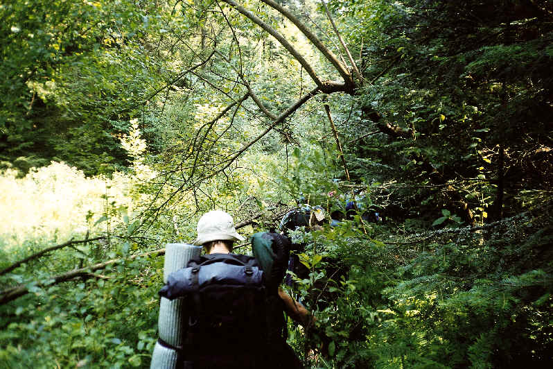
Backpacking is the outdoor recreation of carrying gear on one's back while hiking for more than a day. It is often an extended journey and may involve camping outdoors. In North America, tenting is common, where simple shelters and mountain huts, widely found in Europe, are rare. In New Zealand, hiking is called tramping, and tents are used alongside a nationwide network of huts. Hill walking is equivalent in Britain (but this can also refer to a day walk), though backpackers make use of a variety of accommodation, in addition to camping. Backpackers use simple huts in South Africa. Trekking and bushwalking are other words used to describe such multi-day trips. The terms walking tour or long distance hike are also used. Backpacking as a method of travel is a different activity, which mainly uses public transport during a journey that can last months. It is, however, similar to bikepacking, bicycle touring, canoe and kayak camping, and trail riding, with saddlebags. De ... [...More Info...] [...Related Items...] OR: [Wikipedia] [Google] [Baidu] |


