|
Ilan Uti
Ilan Uti - (Īlān Ūtī) also called as The Āq Kūtal (White Pass), is a strategic passage between Samarkand and the Great Steppe, separating the Zarafshān Valley from Jizakh, Ūrā Tippa and Khojand. Located two hours east of Samarqand, it formed an extremely narrow gorge which was said to teem with snakes. This earned the pass the name Snake Pass. Many travelers passing through in the nineteenth century called it the “Gateway of Tamerlane” Geography Ilon Uti is a mountain gorge with a pass between the Malguzar and Nurata mountain ranges, located in the narrow valley of the Sangzor River in the Jizzakh region of Uzbekistan. It is 16–18 km long and 200–500 m wide, with the riverbed narrowing to 30 m at its narrowest point. The absolute elevation of the pass ranges from 450 to 550 m, while the surrounding mountain slopes rise to 650–700 m. The ancient Turkic name of the pass was Temir Qapigh ("Iron Gate"). Additionally, it has been historically referred ... [...More Info...] [...Related Items...] OR: [Wikipedia] [Google] [Baidu] |
Jizzakh Region
Jizzakh Region is one of the regions of Uzbekistan. It is located in the center/east of the country. It borders Tajikistan to the south and south-east, Samarqand Region to the west, Navoiy Region to the north-west, Kazakhstan to the north, and Sirdaryo Region to the east. It covers an area of 21,210 km2. The population is 1,443,408 (2024 estimate) with 53% living in rural areas. The regional capital is Jizzakh (pop. 212,689, 2024). Other major towns include Doʻstlik, Gagarin, Gʻallaorol, Paxtakor, and Dashtobod. Jizzakh Region was formerly a part of Sirdaryo Region but was given separate status in 1973. Economy The economy of the Jizzakh Region is primarily based on agriculture. Cotton and wheat are the main crops, and extensive irrigation is used. Natural resources include lead, zinc, iron, and limestone. Uzbekistan and China are working together to jointly establish a Special Economic Zone in the region. This high-tech industrial park will be formally establish ... [...More Info...] [...Related Items...] OR: [Wikipedia] [Google] [Baidu] |
Porphyry (geology)
Porphyry ( ) is any of various granites or igneous rocks with coarse-grained crystals such as feldspar or quartz dispersed in a fine-grained silicate-rich, generally aphanitic matrix or groundmass. In its non-geologic, traditional use, the term ''porphyry'' usually refers to the purple-red form of this stone, valued for its appearance, but other colours of decorative porphyry are also used such as "green", "black" and "grey". The term ''porphyry'' is from the Ancient Greek (), meaning " purple". Purple was the colour of royalty, and the Roman "imperial porphyry" was a deep purple igneous rock with large crystals of plagioclase. Some authors claimed the rock was the hardest known in antiquity. Thus porphyry was prized for monuments and building projects in Imperial Rome and thereafter. Subsequently, the name was given to any igneous rocks with large crystals. The adjective ''porphyritic'' now refers to a certain texture of igneous rock regardless of its chemical and miner ... [...More Info...] [...Related Items...] OR: [Wikipedia] [Google] [Baidu] |
Moghulistan
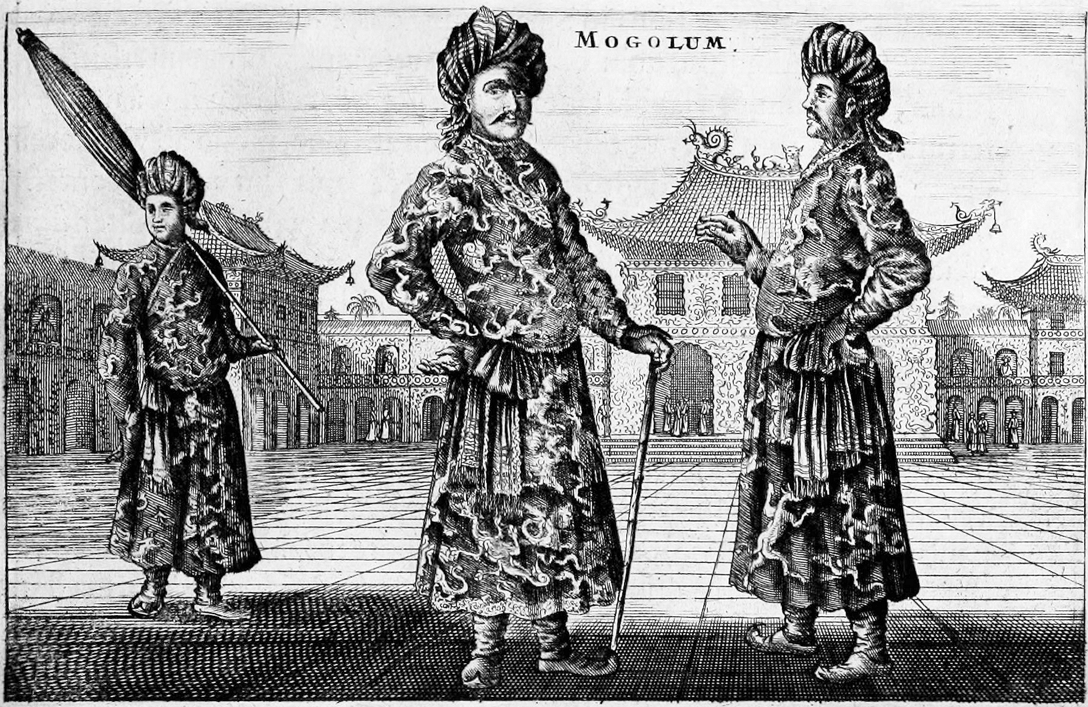
Moghulistan, also called the Moghul Khanate or the Eastern Chagatai Khanate, was a Muslims, Muslim, Mongol, and later Turkic peoples, Turkic breakaway khanate of the Chagatai Khanate and a historical geographic area north of the Tian Shan, Tengri Tagh mountain range, on the border of Central Asia and East Asia. That area today includes parts of Kazakhstan, Kyrgyzstan, and northwest Xinjiang, China. The khanate nominally ruled over the area from the mid-14th century until the late 17th century. Beginning in the mid-14th century a new khanate, in the form of a nomadic tribal confederacy headed by a member of the family of Chagatai, arose in the region of the Ili River. It is therefore considered to be a continuation of the Chagatai Khanate, but it is also referred to as the ''Moghul Khanate''. In actuality, local control rested with local Mongol Dughlats or Naqshbandi Sufis in their respective oases. Although the rulers enjoyed great wealth from trade with the Ming dynasty, it wa ... [...More Info...] [...Related Items...] OR: [Wikipedia] [Google] [Baidu] |
Ulugh Beg
Mīrzā Muhammad Tarāghāy bin Shāhrukh (; ), better known as Ulugh Beg (; 22 March 1394 – 27 October 1449), was a Timurid sultan, as well as an astronomer and mathematician. Ulugh Beg was notable for his work in astronomy-related mathematics, such as trigonometry and spherical geometry, as well as his general interests in the arts and intellectual activities.Science in Islamic civilisation: proceedings of the international symposia: "Science institutions in Islamic civilisation", & "Science and technology in the Turkish and Islamic worl/ref> Ulugh Beg, OU Libraries, Britannica Academic It is thought that he spoke five languages: Arabic, Persian, Chaghatai Turkic, Mongolian, and a small amount of Chinese. During his rule (first as a governor, then outright) the Timurid Empire achieved the cultural peak of the Timurid Renaissance through his attention and patronage. Samarkand was captured and given to Ulugh Beg by his father Shah Rukh. He built the great ... [...More Info...] [...Related Items...] OR: [Wikipedia] [Google] [Baidu] |
Zomin
Zomin (, ) is an urban-type settlement in Jizzakh Region, Uzbekistan. It is the administrative centre of Zomin District. 14,215 people were residing in the town as of the 1989 census. The association football club FK Zaamin, FK Zomin is based in the town. References Populated places in Jizzakh Region Urban-type settlements in Uzbekistan {{Uzbekistan-geo-stub ... [...More Info...] [...Related Items...] OR: [Wikipedia] [Google] [Baidu] |
Khanate Of Bukhara
The Khanate of Bukhara was an Uzbek state in Central Asia from 1501 to 1785, founded by the Abu'l-Khayrid dynasty, a branch of the Shaybanids. From 1533 to 1540, Bukhara briefly became its capital during the reign of Ubaidullah Khan. The Khanate reached its greatest extent and influence under its penultimate Abu'l-Khayrid ruler, the scholarly Abdullah Khan II (r. 1557–1598). In the 17th and 18th centuries, the Khanate was ruled by the Janid dynasty (Astrakhanids or Toqay Timurids). They were the last Genghisid descendants to rule Bukhara. In 1740, it was conquered by Nader Shah, the Shah of Iran. After his death in 1747, the khanate was controlled by the non-Genghisid descendants of the Uzbek emir Khudayar Bi, through the prime ministerial position of ''ataliq''. In 1785, his descendant, Shah Murad, formalized the family's dynastic rule ( Manghit dynasty), and the khanate became the Emirate of Bukhara. The Manghits were non-Genghisid and took the Islamic title of Emir i ... [...More Info...] [...Related Items...] OR: [Wikipedia] [Google] [Baidu] |
Ubaidullah Khan
Ubaidullah Khan ( Chagatai/; 1487–1539), also Ubaid Khan, was the 4th Shaybanid Khan of Bukhara, who ruled between 1534 and 1539. He was the son of Mahmud and nephew of Muhammad Shaybani, founder of the Shaybanid dynasty. Biography After the death of Muhammad Shaybani in 1510, the cities and lands controlled by the Uzbeks were divided among the family members. Bukhara fell to Ubaidullah Khan, which he had to defend against Babur Emir of Kabul and future Mughal Emperor, and against the Safavids of Iran in 1511/12. Ubaidullah and Jani Beg, the commander-in-chief of the army, proved themselves as capable generals. Babur's defeat at Gadjdivan in 1512 finally secured the Uzbeks' possession of the land between Amu Darya and Syr Darya. Ubaidullah was not only a military man and politician, but also an amateur scholar, poet and builder. His time saw the construction of the Kalan Mosque in 1514, next to the Kalyan Minaret from the 12th century on the site of an old palace mosq ... [...More Info...] [...Related Items...] OR: [Wikipedia] [Google] [Baidu] |
National Encyclopedia Of Uzbekistan
The ''National Encyclopedia of Uzbekistan'' () is a general-knowledge encyclopedia written in Uzbek language, Uzbek. The majority of the articles in the ''National Encyclopedia'' were directly taken from the ''Uzbek Soviet Encyclopedia''. While the ''Uzbek Soviet Encyclopedia'' was published in 14 volumes, the ''National Encyclopedia of Uzbekistan'' has only 12 volumes. The first volume of the ''National Encyclopedia'' was published in 2000. The final 12th volume was published in 2006. History The ''National Encyclopedia of Uzbekistan'' was published in Tashkent from 2000 to 2005 by the National Encyclopedia of Uzbekistan State Scientific Publishing House. The encyclopedia was printed in Cyrillic even though it was published long after Uzbekistan introduced the Latin script to Uzbek. In 2013, all of the articles of the ''National Encyclopedia'' were added to the Uzbek Wikipedia with the help of a Wikipedia bots, bot. In 2022, the Agency of Information and Mass Communications unde ... [...More Info...] [...Related Items...] OR: [Wikipedia] [Google] [Baidu] |
Mirzachoʻl
Mirzachoʻl () is a loess plain of some 10,000 km2 on the left bank of Syr Darya in Uzbekistan, extending from the mouth of Ferghana Valley on the border with Tajikistan to the east across Sirdaryo Region and the northern part of Jizzakh Region to the west. To the south it is bounded by Turkestan Range. Geographically Mirzachoʻl Steppe is a south-eastern extension of the Kyzyl Kum desert, with about 240 mm of annual precipitation and extreme continental climate (average temperatures from 28°C in July to −2°C in January). Efforts that began as early as the end of the 19th century gradually transformed the Mirzachoʻl Steppe from a desert into an intensively irrigated agricultural area, today one of the major cotton and grain producing regions of Uzbekistan with around 500,000 hectares of irrigated land under cultivation.''Agricultural of Uzbekistan 2006'', statistical yearbook, Goskomstat Uzbekistana, Tashkent, 2007. Three main canals constructed in the 1950s and the 1960s brin ... [...More Info...] [...Related Items...] OR: [Wikipedia] [Google] [Baidu] |
Middle Pleistocene
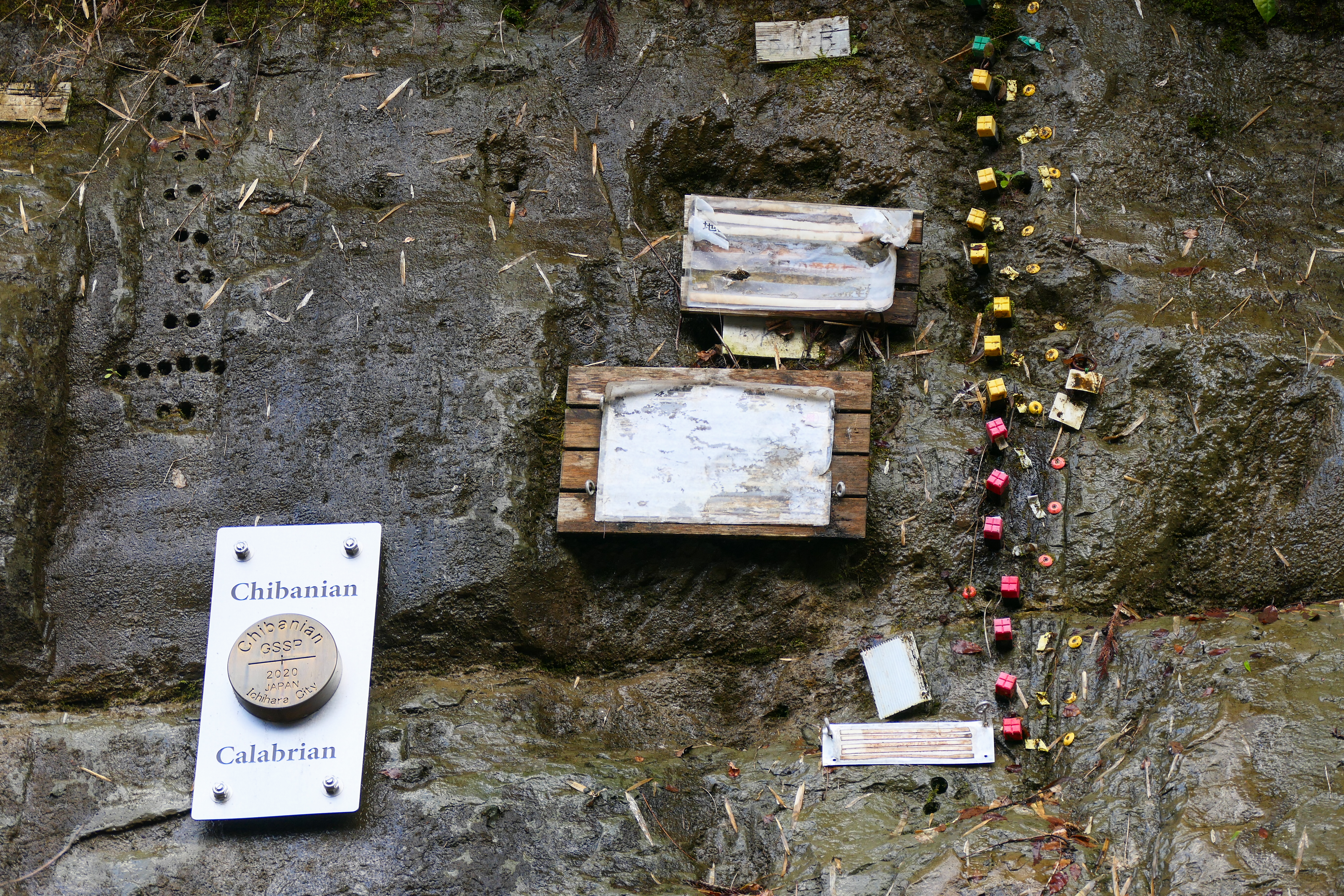
The Chibanian, more widely known as the Middle Pleistocene (its previous informal name), is an Age (geology), age in the international geologic timescale or a Stage (stratigraphy), stage in chronostratigraphy, being a division of the Pleistocene Epoch within the ongoing Quaternary Period. The Chibanian name was officially ratified in January 2020. It is currently estimated to span the time between 0.7741 annum, Ma (774,100 years ago) and 0.129 Ma (129,000 years ago), also expressed as 774.1–129 ka. It includes the transition in palaeoanthropology from the Lower Paleolithic, Lower to the Middle Paleolithic over 300 ka. The Chibanian is preceded by the Calabrian (stage), Calabrian and succeeded by the Late Pleistocene. The beginning of the Chibanian is the Brunhes–Matuyama reversal, when the Earth's magnetic field last underwent reversal. Its end roughly coincides with the termination of the Penultimate Glacial Period and the onset of the Last Interglacial period (correspondin ... [...More Info...] [...Related Items...] OR: [Wikipedia] [Google] [Baidu] |
Granodiorite
Granodiorite ( ) is a coarse-grained (phaneritic) intrusive igneous rock similar to granite, but containing more plagioclase feldspar than orthoclase feldspar. The term banatite is sometimes used informally for various rocks ranging from granite to diorite, including granodiorite. The term ''granodiorite'' was first used by George F. Becker, G. F. Becker (1893) to describe granitic rocks in the Sierra Nevada, United States. Composition According to the QAPF diagram, granodiorite has a greater than 20% quartz by volume, and between 65% and 90% of the feldspar is plagioclase. A greater amount of plagioclase would designate the rock as tonalite. Granodiorite is felsic to intermediate composition, intermediate in composition. It is the Intrusive rock, intrusive igneous equivalent of the extrusive igneous dacite. It contains a large amount of sodium (Na) and calcium (Ca) rich plagioclase, potassium feldspar, quartz, and minor amounts of muscovite mica as the lighter colored miner ... [...More Info...] [...Related Items...] OR: [Wikipedia] [Google] [Baidu] |


