|
Ideani
Ideani, sometimes spelled Ide Ani, is a town in Idemili North Local Government Area of Anambra State, Nigeria. It is bordered by Uke in the West, Alor in the South and Abatete in the North and East."Ideani Quarterly" by Chief Stanley N. Mezue, Ikemba. Demographics The population is an estimated 20,000. History Ideani was formerly a village in Alor. It obtained autonomous status in 1970 following the Biafra-Nigeria civil war. Ideani comprises seven villages: Urueze, Umuduba, Nsokwe, Umuru, Oko, Uruechem Akama and Nkpazueziama. It was ruled in the colonial period by British-appointed regents. Chiefs Ezenwanne Obianyo and Onyido Uwaezuoke governed Ideani and parts of Alor. Ideanians, as indigenes are known, held joint meetings with Alor indigenes in townships. This brotherly relationship soured when Ideanians demanded that funds raised by the association be of mutual benefit to both Alor and Ideani. They started seeking secession from Alor due to this perceived marginalizatio ... [...More Info...] [...Related Items...] OR: [Wikipedia] [Google] [Baidu] |
Idemili North
Idemili North is a Local Government Area in Anambra State, south-central Nigeria. Towns that make up the local government are Abacha, Abatete, Eziowelle, Ideani, Nkpor, Obosi, Ogidi, Oraukwu, Uke, Umuoji The Umuoji people are those whose roots can be traced to the town of Umuoji, in Idemili North - a local government area in Anambra State, Nigeria. These people are an Igbo speaking ethnic group, whose early history is adversely affected by a la .... Schools Here is the list of secondary schools in Idemili North Local Government Area: * Notre Dame High School, Abatete * Abanna Secondary School, Abatete * Community Secondary School, Eziowelle * Queen of the Rosary Secondary School, Eziowelle * Community Secondary School, Ideani * Government Technical College, Nkpor * Urban Secondary School, Nkpor * Community Secondary School, Obosi * Unity Secondary School, Obosi * Boys’ Secondary School, Ogidi * Anglican Girls’ Secondary School, Ogidi * Community Secondary School, ... [...More Info...] [...Related Items...] OR: [Wikipedia] [Google] [Baidu] |
Alor, Nigeria
Alor is one of the seven communities comprising the Idemili South Local Government of Anambra State in the southeast geopolitical zone of Nigeria. It is surrounded by seven neighbouring towns, namely Oraukwu, Nnobi, Abatete, Ideani, Uke, Adazi Ani and Nnokwa. Alor has several rivers which names in most cases are derived from the major idol of the village touched by the river – Mmili Ezigbo, Mmili Nwangene, Mmili Ọhọsha, Mmili Ideọhwọlọ, Mmili Iyiogwgwu, and Mmili Ọbịaja. Physical Environment Alor town is located within the triangle formed by the three main towns of Anambra State. Conceptually straightening out the roads connecting the towns, the northern side of the triangle is the Onitsha – Awka road, whether the expressway or the old Enugu – Onitsha road. The eastern or southeastern edge of the triangle is the connection from Awka through Agulu or Nimo, Neni, Oraukwu, Adazi Ani, Nnokwa, and Nnobi to Nnewi. The third side is Onitsha to Nnewi. Alor happe ... [...More Info...] [...Related Items...] OR: [Wikipedia] [Google] [Baidu] |
Anambra State
Anambra State is a Nigerian state, located in the southeastern region of the country. The state was created on August 27, 1991. Anambra state is bounded by Delta State to the west, Imo State to the south, Enugu State to the east and Kogi State to the north. According to the 2022 census report, there are over 9 million residents in the state. The state name was formed in 1976 from the former East Central State. The state is named after Omambala River, a river that runs through the state. Anambra is the Anglicized name of the Omambala. The State capital is Awka, a rapidly growing city that increased in population from approximately 700,000 to more than 6 million between 2006 and 2020. The city of Onitsha, a historic port city from the pre-colonial era, remains an important centre of commerce within the state. Nicknamed the "Light of the Nation", Anambra State is the eighth most populous state in the nation, although that has seriously been argued against as Onitsha, the ... [...More Info...] [...Related Items...] OR: [Wikipedia] [Google] [Baidu] |
Abatete
Abatete is a Town in Anambra State in Nigeria. Abatete is bordered by Uke, Ogidi, Abacha, Oraukwu Oraukwu is a town in Anambra State, Nigeria. It used to be called Ohaukwu. It is among the towns in Idemili North Local Government Area of Anambra State, and lies approximately 40 kilometers east of Onitsha along the old Enugu–Onitsha trunk ...Alor Ideani, Nimo, Eziowelle, Umuoji. It is located in Idemili North Local Government Area of Anambra State. It is made up of four villages namely : Agbaja, Nsukwu, Ogbu and Odida. Its people are one of the Igbo speaking peoples of Eastern Nigeria. Abatete, like most Igbo communities, has a rich cultural heritage. References {{Reflist Towns in Anambra State ... [...More Info...] [...Related Items...] OR: [Wikipedia] [Google] [Baidu] |
Nigeria
Nigeria ( ), , ig, Naìjíríyà, yo, Nàìjíríà, pcm, Naijá , ff, Naajeeriya, kcg, Naijeriya officially the Federal Republic of Nigeria, is a country in West Africa. It is situated between the Sahel to the north and the Gulf of Guinea to the south in the Atlantic Ocean. It covers an area of , and with a population of over 225 million, it is the List of African countries by population, most populous country in Africa, and the List of countries and dependencies by population, world's sixth-most populous country. Nigeria borders Niger in Niger–Nigeria border, the north, Chad in Chad–Nigeria border, the northeast, Cameroon in Cameroon–Nigeria border, the east, and Benin in Benin–Nigeria border, the west. Nigeria is a Federation, federal republic comprising of States of Nigeria, 36 states and the Federal Capital Territory, Nigeria, Federal Capital Territory, where the capital, Abuja, is located. The List of Nigerian cities by population, largest city in Nigeria ... [...More Info...] [...Related Items...] OR: [Wikipedia] [Google] [Baidu] |
Uke, Nigeria
Uke in Idemili North (Anambra) is a town in Eastern Nigeria about 208 mi (or 334 km) south of Abuja, the country's capital city. It is made up of six villages (brothers): Ubulenu-Ezema, Uruabor, Oba, Umunnakwe-Omimi, Umuazu and Nkwelle. It has a very popular market known as Eke Uke, which is situated in the middle of the villages. Notable People: Obi Ezeude founder and CEO of Beloxxi Nigeria, Chief Sir Tochukwu Kpajie (Okunaenyeife) CEO STK Industries, Chief Ikechukwu Okosa, (Ijele) Uke, Barr S.N.S Eze (Ezekwesili), Surv. Emeka Enendu, Chief Ikedi Obi (Obataifeadi), Dr Edwin Emegoakor (Odu Uke) The traditional head is elected on the demise of the previous traditional leader, and it is rotated round the six villages. The current traditional ruler is Igwe Charles Chuma Agbala Igwe Oranyelu III. His predecessors are Igwe GNC Ezeude Igwe Oranyelu II, Igwe WI Ileka Igwe Oranyelu I. The town is host to the Holy Ghost Adoration Ministry whose Spiritual Director Rev.Fr. Em ... [...More Info...] [...Related Items...] OR: [Wikipedia] [Google] [Baidu] |
Nigerian Civil War
The Nigerian Civil War (6 July 1967 – 15 January 1970), also known as the Nigerian–Biafran War or the Biafran War, was a civil war fought between Nigeria and the Republic of Biafra, a secessionist state which had declared its independence from Nigeria in 1967. Nigeria was led by General Yakubu Gowon, while Biafra was led by Lieutenant Colonel Chukwuemeka "Emeka" Odumegwu Ojukwu. Biafra represented the nationalist aspirations of the Igbo ethnic group, whose leadership felt they could no longer coexist with the federal government dominated by the interests of the Muslim Hausa-Fulanis of Northern Nigeria. The conflict resulted from political, economic, ethnic, cultural and religious tensions which preceded the United Kingdom's formal decolonization of Nigeria from 1960 to 1963. Immediate causes of the war in 1966 included a military coup, a counter-coup, and anti-Igbo pogroms in Northern Nigeria. Control over the lucrative oil production in the Niger Delta also played a vi ... [...More Info...] [...Related Items...] OR: [Wikipedia] [Google] [Baidu] |
Enugu
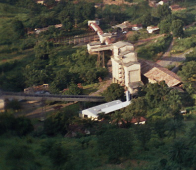
Enugu ( ; ) is the capital city of Enugu State in Nigeria. It is located in southeastern part of Nigeria. The city had a population of 820,000 according to the 2022 Nigerian census. The name ''Enugu'' is derived from the two Igbo words ''Énú Ụ́gwụ́'', meaning "hill top", denoting the city's hilly geography. Since the 17th century the location of present-day Enugu has been inhabited by the Enugwu-Ngwo and Nike ( ) subgroup of the Igbo people; . In 1900, the Southern Nigeria Protectorate was established by the colonial administration of the British Empire. The discovery of coal by the colonists led to the creation of what was then known as the Enugu Coal Camp, named after the nearby village of Enugu Ngwo, under which coal was first found. The nearby city of Port Harcourt was created for the purpose of shipping this coal abroad, being located south of the camp. Coal mining opportunities in Enugu attracted people from throughout the region; this marked the core of the ... [...More Info...] [...Related Items...] OR: [Wikipedia] [Google] [Baidu] |


