|
Iceberg C-19
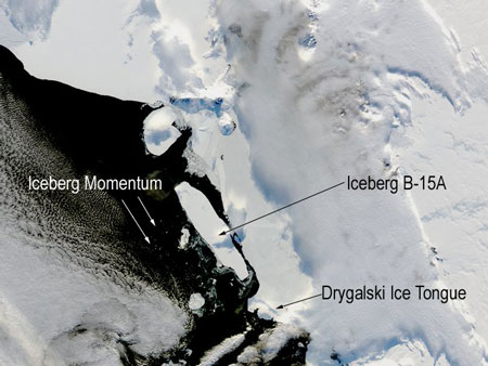
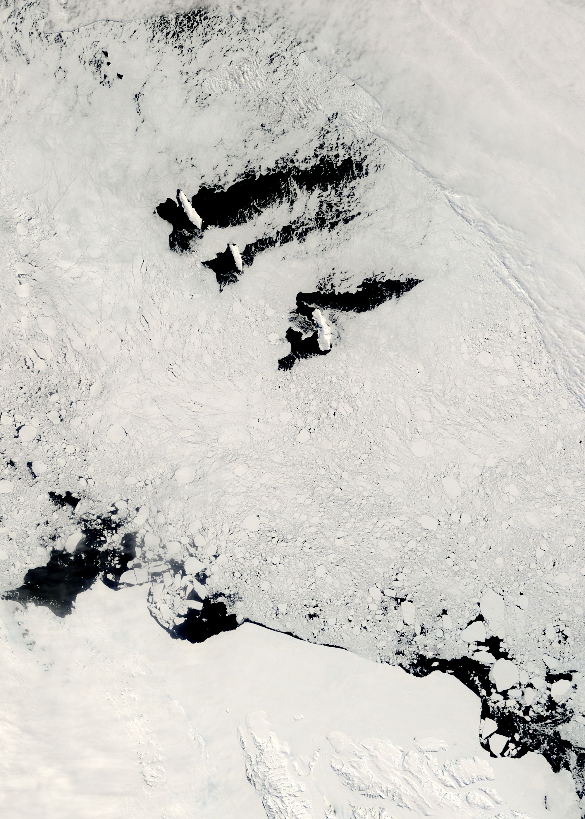
Iceberg C-19 is an iceberg that calved from the Ross Ice Shelf in May 2002 on a fissure scientists had been watching since the 1980s. After that the Ross Ice Shelf returned to the size it was in 1911, when it was mapped by Robert F. Scott’s party. It was the second-largest iceberg to calve in the region in a few years (after B-15). It had a surface area larger than 5500 km2. During 2002 C-19 prevented sea ice from moving out of the southwestern Ross Sea region and this blockage resulted in an unusually high sea ice level during spring and summer, thus provoking a huge reduction in phytoplankton production which is at the base of the food chain. In summer 2003 C-19 moved northward very rapidly, passed Cape Adare, and broke in two pieces: C-19A and C-19B. In September 2005, after a two-year stay along the coast of Victoria Land (west of French station Dumont d'Urville) C-19A started drifting northward. In March 2006 its location was in the Pacific Ocean, 200 km we ... [...More Info...] [...Related Items...] OR: [Wikipedia] [Google] [Baidu] |
Victoria Land
Victoria Land is a region in eastern Antarctica which fronts the western side of the Ross Sea and the Ross Ice Shelf, extending southward from about 70°30'S to 78°00'S, and westward from the Ross Sea to the edge of the Antarctic Plateau. It was discovered by Captain James Clark Ross in January 1841 and named after Queen Victoria. The rocky promontory of Minna Bluff is often regarded as the southernmost point of Victoria Land, and separates the Scott Coast to the north from the Hillary Coast of the Ross Dependency to the south. The region includes ranges of the Transantarctic Mountains and the McMurdo Dry Valleys (the highest point being Mount Abbott in the Northern Foothills), and the flatlands known as the Labyrinth. The Mount Melbourne is an active volcano in Victoria Land. Early explorers of Victoria Land include James Clark Ross and Douglas Mawson. In 1979, scientists discovered a group of 309 meteorites A meteorite is a solid piece of debris from an ... [...More Info...] [...Related Items...] OR: [Wikipedia] [Google] [Baidu] |
NASA
The National Aeronautics and Space Administration (NASA ) is an independent agency of the US federal government responsible for the civil space program, aeronautics research, and space research. NASA was established in 1958, succeeding the National Advisory Committee for Aeronautics (NACA), to give the U.S. space development effort a distinctly civilian orientation, emphasizing peaceful applications in space science. NASA has since led most American space exploration, including Project Mercury, Project Gemini, the 1968-1972 Apollo Moon landing missions, the Skylab space station, and the Space Shuttle. NASA supports the International Space Station and oversees the development of the Orion spacecraft and the Space Launch System for the crewed lunar Artemis program, Commercial Crew spacecraft, and the planned Lunar Gateway space station. The agency is also responsible for the Launch Services Program, which provides oversight of launch operations and countdown m ... [...More Info...] [...Related Items...] OR: [Wikipedia] [Google] [Baidu] |
List Of Recorded Icebergs By Area ...
This is a list of icebergs by total area. In 1956, an iceberg in the Antarctic was reported to be an estimated long and wide. Recorded before the era of satellite photography, the 1956 iceberg's estimated dimensions are less reliable. References {{portalbar, Oceans * Physical oceanography Icebergs An iceberg is a piece of freshwater ice more than 15 m long that has broken off a glacier or an ice shelf and is floating freely in open (salt) water. Smaller chunks of floating glacially-derived ice are called "growlers" or "bergy bits". The ... [...More Info...] [...Related Items...] OR: [Wikipedia] [Google] [Baidu] |
Scott Polar Research Institute
The Scott Polar Research Institute (SPRI) is a centre for research into the polar regions and glaciology worldwide. It is a sub-department of the Department of Geography in the University of Cambridge, located on Lensfield Road in the south of Cambridge. SPRI was founded by Frank Debenham in 1920 as the national memorial to Captain Robert Falcon Scott and his companions, who died on their return journey from the South Pole in 1912. It investigates issues relevant to the Arctic and Antarctic in the environmental sciences, social sciences and humanities. The institute is home the Polar Museum and has some 60 personnel, consisting of academic, library and support staff plus postgraduate students, associates and fellows attached to research programmes. The institute also hosts the Scientific Committee on Antarctic Research. Research SPRI has several research groups. Notable researchers that have been based at the institute include Julian Dowdeswell, British diplomat Bry ... [...More Info...] [...Related Items...] OR: [Wikipedia] [Google] [Baidu] |
Hay Festival
The Hay Festival of Literature & Arts, better known as the Hay Festival ( cy, Gŵyl Y Gelli), is an annual literature festival held in Hay-on-Wye, Powys, Wales, for 10 days from May to June. Devised by Norman, Rhoda and Peter Florence in 1988, the festival was described by Bill Clinton in 2001 as "The Woodstock of the mind". Tony Benn said: "In my mind it's replaced Christmas". It has become a prominent festival in British culture, and sessions at the festival have been recorded for television and radio programmes such as ''The Readers' and Writers' Roadshow'' and ''The One Show''. All the BBC's national radio channels apart from Radio One have been involved in broadcasting from the festival, and Sky Arts showed highlights of the festival from 2010 until 2013, handing over the main coverage to the BBC for the 2014 event. History The festival was founded in 1988 by Peter Florence and his parents Rhoda and Norman. Hay-on-Wye was already well known for its many bookshops bef ... [...More Info...] [...Related Items...] OR: [Wikipedia] [Google] [Baidu] |
Balleny Islands
The Balleny Islands () are a series of uninhabited islands in the Southern Ocean extending from 66°15' to 67°35'S and 162°30' to 165°00'E. The group extends for about in a northwest-southeast direction. The islands are heavily glaciated and of volcanic origin. Glaciers project from their slopes into the sea. The islands were formed by the so-called Balleny hotspot. The group includes three main islands: Young, Buckle and Sturge, which lie in a line from northwest to southeast, and several smaller islets and rocks: *northeast of Young Island: Seal Rocks, Pillar *southeast of Young Island: Row Island, Borradaile Island (with Swan Base shelter hut) *south of Buckle Island: Scott Cone, Chinstrap Islet, Sabrina Islet (with Sabrina Refuge shelter hut), and the Monolith The islands are claimed by New Zealand as part of the Ross Dependency (see Territorial claims in Antarctica). Islands and rocks from north to south The islands' area totals and the highest point has b ... [...More Info...] [...Related Items...] OR: [Wikipedia] [Google] [Baidu] |
Dumont D'Urville Station
The Dumont d'Urville Station (french: Base antarctique Dumont-d'Urville) is a French scientific station in Antarctica on Île des Pétrels, archipelago of Pointe-Géologie in Adélie Land. It is named after explorer Jules Dumont d'Urville, whose expedition landed on Débarquement Rock in the Dumoulin Islands at the northeast end of the archipelago on January 21, 1840. It is operated by the " French Polar Institute Paul-Émile Victor", a joint operation of French public and para-public agencies. It is the administrative centre of Adélie Land. History A pioneering French Antarctic research station, Port Martin, located east of D'Urville, was destroyed by fire on the night of January 23, 1952, without death or injury. In 1952, a small base was built on Île des Pétrels to study a rookery of emperor penguins. This base was called Base Marret. As the main base Port Martin was a total loss, Base Marret was chosen as overwintering site for 1952/1953. The new main base, Dumont D'Urv ... [...More Info...] [...Related Items...] OR: [Wikipedia] [Google] [Baidu] |
Cape Adare
Cape Adare is a prominent cape of black basalt forming the northern tip of the Adare Peninsula and the north-easternmost extremity of Victoria Land, East Antarctica. Description Marking the north end of Borchgrevink Coast and the west end of Pennell Coast, the cape separates the Ross Sea to the east from the Southern Ocean to the west, and is backed by the high Admiralty Mountains. Cape Adare was an important landing site and base camp during early Antarctic exploration. Off the coast to the northeast are the Adare Seamounts and the Adare Trough. History Captain James Ross discovered Cape Adare in January 1841 and named it after his friend the Viscount Adare (the title is derived from Adare, Ireland). In January 1895, Norwegian explorers Henrik Bull and Carsten Borchgrevink from the ship ''Antarctic'' landed at Cape Adare as the first documented landing on Antarctica, collecting geological specimens. Borchgrevink returned to the cape leading his own ex ... [...More Info...] [...Related Items...] OR: [Wikipedia] [Google] [Baidu] |
Iceberg C19
Iceberg C-19 is an iceberg that calved from the Ross Ice Shelf in May 2002 on a fissure scientists had been watching since the 1980s. After that the Ross Ice Shelf returned to the size it was in 1911, when it was mapped by Robert F. Scott’s party. It was the second-largest iceberg to calve in the region in a few years (after B-15). It had a surface area larger than 5500 km2. During 2002 C-19 prevented sea ice from moving out of the southwestern Ross Sea region and this blockage resulted in an unusually high sea ice level during spring and summer, thus provoking a huge reduction in phytoplankton production which is at the base of the food chain. In summer 2003 C-19 moved northward very rapidly, passed Cape Adare, and broke in two pieces: C-19A and C-19B. In September 2005, after a two-year stay along the coast of Victoria Land (west of French station Dumont d'Urville) C-19A started drifting northward. In March 2006 its location was in the Pacific Ocean, 200 km we ... [...More Info...] [...Related Items...] OR: [Wikipedia] [Google] [Baidu] |
Phytoplankton
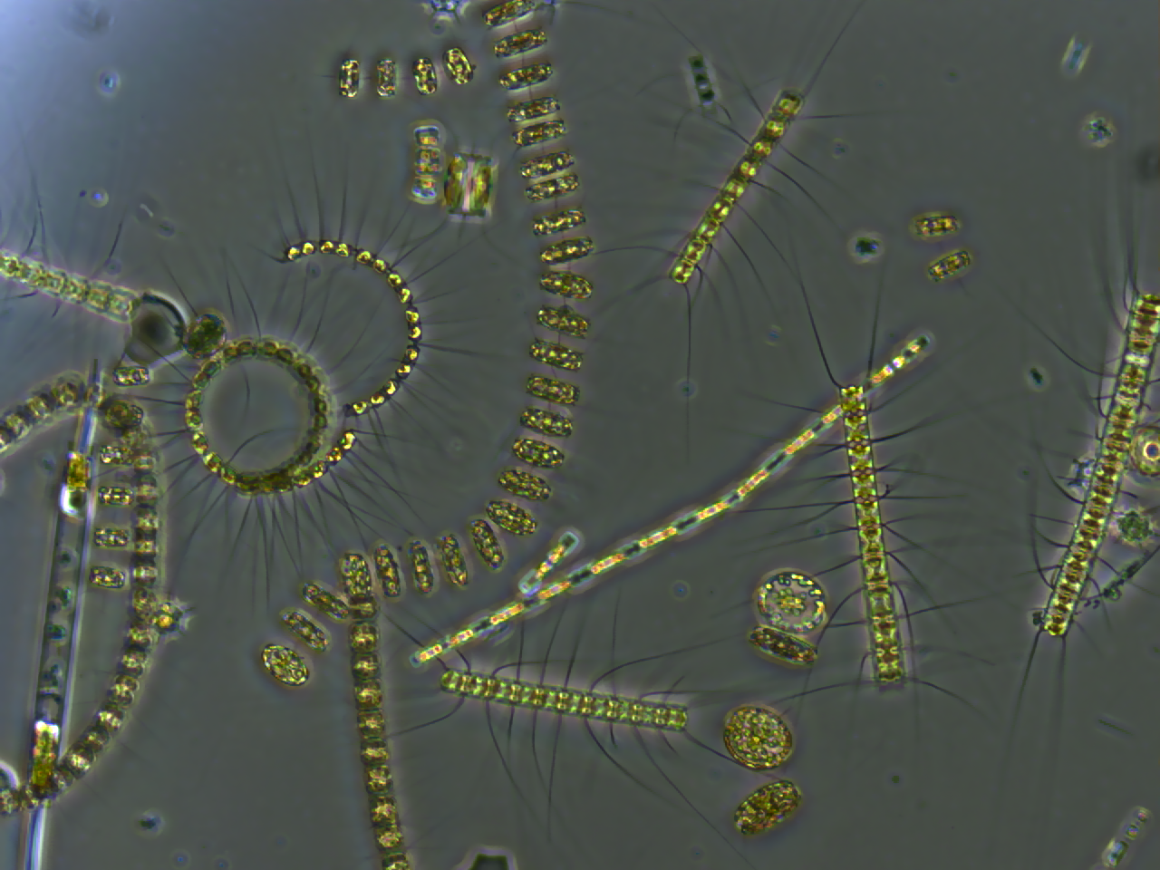
Phytoplankton () are the autotrophic (self-feeding) components of the plankton community and a key part of ocean and freshwater ecosystems. The name comes from the Greek words (), meaning 'plant', and (), meaning 'wanderer' or 'drifter'. Phytoplankton obtain their energy through photosynthesis, as do trees and other plants on land. This means phytoplankton must have light from the sun, so they live in the well-lit surface layers ( euphotic zone) of oceans and lakes. In comparison with terrestrial plants, phytoplankton are distributed over a larger surface area, are exposed to less seasonal variation and have markedly faster turnover rates than trees (days versus decades). As a result, phytoplankton respond rapidly on a global scale to climate variations. Phytoplankton form the base of marine and freshwater food webs and are key players in the global carbon cycle. They account for about half of global photosynthetic activity and at least half of the oxygen production, despi ... [...More Info...] [...Related Items...] OR: [Wikipedia] [Google] [Baidu] |
Ross Sea
The Ross Sea is a deep bay of the Southern Ocean in Antarctica, between Victoria Land and Marie Byrd Land and within the Ross Embayment, and is the southernmost sea on Earth. It derives its name from the British explorer James Clark Ross who visited this area in 1841. To the west of the sea lies Ross Island and Victoria Land, to the east Roosevelt Island and Edward VII Peninsula in Marie Byrd Land, while the southernmost part is covered by the Ross Ice Shelf, and is about from the South Pole. Its boundaries and area have been defined by the New Zealand National Institute of Water and Atmospheric Research as having an area of . The circulation of the Ross Sea is dominated by a wind-driven ocean gyre and the flow is strongly influenced by three submarine ridges that run from southwest to northeast. The circumpolar deep water current is a relatively warm, salty and nutrient-rich water mass that flows onto the continental shelf at certain locations. The Ross Sea is covered with ... [...More Info...] [...Related Items...] OR: [Wikipedia] [Google] [Baidu] |


