|
INSAT-4A
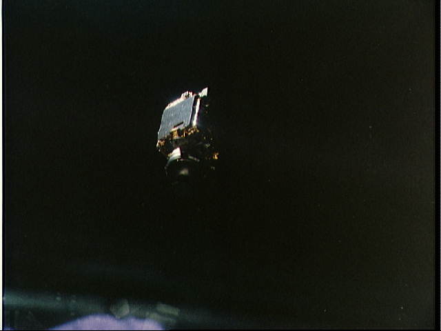
INSAT-4A was the first one in the INSAT-4 Satellites series, providing services in the Ku and C band frequency bands. At the time of launch, it was the heaviest satellite India had produced. The Ku transponders cover the Indian main land and C-Band transponders cover an extended area. It has a dozen Ku transponders and another dozen of C-band transponders. This spacecraft was placed at 83°E along with INSAT-2E and INSAT-3B, by Ariane launch vehicle (ARIANE5-V169). Overview INSAT-4A was a communication satellite intended for providing high quality television, telecommunication, broadcasting services and was the first satellite to be launched in the INSAT-4 series. Launch INSAT-4A was launched by an Ariane 5, produced by Arianespace, on 21 Dec 2005 at 22.33 UTC from Kourou, French Guiana. It was placed into a Geosynchronous Transfer Orbit (GTO), 30 minutes after lift-off in 3-axis stabilized mode, with a perigee of 859 km and an apogee of 36,055 km. Its co-passen ... [...More Info...] [...Related Items...] OR: [Wikipedia] [Google] [Baidu] |
INSAT Satellites
The Indian National Satellite System or INSAT, is a series of multipurpose geostationary satellites launched by ISRO to satisfy the telecommunications, broadcasting, meteorology, and search and rescue operations. Commissioned in 1983, INSAT is the largest domestic communication system in the Indo-Pacific Region. It is a joint venture of the Department of Space, Department of Telecommunications, India Meteorological Department, All India Radio and Doordarshan. The overall coordination and management of INSAT system rests with the Secretary-level INSAT Coordination Committee. INSAT satellites provide transponders in various bands to serve the television and communication needs of India. Some of the satellites also have the Very High Resolution Radiometer (VHRR), CCD cameras for meteorological imaging. The satellites also incorporate transponder(s) for receiving distress alert signals for search and rescue missions in the South Asian and Indian Ocean Region, as ISRO is a member o ... [...More Info...] [...Related Items...] OR: [Wikipedia] [Google] [Baidu] |
INSAT
The Indian National Satellite System or INSAT, is a series of multipurpose geostationary satellites launched by ISRO to satisfy the telecommunications, broadcasting, meteorology, and search and rescue operations. Commissioned in 1983, INSAT is the largest domestic communication system in the Indo-Pacific Region. It is a joint venture of the Department of Space, Department of Telecommunications, India Meteorological Department, All India Radio and Doordarshan. The overall coordination and management of INSAT system rests with the Secretary-level INSAT Coordination Committee. INSAT satellites provide transponders in various bands to serve the television and communication needs of India. Some of the satellites also have the Very High Resolution Radiometer (VHRR), CCD cameras for meteorological imaging. The satellites also incorporate transponder(s) for receiving distress alert signals for search and rescue missions in the South Asian and Indian Ocean Region, as ISRO is a member o ... [...More Info...] [...Related Items...] OR: [Wikipedia] [Google] [Baidu] |
Tata Sky
Tata Play (stylised as TΛTΛ PLΛY, formerly TΛTΛ , sky) is an Indian direct broadcast satellite (DTH) service provider using MPEG-4 digital compression technology, transmitting using INSAT-4A and GSAT-10 satellite. Incorporated in 2005; it currently offers a total of 601 channels, 495 SD channels and 99 HD channels and services, along with many other value added services. As of March 2020, according to TRAI Tata Play serves 22 million subscribers which is 33.37% of total DTH users in India. Tata Play is the largest DTH service provider in India. Tata Play entered into an agreement with French firm Technicolor to supply 4K set top boxes from early 2015. History Tata Sky was an equity strategic alliance in the nature of a joint venture between the Tata Group and 21st Century Fox, which owned 80% and 20% stakes respectively until 2008, when Singapore-based Temasek Holdings picked up a 10% stake in Tata Play from the Tata Group. Tata Sky was incorporated in 2001, but ... [...More Info...] [...Related Items...] OR: [Wikipedia] [Google] [Baidu] |
GSAT-30
GSAT-30 is a telecommunications satellite developed by the Indian Space Research Organisation (ISRO). Mission The satellite's main communication payload is 12 Ku band transponders for covering Indian mainland and islands and 12 C-band transponders for extended coverage over Asia and Australia. The satellite will act as a replacement for the defunct INSAT-4A. The satellite provides advanced telecommunication services to the Indian subcontinent. It is used for Very-small-aperture terminal (VSAT) networks, television uplinks, digital satellite news gathering, Direct-broadcast satellite (DTH) services and other communication systems. This is the 41st communication satellite launched by ISRO and the 24th launch of ISRO satellite by Arianespace. Satellite The satellite is based on ISRO's I-3K bus. It was assembled by a consortium of mid-sized industries led by Alpha Design Technologies Ltd. at ISRO Satellite Integration and Test Establishment at Bengaluru. Launch GSAT-30 sa ... [...More Info...] [...Related Items...] OR: [Wikipedia] [Google] [Baidu] |
I-3K
I-3K or the INSAT 3000 is a satellite bus developed by Indian Space Research Organisation (ISRO), and marketed by Antrix Corporation and New Space India Ltd. It is the standard bus for 3,000-kg class satellites; the 'I' in I-3K stands for INSAT, a group of communication satellites developed and launched by ISRO. The I-3K bus can supply DC power up to 6500 watts, and is suitable for satellites with lift-off mass in range of 3,000-3,400 kg. List of satellites launched using I-3K bus * Eutelsat W2M Afghansat 1 ( Pashto: افغان سټ یو, Persian: افغانست 1), formerly named Eutelsat W2M, Eutelsat 48B, Eutelsat 28B is a telecommunications satellite operated by Afghanistan's Ministry of Communications and Information Technology ... (Now Afghansat 1) * INSAT series ( 4A 4B) * GSAT series ( 8 10 16 15 18 19 17 24 29 30) See also * Comparison of satellite buses References External links I-3K ISRO brochure Indian Space Research Organisa ... [...More Info...] [...Related Items...] OR: [Wikipedia] [Google] [Baidu] |
Ariane 5
Ariane 5 is a European heavy-lift space launch vehicle developed and operated by Arianespace for the European Space Agency (ESA). It is launched from the Centre Spatial Guyanais (CSG) in French Guiana. It has been used to deliver payloads into geostationary transfer orbit (GTO) or low Earth orbit (LEO). The launch vehicle had a streak of 82 consecutive successful launches between 9 April 2003 and 12 December 2017. Since 2014, Ariane 6, a direct successor system, is in development. The system was designed as an expendable launch system by the '' Centre national d'études spatiales'' (CNES), the French government's space agency, in cooperation with various European partners. Despite not being a direct derivative of its predecessor launch vehicle program, it is classified as part of the Ariane rocket family. ArianeGroup is the prime contractor for the manufacturing of the vehicles, leading a multi-country consortium of other European contractors. Ariane 5 was originally int ... [...More Info...] [...Related Items...] OR: [Wikipedia] [Google] [Baidu] |
ELA-3
ELA-3 (french: Ensemble de Lancement Ariane 3, lit=Ariane Launch Complex 3), is a launch pad and associated facilities at the Centre Spatial Guyanais in French Guiana. ELA-3 is operated by Arianespace as part of the expendable launch system for Ariane 5 Ariane 5 is a European heavy-lift space launch vehicle developed and operated by Arianespace for the European Space Agency (ESA). It is launched from the Centre Spatial Guyanais (CSG) in French Guiana. It has been used to deliver payloads in ... launch vehicles. , 114 launches have been carried out from it, the first of which occurred on 4 June 1996. ELA-3 is 21 square kilometres in size. Launch history Scheduled flights References {{Ariane Guiana Space Centre ... [...More Info...] [...Related Items...] OR: [Wikipedia] [Google] [Baidu] |
Perigee
An apsis (; ) is the farthest or nearest point in the orbit of a planetary body about its primary body. For example, the apsides of the Earth are called the aphelion and perihelion. General description There are two apsides in any elliptic orbit. The name for each apsis is created from the prefixes ''ap-'', ''apo-'' (), or ''peri-'' (), each referring to the farthest and closest point to the primary body the affixing necessary suffix that describes the primary body in the orbit. In this case, the suffix for Earth is ''-gee'', so the apsides' names are ''apogee'' and ''perigee''. For the Sun, its suffix is ''-helion'', so the names are ''aphelion'' and ''perihelion''. According to Newton's laws of motion, all periodic orbits are ellipses. The barycenter of the two bodies may lie well within the bigger body—e.g., the Earth–Moon barycenter is about 75% of the way from Earth's center to its surface. If, compared to the larger mass, the smaller mass is negligible (e.g. ... [...More Info...] [...Related Items...] OR: [Wikipedia] [Google] [Baidu] |
Communications Satellites In Geostationary Orbit
Communication (from la, communicare, meaning "to share" or "to be in relation with") is usually defined as the transmission of information. The term may also refer to the message communicated through such transmissions or the field of inquiry studying them. There are many disagreements about its precise definition. John Peters argues that the difficulty of defining communication emerges from the fact that communication is both a universal phenomenon and a specific discipline of institutional academic study. One definitional strategy involves limiting what can be included in the category of communication (for example, requiring a "conscious intent" to persuade). By this logic, one possible definition of communication is the act of developing meaning among entities or groups through the use of sufficiently mutually understood signs, symbols, and semiotic conventions. An important distinction is between verbal communication, which happens through the use of a language, and n ... [...More Info...] [...Related Items...] OR: [Wikipedia] [Google] [Baidu] |
Spacecraft Launched In 2005
A spacecraft is a vehicle or machine designed to fly in outer space. A type of artificial satellite, spacecraft are used for a variety of purposes, including communications, Earth observation, meteorology, navigation, space colonization, planetary exploration, and transportation of humans and cargo. All spacecraft except single-stage-to-orbit vehicles cannot get into space on their own, and require a launch vehicle (carrier rocket). On a sub-orbital spaceflight, a space vehicle enters space and then returns to the surface without having gained sufficient energy or velocity to make a full Earth orbit. For orbital spaceflights, spacecraft enter closed orbits around the Earth or around other celestial bodies. Spacecraft used for human spaceflight carry people on board as crew or passengers from start or on orbit (space stations) only, whereas those used for robotic space missions operate either autonomously or telerobotically. Robotic spacecraft used to support scientific re ... [...More Info...] [...Related Items...] OR: [Wikipedia] [Google] [Baidu] |
EUMETSAT
The European Organization for the Exploitation of Meteorological Satellites (EUMETSAT) is an intergovernmental organisation created through an international convention agreed by a current total of 30 European Member States. EUMETSAT's primary objective is to establish, maintain and exploit European systems of operational meteorological satellites. EUMETSAT is responsible for the launch and operation of the satellites and for delivering satellite data to end-users as well as contributing to the operational monitoring of climate and the detection of global climate changes. The activities of EUMETSAT contribute to a global meteorological satellite observing system coordinated with other space-faring nations. Satellite observations are an essential input to numerical weather prediction systems and also assist the human forecaster in the diagnosis of potentially hazardous weather developments. Of growing importance is the capacity of weather satellites to gather long-term measu ... [...More Info...] [...Related Items...] OR: [Wikipedia] [Google] [Baidu] |


.png)

