|
ICESat-2
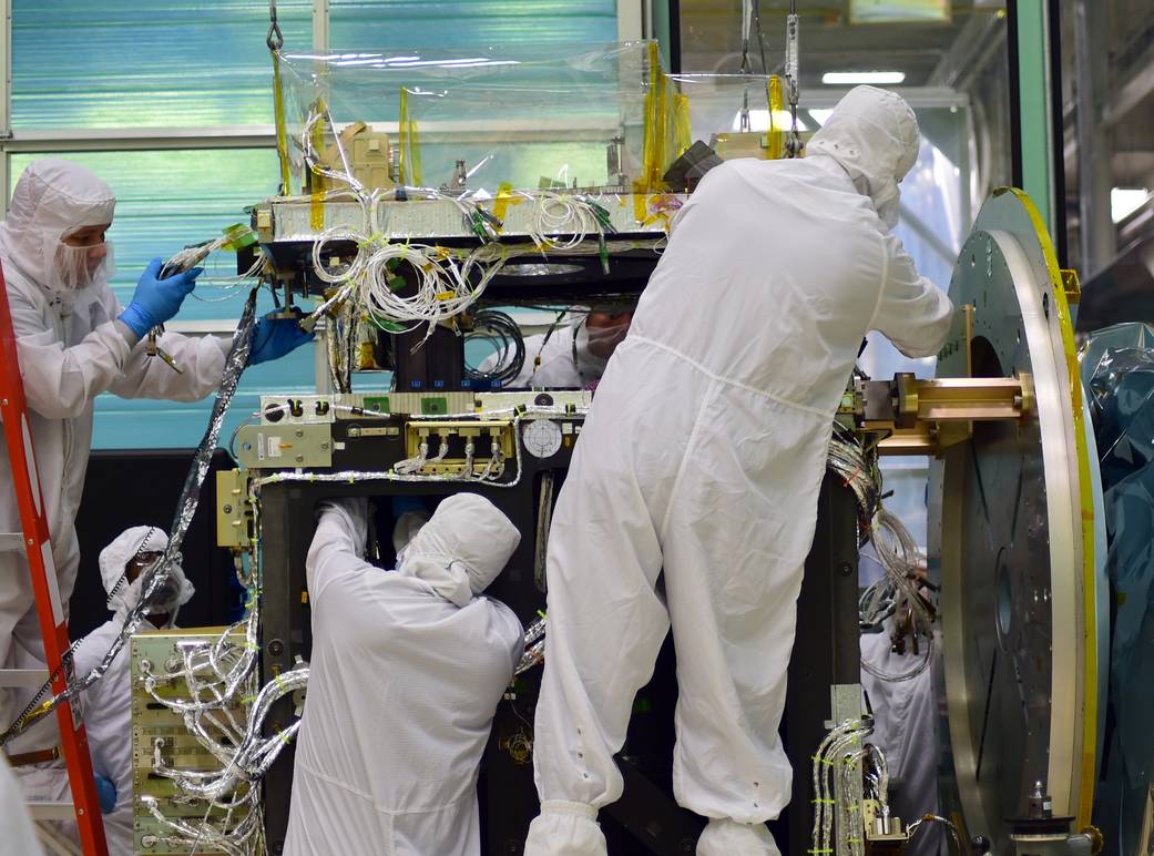
ICESat-2 (Ice, Cloud, and land Elevation Satellite 2), part of NASA's Earth Observing System, is a satellite mission for measuring ice sheet elevation and sea ice thickness, as well as land topography, vegetation characteristics, and clouds. ICESat-2, a follow-on to the ICESat mission, was launched on 15 September 2018 onboard Delta II as the final flight from Vandenberg Air Force Base in California, into a near-circular, near-polar orbit with an altitude of approximately . It was designed to operate for three years and carry enough propellant for seven years. The satellite orbits Earth at a speed of . The ICESat-2 mission was designed to provide elevation data needed to determine ice sheet mass balance as well as vegetation canopy information. For over six years, it has delivered precise topographic data across ice sheets, oceans, land, lakes, reservoirs and cities worldwide, in addition to focused polar coverage. ICESat-2 also has the ability to detect seafloor topography up t ... [...More Info...] [...Related Items...] OR: [Wikipedia] [Google] [Baidu] |
Delta II
Delta II was an expendable launch system, originally designed and built by McDonnell Douglas, and sometimes known as the Thorad Delta 1. Delta II was part of the Delta rocket family, derived directly from the Delta 3000, and entered service in 1989. There were two main variants, the Delta 6000 and Delta 7000, with the latter also having "Light" and "Heavy" subvariants. During its career, Delta II flew several notable payloads, including 24 Global Positioning System (GPS) GPS satellite blocks, Block II satellites, several dozen NASA payloads, and 60 Iridium communication satellites. The rocket flew its final mission, ICESat-2, on 15 September 2018, earning the launch vehicle a streak of 100 successful missions in a row, with the last failure being GPS IIR-1 in 1997. In the late 1990s, Delta II was developed further into the unsuccessful Delta III, which was in turn developed into the more capable and successful Delta IV, though the latter shares little heritage with the original ... [...More Info...] [...Related Items...] OR: [Wikipedia] [Google] [Baidu] |
ICESat
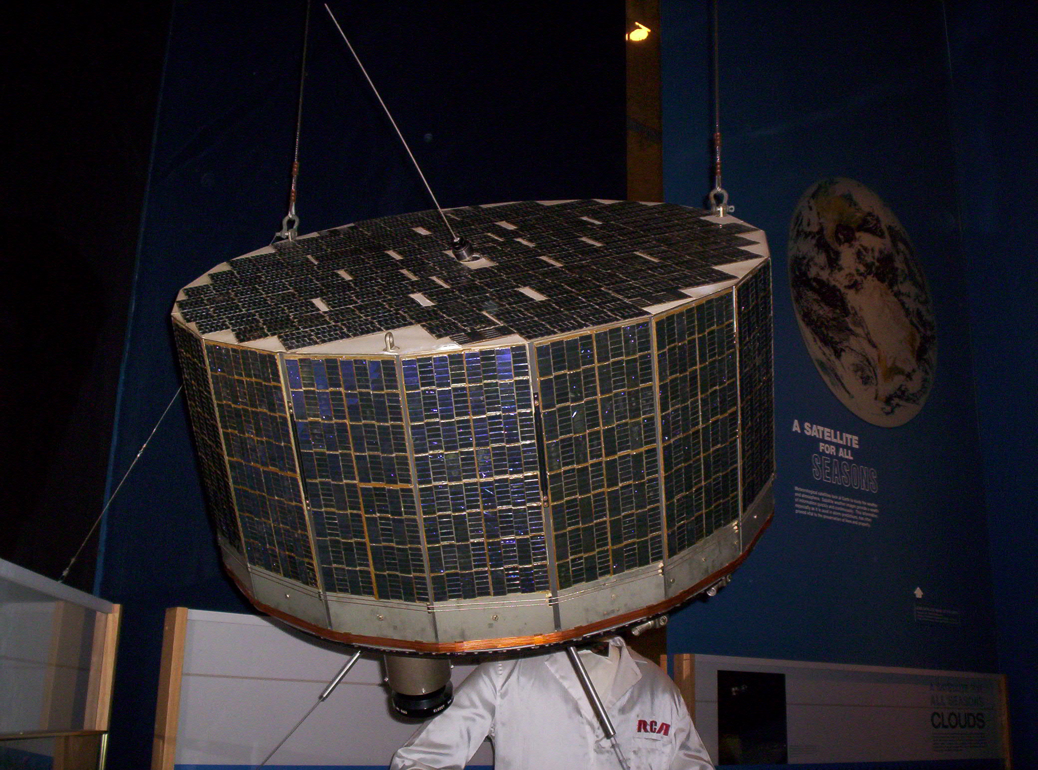
ICESat (Ice, Cloud, and land Elevation Satellite) was a NASA satellite mission for measuring ice sheet mass balance, cloud and aerosol heights, as well as land topography and vegetation characteristics. It operated as part of NASA's Earth Observing System (EOS). ICESat was launched 13 January 2003 on a Delta II launch vehicle from Vandenberg Air Force Base in California into a near-circular, near-polar orbit with an altitude of approximately . It operated for seven years before being retired in February 2010, after its scientific payload shut down and scientists were unable to restart it. The ICESat mission was designed to provide elevation data needed to determine ice sheet mass balance as well as cloud property information, especially for stratospheric clouds common over polar areas. It provides topography and vegetation data around the globe, in addition to the polar-specific coverage over the Greenland and Antarctic ice sheets. The satellite was found useful in assessing im ... [...More Info...] [...Related Items...] OR: [Wikipedia] [Google] [Baidu] |
NASA
The National Aeronautics and Space Administration (NASA ) is an independent agencies of the United States government, independent agency of the federal government of the United States, US federal government responsible for the United States's civil list of government space agencies, space program, aeronautics research and outer space, space research. National Aeronautics and Space Act, Established in 1958, it succeeded the National Advisory Committee for Aeronautics (NACA) to give the American space development effort a distinct civilian orientation, emphasizing peaceful applications in space science. It has since led most of America's space exploration programs, including Project Mercury, Project Gemini, the 1968–1972 Apollo program missions, the Skylab space station, and the Space Shuttle. Currently, NASA supports the International Space Station (ISS) along with the Commercial Crew Program and oversees the development of the Orion (spacecraft), Orion spacecraft and the Sp ... [...More Info...] [...Related Items...] OR: [Wikipedia] [Google] [Baidu] |
Vandenberg AFB Space Launch Complex 2
Space Launch Complex 2 (SLC-2) is an active rocket launch site at Vandenberg Space Force Base, in California, USA. It consists of two launch pads: Space Launch Complex 2 East (SLC-2E, originally LC 75-1-1), used by the PGM-17 Thor missile and several of its derivatives from 1958 to 1972; and Space Launch Complex 2 West (SLC-2W, originally LC 75-1-2), which has been in use since 1959 to launch the Thor-Delta family and Delta II, and is currently used by the Firefly Alpha. Space Launch Complex 2 was originally part of Launch Complex 75 (LC 75) and was known by designation LC 75-1 or just 75-1 (and the launch pads were designated LC 75-1-1 and LC 75–1–2). The first launch out of the newly designated Space Launch Complex 2 was that of a Delta E with ESSA-3 on 2 October 1966 from SLC-2E. SLC-2E and SLC-2W are located approximately apart. SLC-2W Thor and Thor-Agena (1959–1968) Space Launch Complex 2 West (originally Launch Complex 75-1-2) was built in the late 1950s to ... [...More Info...] [...Related Items...] OR: [Wikipedia] [Google] [Baidu] |
United Launch Alliance
United Launch Alliance, LLC (ULA) is an American launch service provider formed in December 2006 as a joint venture between Lockheed Martin Space and Boeing Defense, Space & Security. The company designs, assembles, sells and launches rockets, but the company subcontracts out the production of rocket engines and solid rocket boosters. When founded, the company inherited the Atlas rocket family from Lockheed Martin and the Delta rocket family from Boeing. As of 2024, the Delta family has been retired and the Atlas V is in the process of being retired. ULA began development of the Vulcan Centaur in 2014 as replacement for both the Atlas and Delta rocket families. The Vulcan Centaur completed its maiden flight in January 2024. The primary customers of ULA are the Department of Defense (DoD) and NASA, but it also serves commercial clients. Company history Formation Boeing and Lockheed Martin announced on 2 May 2005 that they would establish a 50/50 joint venture, United L ... [...More Info...] [...Related Items...] OR: [Wikipedia] [Google] [Baidu] |
Orbital Sciences
Orbital Sciences Corporation (commonly referred to as Orbital) was an American company specializing in the design, manufacture, and launch of small- and medium- class space and launch vehicle systems for commercial, military and other government customers. In 2014, Orbital merged with Alliant Techsystems (ATK) to create a new company called Orbital ATK, which in turn was purchased by Northrop Grumman in 2018. Orbital was headquartered in Dulles, Virginia and publicly traded on the New York Stock Exchange with the ticker symbol ORB. Orbital's primary products were satellites and launch vehicles, including low Earth orbit (LEO), geosynchronous Earth orbit and planetary spacecraft for communications, remote sensing, scientific and defense missions; ground- and air-launched launch vehicles that delivered satellites into orbit; missile defense systems that were used as interceptor and target vehicles; and human-rated space systems for Earth orbit, lunar and other missions. Orbital ... [...More Info...] [...Related Items...] OR: [Wikipedia] [Google] [Baidu] |
Earth Observing System
The Earth Observing System (EOS) is a program of NASA comprising a series of artificial satellite missions and scientific instruments in Earth orbit designed for long-term global observations of the land surface, biosphere, earth's atmosphere, atmosphere, and oceans. Since the early 1970s, NASA has been developing its Earth Observing System, launching a series of Landsat program, Landsat satellites in the decade. Some of the first included Passive microwave sensor, passive microwave imaging in 1972 through the Nimbus 5 satellite. Following the launch of various satellite missions, the conception of the program began in the late 1980s and expanded rapidly through the 1990s. Since the inception of the program, it has continued to develop, including; land, sea, radiation and atmosphere. Collected in a system known as EOSDIS, NASA uses this data in order to study the progression and changes in the biosphere of Earth. The main focus of this data collection surrounds climatic science. Th ... [...More Info...] [...Related Items...] OR: [Wikipedia] [Google] [Baidu] |
Orbital ATK
Orbital ATK Inc. was an American aerospace manufacturer and defense industry company. It was formed in February 9, 2015 from the merger of Orbital Sciences Corporation and parts of Alliant Techsystems (ATK). Orbital ATK designed, built, and delivered rocket engines, military vehicles, firearms, autocannons, missiles, ammunition, precision-guided munitions, satellites, missile approach warning systems, launch vehicles and spacecraft. The company was acquired by Northrop Grumman on June 6, 2018. The former Orbital ATK operations were renamed Northrop Grumman Innovation Systems and operated as a division until January 1, 2020 when a reorganization merged the operations into the company's other divisions. History A merger of Orbital Sciences Corporation and the defense and aerospace divisions of Alliant Techsystems (ATK) was announced on April 29, 2014. The two companies had collaborated on several previous projects, including the use of 400 ATK rocket motors in Orbital's laun ... [...More Info...] [...Related Items...] OR: [Wikipedia] [Google] [Baidu] |
Northrop Grumman Innovation Systems
Orbital ATK Inc. was an American aerospace manufacturer and defense industry company. It was formed in February 9, 2015 from the merger of Orbital Sciences Corporation and parts of Alliant Techsystems (ATK). Orbital ATK designed, built, and delivered rocket engines, military vehicles, firearms, autocannons, missiles, ammunition, precision-guided munitions, satellites, missile approach warning systems, launch vehicles and spacecraft. The company was acquired by Northrop Grumman on June 6, 2018. The former Orbital ATK operations were renamed Northrop Grumman Innovation Systems and operated as a division until January 1, 2020 when a reorganization merged the operations into the company's other divisions. History A merger of Orbital Sciences Corporation and the defense and aerospace divisions of Alliant Techsystems (ATK) was announced on April 29, 2014. The two companies had collaborated on several previous projects, including the use of 400 ATK rocket motors in Orbital's launch v ... [...More Info...] [...Related Items...] OR: [Wikipedia] [Google] [Baidu] |
Remote Sensing
Remote sensing is the acquisition of information about an physical object, object or phenomenon without making physical contact with the object, in contrast to in situ or on-site observation. The term is applied especially to acquiring information about Earth and other planets. Remote sensing is used in numerous fields, including geophysics, geography, land surveying and most Earth science disciplines (e.g. exploration geophysics, hydrology, ecology, meteorology, oceanography, glaciology, geology). It also has military, intelligence, commercial, economic, planning, and humanitarian applications, among others. In current usage, the term ''remote sensing'' generally refers to the use of satellite- or airborne-based sensor technologies to detect and classify objects on Earth. It includes the surface and the atmosphere and oceans, based on wave propagation, propagated signals (e.g. electromagnetic radiation). It may be split into "active" remote sensing (when a signal is emitted b ... [...More Info...] [...Related Items...] OR: [Wikipedia] [Google] [Baidu] |
Goddard Space Flight Center
The Goddard Space Flight Center (GSFC) is a major NASA space research laboratory located approximately northeast of Washington, D.C., in Greenbelt, Maryland, United States. Established on May 1, 1959, as NASA's first space flight center, GSFC employs about 10,000 civil servants and contractors. Named for American rocket propulsion pioneer Robert H. Goddard, it is one of ten major NASA field centers. GSFC is partially within the former Goddard, Maryland, Goddard census-designated place; it has a Greenbelt, Maryland, Greenbelt mailing address.CENSUS 2000 BLOCK MAP: GODDARD CDP (PDF). U.S. Census Bureau. Retrieved September 1, 2018. 1990 Census map of Prince George's County [...More Info...] [...Related Items...] OR: [Wikipedia] [Google] [Baidu] |


