|
Hydrographers Cove
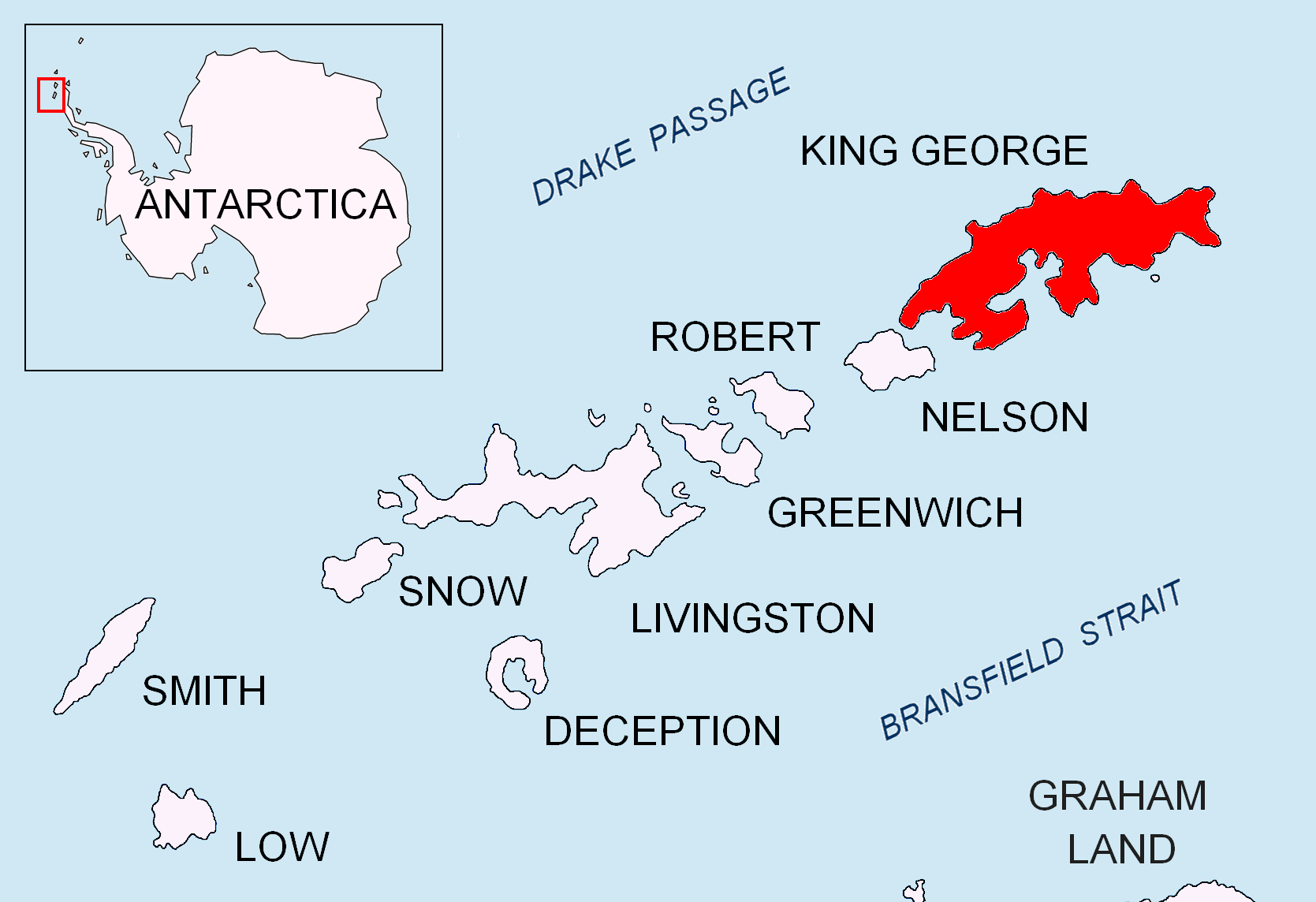
Hydrographers Cove () is a cove between the southwest side of Ardley Island and Fildes Peninsula, King George Island, in the South Shetland Islands The South Shetland Islands are a group of List of Antarctic and subantarctic islands, Antarctic islands located in the Drake Passage with a total area of . They lie about north of the Antarctic Peninsula, and between southwest of the n .... The approved name is a translation of the Russian "Bukhta Gidrografov" (bay of the hydrographers), applied in 1968 following Soviet Antarctic Expedition surveys from Bellingshausen Station. References Coves of Antarctica {{KingGeorgeIslandAQ-geo-stub ... [...More Info...] [...Related Items...] OR: [Wikipedia] [Google] [Baidu] |
Cove
A cove is a small bay or coastal inlet. They usually have narrow, restricted entrances, are often circular or oval, and are often situated within a larger bay. Small, narrow, sheltered bays, inlets, creek (tidal), creeks, or recesses in a coast are often considered coves. Colloquially, the term can be used to describe a sheltered bay. Geomorphology describes coves as precipitously walled and rounded cirque-like openings like a valley extending into or down a mountainside, or in a hollow or nook of a cliff or steep mountainside. A cove can also refer to a corner, nook, or cranny, either in a river, road, or wall, especially where the wall meets the floor. Formation Coves are formed by differential erosion, which occurs when softer rocks are worn away faster than the harder rocks surrounding them. These rocks further erode to form a circular bay with a narrow entrance, called a ''cove''. Another way is that waves can transport rocks and sediment towards cliffs or rock faces, whic ... [...More Info...] [...Related Items...] OR: [Wikipedia] [Google] [Baidu] |
Ardley Island
Ardley Island is an island long, lying in Maxwell Bay close off the south-west end of King George Island, in the South Shetland Islands of Antarctica. It was charted as a peninsula in 1935 by Discovery Investigations personnel of the '' Discovery II'' and named for Lieutenant R.A.B. Ardley, Royal Naval Reserve, an officer on the ship in 1929–31 and 1931–33. Aerial photography has since shown that the feature is an island with Braillard Point being the headland forming the northeast end of Ardley Island. It has been designated an Antarctic Specially Protected Area (ASPA 150) because of the importance of its seabird colonies. Birds The island has been identified as an Important Bird Area by BirdLife International because it supports a breeding colony of about 4,600 pairs of gentoo penguins, as well as smaller numbers of Adélie and chinstrap penguins, southern giant petrels, Wilson's and black-bellied storm petrels, Cape petrels, brown and south polar skuas, and Antarc ... [...More Info...] [...Related Items...] OR: [Wikipedia] [Google] [Baidu] |
Fildes Peninsula
The Fildes Peninsula is a long peninsula that forms the south-western end of King George Island (South Shetland Islands), King George Island in the South Shetland Islands of Antarctica. It was named from association with nearby Fildes Strait by the UK Antarctic Place-Names Committee in 1960; the strait was likely named for Robert Fildes, a British sealer of the 1800s. Description The peninsula is the most extensively snow-free coastal area in summer on the island, most of which is permanently covered by ice. Its southeastern end is a point called Halfthree Point. It was charted and named by Discovery Investigations personnel on the ''RRS Discovery II, Discovery II'' in 1935. It is part of the Fildes Peninsula Antarctic Specially Protected Area (ASPA 125), designated as such because of its Paleontology, paleontological values. It is separated at its tip from Nelson Island (South Shetland Islands), Nelson Island by Fildes Strait, only 370 m wide at its narrowest. It is boun ... [...More Info...] [...Related Items...] OR: [Wikipedia] [Google] [Baidu] |
King George Island (South Shetland Islands)
King George Island (Argentinian Spanish: Isla 25 de Mayo, Chilean Spanish: Isla Rey Jorge, Russian: Ватерло́о Vaterloo) is the largest of the South Shetland Islands, lying off the coast of Antarctica in the Southern Ocean. The island was named after George III of the United Kingdom, King George III. Geography King George island has three major bays, Maxwell Bay (Antarctica), Maxwell Bay, Admiralty Bay (South Shetland Islands), Admiralty Bay, and King George Bay (Antarctica), King George Bay. Admiralty Bay contains three fjords, and is protected as an Antarctic Specially Managed Area under the Protocol on Environmental Protection to the Antarctic Treaty. The Fildes Peninsula, long, forms the SW extremity of the island. It was named from association with nearby Fildes Strait by the UK-APC in 1960. History Chilean scientists have claimed that Amerind peoples, Amerinds visited the area, citing stone artifacts recovered from bottom-sampling operations in Admiralty Bay ... [...More Info...] [...Related Items...] OR: [Wikipedia] [Google] [Baidu] |
South Shetland Islands
The South Shetland Islands are a group of List of Antarctic and subantarctic islands, Antarctic islands located in the Drake Passage with a total area of . They lie about north of the Antarctic Peninsula, and between southwest of the nearest point of the South Orkney Islands. By the Antarctic Treaty System, Antarctic Treaty of 1959, the islands' sovereignty is neither recognized nor disputed by the signatories. According to British government language on the topic, "the whole of Antarctica is protected in the interests of peace and science." The islands have been claimed by three countries, beginning with the United Kingdom since 1908 (since 1962 as part of the equally unrecognized British Antarctic Territory). The islands are also claimed by the governments of Chile (since 1940, as part of the Antártica Chilena province), and by Argentina (since 1943, as part of Argentine Antarctica, Tierra del Fuego Province, Argentina, Tierra del Fuego Province). Several countries ... [...More Info...] [...Related Items...] OR: [Wikipedia] [Google] [Baidu] |
Soviet Antarctic Expedition
The Soviet Antarctic Expedition (SAE or SovAE) (, ''Sovetskaya antarkticheskaya ekspeditsiya'') was part of the Arctic and Antarctic Research Institute of the Soviet Committee on Antarctic Research of the Academy of Sciences of the USSR. It was succeeded by the Russian Antarctic Expedition. The Soviet Union's Ministry of Sea Transport was responsible for the administration, logistics and supply of the expeditions. The first Soviet contact with Antarctica was in January 1947 when the Slava whaling flotilla began whaling in Antarctic waters. Stations The first Soviet Antarctic station, '' Mirny'', was established near the coast on February 13, 1956. In December 1957 another station, '' Vostok,'' was built inland near the South geomagnetic pole. Year-round stations * Mirny (established February 13, 1956) * Vostok (established December 16, 1957) * Novolazarevskaya (established January 18, 1961) * Molodyozhnaya (established January 14, 1963) * Bellingshausen (established Fe ... [...More Info...] [...Related Items...] OR: [Wikipedia] [Google] [Baidu] |
Bellingshausen Station
Bellingshausen Station () is a Russian Antarctic station at Collins Harbour, on King George Island of the South Shetland Islands. It was one of the first research stations founded by the Soviet Antarctic Expedition in 1968. It is also the location of Trinity Church, the only permanently staffed Eastern Orthodox church in Antarctica. The station is connected by unimproved roads to the nearby stations: Chilean Base Presidente Eduardo Frei Montalva, Chinese Great Wall Station, and Uruguayan Artigas Base. It is antipodal to a location in Russian Siberia, ~ west from Yakutsk. History The station is named for the 19th-century Russian explorer of the Antarctic Fabian von Bellingshausen. In October 2018, it was the site of the first attempted murder in Antarctica. Climate The Antarctic Peninsula and its nearby islands are considered to have the mildest living conditions in Antarctica. Bellingshausen Station's climate is strongly influenced by the surrounding ocean. Under the ... [...More Info...] [...Related Items...] OR: [Wikipedia] [Google] [Baidu] |


