|
Hveravellir
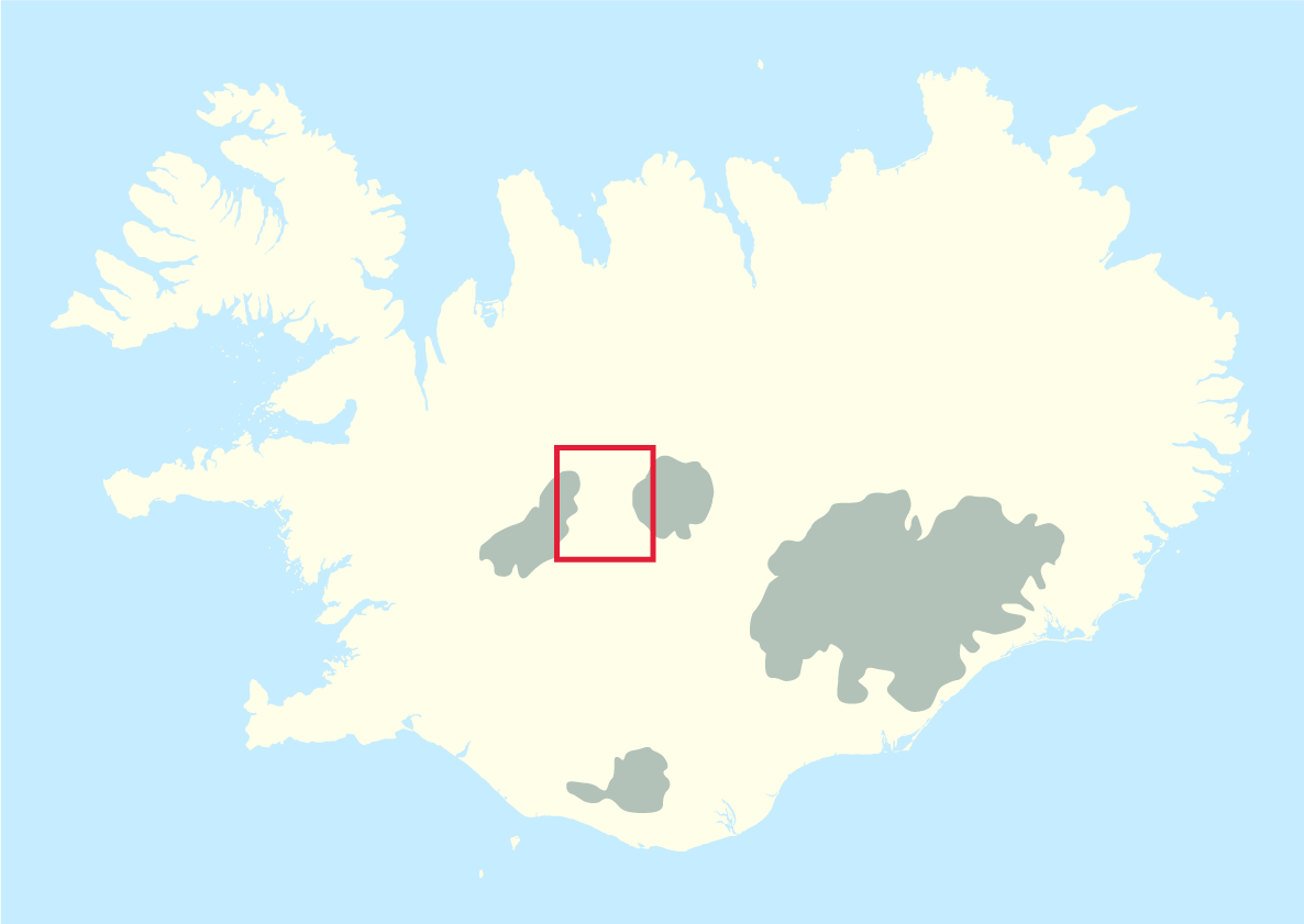
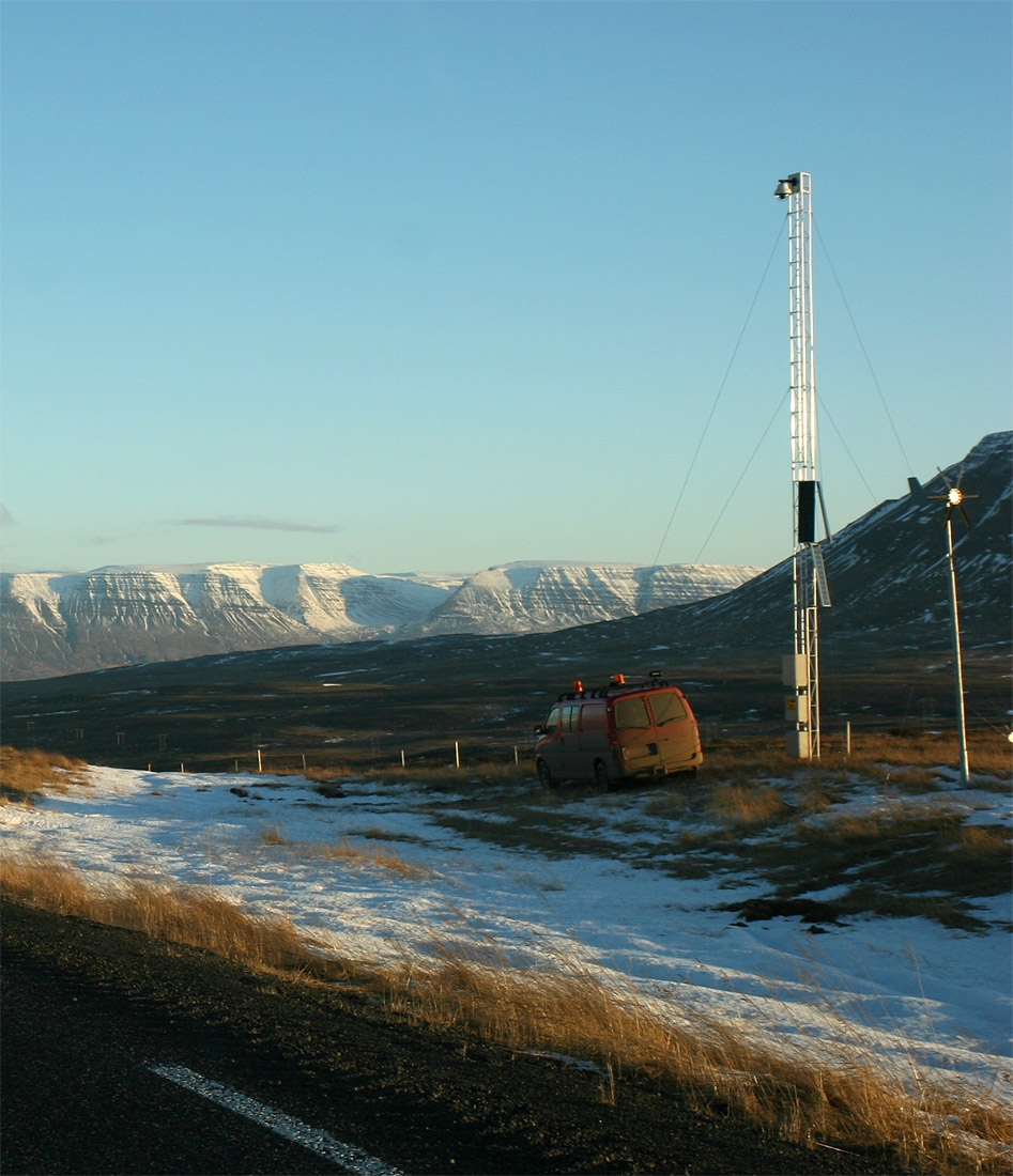
Hveravellir () is a geothermal field (high temperature field) of the Oddnýjarhnjúkur-Langjökull subglacial volcanic system in the north of Langjökull glacier. Description Hveravellir geothermal area is a small nature reserve and a tourist centre located in 600 m a.s.l. at the Kjölur mountain route between the glaciers Hofsjökull and Langjökull, Central Iceland. It is part of the Oddnýjarhnjúkur-Langjökull volcanic system. The place has been a popular resting place in highland travels since the age of settlement, 1100-1200 years ago. It is frequently mentioned in the old sagas, annals and folklore. Refuge huts have been situated there from the early beginning. The main geothermal activity is at the northern border of the large lava shield Kjalhraun . The main geothermal area covers around 2.5 km². The hot springs are of various types, geysers, fumaroles, solfataras, boiling pits and warm springs with lower temperatures. The currently active geysers only have small ... [...More Info...] [...Related Items...] OR: [Wikipedia] [Google] [Baidu] |
Kjölur
Kjölur () is a plateau in the highlands of Iceland, roughly defined as the area between the Langjökull and Hofsjökull glaciers. It lies at an elevation of about 600–700 metres. Geography At the northern end of the Kjölur road, near the headwaters of the Blanda river, the hot springs of Hveravellir provide a warm oasis. Not far from Hveravellir, the Kerlingarfjöll, a volcanic mountain range, is situated to the north-east of the Kjölur road. History Like Sprengisandur highland road, the area was probably known since the first times of Icelandic settlement and is mentioned in the Icelandic sagas. A track along Langjökull was used as a shortcut between regions during summer. This is today known as ''Kjalvegur hinn forni'' (Old Kjalvegur) and is still in use for trekking and horse-riding. Piles of stones mark the track through the highland desert. After some people had perished in a snowstorm by the end of the 18th century, the Kjölur road was forgotten for about 100 ye ... [...More Info...] [...Related Items...] OR: [Wikipedia] [Google] [Baidu] |
Langjökull
Langjökull (, Icelandic for "long glacier") is the second largest ice cap in Iceland (953 km2), after Vatnajökull. It is situated in the west of the Icelandic interior or Highlands of Iceland and can be seen clearly from Haukadalur. Its volume is 195 km³ and the ice is up to thick. The highest point of the ice cap (at ''Baldjökull'' at the northern end of Langjökull) is about above sea level. In the past, the largest recorded surface area was in 1840. Situation and form The glacier is roughly parallel to the direction of the country's active volcanic zone: north-east to south-west. It is about long and wide, and has a slightly narrower point roughly between the lake Hvítárvatn on the Kjölur mountain road to the east and the Þrístapajökull glacier to the west, near another smaller glacier, Eiríksjökull, which is not quite connected to Langjökull. It is the nearest large glacier to Reykjavík. The area of the glacier includes some mountains, e.g. ... [...More Info...] [...Related Items...] OR: [Wikipedia] [Google] [Baidu] |
List Of Volcanoes In Iceland
This list of volcanoes in Iceland includes active and dormant volcanic mountains, of which 18 have erupted since human settlement of Iceland began around 900 AD. __TOC__ List Volcanic zones and systems Iceland has four major volcanic zones surrounding an hypothetical hotspot: * the Reykjanes zone (RVZ), subdivided into the Reykjanes Ridge (RR) (the Mid-Atlantic Ridge South of Iceland) and the Reykjanes Volcanic Belt (RVB) (on the main island); * the West Volcanic Zone (WVZ); * the East Volcanic Zone (EVZ) (extended to the Westman Islands, South of the main island); * the North Volcanic Zone (NVZ). The Mid-Iceland Belt (MIB) connects them across central Iceland. In Iceland's East Volcanic Zone (EVZ), the central volcanoes, Vonarskarð and Hágöngur belong to the same volcanic system; this also applies to Bárðarbunga and Hamarinn, and to Grímsvötn and Þórðarhyrna. North of Iceland, the Mid-Atlantic Ridge is called Kolbeinsey Ridge (KR) and is connected to ... [...More Info...] [...Related Items...] OR: [Wikipedia] [Google] [Baidu] |
Húnavatnshreppur
Húnavatnshreppur () is a former rural municipality located in northwestern Iceland. History The municipality was formed on 1 January 2006 by the union of the former municipalities of Sveinsstaðahreppur , Torfalækjarhreppur , Svínavatnshreppur and Bólstaðarhlíðarhreppur . In 2022, the municipality merged with Blönduós to form Húnabyggð. Geography Húnavatn is one of the largest Icelandic municipalities. Its southern borders touch the glaciers of Hofsjökull and Langjökull. In the south are situated also the hot springs in Hveravellir Hveravellir () is a geothermal field (high temperature field) of the Oddnýjarhnjúkur-Langjökull subglacial volcanic system in the north of Langjökull glacier. Description Hveravellir geothermal area is a small nature reserve and a tourist c .... References External links Official website Former municipalities of Iceland Northwestern Region (Iceland) States and territories disestablished in 2022 {{Iceland ... [...More Info...] [...Related Items...] OR: [Wikipedia] [Google] [Baidu] |
Geyserite
Geyserite, or siliceous sinter, is a form of opaline silica that is often found as crusts or layers around hot springs and geysers. Botryoidal geyserite is known as fiorite. Geyserite is porous due to the silica enclosing many small cavities. Siliceous sinter should not be confused with calcareous sinter, which is made of calcium carbonate. In May 2017, evidence of the earliest known life on land may have been found in 3.48-billion-year-old geyserite uncovered in the Pilbara Craton of Western Australia. See also * * * * Timeline of the evolutionary history of life The timeline of the evolutionary history of life represents the current scientific theory outlining the major events during the development of life on planet Earth. Dates in this article are consensus estimates based on scientific evidence, mai ... References External links Mindat with location data Geysers Opals Sedimentary rocks {{mineral-stub ... [...More Info...] [...Related Items...] OR: [Wikipedia] [Google] [Baidu] |
Icelandic Meteorological Office
Icelandic Meteorological Office (IMO; is, Veðurstofa Íslands) is Iceland's national weather service and as such a government agency under the Ministry of Environment and Natural Resources. It is also active in volcano monitoring, esp. volcano seismology, and, together with other institutions, responsible for civil protection in IcelandMission. About the Icelandic Meteorological Office. (28.5.2010) Retrieved 18 August 2020. Aims and functions "The research focus of IMO is on and ,[...More Info...] [...Related Items...] OR: [Wikipedia] [Google] [Baidu] |
Tourist Attraction
A tourist attraction is a place of interest that tourists visit, typically for its inherent or an exhibited natural or cultural value, historical significance, natural or built beauty, offering leisure and amusement. Types Places of natural beauty such as beaches, tropical island resorts, national parks, mountains, deserts and forests, are examples of traditional tourist attractions which people may visit. Cultural tourist attractions can include historical places, sites of significant historic event, monuments, ancient temples, zoos, aquaria, museums and art galleries, botanical gardens, buildings and structures (such as forts, castles, libraries, former prisons, skyscrapers, bridges), theme parks and carnivals, living history museums, public art ( sculptures, statues, murals), ethnic enclave communities, historic trains and cultural events. Factory tours, industrial heritage, creative art and crafts workshops are the object of cultural niches like industri ... [...More Info...] [...Related Items...] OR: [Wikipedia] [Google] [Baidu] |
Bjarni Pálsson
Bjarni Pálsson (17 May 1719 - 8 September 1779) was an Icelandic doctor and naturalist. On 18 March 1760 he was named the first Director of Health in Iceland. Life Bjarni was born in Upsum at Eyjafjörður to Páll Bjarnason and Sigríður Ásmundsdóttir. From 1752 to 1757 he traveled around the country with his friend Eggert Ólafsson Eggert Ólafsson (1 December 1726 – 30 May 1768) was an Icelandic explorer, writer and conservator of the Icelandic language. He also worked to revive the Icelandic culture and economy. Background He was the son of a farmer from Svefneyjar i ... on a grant from the Danish state. A book that they subsequently wrote about the trip was published in 1772 under the title ''Journey through Iceland''. It is a comprehensive representation of the country and its population at that time. The book was translated into German, French and English in the 19th century, but was not published until 1943 in Icelandic under the title Ferðabók Eggerts og ... [...More Info...] [...Related Items...] OR: [Wikipedia] [Google] [Baidu] |
Eggert Ólafsson
Eggert Ólafsson (1 December 1726 – 30 May 1768) was an Icelandic explorer, writer and conservator of the Icelandic language. He also worked to revive the Icelandic culture and economy. Background He was the son of a farmer from Svefneyjar in Breiðafjörður. He studied natural sciences, Classics, Grammar, Law, and Agriculture at the University of Copenhagen. He obtained a bachelor's degree from the University of Copenhagen. In 1772 he posthumously published ''Reise igiennem Island'' (Travels in Iceland), an account of the scientific and cultural survey he conducted between 1752 and 1757. The book remains a seminal work on Iceland and its people. Eggert wrote on a wide range of topics. His writing has made him known for his pro-conservation stance on the Icelandic language, which has undergone significant change since the 18th century. Eggert was a devout patriot, and his literary works, chiefly his poems, burn with this fervor. He used his writings to stir up patriotism ... [...More Info...] [...Related Items...] OR: [Wikipedia] [Google] [Baidu] |
Solfatara
A fumarole (or fumerole) is a vent in the surface of the Earth or other rocky planet from which hot volcanic gases and vapors are emitted, without any accompanying liquids or solids. Fumaroles are characteristic of the late stages of volcanic activity, but fumarole activity can also precede a volcanic eruption and has been used for eruption prediction. Most fumaroles die down within a few days or weeks of the end of an eruption, but a few are persistent, lasting for decades or longer. An area containing fumaroles is known as a fumarole field. The predominant vapor emitted by fumaroles is steam, formed by the circulation of groundwater through heated rock. This is typically accompanied by volcanic gases given off by magma cooling deep below the surface. These volcanic gases include sulfur compounds, such as various sulfur oxides and hydrogen sulfide, and sometimes hydrogen chloride, hydrogen fluoride, and other gases. A fumarole that emits significant sulfur compounds is som ... [...More Info...] [...Related Items...] OR: [Wikipedia] [Google] [Baidu] |
Siliceous Sinter
Geyserite, or siliceous sinter, is a form of opaline silica that is often found as crusts or layers around hot springs and geyser A geyser (, ) is a spring characterized by an intermittent discharge of water ejected turbulently and accompanied by steam. As a fairly rare phenomenon, the formation of geysers is due to particular hydrogeological conditions that exist only in ...s. Botryoidal geyserite is known as fiorite. Geyserite is porous due to the silica enclosing many small cavities. Siliceous sinter should not be confused with calcareous sinter, which is made of calcium carbonate. In May 2017, evidence of the earliest known life on land may have been found in 3.48-billion-year-old geyserite uncovered in the Pilbara Craton of Western Australia. See also * * * * Timeline of the evolutionary history of life References External links Mindat with location data Geysers Opals Sedimentary rocks {{mineral-stub ... [...More Info...] [...Related Items...] OR: [Wikipedia] [Google] [Baidu] |


.jpg)