|
Hurricane Nora (2021)
Hurricane Nora was a large tropical cyclone that caused significant damage across the Pacific Coast of Mexico in late August 2021. The fourteenth named storm and fifth hurricane of the 2021 Pacific hurricane season, Nora was first monitored by the National Hurricane Center (NHC) as an area of low pressure near the coast of Mexico. On August 24, the low organized into tropical depression, but struggled to develop further due to wind shear in its surrounding environment. The depression eventually intensified into a tropical storm and was named ''Nora'' as it tracked to the west-northwest. Nora peaked as a strong Category 1 hurricane with maximum sustained winds of on August 28. The storm then grazed the west coast of Mexico and made landfall two separate times, first in the state of Jalisco, followed by neighboring Nayarit. Nora weakened as it interacted with land, dissipating on August 30 just inland of the Mexican coast. Nora caused extensive and destructive flooding as the cycl ... [...More Info...] [...Related Items...] OR: [Wikipedia] [Google] [Baidu] |
Mexico
Mexico, officially the United Mexican States, is a country in North America. It is the northernmost country in Latin America, and borders the United States to the north, and Guatemala and Belize to the southeast; while having maritime boundary, maritime boundaries with the Pacific Ocean to the west, the Caribbean Sea to the southeast, and the Gulf of Mexico to the east. Mexico covers 1,972,550 km2 (761,610 sq mi), and is the List of countries by area, thirteenth-largest country in the world by land area. With a population exceeding 130 million, Mexico is the List of countries by population, tenth-most populous country in the world and is home to the Hispanophone#Countries, largest number of native Spanish speakers. Mexico City is the capital and List of cities in Mexico, largest city, which ranks among the List of cities by population, most populous metropolitan areas in the world. Human presence in Mexico dates back to at least 8,000 BC. Mesoamerica, considered a cradle ... [...More Info...] [...Related Items...] OR: [Wikipedia] [Google] [Baidu] |
Sea Surface Temperature
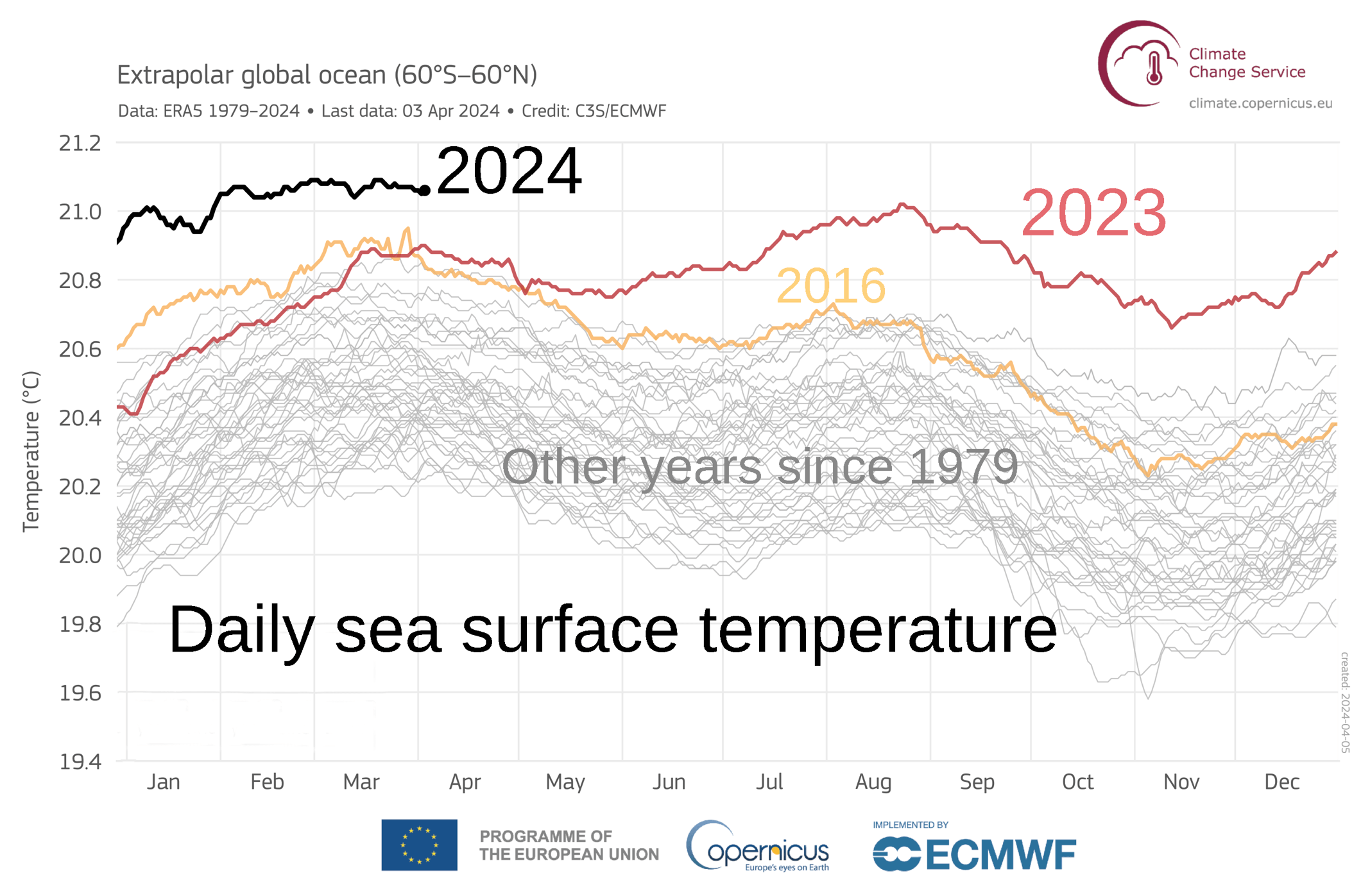
Sea surface temperature (or ocean surface temperature) is the ocean temperature, temperature of ocean water close to the surface. The exact meaning of ''surface'' varies in the literature and in practice. It is usually between and below the sea surface. Sea surface temperatures greatly modify air masses in the Atmosphere of Earth, Earth's atmosphere within a short distance of the shore. The thermohaline circulation has a major impact on average sea surface temperature throughout most of the world's oceans. Warm sea surface temperatures can develop and Tropical cyclogenesis, strengthen cyclones over the ocean. Tropical cyclones can also cause a cool wake. This is due to turbulent mixing of the upper of the ocean. Sea surface temperature changes during the day. This is like the air above it, but to a lesser degree. There is less variation in sea surface temperature on breezy days than on calm days. Coastal sea surface temperatures can cause offshore winds to generate upwelling ... [...More Info...] [...Related Items...] OR: [Wikipedia] [Google] [Baidu] |
Servicio Meteorológico Nacional (Mexico)
The Servicio Meteorológico Nacional (SMN; "National Meteorological Service") is Mexico's national weather organization. It collects data and issues forecasts, advisories, and warnings for the entire country. History A presidential decree founded El Observatorio Meteorológico y Astrónomico de México (The Meteorological and Astronomical Observatory of Mexico) on February 6, 1877 as part of the Geographic Exploring of the National Territory commission. By 1880, it became an independent agency located at Chapultepec Castle, then encompassing six observatories. In 1901, the Servicio Meteorologia Nacional was formed with 31 sections for each state and 18 independent observatories which reported back to the central office in Tacubaya via telegraph. It joined the World Meteorological Organization in 1947. By 1980, the organization included 72 observatories, of which eight launched weather balloons and radiosondes, and five radars serviced the country. In 1989, it became a subagency ... [...More Info...] [...Related Items...] OR: [Wikipedia] [Google] [Baidu] |
La Paz, Baja California Sur
La Paz (, ) is the capital and largest city of the Mexico, Mexican States of Mexico, state of Baja California Sur, with a 2020 census population of 250,141 inhabitants, making it the most populous city in the state. La Paz City is located in La Paz Municipality, Baja California Sur, La Paz Municipality—the fourth-largest Municipalities of Mexico, municipality in Mexico, by area and populace (with a reported 292,241 inhabitants), covering an area of . For air travelers, La Paz is served by Manuel Márquez de León International Airport, with connecting flights to some of Mexico's main cities (Guadalajara, Mexico City, Monterrey, León, Guanajuato, Tijuana), as well as other destinations across the north-northwest of the country (including Chihuahua City, Ciudad Juárez, Ciudad Obregón, Culiacán, Hermosillo, Mazatlán and Querétaro, among others). Seasonal services to American Airlines hubs Dallas, Texas, and Phoenix, Arizona, are also provided. Additionally, two ferry servi ... [...More Info...] [...Related Items...] OR: [Wikipedia] [Google] [Baidu] |
Cabo San Lucas
Cabo San Lucas (, "Luke the Evangelist, Saint Luke Cape (geography), Cape"), also known simply as Cabo, is a Resort town, resort city at the southern tip of the Baja California peninsula, in the Mexican Political divisions of Mexico, state of Baja California Sur. As of the 2020 Census, the population of the city was 202,694.2020 Census of Mexico. Cabo San Lucas and the neighboring San José del Cabo are collectively known as Los Cabos. Together, they form a metropolitan area of 351,111 inhabitants.2020 Census of Mexico. Rated as one of Mexico's top tourist destinations, Cabo San Lucas is known for its beaches, scuba diving locations, Balnearios, the sea arch El Arco de Cabo San Lucas, and marine life. The Los Cabos Corridor has become a heavily trafficked Tourism, vacation destination for tourists, with numerous resorts and timeshares along the coast between Cabo San Lucas and San José del Cabo. The waters around Cabo are home to a variety of marine wildlife including Batoidea, r ... [...More Info...] [...Related Items...] OR: [Wikipedia] [Google] [Baidu] |
Topolobampo
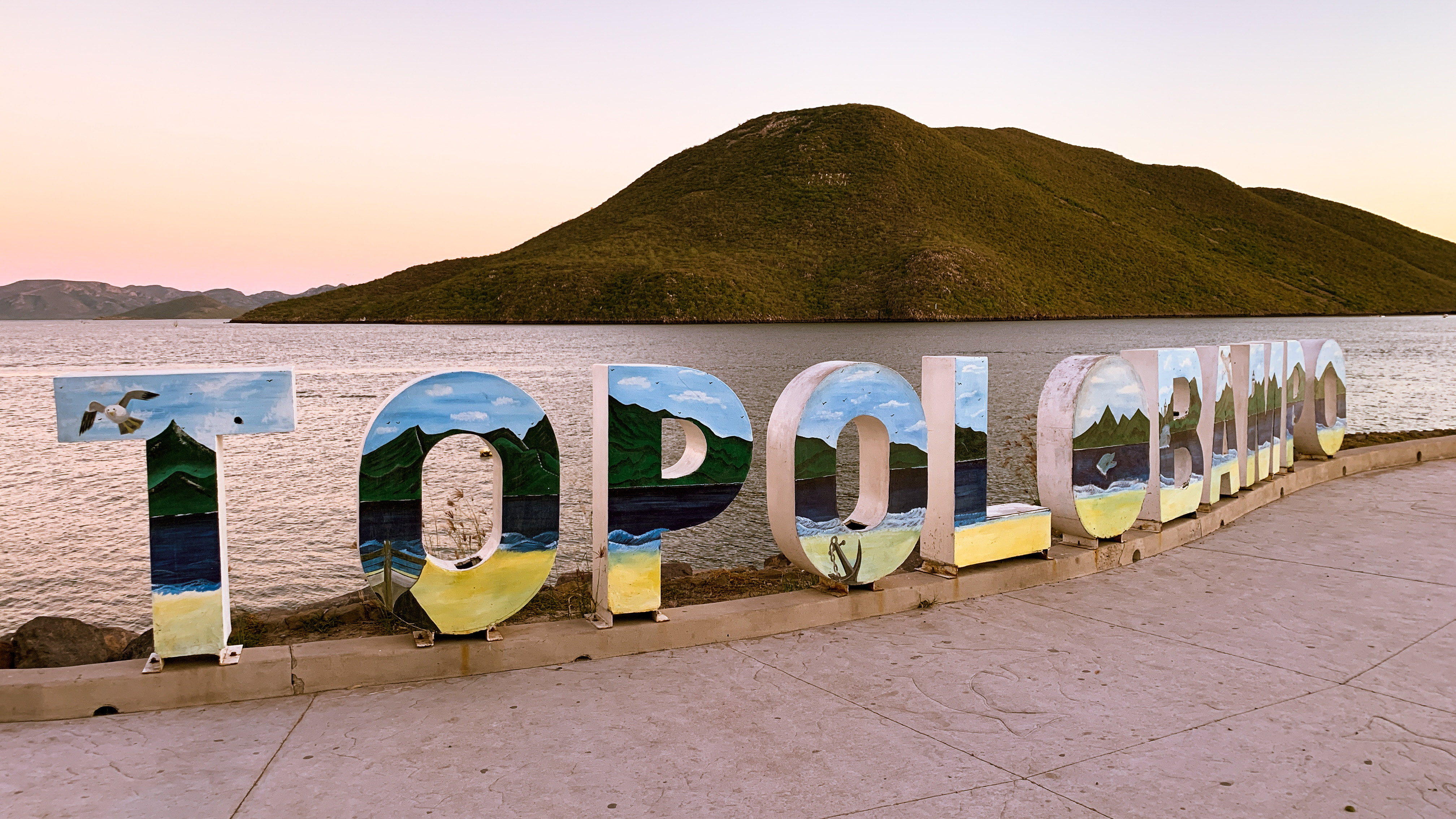
Topolobampo () is a port on the Gulf of California in northwestern Sinaloa, Mexico. It is the fourth-largest town in the municipality of Ahome (after Los Mochis, Ahome, and Higuera de Zaragoza), reporting a 2010 census population of 6,361 inhabitants. The port connects the northern Mexican states through the Chihuahua-Pacific Railroad, which has a terminus in nearby Los Mochis. It is the eastern port for the daily car ferry connecting to La Paz in Baja California Sur. Topolobampo is also the beginning of the international trade corridor, "La Entrada al Pacifico", that ends near the Midland-Odessa, Texas area. History Topolobampo was the site of a Radical "utopian" colony inspired by Henry George's economic ideas. Albert Kimsey Owen was its founder and leader; Marie Howland and John W. Lovell were prominent backers. That utopian group published a newsletter in English, ''The Credit Foncier of Sinaloa'' in Topolobampo. The masthead says "Collective ownership and manag ... [...More Info...] [...Related Items...] OR: [Wikipedia] [Google] [Baidu] |
Altata
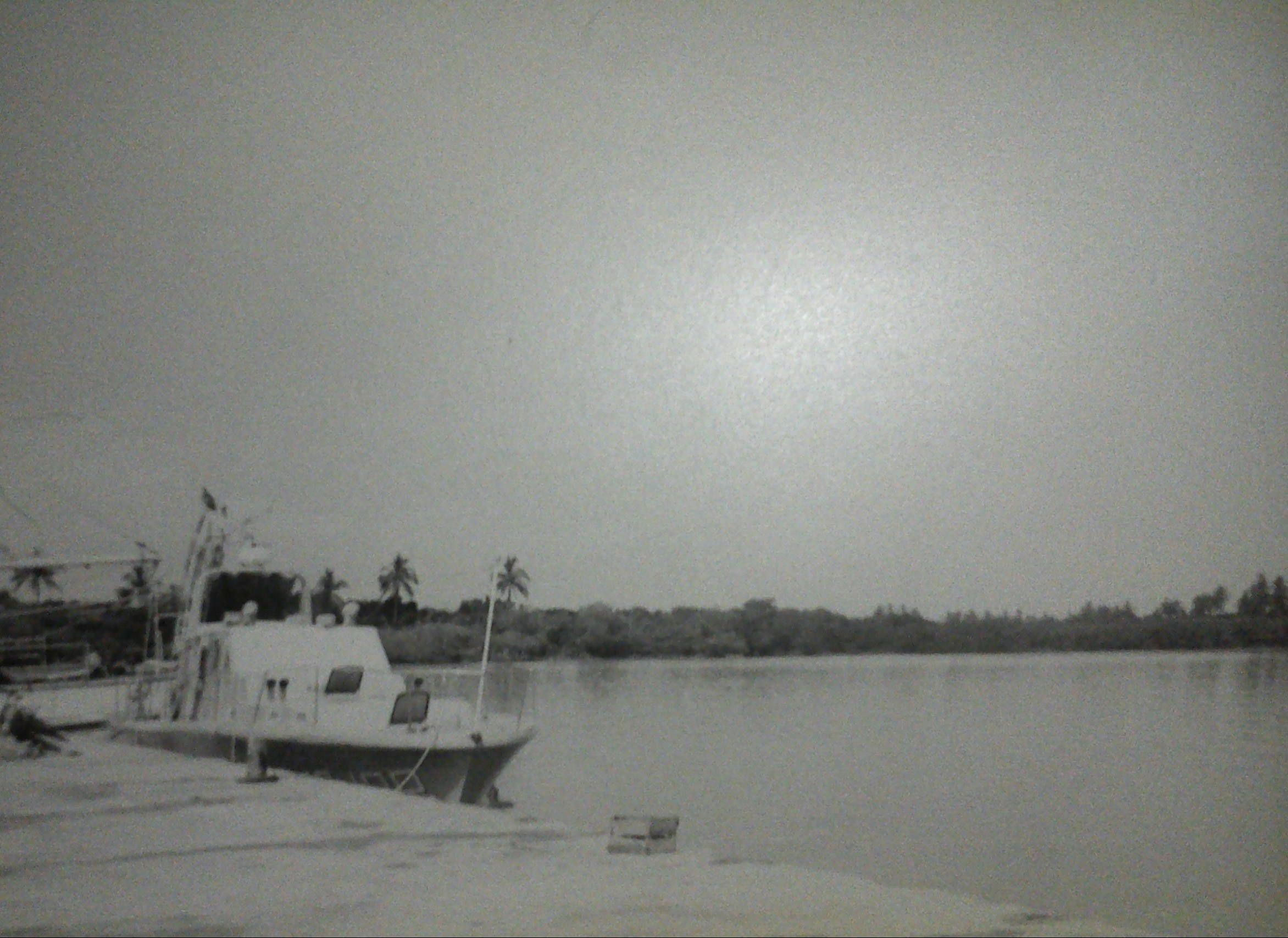
Altata is a small town in Navolato Municipality Municipality of Navolato is a municipality in the Mexican state of Sinaloa in northwestern Mexico Mexico, officially the United Mexican States, is a country in North America. It is the northernmost country in Latin America, and borders the ... connected to the Pacific Ocean, located about 45 miles west of Culiacán, Sinaloa in Mexico by Freeway 30. External links Populated places in Sinaloa {{Sinaloa-geo-stub ... [...More Info...] [...Related Items...] OR: [Wikipedia] [Google] [Baidu] |
San Blas, Nayarit
San Blas is both a municipality and municipal seat located on the Pacific coast of Mexico in Nayarit. City San Blas is a port and popular tourist destination, located about north of Puerto Vallarta, and west of the state capital Tepic, and three hours drive from Guadalajara. The town has a population of 8,707. Municipality The municipality had a population of 37,478 in 2005. The Islas Marías, the site of the former Islas Marías Federal Prison, are part of the municipality. President Andrés Manuel López Obrador announced in 2021 that the former prison would be rehabilitated as the environmental and cultural education center "Muros de Agua-José Revueltas" in honor of the writer who was imprisoned there. History In 1768, the Bourbon Visitador José de Gálvez, 1st Marquess of Sonora, José de Gálvez decided to found the port of San Blas as a jumping off point for military expeditions to Sinaloa, Sonora, Baja California and Alta California. The military nature of San Blas d ... [...More Info...] [...Related Items...] OR: [Wikipedia] [Google] [Baidu] |
GOES 16 2021-08-28 1400Z
The Geostationary Operational Environmental Satellite (GOES), operated by the United States' National Oceanic and Atmospheric Administration (NOAA)'s National Environmental Satellite, Data, and Information Service division, supports weather forecasting, severe storm tracking, and meteorology research. Spacecraft and ground-based elements of the system work together to provide a continuous stream of environmental data. The National Weather Service (NWS) and the Meteorological Service of Canada use the GOES system for their North American weather monitoring and forecasting operations, and scientific researchers use the data to better understand land, atmosphere, ocean, and climate dynamics. The GOES system uses geosynchronous equatorial satellites that, since the launch of SMS-1 in 1974, have been a basic element of U.S. weather monitoring and forecasting. The procurement, design, and manufacture of GOES satellites is overseen by NASA. NOAA is the official provider of both GOE ... [...More Info...] [...Related Items...] OR: [Wikipedia] [Google] [Baidu] |
Cloud Top
The cloud top (or the top of the cloud) is the highest altitude of the visible portion of a cloud. It is traditionally expressed either in metres above the Earth (or planetary) surface, or as the corresponding pressure level in hectopascal (hPa, equivalent to the traditional but now obsolete millibar). Measurement The cloud top is where the snow, rain and sleet come from. Cloud top height can be estimated from the ground by triangulation. However, this is often inconvenient as this is practically feasible only for isolated clouds in full view of (and some horizontal distance away from) the observers. Ground-based radars can be used to derive this cloud property. An alternative (but also more expensive) approach is to acquire airborne observations either visually or using specific instruments such as a lidar. This technique is very appropriate to characterize individual clouds (and specifically to control or evaluate the accuracy of other methods) but becomes unmanageable to repetit ... [...More Info...] [...Related Items...] OR: [Wikipedia] [Google] [Baidu] |
Eye (cyclone)
The eye is a region of mostly calm weather at the center of a tropical cyclone. The eye of a storm is a roughly circular area, typically in diameter. It is surrounded by the eyewall, a ring of towering thunderstorms where the most severe weather and highest winds of the cyclone occur. The cyclone's lowest barometric pressure occurs in the eye and can be as much as 15 percent lower than the pressure outside the storm. In strong tropical cyclones, the eye is characterized by light winds and clear skies, surrounded on all sides by a towering, symmetric eyewall. In weaker tropical cyclones, the eye is less well defined and can be covered by the central dense overcast, an area of high, thick clouds that show up brightly on satellite imagery. Weaker or disorganized storms may also feature an eyewall that does not completely encircle the eye or have an eye that features heavy rain. In all storms, however, the eye is where the barometer reading is lowest. Structure A typical tropi ... [...More Info...] [...Related Items...] OR: [Wikipedia] [Google] [Baidu] |
Microwave Imaging
Microwave imaging is a science which has been evolved from older detecting/locating techniques (e.g., radar) in order to evaluate hidden or embedded objects in a structure (or media) using electromagnetic (EM) waves in microwave regime (i.e., ~300 MHz-300 GHz). Engineering and application oriented microwave imaging for non-destructive testing is called #Microwave testing, microwave testing, see below. Microwave imaging techniques can be classified as either quantitative or qualitative. Quantitative imaging techniques (are also known as inverse scattering methods) give the electrical (i.e., electrical and magnetic property distribution) and geometrical parameters (i.e., shape, size and location) of an imaged object by solving a nonlinear inverse problem. The nonlinear inverse problem is converted into a linear inverse problem (i.e., Ax=b where A and b are known and x (or image) is unknown) by using Born or distorted Born approximations. Despite the fact that direct matrix i ... [...More Info...] [...Related Items...] OR: [Wikipedia] [Google] [Baidu] |


