|
Hurricane Dorian
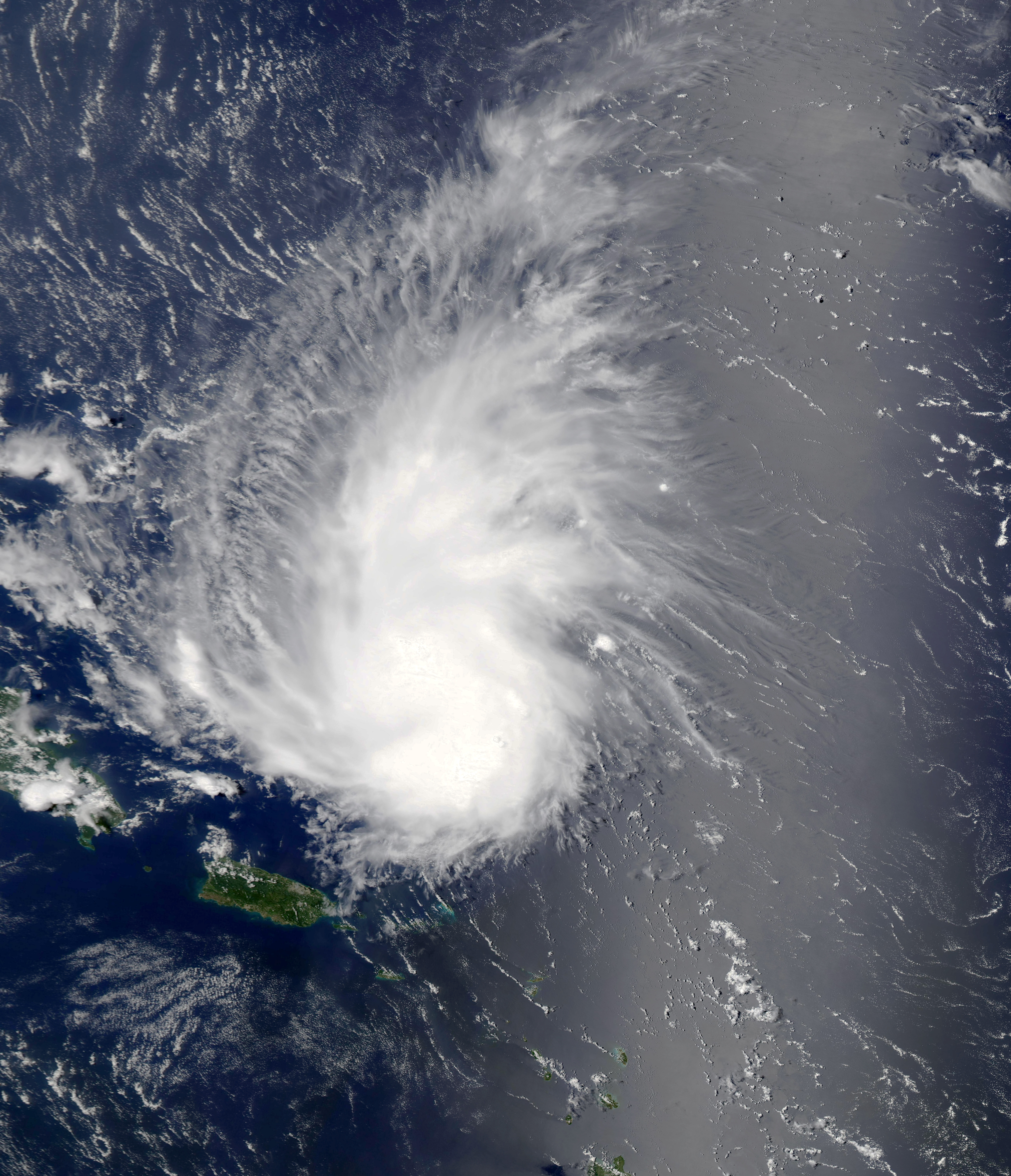
Hurricane Dorian was an extremely powerful and catastrophic tropical cyclone, which became the most intense on record to strike The Bahamas. It is tied with the 1935 Labor Day hurricane for the strongest landfall in the Atlantic basin in terms of maximum sustained winds. It is regarded as the worst natural disaster in The Bahamas' recorded history. With winds peaking at , it was also one of the most powerful hurricanes recorded in the Atlantic Ocean in terms of Maximum sustained wind, 1-minute sustained winds, and the strongest since Hurricane Wilma, Wilma in 2005 Atlantic hurricane season, 2005. Dorian was the fourth named storm, second hurricane, the first major hurricane, and the first Category 5 hurricane of the 2019 Atlantic hurricane season. Dorian struck the Abaco Islands on September 1 with maximum sustained winds of 185 mph (295 km/h), tying with the 1935 Labor Day hurricane for the highest wind speeds of an Atlantic hurricane ever recorded at landfall. ... [...More Info...] [...Related Items...] OR: [Wikipedia] [Google] [Baidu] |
Abaco Islands
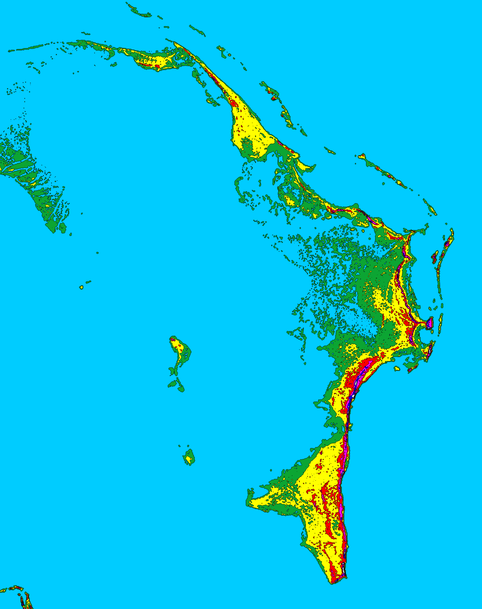
The Abaco Islands lie in the north of Bahamas, The Bahamas, about 193 miles (167.7 nautical miles or 310.6 km) east of Miami, Florida, US. The main islands are Great Abaco and Little Abaco, which is just west of Great Abaco's northern tip. There are several smaller barrier cays, of which the northernmost are Walker's Cay and its sister island Grand Cay. To the south, the next inhabited islands are Spanish Cay and Green Turtle Cay, with its settlement of New Plymouth, Great Guana Cay, private Scotland Cay, Man-O-War Cay and Elbow Cay, with its settlement of Hope Town. Southernmost are Tilloo Cay and Lubbers Quarters. Also off Abaco's western shore is Gorda Cay, a Disney-owned island and cruise ship stop renamed Castaway Cay. Also in the vicinity is Moore's Island. On the Big Island of Abaco is Marsh Harbour, the Abacos' commercial hub and The Bahamas' third-largest city, plus the resort area of Treasure Cay. Both have airports. Mainland settlements include Coopers Town and Fo ... [...More Info...] [...Related Items...] OR: [Wikipedia] [Google] [Baidu] |
2005 Atlantic Hurricane Season
The 2005 Atlantic hurricane season was a record-breaking, devastating and deadly Atlantic hurricane season. It is the second-costliest hurricane season, just behind the 2017 season And 2024. It featured 28 tropical and subtropical storms, which was the most recorded in a hurricane season until the 2020 season. The United States National Hurricane Center named 27 storms, exhausting the annual pre-designated list, requiring the use of six Greek letter names, and adding an additional unnamed subtropical storm during a post-season re-analysis. A record 15 storms attained hurricane status, with maximum sustained winds of at least . Of those, a record seven became major hurricanes, rated Category 3 or higher on the Saffir–Simpson scale. Four storms of this season became Category 5 hurricanes, the most of any season on record. The four Category 5 hurricanes during the season were: Emily, Katrina, Rita, and Wilma. In July, Emily reached peak i ... [...More Info...] [...Related Items...] OR: [Wikipedia] [Google] [Baidu] |
Nova Scotia
Nova Scotia is a Provinces and territories of Canada, province of Canada, located on its east coast. It is one of the three Maritime Canada, Maritime provinces and Population of Canada by province and territory, most populous province in Atlantic Canada, with an estimated population of over 1 million as of 2024; it is also the second-most densely populated province in Canada, and second-smallest province by area. The province comprises the Nova Scotia peninsula and Cape Breton Island, as well as 3,800 other coastal islands. The province is connected to the rest of Canada by the Isthmus of Chignecto, on which the province's land border with New Brunswick is located. Nova Scotia's Capital city, capital and largest municipality is Halifax, Nova Scotia, Halifax, which is home to over 45% of the province's population as of the 2021 Canadian census, 2021 census. Halifax is the List of census metropolitan areas and agglomerations in Canada, twelfth-largest census metropolitan area in ... [...More Info...] [...Related Items...] OR: [Wikipedia] [Google] [Baidu] |
Cape Hatteras
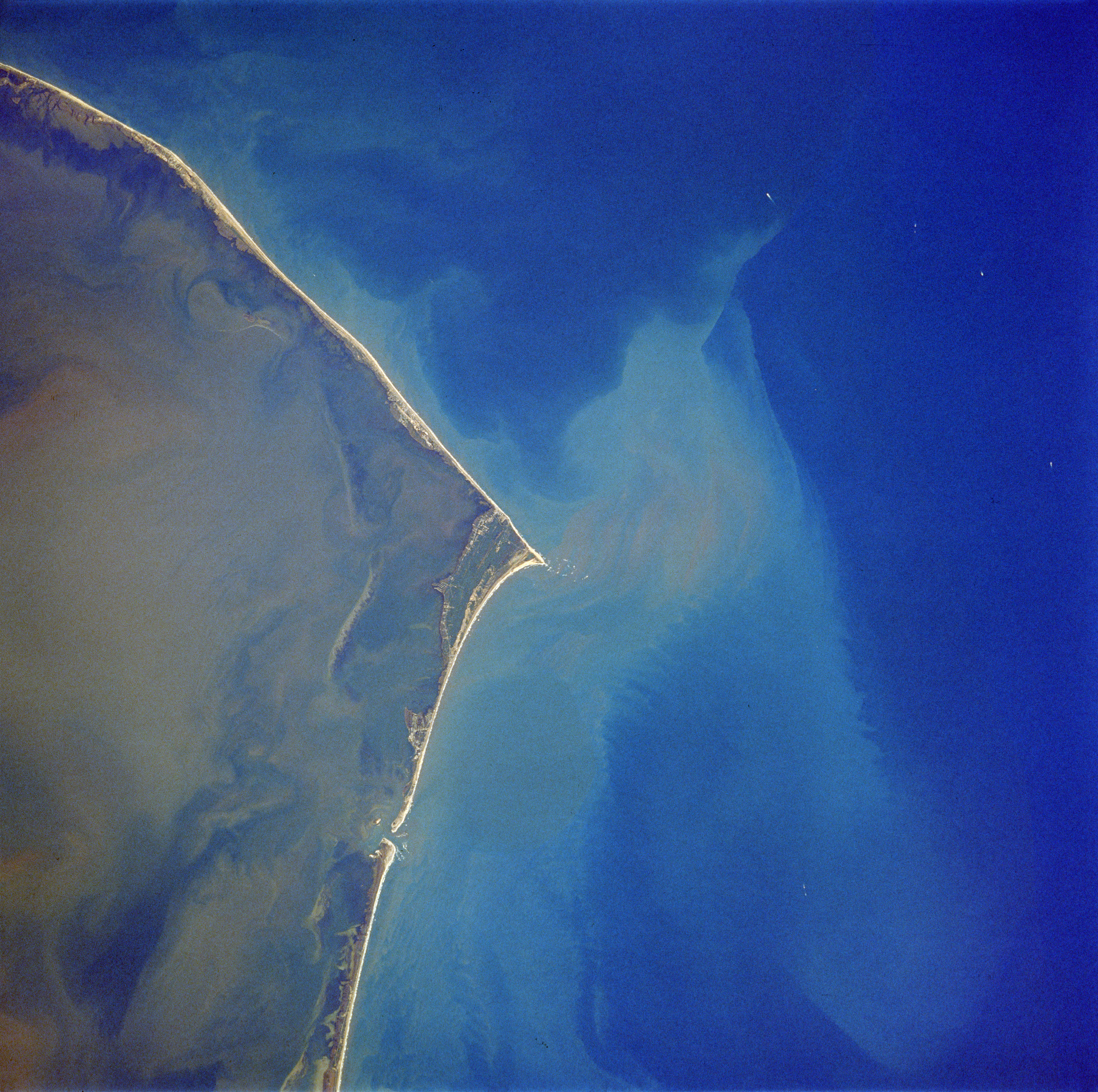
Cape Hatteras is a cape located at a pronounced bend in Hatteras Island, one of the barrier islands of North Carolina. As a temperate barrier island, the landscape has been shaped by wind, waves, and storms. There are long stretches of beach, sand dunes, marshes, and maritime forests in the area. A large area of the Outer Banks is part of a National Park, called the Cape Hatteras National Seashore. It is also the nearest landmass on the North American mainland to Bermuda, which is about to the east-southeast. The treacherous waters off the coast of the Outer Banks are known as the Graveyard of the Atlantic. Over 600 ships wrecked here as victims of shallow shoals, storms, and war. Diamond Shoals, a bank of shifting sand ridges hidden beneath the turbulent sea off Cape Hatteras, has never promised safe passage for ships. In the past 400 years, the graveyard has claimed many lives, but island villagers saved many. As early as the 1870s, villagers served in the United States ... [...More Info...] [...Related Items...] OR: [Wikipedia] [Google] [Baidu] |
Elbow Cay
Elbow Cay is a cay in the Abaco Islands of The Bahamas. Originally populated by British loyalists fleeing the newly independent United States of America in 1785, it has survived on fishing, boat building, and salvage. Its main village of Hope Town surrounds a protected harbor with a noted red-and-white-striped lighthouse built in 1863. On September 1, 2019, Elbow Cay took a direct hit from Category 5 Hurricane Dorian, with sustained winds of 185 mph (295 km/h). The lighthouse survived. Geography Elbow Cay is located about east of Marsh Harbour on Great Abaco Island. Most visitors fly into Marsh Harbour and take the ferry to either Hope Town at the Northern end of Elbow Cay or White Sound, a mid-island harbour and settlement developed in 1960. At the Southern end of the island is Tahiti Beach near Doros Cove. The Atlantic Ocean runs along the entire Eastern coast of Elbow Cay, while the South Abaco Sound is on the western coast. Elbow Cay is between Man-O-W ... [...More Info...] [...Related Items...] OR: [Wikipedia] [Google] [Baidu] |
Maximum Sustained Winds
The maximum sustained wind associated with a tropical cyclone is a common indicator of the intensity of the storm. Within a mature tropical cyclone, it is found within the eyewall at a certain distance from the center, known as the radius of maximum wind, or RMW. Unlike gusts, the value of these winds are determined via their sampling and averaging the sampled results over a period of time. Wind measuring has been standardized globally to reflect the winds at above mean sea level, and the maximum sustained wind represents the highest average wind over either a one-minute (US) or ten-minute time span (see the definition, below), anywhere within the tropical cyclone. Surface winds are highly variable due to friction between the atmosphere and the Earth's surface, as well as near hills and mountains over land. Over the ocean, satellite imagery is often used to estimate the maximum sustained winds within a tropical cyclone. Land, ship, aircraft reconnaissance observations, an ... [...More Info...] [...Related Items...] OR: [Wikipedia] [Google] [Baidu] |
Saffir–Simpson Scale
The Saffir–Simpson hurricane wind scale (SSHWS) is a tropical cyclone intensity scale that classifies hurricanes—which in the Western Hemisphere are tropical cyclones that exceed the intensities of tropical depressions and tropical storms—into five categories distinguished by the intensities of their sustained winds. This measuring system was formerly known as the Saffir–Simpson hurricane scale, or SSHS. To be classified as a hurricane, a tropical cyclone must have one-minute-average maximum sustained winds at above the surface of at least 74 mph (64 kn, 119 km/h; Category 1). The highest classification in the scale, Category 5, consists of storms with sustained winds of at least 157 mph (137 kn, 252 km/h). The classifications can provide some indication of the potential damage and flooding a hurricane will cause upon landfall. The Saffir–Simpson hurricane wind scale is based on the highest wind speed averaged over a ... [...More Info...] [...Related Items...] OR: [Wikipedia] [Google] [Baidu] |
Rapid Intensification
Rapid intensification (RI) is any process wherein a tropical cyclone strengthens very dramatically in a short period of time. Tropical cyclone forecasting agencies utilize differing thresholds for designating rapid intensification events, though the most widely used definition stipulates an increase in the maximum sustained winds of a tropical cyclone of at least in a 24-hour period. However, periods of rapid intensification often last longer than a day. About 20–30% of all tropical cyclones undergo rapid intensification, including a majority of tropical cyclones with peak wind speeds exceeding . Rapid intensification constitutes a major source of error for tropical cyclone forecasting, and its predictability is commonly cited as a key area for improvement. The specific physical mechanisms that underlie rapid intensification and the environmental conditions necessary to support rapid intensification are unclear due to the complex interactions between the environment surr ... [...More Info...] [...Related Items...] OR: [Wikipedia] [Google] [Baidu] |
Greater Antilles
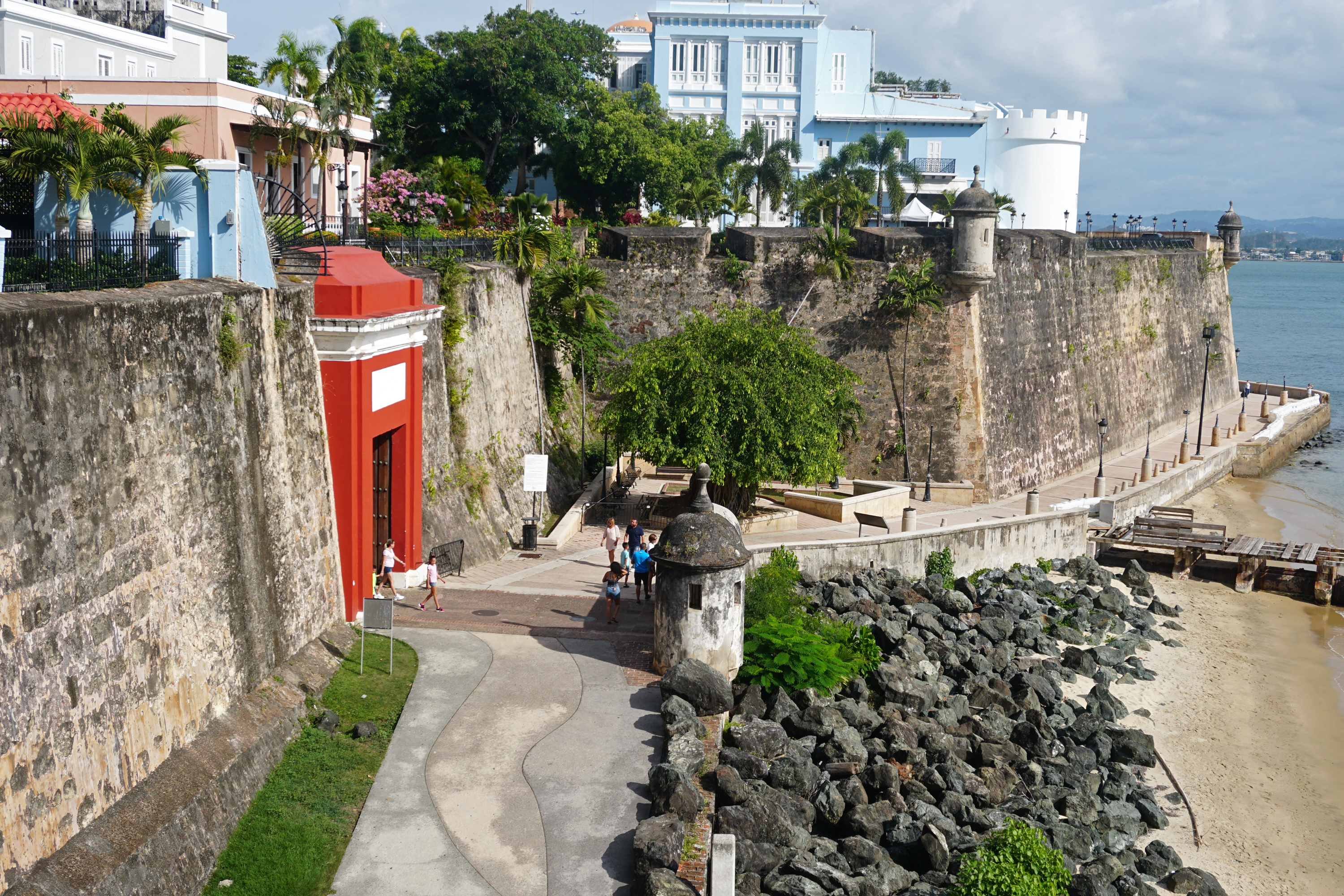
The Greater Antilles is a grouping of the larger islands in the Caribbean Sea, including Cuba, Hispaniola, Puerto Rico, and Jamaica, together with Navassa Island and the Cayman Islands. Seven island states share the region of the Greater Antilles, with Haiti and the Dominican Republic sharing the island of Hispaniola. Together with the Lesser Antilles, they make up the Antilles, which along with the Lucayan Archipelago, form the West Indies in the Caribbean region of the Americas. While most of the Greater Antilles consists of independent countries, Puerto Rico and Navassa Island are Territories of the United States, unincorporated territories of the United States, while the Cayman Islands are a British Overseas Territories, British Overseas Territory. The largest island is Cuba, which extends to the western end of the island group. Puerto Rico lies on the eastern end, and the island of Hispaniola, the most populated island, is located in the middle. Jamaica lies to the south of ... [...More Info...] [...Related Items...] OR: [Wikipedia] [Google] [Baidu] |
Tropical Wave
A tropical wave (also called easterly wave, tropical easterly wave, and African easterly wave), in and around the Atlantic Ocean, is a type of atmospheric trough, an elongated area of relatively low air pressure, oriented north to south, which moves from east to west across the tropics, causing areas of cloudiness and thunderstorms. Tropical waves form in the easterly flow along the equatorial side of the subtropical ridge or belt of high air pressure which lies north and south of the Intertropical Convergence Zone (ITCZ). Tropical waves are generally carried westward by the prevailing easterly winds along the tropics and subtropics near the equator. They can lead to the formation of tropical cyclones in the north Atlantic and northeastern Pacific basins. A tropical wave study is aided by Hovmöller diagrams, a graph of meteorological data. West-moving waves can also form from the tail end of frontal zones in the subtropics and tropics, and may be referred to as easterly ... [...More Info...] [...Related Items...] OR: [Wikipedia] [Google] [Baidu] |
Atlantic Canada
Atlantic Canada, also called the Atlantic provinces (), is the list of regions of Canada, region of Eastern Canada comprising four provinces: New Brunswick, Newfoundland and Labrador, Nova Scotia, and Prince Edward Island. As of 2021, the landmass of the four Atlantic provinces was approximately , and had a population of over 2.4 million people. The term ''Atlantic Canada'' was popularized following the admission of Newfoundland as a Canadian province in 1949. The province of Newfoundland and Labrador is not included in the Maritimes, another significant regional term, but ''is'' included in Atlantic Canada. History The Atlantic Provinces are the historical territories of the Mi'kmaq, Naskapi, Beothuk and Nunatsiavut peoples. The people of Nunatsiavut are the Labrador Inuit (Labradormiut), who are descended from the Thule people. Exploration and settlement Leif Erikson and other members of his family began exploring the North American coast in 986 CE. Leif landed in three pla ... [...More Info...] [...Related Items...] OR: [Wikipedia] [Google] [Baidu] |
Southeastern United States
The Southeastern United States, also known as the American Southeast or simply the Southeast, is a geographical List of regions in the United States, region of the United States located in the eastern portion of the Southern United States and the southern portion of the East Coast of the United States, Eastern United States. The region includes a core of states that reaches north to Maryland and West Virginia, bordering the Ohio River and Mason–Dixon line, and stretches west to Arkansas and Louisiana. There is no official Federal government of the United States, U.S. government definition for the region, and it is defined variably among agencies and organizations. History The history of the present-day Southeastern United States dates to the dawn of civilization in approximately 11,000 BC or 13,000 BC. The earliest artifacts from the region were from the Clovis culture. Prior to the arrival of Colonial history of the United States, European colonialists, Native Americans in ... [...More Info...] [...Related Items...] OR: [Wikipedia] [Google] [Baidu] |


