|
Hurricane Dog (1950)
Hurricane Dog was the most intense hurricane in the 1950 Atlantic hurricane season. Prior to reanalysis by the Hurricane Research Division in 2014, it was considered one of the strongest Atlantic hurricanes on record, equivalent to Category 5 status on the modern Saffir-Simpson scale, with winds of . The fourth named storm of the season, Dog developed on August 30 to the east of Antigua; after passing through the northern Lesser Antilles, it turned to the north and intensified into a Category 4 hurricane. Dog reached its peak intensity with winds of over the open Atlantic, and after weakening it passed within of Cape Cod, Massachusetts. The storm became extratropical on September 12. Hurricane Dog caused extensive damage to the Leeward Islands, and was considered the most severe hurricane on record in Antigua. Many buildings were destroyed or severely damaged on the island, with thousands left homeless just weeks after Hurricane Baker caused serious damage the ... [...More Info...] [...Related Items...] OR: [Wikipedia] [Google] [Baidu] |
Surface Weather Analysis
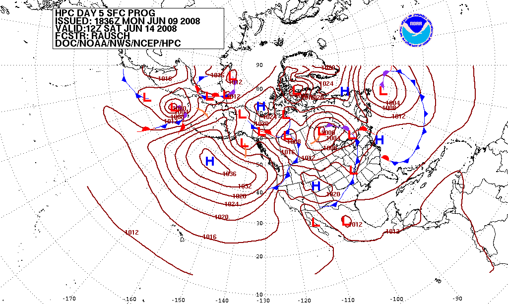
Surface weather analysis is a special type of weather map that provides a view of weather elements over a geographical area at a specified time based on information from ground-based weather stations. Weather maps are created by plotting or tracing the values of relevant quantities such as sea level pressure, temperature, and cloud cover onto a geographical map to help find synoptic scale features such as weather fronts. The first weather maps in the 19th century were drawn well after the fact to help devise a theory on storm systems.Eric R. MillerAmerican Pioneers in Meteorology.Retrieved on 2007-04-18. After the advent of the telegraph, simultaneous surface weather observations became possible for the first time, and beginning in the late 1840s, the Smithsonian Institution became the first organization to draw real-time surface analyses. Use of surface analyses began first in the United States, spreading worldwide during the 1870s. Use of the Norwegian cyclone model for fronta ... [...More Info...] [...Related Items...] OR: [Wikipedia] [Google] [Baidu] |
Extratropical
Extratropical cyclones, sometimes called mid-latitude cyclones or wave cyclones, are low-pressure areas which, along with the anticyclones of high-pressure areas, drive the weather over much of the Earth. Extratropical cyclones are capable of producing anything from cloudiness and mild showers to severe hail, thunderstorms, blizzards, and tornadoes. These types of cyclones are defined as large scale (synoptic) low pressure weather systems that occur in the middle latitudes of the Earth. In contrast with tropical cyclones, extratropical cyclones produce rapid changes in temperature and dew point along broad lines, called weather fronts, about the center of the cyclone. Terminology The term "cyclone" applies to numerous types of low pressure areas, one of which is the extratropical cyclone. The descriptor ''extratropical'' signifies that this type of cyclone generally occurs outside the tropics and in the middle latitudes of Earth between 30° and 60° latitude. They are term ... [...More Info...] [...Related Items...] OR: [Wikipedia] [Google] [Baidu] |
Landfall
Landfall is the event of a storm moving over land after being over water. More broadly, and in relation to human travel, it refers to 'the first land that is reached or seen at the end of a journey across the sea or through the air, or the fact of arriving there.' Tropical cyclone A tropical cyclone is classified as making landfall when the center of the storm moves across the coast; in a relatively strong tropical cyclone, this is when the center of its eye moves over land. This is where most of the damage occurs within a mature tropical cyclone, such as a typhoon or hurricane, as most of the damaging aspects of these systems are concentrated near the eyewall. Such effects include the peaking of the storm surge, the core of strong winds coming ashore, and heavy flooding rains. These coupled with high surf can cause major beach erosion. When a tropical cyclone makes landfall, the eye usually closes in upon itself due to negative environmental factors over land, such as ... [...More Info...] [...Related Items...] OR: [Wikipedia] [Google] [Baidu] |
Reconnaissance Aircraft
A reconnaissance aircraft (colloquially, a spy plane) is a military aircraft designed or adapted to perform aerial reconnaissance with roles including collection of imagery intelligence (including using Aerial photography, photography), signals intelligence, as well as measurement and signature intelligence. Modern technology has also enabled some aircraft and Unmanned aerial vehicle, UAVs to carry out real-time surveillance in addition to general Military intelligence, intelligence gathering. Before the development of devices such as radar, military forces relied on reconnaissance aircraft for visual Artillery observer, observation and Reconnaissance, scouting of enemy movement. An example is the Consolidated PBY Catalina, PBY Catalina Maritime patrol aircraft, maritime patrol flying boat used by the Allies of World War II, Allies in World War II: a Formation flying, flight of United States Navy, U.S. Navy Catalinas spotted part of the Japanese fleet approaching Midway Island ... [...More Info...] [...Related Items...] OR: [Wikipedia] [Google] [Baidu] |
Eye (cyclone)
The eye is a region of mostly calm weather at the center of a tropical cyclone. The eye of a storm is a roughly circular area, typically in diameter. It is surrounded by the eyewall, a ring of towering thunderstorms where the most severe weather and highest winds of the cyclone occur. The cyclone's lowest barometric pressure occurs in the eye and can be as much as 15 percent lower than the pressure outside the storm. In strong tropical cyclones, the eye is characterized by light winds and clear skies, surrounded on all sides by a towering, symmetric eyewall. In weaker tropical cyclones, the eye is less well defined and can be covered by the central dense overcast, an area of high, thick clouds that show up brightly on satellite imagery. Weaker or disorganized storms may also feature an eyewall that does not completely encircle the eye or have an eye that features heavy rain. In all storms, however, the eye is where the barometer reading is lowest. Structure A typical tropi ... [...More Info...] [...Related Items...] OR: [Wikipedia] [Google] [Baidu] |
Atmospheric Pressure
Atmospheric pressure, also known as air pressure or barometric pressure (after the barometer), is the pressure within the atmosphere of Earth. The standard atmosphere (symbol: atm) is a unit of pressure defined as , which is equivalent to 1,013.25 millibars, 760 mm Hg, 29.9212 inchesHg, or 14.696 psi.International Civil Aviation Organization. ''Manual of the ICAO Standard Atmosphere'', Doc 7488-CD, Third Edition, 1993. . The atm unit is roughly equivalent to the mean sea-level atmospheric pressure on Earth; that is, the Earth's atmospheric pressure at sea level is approximately 1 atm. In most circumstances, atmospheric pressure is closely approximated by the hydrostatic pressure caused by the weight of air above the measurement point. As elevation increases, there is less overlying atmospheric mass, so atmospheric pressure decreases with increasing elevation. Because the atmosphere is thin relative to the Earth's radius—especially the dense atmospheric layer at low altitu ... [...More Info...] [...Related Items...] OR: [Wikipedia] [Google] [Baidu] |
Weather Station
A weather station is a facility, either on land or sea, with instruments and equipment for measuring atmosphere of Earth, atmospheric conditions to provide information for weather forecasting, weather forecasts and to study the weather and climate. The measurements taken include temperature, atmospheric pressure, humidity, wind speed, wind direction, and precipitation amounts. Wind measurements are taken with as few other obstructions as possible, while temperature and humidity measurements are kept free from direct solar radiation, or insolation. Manual observations are taken at least once daily, while automated measurements are taken at least once an hour. Weather conditions out at sea are taken by ships and buoys, which measure slightly different meteorological quantities such as sea surface temperature (SST), wave height, and wave period. Drifting weather buoys outnumber their moored versions by a significant amount. Weather instruments A weather instrument is any device t ... [...More Info...] [...Related Items...] OR: [Wikipedia] [Google] [Baidu] |
Rapidly Intensified
Rapid intensification (RI) is any process wherein a tropical cyclone strengthens very dramatically in a short period of time. Tropical cyclone forecasting agencies utilize differing thresholds for designating rapid intensification events, though the most widely used definition stipulates an increase in the maximum sustained winds of a tropical cyclone of at least in a 24-hour period. However, periods of rapid intensification often last longer than a day. About 20–30% of all tropical cyclones undergo rapid intensification, including a majority of tropical cyclones with peak wind speeds exceeding . Rapid intensification constitutes a major source of error for tropical cyclone forecasting, and its predictability is commonly cited as a key area for improvement. The specific physical mechanisms that underlie rapid intensification and the environmental conditions necessary to support rapid intensification are unclear due to the complex interactions between the environment surrou ... [...More Info...] [...Related Items...] OR: [Wikipedia] [Google] [Baidu] |
Ridge (meteorology)
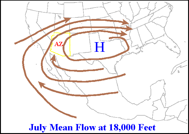
In meteorology a ridge or barometric ridge is an elongated area of relatively high atmospheric pressure compared to the surrounding environment, without being a closed circulation. It is associated with an area of maximum anticyclonic curvature of wind flow. The ridge originates in the center of an anticyclone and sandwiched between two low-pressure areas, and the locus of the maximum curvature is called the ''ridge line''. This phenomenon is the opposite of a trough. Description Ridges can be represented in two ways: * On surface weather maps, the pressure isobars form contours where the maximum pressure is found along the axis of the ridge. * In upper-air maps, geopotential height isohypses form similar contours where the maximum defines the ridge. Related weather Given the direction of the winds around an anticyclonic circulation and the fact that weather systems move from west to east: *ahead of an upper-ridge, the airflow that comes from the polar regions and bri ... [...More Info...] [...Related Items...] OR: [Wikipedia] [Google] [Baidu] |
Area Of Low Pressure
In meteorology, a low-pressure area (LPA), low area or low is a region where the atmospheric pressure is lower than that of surrounding locations. It is the opposite of a high-pressure area. Low-pressure areas are commonly associated with inclement weather (such as cloudy, windy, with possible rain or storms), while high-pressure areas are associated with lighter winds and clear skies. Winds circle anti-clockwise around lows in the northern hemisphere, and clockwise in the southern hemisphere, due to opposing Coriolis force, Coriolis forces. Low-pressure systems form under areas of wind divergence that occur in the upper levels of the Atmosphere of Earth, atmosphere (aloft). The formation process of a low-pressure area is known as cyclogenesis. In Meteorology#Dynamic meteorology, meteorology, atmospheric divergence aloft occurs in two kinds of places: * The first is in the area on the east side of upper Trough (meteorology), troughs, which form half of a Rossby wave within the W ... [...More Info...] [...Related Items...] OR: [Wikipedia] [Google] [Baidu] |
Gale
A gale is a strong wind; the word is typically used as a descriptor in nautical contexts. The U.S. National Weather Service defines a gale as sustained surface wind moving at a speed between .National Weather Service Glossary s.v "gale" Forecasters typically issue s when winds of this strength are expected. In the , a gale warning is specifically a maritime warning; the land-based equivalent in National Weather Service ... [...More Info...] [...Related Items...] OR: [Wikipedia] [Google] [Baidu] |
Cape Verde
Cape Verde or Cabo Verde, officially the Republic of Cabo Verde, is an island country and archipelagic state of West Africa in the central Atlantic Ocean, consisting of ten volcanic islands with a combined land area of about . These islands lie between west of Cap-Vert, the westernmost point of continental Africa. The List of islands of Cape Verde, Cape Verde islands form part of the Macaronesia ecoregion, along with the Azores, the Canary Islands, Madeira and the Savage Isles. The Cape Verde archipelago was uninhabited until the 15th century, when Portuguese Empire, Portuguese explorers colonized the islands, establishing one of the first Age of Discovery, European settlements in the tropics. Due to its strategic position, Cape Verde became a significant location in the Atlantic slave trade, transatlantic slave trade during the 16th and 17th centuries. The islands experienced economic growth during this period, driven by their role by the rapid emergence of merchants, priva ... [...More Info...] [...Related Items...] OR: [Wikipedia] [Google] [Baidu] |


