|
Huocheng County
Huocheng County ( zh, s=霍城县, p=Huòchéng xiàn), as the official romanized name, is also transliterated from Uyghur as Korgas County (; in Kazakh: ; zh, s=霍尔果斯县). It is situated within the Xinjiang Uyghur Autonomous Region and falls under the administration of the Ili Kazakh Autonomous Prefecture. The county is located between Yining and the border city of Khorgas, covering an area of , with a population of 360,000 (2004 estimate). There are twenty-nine ethnic groups residing in the county, including the Han and Uyghur nationalities. To the north of Huocheng County is Wenquan County, while the Ili River lies to the south. Its Western side is bordered by Khorgas City, and Yining is located approximately to the east. History Within Huocheng County, lies the significant ruined site of ancient Almaliq. Additionally, the mausoleum of the first khan of Moghulistan, Tughlugh Timur, is also located within the county. During the 1760s, nine fortresses were ... [...More Info...] [...Related Items...] OR: [Wikipedia] [Google] [Baidu] |
Counties Of China
Counties ( zh, s=县, labels=no) are found in the County-level divisions of China, third level of the administrative hierarchy in Provinces of China, provinces and Autonomous regions of China, autonomous regions and the second level in Direct-controlled municipality#People's Republic of China, municipalities and Hainan, a level that is known as "county level" and also contains autonomous county, autonomous counties, county-level city, county-level cities, Banners of Inner Mongolia, banners, Banners of Inner Mongolia#Autonomous banners, autonomous banners and District (China)#Ethnic districts, city districts. There are 1,355 counties in mainland China out of a total of 2,851 county-level divisions. The term ''xian'' is sometimes translated as "district" or "prefecture" when put in the context of History of China, Chinese history. History ''Xian'' have existed since the Warring States period and were set up nationwide by the Qin dynasty. The number of counties in China proper ... [...More Info...] [...Related Items...] OR: [Wikipedia] [Google] [Baidu] |
Moghulistan
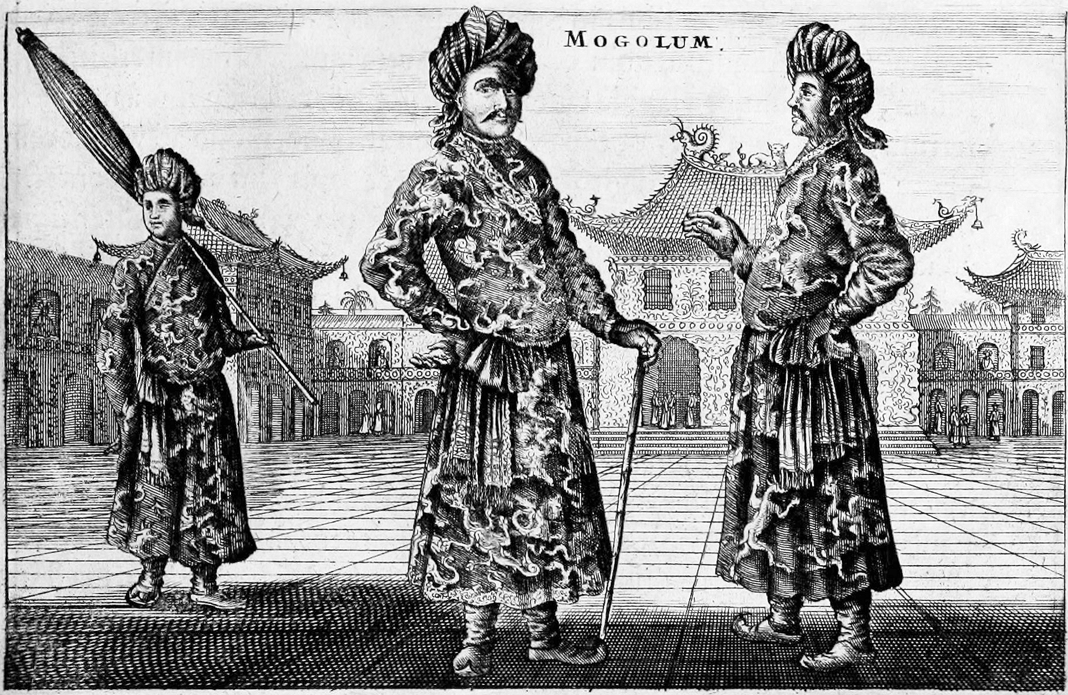
Moghulistan, also called the Moghul Khanate or the Eastern Chagatai Khanate, was a Muslims, Muslim, Mongol, and later Turkic peoples, Turkic breakaway khanate of the Chagatai Khanate and a historical geographic area north of the Tian Shan, Tengri Tagh mountain range, on the border of Central Asia and East Asia. That area today includes parts of Kazakhstan, Kyrgyzstan, and northwest Xinjiang, China. The khanate nominally ruled over the area from the mid-14th century until the late 17th century. Beginning in the mid-14th century a new khanate, in the form of a nomadic tribal confederacy headed by a member of the family of Chagatai, arose in the region of the Ili River. It is therefore considered to be a continuation of the Chagatai Khanate, but it is also referred to as the ''Moghul Khanate''. In actuality, local control rested with local Mongol Dughlats or Naqshbandi Sufis in their respective oases. Although the rulers enjoyed great wealth from trade with the Ming dynasty, it wa ... [...More Info...] [...Related Items...] OR: [Wikipedia] [Google] [Baidu] |
Qingshuihe
Qingshuihe County (Mongolian: ; zh, s=清水河县) is a county of Inner Mongolia Autonomous Region, North China, it is under the administration of the prefecture-level city of Hohhot, the capital of the autonomous region, bordering Shanxi province to the south and east. It is the southernmost county-level division of the regional capital of Hohhot, which lies more than to the north. In 2005, the county council started development on a new city, north of the existing town of Qingshuihe, closer to Hohhot. Chinese media reports said the scheme would have cost more than $6b yuan ($880m, £610m) in total, many times more than the county government's annual expenditure. The council expected either local, regional or national help to complete the project, but this was not approved. In 2007, money for the project ran out, and development stopped, leaving both a half-developed and unoccupied city, as well as a lack of finances and resource to maintain the existing town. Administrativ ... [...More Info...] [...Related Items...] OR: [Wikipedia] [Google] [Baidu] |
Uyghur Latin Alphabet
The Uyghur Latin alphabet (, ''Uyghur Latin Yëziqi'', ''ULY'', Уйғур Латин Йезиқи) is an auxiliary alphabet for the Uyghur language based on the Latin script. Uyghur is primarily written in Uyghur Arabic alphabet and sometimes in Uyghur Cyrillic alphabet. In 2023, the alphabet was agreed as the BGN/PCGN romanization system for Uyghur. Construction The Uyghur Latin alphabet was first introduced in the 1930s in the former Soviet Union and was briefly used in the Uyghur Autonomous Region during the 1960s to 1970s. The ULY project was finalized at Xinjiang University, Ürümqi, Xinjiang Uyghur Autonomous Region (XUAR), People's Republic of China in July 2001, at the fifth conference of a series held there for that purpose that started in November 2000. In January 2008, the ULY project was amended and identified by Xinjiang Uyghur Autonomous Regional Working Committee of Minorities' Language and Writing. The letters in the Uyghur Latin alphabet are, in order: Pu ... [...More Info...] [...Related Items...] OR: [Wikipedia] [Google] [Baidu] |
Uyghur Arabic Script
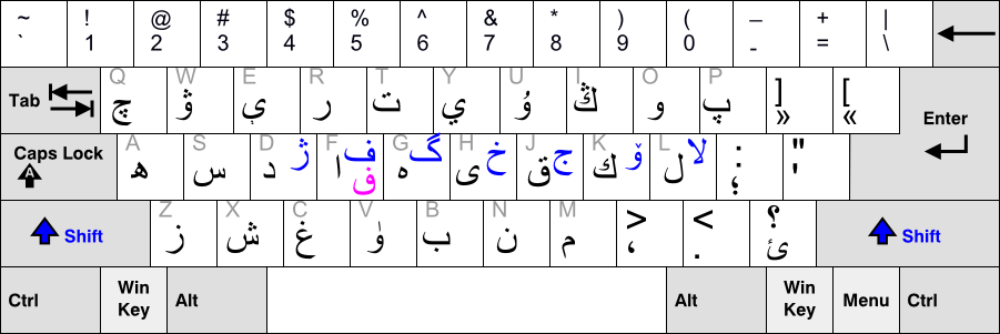
The Uyghur Arabic alphabet () is a version of the Arabic alphabet used for writing the Uyghur language, primarily by Uyghurs living in Xinjiang Uyghur Autonomous Region. It is one of several Uyghur alphabets and has been the official alphabet of the Uyghur language since 1982. The first Perso-Arabic derived alphabet for Uyghur was developed in the 10th century, when Islam was introduced there. The alphabet was used for writing the Chagatai language, the regional literary language, and is now known as the Chagatay alphabet (). It was used nearly exclusively up to the early 1920s. This alphabet did not represent Uyghur vowels and according to Robert Barkley Shaw, spelling was irregular and long vowel letters were frequently written for short vowels since most Turki speakers were unsure of the difference between long and short vowels. The pre-modification alphabet used Arabic diacritics (, and ) to mark short vowels. Also, the was used to represent a short by some Turki w ... [...More Info...] [...Related Items...] OR: [Wikipedia] [Google] [Baidu] |
Uyghur Language
Uyghur or Uighur (; , , or , , ), formerly known as Turki or Eastern Turki, is a Turkic languages, Turkic language with 8 to 13 million speakers (), spoken primarily by the Uyghur people in the Xinjiang Uyghur Autonomous Region of Western China. Apart from Xinjiang, significant communities of Uyghur speakers are also located in Kazakhstan, Kyrgyzstan, and Uzbekistan, and various other countries. Uyghur is an official language of the Xinjiang Uyghur Autonomous Region; it is widely used in both social and official spheres, as well as in print, television, and radio. Other Ethnic minorities in China, ethnic minorities in Xinjiang also use Uyghur as a Lingua franca, common language. Uyghur belongs to the Karluk languages, Karluk branch of the Turkic languages, Turkic language family, which includes languages such as Uzbek language, Uzbek. Like many other Turkic languages, Uyghur displays vowel harmony and agglutination, lacks noun classes or grammatical gender, and is a Branchi ... [...More Info...] [...Related Items...] OR: [Wikipedia] [Google] [Baidu] |
Ethnic Townships, Towns, And Sums
Ethnic townships (officially translated as nationality townshipsConstitution of the People's Republic of China, Article 95), ethnic towns, and ethnic sums are fourth-level administrative units designated for ethnic minorities of political divisions in the People's Republic of China. They are not considered to be autonomous and do not enjoy the laws pertaining to the larger ethnic autonomous areas such as autonomous regions, autonomous prefectures, autonomous counties, and autonomous banners. However, what defines an ethnic township is that the law requires that its head of government be a member of the titular ethnic minority. The only ethnic sum is the Evenk Ethnic Sum in Old Barag Banner, Inner Mongolia. Numbers of ethnic townships, towns, and sums List of ethnic townships and ethnic towns Anhui * Paifang Hui and Manchu Ethnic Township () * Saijian Hui Ethnic Township () * Gugou Hui Ethnic Township () * Gudui Hui Ethnic Township () * Lichong Hui Ethnic Tow ... [...More Info...] [...Related Items...] OR: [Wikipedia] [Google] [Baidu] |
Townships Of China
Townships ( zh, s=乡, labels=no), formally township-level divisions ( zh, s=乡级行政区, labels=no), are the basic level (fourth-level administrative units) of political divisions in the People's Republic of China. They are similar to municipalities and communes in other countries and in turn may contain village committees and villages. In 1995 there were 29,648 townships and 17,570 towns (a total of 47,218 township-level divisions) in China which included the territories held by the Republic of China and claimed by the PRC. Much like other levels of government in mainland China, the township's governance is divided between the Communist Party Township Secretary, and the " county magistrate" ( zh, s=乡长, hp=xiāngzhǎng, links=no). The township party secretary, along with the township's party committee, determines policy. The magistrate is in charge of administering the daily affairs of government and executing policies as determined by the party committee. A township o ... [...More Info...] [...Related Items...] OR: [Wikipedia] [Google] [Baidu] |
Towns Of China
When referring to political divisions of China, town is the standard English translation of the Chinese (traditional: ; zh, p=zhèn , w=chen4). The Constitution of the People's Republic of China classifies towns as fourth-level administrative units, along with, for example, townships ( zh, s=乡 , p=xiāng). A township is typically smaller in population and more remote than a town. Similar to higher-level administrative units, the borders of a town would typically include an urban core (a small town with the population on the order of 10,000 people), as well as a rural area with some villages ( zh, labels=no, s=村 , p=cūn, or zh, labels=no, s=庄 , p=zhuāng). Map representation A typical provincial map would merely show a town as a circle centered at its urban area and labeled with its name, while a more detailed one (e.g., a map of a single county-level division) would also show the borders dividing the county or county-level city A county-level city () is a Count ... [...More Info...] [...Related Items...] OR: [Wikipedia] [Google] [Baidu] |


