|
Hoveton
Hoveton is a village and civil parishes in England, civil parish in the England, English county of Norfolk, within The Broads, the Norfolk Broads. Hoveton is located south of North Walsham and north-east of Norwich, separated from Wroxham by the River Bure. History Hoveton's name is of Anglo-Saxons, Anglo-Saxon origin and derives from the Old English for ''Hofa's'' farmstead. In the Domesday Book, Hoveton is listed as a settlement of 58 households in the Hundred (county division), hundred of Tunstead. In 1086, the village was divided between the East Anglia, East Anglian estates of St Benet's Abbey, St. Benet's Abbey and Roger of Poitou. Hoveton & Wroxham railway station, Hoveton & Wroxham Railway Station opened in the village in 1874 and still operates as a stop on the Bittern Line, between Norwich railway station, Norwich and Sheringham railway station, Sheringham. Geography According to the 2021 United Kingdom census, 2021 census, Hoveton has a population of 2,127 peop ... [...More Info...] [...Related Items...] OR: [Wikipedia] [Google] [Baidu] |
Wroxham
Wroxham is a village and civil parish in the English county of Norfolk. The civil parish of Wroxham has an area of 6.21 square kilometres, and in 2001, had a population of 1,532 in 666 households. A reduced population of 1,502 in 653 households was noted in the 2011 Census. The village is situated within the Norfolk Broads on the south side of a loop in the middle reaches of the River Bure. It lies in an elevated position above the Bure, between Belaugh Broad to the west, and Wroxham Broad to the east and south east. Wroxham is some eight miles north-east of Norwich, to which it is linked by the A1151 road. The village and broad lie in an area of fairly intensive agriculture, with areas of wet woodland adjoining the broad and river. For the purposes of local government, the parish falls within the district of Broadland although the river, broad and their immediate environs fall within the executive area of the Broads Authority. On the northern side of the Bure is the villag ... [...More Info...] [...Related Items...] OR: [Wikipedia] [Google] [Baidu] |
Hoveton Great Broad
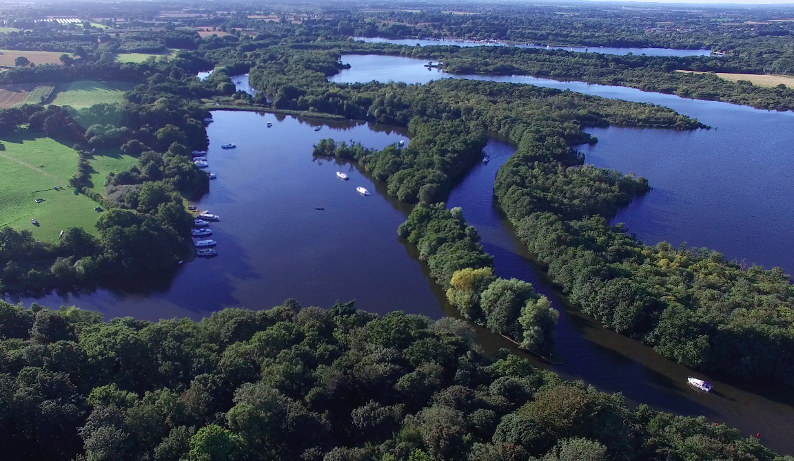
Hoveton Great Broad lies within The Broads in Norfolk, England, between Wroxham Broad and Salhouse Broad. The broad is connected to the River Bure, but not open to boat traffic. Hoveton Great Broad is part of an ancient navigation that has been deliberately allowed to become closed off to any public access since well before the last War. Recent changes in the official Ordnance Survey tide line mean that it is now tidal water and therefore closed illegally. A nature trail was laid out in 1968 - the first in the region. It is accessible only by boat. Mooring is allowed on the north bank of the Bure, opposite Salhouse Broad. Natural England has established a Nature trail. From the boardwalk, one can see the broad with its adjoining fens and alder Alders are trees of the genus ''Alnus'' in the birch family Betulaceae. The genus includes about 35 species of monoecious trees and shrubs, a few reaching a large size, distributed throughout the north temperate zone with ... [...More Info...] [...Related Items...] OR: [Wikipedia] [Google] [Baidu] |
Hoveton & Wroxham Railway Station
Hoveton & Wroxham railway station is on the Bittern Line in Norfolk, England, serving the village of Hoveton and the adjacent village of Wroxham (the two settlements are usually regarded as one). Zoomed to station location with civil parish boundaries and names shown. It is down the line from and is situated between and . It was previously the site of a junction, with the East Norfolk Railway to diverging from the Norwich line a short distance north of the station; however the former line closed to all traffic in 1982 and was subsequently dismantled. The station is the last on the double-track section of the Bittern line: it becomes single-track north of here to (except for a passing loop at and a short section into the station at ). The station is managed by Greater Anglia, which also operates all passenger trains that call. Heritage connection A nearby station named is the southern terminus of the narrow gauge A narrow-gauge railway (narrow-gauge railroad in ... [...More Info...] [...Related Items...] OR: [Wikipedia] [Google] [Baidu] |
Hoveton Little Broad
Hoveton Little Broad, also known as Black Horse Broad, is a secluded broad of fairly open aspect, in the middle reaches of the River Bure between Hoveton and Horning, Norfolk, in The Norfolk Broads. Privately owned, it was the site of direct action in the mid-20th century by local people hoping to establish the right of free public access to all Broadland waterways. Situation and access The broad is closer to Horning than to the village of Hoveton and lies adjacent to the hamlet of Hoveton St John. Inaccessible by road, it is linked to the river by Black Horse Dyke. Another dyke (a narrow waterway) leads from a corner of the broad to the main Hoveton Hoveton is a village and civil parishes in England, civil parish in the England, English county of Norfolk, within The Broads, the Norfolk Broads. Hoveton is located south of North Walsham and north-east of Norwich, separated from Wroxham by ...- Horning road B1354. Just up hill towards Hoveton formerly stood the Black Hors ... [...More Info...] [...Related Items...] OR: [Wikipedia] [Google] [Baidu] |
Roys Of Wroxham
Roys of Wroxham is a family owned group of general stores based in Hoveton, Norfolk. Following a competition in the early 1930s, the store uses the motto "''The World's Largest Village Store''" in all its advertising and literature. History Roys was founded in 1895 when brothers Alfred and Arnold Roy opened their general store in the village of Coltishall. In 1899, a second store was opened in Hoveton. Following the deaths of the founders in the 1950s the business passed to Alfred's children with Fred Roy being appointed chairman and managing director. After his death in 1994, his brother Peter succeeded him as chairman of the board. He served as chairman until his death in 2004, but not before his sons Edward and Paul had joined the board of directors.Roys of Wroxham-history Retrieved 25 January 2011 In 1995, there was a catastrophic fire ... [...More Info...] [...Related Items...] OR: [Wikipedia] [Google] [Baidu] |
The Broads
The Broads (known for marketing purposes as The Broads National Park) is a network of mostly navigable rivers and lakes in the English counties of Norfolk and Suffolk. Although the terms "Norfolk Broads" and "Suffolk Broads" are correctly used to identify specific areas within the two counties respectively, the whole area is frequently referred to as the Norfolk Broads. The lakes, known as broads, were formed by the flooding of peat workings. The Broads, and some surrounding land, were constituted as a special area with a level of protection similar to a national parks of England and Wales, national park by the Norfolk and Suffolk Broads Act 1988. The #Management, Broads Authority, a special statutory authority responsible for managing the area, became operational in 1989. The area is , most of which is in Norfolk, with over of navigable waterways. There are seven rivers and 63 broads, mostly less than deep. Thirteen broads are generally open to navigation, with a further th ... [...More Info...] [...Related Items...] OR: [Wikipedia] [Google] [Baidu] |
Bittern Line
The Bittern Line is a railway branch line in Norfolk, England, that links to . It passes through the Broads on its route to an Area of Outstanding Natural Beauty on the north Norfolk coast. It is named after the Eurasian bittern, bittern, a rare bird found in the reedy wetlands of Norfolk. The line is in length and there are 10 stations. It is part of Network Rail Network Rail Route 7 (Great Eastern), Strategic Route 7, SRS 07.11, and is classified as a rural line. Passenger services are operated by Greater Anglia (train operating company), Greater Anglia, which also manages all of the stations. History The line was granted permission in 1864 and the first stretch was opened between Norwich and in 1874 by the East Norfolk Railway. It was extended to Cromer railway station, Cromer by 1877 before being extended to in 1877, using a section of the Midland and Great Northern Joint Railway line. From the early twentieth century until the end of steam services, in 1962, the Grea ... [...More Info...] [...Related Items...] OR: [Wikipedia] [Google] [Baidu] |
North Norfolk (UK Parliament Constituency)
North Norfolk is a List of United Kingdom Parliament constituencies, constituency represented in the House of Commons of the United Kingdom, House of Commons of the Parliament of the United Kingdom, UK Parliament since 2024 United Kingdom general election, 2024 by Steffan Aquarone, a Liberal Democrats (UK), Liberal Democrat. Constituency profile The seat covers a long stretch of the Norfolk coast including the seaside towns of Cromer, Wells-next-the-Sea and Sheringham. History The North Division of Norfolk was first created by the Reform Act 1867 as one of three two-member divisions of the Parliamentary County of Norfolk. Under the Redistribution of Seats Act 1885, the three two-member county divisions were replaced with six single-member divisions. The second version of this constituency was one of the single-member seats. It has remained as a single-member seat since then, being designated as a County Constituency from the 1950 United Kingdom general election, 1950 general ... [...More Info...] [...Related Items...] OR: [Wikipedia] [Google] [Baidu] |
St Benet's Abbey
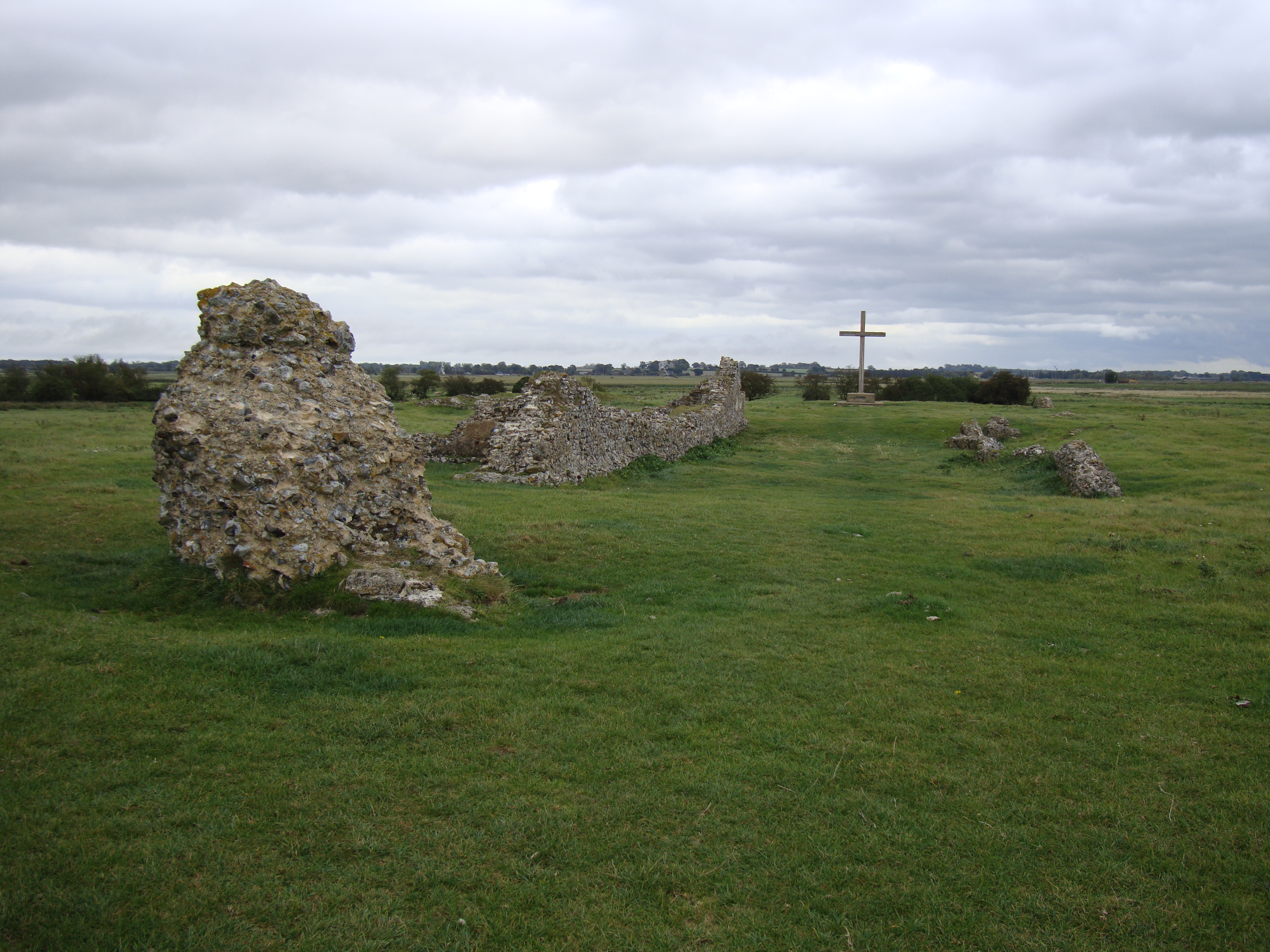
St Benet's Abbey, also known as St Benet's at Holme or St Benet Hulme, was a medieval monastery of the Order of Saint Benedict situated at Cow Holm in Horning, Norfolk, Kingdom of England, England. It lay on the River Bure within the Broads. St Benet is a medieval English version of the name of St Benedict of Nursia, hailed as the founder of western monasticism. At the period of the Dissolution of the Monasteries the abbey's possessions were in effect seized by the crown and assigned to the diocese of Norwich. Though the monastery was supposed to continue as a community, within a few years at least the monks had dispersed. Today there remain only ruins. The Abbey in Anglo-Saxon times The early history of the monastery has to be told tentatively since it is difficult to reconcile the surviving sources with what is known of the bigger picture of the development of the area. It is said that St Benet's was founded on the site of a 9th-century monastery where the hermit Suneman was m ... [...More Info...] [...Related Items...] OR: [Wikipedia] [Google] [Baidu] |
North Norfolk
North Norfolk is a Non-metropolitan district, local government district in Norfolk, England. Its council is based in Cromer, and the largest town is North Walsham. The district also includes the towns of Fakenham, Holt, Norfolk, Holt, Sheringham, Stalham and Wells-next-the-Sea, along with numerous villages and surrounding rural areas. The district lies on the north coast of Norfolk, facing the North Sea, with much of its coastline lying within the Norfolk Coast AONB, Norfolk Coast Area of Outstanding Natural Beauty. Some south-eastern parts of the district lie within The Broads. The neighbouring districts are Borough of Great Yarmouth, Great Yarmouth, Breckland District, Breckland, Broadland and King's Lynn and West Norfolk. History The district was created on 1 April 1974 under the Local Government Act 1972, covering seven former districts which were all abolished at the same time: *Cromer Urban district (England and Wales), Urban District *Erpingham Rural District *North Wa ... [...More Info...] [...Related Items...] OR: [Wikipedia] [Google] [Baidu] |
River Bure
The River Bure is a river in the county of Norfolk, England, most of it in the Broads.Ordnance Survey (2005). ''OS Explorer Map OL40 - The Broads''. . The Bure rises near Melton Constable, upstream of Aylsham, which was the original head of navigation. Nowadays, the head of navigation is downstream at Coltishall Bridge. After Aylsham Lock and Burgh Bridge, the Bure passes through Buxton Lammas, Coltishall, Belaugh, Wroxham, Horning, past St. Benet's Abbey, through Oby, Acle, Stokesby, along the northern border of the Halvergate Marshes, through Runham and Great Yarmouth where it meets Breydon Water and flows into the sea at Gorleston. It has two major tributaries, the River Thurne and the River Ant. There is also Muck Fleet which connects the Trinity Broads (Ormesby, Rollesby and Filby Broad) to the main network. Other minor tributaries include the River Hor, which joins the Bure just upstream of Hoveton, The Mermaid which merges at Burgh-next-Aylsham and ... [...More Info...] [...Related Items...] OR: [Wikipedia] [Google] [Baidu] |
Anglo-Saxons
The Anglo-Saxons, in some contexts simply called Saxons or the English, were a Cultural identity, cultural group who spoke Old English and inhabited much of what is now England and south-eastern Scotland in the Early Middle Ages. They traced their origins to Germanic peoples, Germanic settlers who became one of the most important cultural groups in Britain by the 5th century. The Anglo-Saxon period in Britain is considered to have started by about 450 and ended in 1066, with the Norman conquest of England, Norman Conquest. Although the details of Anglo-Saxon settlement of Britain, their early settlement and History of Anglo-Saxon England, political development are not clear, by the 8th century an Anglo-Saxon cultural identity which was generally called had developed out of the interaction of these settlers with the existing Romano-British culture. By 1066, most of the people of what is now England spoke Old English, and were considered English. Viking and Norman invasions chang ... [...More Info...] [...Related Items...] OR: [Wikipedia] [Google] [Baidu] |


