|
Horrom
Horom () is a village in the Artik Municipality of the Shirak Province of Armenia. Located 1 km east of Horom and situated upon two large hills south of the main road and opposite of the dam and reservoir is the ancient Bronze Age through Urartian Citadel of Horom. Not far from this location in Ghak and Shvaghtapa are two Urartian cyclopean forts. Demographics Development programs Horom village became part of COAF-supported villages (Children of Armenia Fund). The programs implemented include: Student Councils, Debate Clubs, Health and Lifestyle Education, School Nutrition & Brushodromes, Women Health Screenings, Support for Reproductive Health. Children of Armenia Fund Children of Armenia Fund (COAF) (Armenian language, Armenian: «Հայաստանի Մանուկներ» բարեգործական հիմնադրամ (ՔՈԱՖ)) is a Nonprofit organization, non-profit, Non-governmental organization, non-government ... also renovated village facilities such as Cafeteri ... [...More Info...] [...Related Items...] OR: [Wikipedia] [Google] [Baidu] |
Horom Citadel
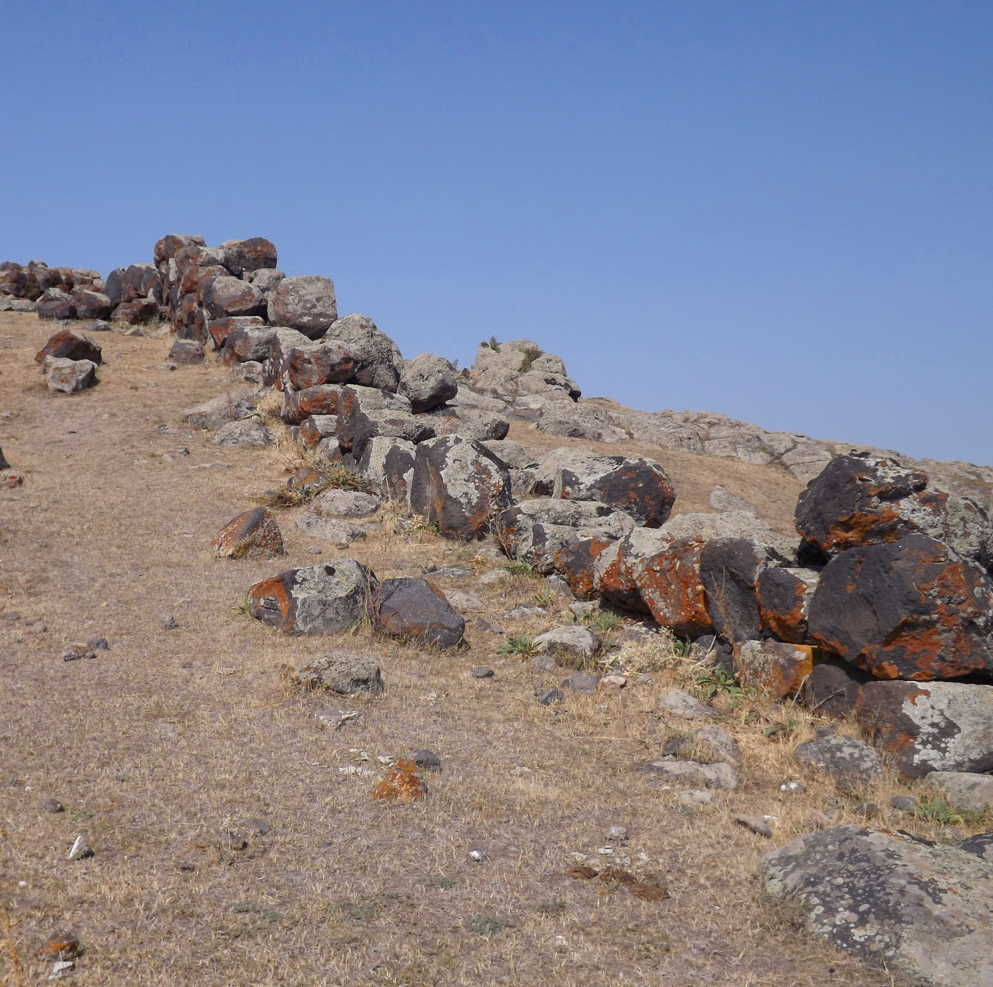
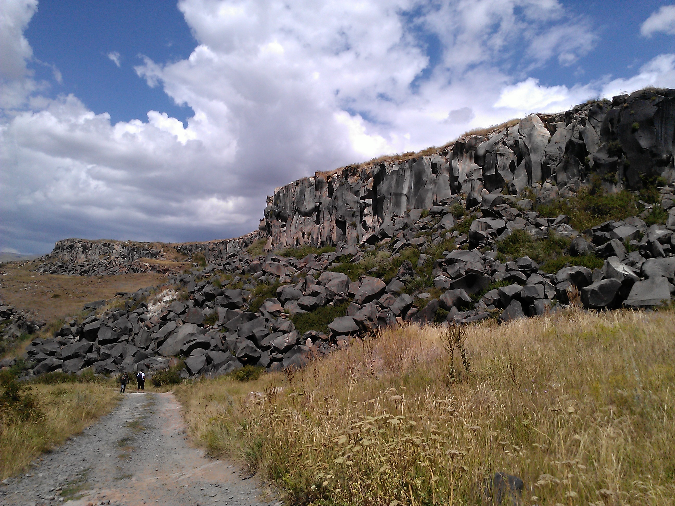
Horom Citadel (, also Romanized as Orom and Horrom) is an ancient Bronze Age through Urartian fortification atop two large hills south of the main road and opposite of the dam and Kamut Reservoir. It is about east of the village of Horrom in the Shirak Province of northwestern Armenia. Not far from this location in Ghak and Shvaghtapa are two Urartian cyclopean forts. Archaeology Horom is considered to be one of the most impressive archaeological sites in Armenia because of its unique architecture. There are potsherds and obsidian flakes strewn on the surface of the ground. Recent excavations In archaeology, excavation is the exposure, processing and recording of archaeological remains. An excavation site or "dig" is the area being studied. These locations range from one to several areas at a time during a project and can be condu ... have been underway at the site recently by Armenian and American archaeologists led by Ruben Badalian and Philip Kohl. The teams have ... [...More Info...] [...Related Items...] OR: [Wikipedia] [Google] [Baidu] |
Armenia
Armenia, officially the Republic of Armenia, is a landlocked country in the Armenian Highlands of West Asia. It is a part of the Caucasus region and is bordered by Turkey to the west, Georgia (country), Georgia to the north and Azerbaijan to the east, and Iran and the Azerbaijani exclave of Nakhchivan Autonomous Republic, Nakhchivan to the south. Yerevan is the Capital city, capital, largest city and Economy of Armenia, financial center. The Armenian Highlands has been home to the Hayasa-Azzi, Shupria and Nairi. By at least 600 BC, an archaic form of Proto-Armenian language, Proto-Armenian, an Indo-European languages, Indo-European language, had diffused into the Armenian Highlands.Robert Drews (2017). ''Militarism and the Indo-Europeanizing of Europe''. Routledge. . p. 228: "The vernacular of the Great Kingdom of Biainili was quite certainly Armenian. The Armenian language was obviously the region's vernacular in the fifth century BC, when Persian commanders and Greek writers ... [...More Info...] [...Related Items...] OR: [Wikipedia] [Google] [Baidu] |
Provinces Of Armenia
Armenia is subdivided into eleven administrative divisions. Of these, ten are provinces, known as () or in the singular form () in Armenian. Yerevan is treated separately and granted special administrative status as the country's capital. The chief executive in each of 10 ''marz''es is the ''marzpet'', appointed by the government of Armenia. In Yerevan, the chief executive is the mayor, elected by the Yerevan City Council. First-level administrative divisions The following is a list of the provinces with population, area, and density information. Figures are from the Statistical Committee of Armenia. The area of the Gegharkunik Province includes Lake Sevan which covers of its territory: Municipalities (''hamaynkner'') Within each province of the republic, there are municipal communities (''hamaynkner'', singular ''hamaynk''), currently considered the second-level administrative division in Armenia. Each municipality - known officially as community, either rural or ... [...More Info...] [...Related Items...] OR: [Wikipedia] [Google] [Baidu] |
Shirak Province
Shirak (, ) is a provinces of Armenia, province () of Armenia. It is located in the north-west of the country, bordering the provinces of Lori Province, Lori to the east and Aragatsotn Province, Aragatsotn to the south and southeast, and the countries of Turkey to the west and Georgia (country), Georgia to the north. Its capital and largest city is Gyumri, which is the second largest city in Armenia. It is as much semi-desert as it is mountain meadow or high alpine. In the south, the high steppes merge into mountain terrain, being verdant green in the spring, with hues of reddish brown in the summer. The province is served by the Gyumri Shirak International Airport, Shirak International Airport of Gyumri. Etymology Shirak Province is named after the Shirak canton of the historical Ayrarat province of Kingdom of Armenia (antiquity), Ancient Armenia. The early medieval Armenian historian Movses Khorenatsi writes that the name Shirak derives from Shara, who was the great-grandson o ... [...More Info...] [...Related Items...] OR: [Wikipedia] [Google] [Baidu] |
Municipalities Of Armenia
A municipality in Armenia referred to as community ( ''hamaynk'', plural: ''hamaynkner''), is an administrative subdivision consisting of a settlement ( ''bnakavayr'') or a group of settlements ( ''bnakavayrer'') that enjoys local self-government. The settlements are classified as either towns ( ''kaghakner'', singular ''kaghak'') or villages ( ''gyugher'', singular ( ''gyugh''). The administrative centre of a community could either be an urban settlement (town) or a rural settlement (village). Two-thirds of the population are now urbanized. As of 2017, 63.6% of Armenians live in urban areas as compared to 36.4% in rural. As of the end of 2017, Armenia has 503 municipal communities (including Yerevan) of which 46 are urban and 457 are rural. The capital, Yerevan, also has the status of a community. Each municipality bears the same name as its administrative centre, with the exception of 7 municipalities, of which 4 are located in Shirak Province (Ani Municipality with its c ... [...More Info...] [...Related Items...] OR: [Wikipedia] [Google] [Baidu] |
Artik Municipality
Shirak (, ) is a provinces of Armenia, province () of Armenia. It is located in the north-west of the country, bordering the provinces of Lori Province, Lori to the east and Aragatsotn Province, Aragatsotn to the south and southeast, and the countries of Turkey to the west and Georgia (country), Georgia to the north. Its capital and largest city is Gyumri, which is the second largest city in Armenia. It is as much semi-desert as it is mountain meadow or high alpine. In the south, the high steppes merge into mountain terrain, being verdant green in the spring, with hues of reddish brown in the summer. The province is served by the Gyumri Shirak International Airport, Shirak International Airport of Gyumri. Etymology Shirak Province is named after the Shirak canton of the historical Ayrarat province of Kingdom of Armenia (antiquity), Ancient Armenia. The early medieval Armenian historian Movses Khorenatsi writes that the name Shirak derives from Shara, who was the great-grandson o ... [...More Info...] [...Related Items...] OR: [Wikipedia] [Google] [Baidu] |
Bronze Age
The Bronze Age () was a historical period characterised principally by the use of bronze tools and the development of complex urban societies, as well as the adoption of writing in some areas. The Bronze Age is the middle principal period of the three-age system, following the Stone Age and preceding the Iron Age. Conceived as a global era, the Bronze Age follows the Neolithic, with a transition period between the two known as the Chalcolithic. The final decades of the Bronze Age in the Mediterranean basin are often characterised as a period of widespread societal collapse known as the Late Bronze Age collapse (), although its severity and scope are debated among scholars. An ancient civilisation is deemed to be part of the Bronze Age if it either produced bronze by smelting its own copper and alloying it with tin, arsenic, or other metals, or traded other items for bronze from producing areas elsewhere. Bronze Age cultures were the first to History of writing, develop writin ... [...More Info...] [...Related Items...] OR: [Wikipedia] [Google] [Baidu] |
Urartu
Urartu was an Iron Age kingdom centered around the Armenian highlands between Lake Van, Lake Urmia, and Lake Sevan. The territory of the ancient kingdom of Urartu extended over the modern frontiers of Turkey, Iran, Iraq, and Armenia.Kleiss, Wolfram (2008). "URARTU IN IRAN". ''Encyclopædia Iranica''. Its kings left behind cuneiform inscriptions in the Urartian language, a member of the Hurro-Urartian languages, Hurro-Urartian language family. Urartu extended from the Euphrates in the west to the region west of Ardabil in Iran, and from Lake Çıldır near Ardahan in Turkey to the region of Rawandiz in Iraqi Kurdistan. The kingdom emerged in the mid-9th century BC and dominated the Armenian Highlands in the 8th and 7th centuries BC. Urartu frequently warred with Neo-Assyrian Empire, Assyria and became, for a time, the most powerful state in the Near East. Weakened by constant conflict, it was eventually conquered, either by the Iranian peoples, Iranian Medes in the early 6th c ... [...More Info...] [...Related Items...] OR: [Wikipedia] [Google] [Baidu] |
Cyclopean Masonry
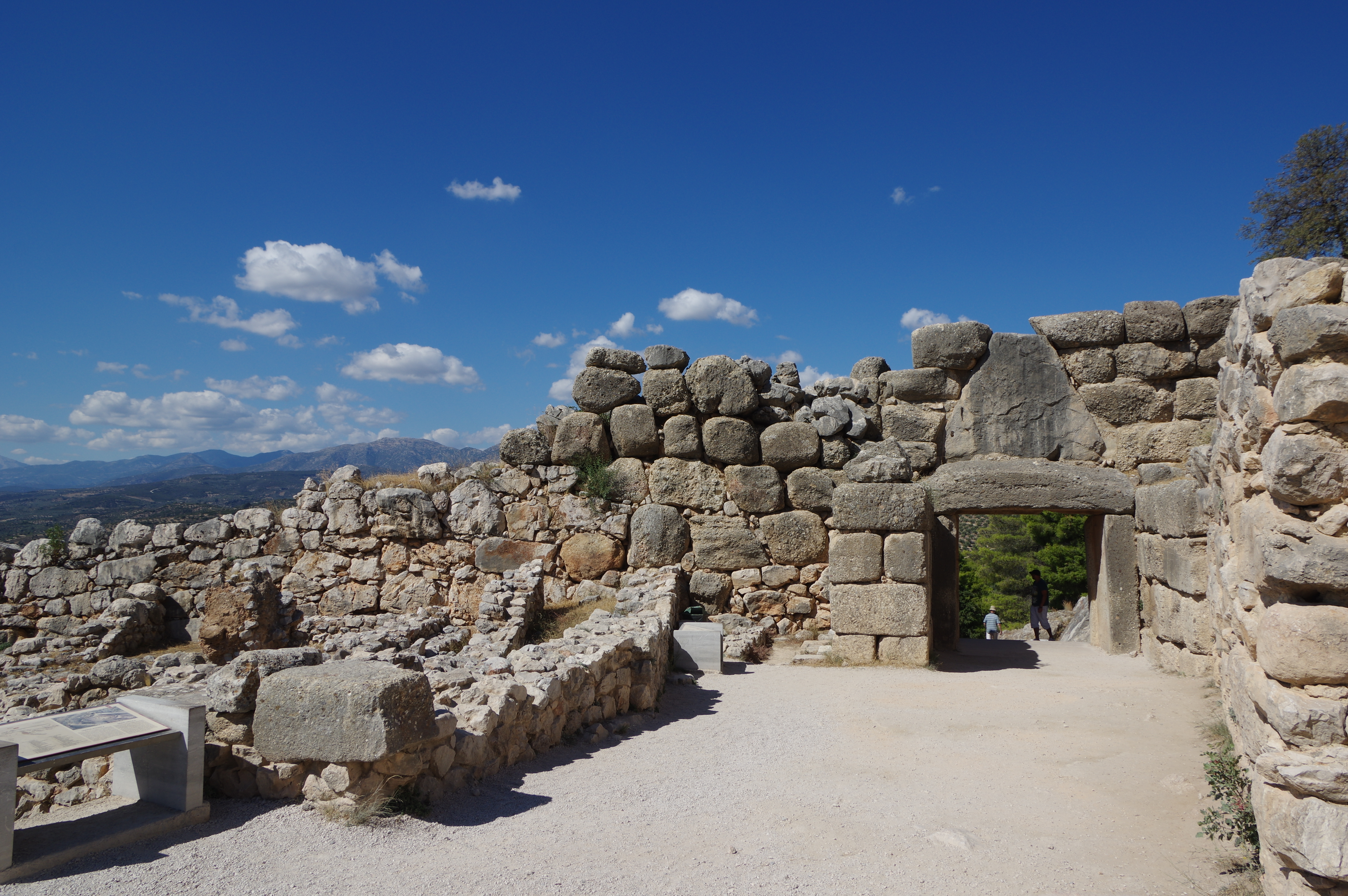
Cyclopean masonry is a type of stonework found in Mycenaean architecture, built with massive limestone boulders, roughly fitted together with minimal clearance between adjacent stones and with clay mortar or no use of mortar. The boulders typically seem unworked, but some may have been worked roughly with a hammer and the gaps between boulders filled in with smaller chunks of limestone. The most famous examples of Cyclopean masonry are found in the walls of Mycenae and Tiryns, and the style is characteristic of Mycenaean fortifications. Similar styles of stonework are found in other cultures and the term has come to be used to describe typical stonework of this sort. The term comes from the belief of classical Greeks that only the mythical Cyclopes had the strength to move the enormous boulders that made up the walls of Mycenae and Tiryns. Pliny's ''Natural History'' reported the tradition, attributed to Aristotle, that the Cyclopes were the inventors of masonry towers, giving ... [...More Info...] [...Related Items...] OR: [Wikipedia] [Google] [Baidu] |
Children Of Armenia Fund
Children of Armenia Fund (COAF) (Armenian language, Armenian: «Հայաստանի Մանուկներ» բարեգործական հիմնադրամ (ՔՈԱՖ)) is a Nonprofit organization, non-profit, Non-governmental organization, non-governmental organization with headquarters in Armenia and the United States focused on child-centered development of rural Armenia. According to the foundation, they have served over 107,000 beneficiaries from 64 rural communities in 6 out of 11 Armenian provinces. COAF was founded in 2004 after the businessman Garo H. Armen, Garo Armen visited Karakert village in Armenia’s Armavir Province, Armavir region and witnessed the level of neglect that rural residents were facing. Consequently, COAF was created to reduce poverty in rural Armenia through “education, Health care, healthcare, child and family services, and economic development programs.” The declared mission of COAF is to “provide resources to children and adults with COAF SMART ini ... [...More Info...] [...Related Items...] OR: [Wikipedia] [Google] [Baidu] |


