|
Hook Norton Cutting And Banks
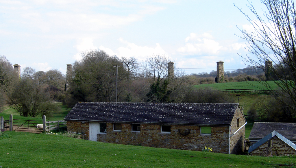
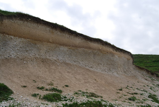
Hook Norton Cutting and Banks is a biological and geological Site of Special Scientific Interest south of Hook Norton in Oxfordshire. The site is in three areas, two of which are managed as a nature reserve called Hook Norton Cutting by Berkshire, Buckinghamshire and Oxfordshire Wildlife Trust. and are designated a Geological Conservation Review site. Hook Norton Cutting is a nature reserve along two stretches of a disused railway line separated by a tunnel. Most of it is unimproved calcareous grassland with a rich variety of flora. The site is notable for its bee species, including one which has only been recorded at three other sites in the country, ''Andrena bucephala''. The cutting exposes rocks dating to the Middle Jurassic, around 167 million years ago, which are the type section of the Hook Norton Member of the Chipping Norton Formation. Hook Norton Bank is a steeply sloping limestone grassland by the River Swere. References {{Berkshire, Buckinghamshire and Oxford ... [...More Info...] [...Related Items...] OR: [Wikipedia] [Google] [Baidu] |
Site Of Special Scientific Interest
A Site of Special Scientific Interest (SSSI) in Great Britain or an Area of Special Scientific Interest (ASSI) in the Isle of Man and Northern Ireland is a conservation designation denoting a protected area in the United Kingdom and Isle of Man. SSSI/ASSIs are the basic building block of site-based nature conservation legislation and most other legal nature/geological conservation designations in the United Kingdom are based upon them, including national nature reserves, Ramsar sites, Special Protection Areas, and Special Areas of Conservation. The acronym "SSSI" is often pronounced "triple-S I". Selection and conservation Sites notified for their biological interest are known as Biological SSSIs (or ASSIs), and those notified for geological or physiographic interest are Geological SSSIs (or ASSIs). Sites may be divided into management units, with some areas including units that are noted for both biological and geological interest. Biological Biological SSSI/A ... [...More Info...] [...Related Items...] OR: [Wikipedia] [Google] [Baidu] |
Hook Norton
Hook Norton is a village and civil parish in Oxfordshire, England. It lies northeast of Chipping Norton, close to the Cotswold Hills. The 2011 Census recorded the parish's population as 2,117. The village is formed of four neighbourhoods: East End, Scotland End (in the west), Down End (in the centre) and Southrop (in the south). Toponymy In the ''Anglo-Saxon Chronicle'' in 917 the village is recorded as ''Hocneratun''. The Domesday Book of 1086 records it as ''Hochenartone''. A charter from 1130 records it as ''Hokenartona''. An episcopal register entry from 1225 records it as ''Hokenartone''. A record from 1267 records it as ''Hokenarton''. The ''Taxatio Ecclesiastica'' of 1291 records it as ''Hoke Norton''. Other past spellings of the name include ''Hocceneretune'' (1050), ''Hogenarton'' (1216) and ''Okenardton'' (1263). ''Hegnorton'' is recorded in a plea roll from 1430. The name is derived from Old English. ''Hocca'' may perhaps be the name of a person or tribe, altho ... [...More Info...] [...Related Items...] OR: [Wikipedia] [Google] [Baidu] |
Oxfordshire
Oxfordshire is a ceremonial and non-metropolitan county in the north west of South East England. It is a mainly rural county, with its largest settlement being the city of Oxford. The county is a centre of research and development, primarily due to the work of the University of Oxford and several notable science parks. These include the Harwell Science and Innovation Campus and Milton Park, both situated around the towns of Didcot and Abingdon-on-Thames. It is a landlocked county, bordered by six counties: Berkshire to the south, Buckinghamshire to the east, Wiltshire to the south west, Gloucestershire to the west, Warwickshire to the north west, and Northamptonshire to the north east. Oxfordshire is locally governed by Oxfordshire County Council, together with local councils of its five non-metropolitan districts: City of Oxford, Cherwell, South Oxfordshire, Vale of White Horse, and West Oxfordshire. Present-day Oxfordshire spanning the area south of the ... [...More Info...] [...Related Items...] OR: [Wikipedia] [Google] [Baidu] |
Berkshire, Buckinghamshire And Oxfordshire Wildlife Trust
The Berkshire, Buckinghamshire and Oxfordshire Wildlife Trust (BBOWT), is a wildlife trust covering the counties of Berkshire, Buckinghamshire and Oxfordshire Oxfordshire is a ceremonial and non-metropolitan county in the north west of South East England. It is a mainly rural county, with its largest settlement being the city of Oxford. The county is a centre of research and development, primarily ... in England. The trust was formerly called the Berkshire, Buckinghamshire and Oxfordshire Naturalists' Trust (BBONT). __TOC__ Sites Berkshire Buckinghamshire Oxfordshire Notes References External links Berkshire, Buckinghamshire and Oxfordshire Wildlife Trust website {{DEFAULTSORT:Berkshire, Buckinghamshire And Oxfordshire Wildlife Trust Wildlife Trusts of England ... [...More Info...] [...Related Items...] OR: [Wikipedia] [Google] [Baidu] |
Geological Conservation Review
The Geological Conservation Review (GCR) is produced by the UK's Joint Nature Conservation Committee and is designed to identify those sites of national and international importance needed to show all the key scientific elements of the geological and geomorphological features of Britain. These sites display sediments, rocks, minerals, fossils, and features of the landscape that make a special contribution to an understanding and appreciation of Earth science and the geological history of Britain, which stretches back more than three billion years. The intention of the project, which was devised in 1974 by George Black and William Wimbledon working for the Governmental advisory agency, the Nature Conservancy Council (NCC), was activated in 1977. It aimed to provide the scientific rationale and information base for the conservation of geological SSSIs ( Sites of Special Scientific Interest, protected under British law (latterly the Wildlife and Countryside Act 1981, as amended ... [...More Info...] [...Related Items...] OR: [Wikipedia] [Google] [Baidu] |
Calcareous
Calcareous () is an adjective meaning "mostly or partly composed of calcium carbonate", in other words, containing lime or being chalky. The term is used in a wide variety of scientific disciplines. In zoology ''Calcareous'' is used as an adjectival term applied to anatomical structures which are made primarily of calcium carbonate, in animals such as gastropods, i.e., snails, specifically about such structures as the operculum, the clausilium, and the love dart. The term also applies to the calcium carbonate tests of often more or less microscopic Foraminifera. Not all tests are calcareous; diatoms and radiolaria have siliceous tests. The molluscs are calcareous, as are calcareous sponges (Porifera), that have spicules which are made of calcium carbonate. In botany ''Calcareous grassland'' is a form of grassland characteristic of soils containing much calcium carbonate from underlying chalk or limestone rock. In medicine The term is used in pathology, for ... [...More Info...] [...Related Items...] OR: [Wikipedia] [Google] [Baidu] |
Andrena Bucephala
''Andrena'' is a genus of bees in the family Andrenidae. With over 1,500 species, it is one of the largest genera of animals. It is a strongly monophyletic group that is difficult to split into more manageable divisions; currently, ''Andrena'' is organized into 104 subgenera. It is nearly worldwide in distribution, with the notable exceptions of Oceania and South America. Bees in this genus are commonly known as mining bees due to their ground-nesting lifestyle. Morphology ''Andrena'' are generally medium-sized bees; body length ranges between 8 and 17 mm with males being smaller and more slender than females. Most are black with white to tan hair, and their wings have either two or three submarginal cells. They carry pollen mainly on femoral scopal hairs, but many ''Andrena'' have an additional propodeal corbicula for carrying some pollen on their thorax.C. D. Michener (2007) ''The Bees of the World'', 2nd Edition, Johns Hopkins University Press. They can be disting ... [...More Info...] [...Related Items...] OR: [Wikipedia] [Google] [Baidu] |
Middle Jurassic
The Middle Jurassic is the second epoch of the Jurassic Period. It lasted from about 174.1 to 163.5 million years ago. Fossils of land-dwelling animals, such as dinosaurs, from the Middle Jurassic are relatively rare, but geological formations containing land animal fossils include the Forest Marble Formation in England, the Kilmaluag Formation in Scotland,British Geological Survey. 2011Stratigraphic framework for the Middle Jurassic strata of Great Britain and the adjoining continental shelf: research report RR/11/06 British Geological Survey, Keyworth, Nottingham. the Daohugou Beds in China, the Itat Formation in Russia, and the Isalo III Formation of western Madagascar. Paleogeography During the Middle Jurassic Epoch, Pangaea began to separate into Laurasia and Gondwana, and the Atlantic Ocean formed. Eastern Laurasia was tectonically active as the Cimmerian plate continued to collide with Laurasia's southern coast, completely closing the Paleo-Tethys Ocean. A subd ... [...More Info...] [...Related Items...] OR: [Wikipedia] [Google] [Baidu] |
Type Section
A stratotype or type section in geology is the physical location or outcrop of a particular reference exposure of a stratigraphic sequence or stratigraphic boundary. If the stratigraphic unit is layered, it is called a stratotype, whereas the standard of reference for unlayered rocks is the type locality. Also it can be defined as "The particular sequence of strata chosen as standard of reference of a layered stratigraphic unit." When a stratigraphic unit is nowhere fully exposed, the original type section may be supplemented with reference sections covering the full thickness of the unit. A reference section may also be defined when the original type section is poorly exposed, or for historical units which were designated without specifying a type section according to more modern standards. See also * Global Boundary Stratotype Section and Point A Global Boundary Stratotype Section and Point (GSSP) is an internationally agreed upon reference point on a stratigraphic sec ... [...More Info...] [...Related Items...] OR: [Wikipedia] [Google] [Baidu] |
Chipping Norton Formation
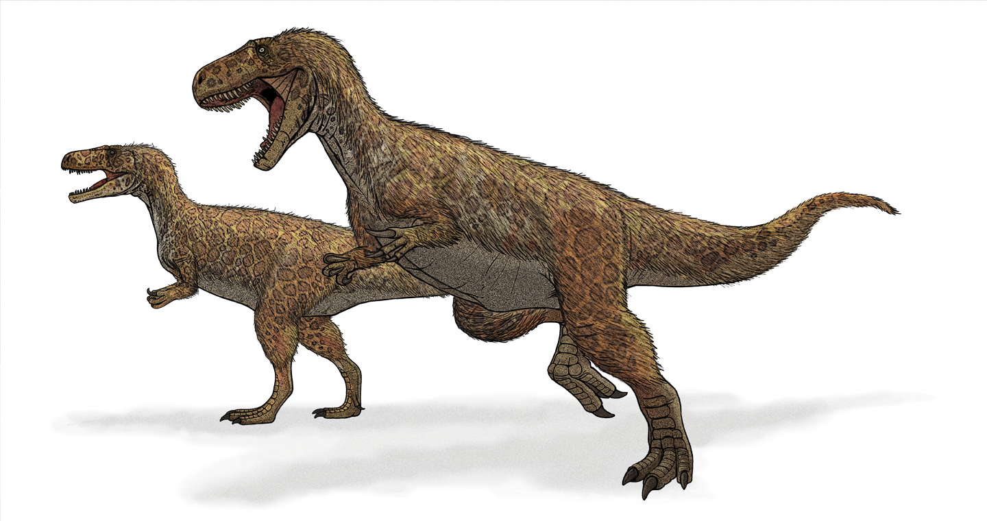
The Chipping Norton Limestone is a geological formation in the Cotswolds, England. It preserves fossils dating back to the Bathonian (Middle Jurassic).Weishampel, David B; et al. (2004). "Dinosaur distribution (Middle Jurassic, Europe)." In: Weishampel, David B.; Dodson, Peter; and Osmólska, Halszka (eds.): The Dinosauria, 2nd, Berkeley: University of California Press. Pp. 538–541. . Including those of dinosaurs ''Cetiosaurus, Megalosaurus'' and '' Cruxicheiros'' as well as the Tritylodontid ''Stereognathus''. It primarily consists of ooidal limestone. Fossil content The so-called "Scrotum humanum" remains may have come from this formation. See also * List of dinosaur-bearing rock formations * List of fossiliferous stratigraphic units in England See also * Lists of fossiliferous stratigraphic units in Europe * Lists of fossiliferous stratigraphic units in the United Kingdom References * {{DEFAULTSORT:Fossiliferous stratigraphic units in England England United ... [...More Info...] [...Related Items...] OR: [Wikipedia] [Google] [Baidu] |
River Swere
The River Swere is a stream in Oxfordshire, England, with a length of 2.09 kilometres and an elevation of 322 feet. The river's source lies around Swerford. It flows north towards Wigginton, and then turns east, passing just above South Newington, Barford St. Michael and Deddingtonhttp://www.deddingtonhistory.uk/__data/assets/pdf_file/0006/1302/224-24October2005.pdf before it feeds into the River Cherwell on the west side of the M40, opposite to Aynho Aynho (, formerly spelt ''Aynhoe'') is a village and civil parish in West Northamptonshire, England, on the edge of the Cherwell valley south-east of the north Oxfordshire town of Banbury and southwest of Brackley. Along with its neighbour C .... References Swere {{England-river-stub ... [...More Info...] [...Related Items...] OR: [Wikipedia] [Google] [Baidu] |
Sites Of Special Scientific Interest In Oxfordshire
Site most often refers to: * Archaeological site * Campsite, a place used for overnight stay in an outdoor area * Construction site * Location, a point or an area on the Earth's surface or elsewhere * Website, a set of related web pages, typically with a common domain name It may also refer to: * Site, a National Register of Historic Places property type * SITE (originally known as ''Sculpture in the Environment''), an American architecture and design firm * Site (mathematics), a category C together with a Grothendieck topology on C * '' The Site'', a 1990s TV series that aired on MSNBC * SITE Intelligence Group, a for-profit organization tracking jihadist and white supremacist organizations * SITE Institute, a terrorism-tracking organization, precursor to the SITE Intelligence Group * Sindh Industrial and Trading Estate, a company in Sindh, Pakistan * SITE Centers, American commercial real estate company * SITE Town, a densely populated town in Karachi, Pakistan * S.I.T ... [...More Info...] [...Related Items...] OR: [Wikipedia] [Google] [Baidu] |


.jpg)


