|
Homonhon
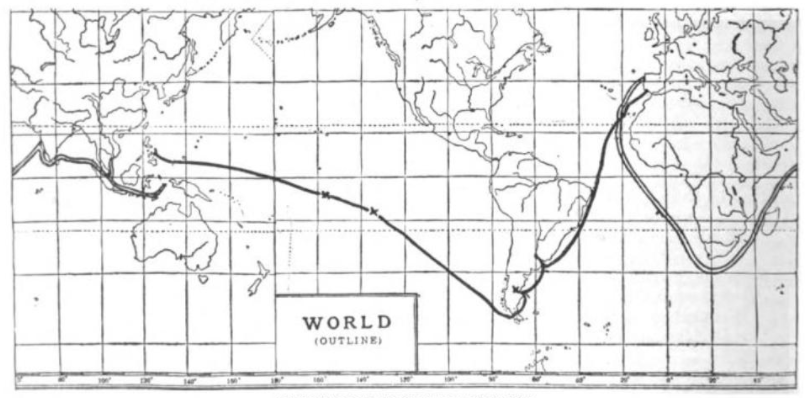
Homonhon Island is an island in the province of Eastern Samar, Philippines, on the east side of Leyte Gulf. The long island is part of the municipality of Guiuan, encompassing eight barangays: Bitaugan, Cagusu-an, Canawayon, Casuguran, Culasi, Habag, Inapulangan, and Pagbabangnan. Mantoconan, an islet just off the northwest corner of Homonhon, is also part of the approximately 7,500 islands comprising the Philippine Archipelago. The island is one of the early Pacific contact sites between the East and the West. History During the first circumnavigation of the globe, Ferdinand Magellan's three surviving vessels passed the Marianas, but did not land, even though he was out of food after crossing the Pacific Ocean. Yet he landed on the island of Homonhon on March 16, 1521. Despite Homonhon being uninhabited at that time, he was detected by the fishing boats of nearby local settlements in Suluan. The local leaders arrived in more boats, receiving him warmly and trading food and sup ... [...More Info...] [...Related Items...] OR: [Wikipedia] [Google] [Baidu] |
Guiuan, Eastern Samar
Guiuan (Help:IPA/Tagalog, [ˈgiˌwan] ; , ), officially the Municipality of Guiuan, is a municipality of the Philippines, municipality in the Philippine Province, province of Eastern Samar, Philippines. It constitutes the southeastern extremity of Samar, Samar Island and some adjacent islands, surrounded by Leyte Gulf and the Philippine Sea (which a marginal sea of the Pacific Ocean), two major bodies of water that makes the town the surfing capital of the Visayas. According to the 2020 census, it has a population of 53,361 people, making it the most populous municipality in Eastern Samar (followed by Dolores, Eastern Samar, Dolores) and the second most populous administrative division in the entire province after the capital city Borongan. Guiuan played a significant part in Philippine history. Historical accounts attested that Ferdinand Magellan's 16th century Magellan expedition, expedition first landed on the island of Homonhon, which lies within the municipality, after their ... [...More Info...] [...Related Items...] OR: [Wikipedia] [Google] [Baidu] |
Homonhon Peak
Homonhon Island is an island in the province of Eastern Samar, Philippines, on the east side of Leyte Gulf. The long island is part of the municipality of Guiuan, encompassing eight barangays: Bitaugan, Cagusu-an, Canawayon, Casuguran, Culasi, Habag, Inapulangan, and Pagbabangnan. Mantoconan, an islet just off the northwest corner of Homonhon, is also part of the approximately 7,500 islands comprising the Philippine Archipelago. The island is one of the early Pacific contact sites between the East and the West. History During the first circumnavigation of the globe, Ferdinand Magellan's three surviving vessels passed the Marianas, but did not land, even though he was out of food after crossing the Pacific Ocean. Yet he landed on the island of Homonhon on March 16, 1521. Despite Homonhon being uninhabited at that time, he was detected by the fishing boats of nearby local settlements in Suluan. The local leaders arrived in more boats, receiving him warmly and trading food and sup ... [...More Info...] [...Related Items...] OR: [Wikipedia] [Google] [Baidu] |
Eastern Samar
Eastern Samar ( Waray-Waray: ''Sinirangan Samar''; ), officially the Province of Eastern Samar, is a province in the Philippines located in the Eastern Visayas region. Its capital is the city of Borongan, which is the most populous. Eastern Samar occupies the eastern portion of the island of Samar. Bordering the province to the north is the province of Northern Samar and to the west is Samar province. To the east lies the Philippine Sea, part of the vast Pacific Ocean, while to the south lies Leyte Gulf. History Spanish colonial era During his circumnavigation of the globe, Ferdinand Magellan had set foot on the tiny island of Homonhon in the southern part of the province. On March 16, 1521, the area of what is now Eastern Samar is said to be the first Philippine landmass spotted by Magellan and his crew. In 1596, many names, such as Samal, Ibabao, and Tandaya, were given to Samar Island prior to the coming of the Spaniards in 1596. During the early days of Spanish occu ... [...More Info...] [...Related Items...] OR: [Wikipedia] [Google] [Baidu] |
Suluan
Suluan is an island barangay in the Philippines, in the municipality of Guiuan, Eastern Samar. It lies east of Leyte Gulf and west of Emden Deep. The inhabitants of the island were the first Filipinos to trade and interact with Ferdinand Magellan's expedition which anchored on the nearby (then uninhabited) island of Homonhon on March 16, 1521. History On March 16, 1521, after 98 days of crossing the Pacific Ocean, Magellan's voyage dropped anchor on the island of Homonhon ("Humunu" in Pigafetta's account). Although Samar ("Zamal") was their first land sighting from afar, Magellan's choice of anchoring on a much smaller island was meant as a security precaution as the island was then uninhabited. On March 18, they were spotted by fishermen from the nearby island of Suluan ("Zuluan"). The islanders called their other leaders together and met with Magellan's crew. Magellan gave them gifts of small trade items. In return, the people of Suluan gave fish, a jar of "''uraca''" ... [...More Info...] [...Related Items...] OR: [Wikipedia] [Google] [Baidu] |
Visayas
The Visayas ( ), or the Visayan Islands (Bisayan languages, Visayan: ''Kabisay-an'', ; Filipino language, Filipino: ''Kabisayaan'' ), are one of the three Island groups of the Philippines, principal geographical divisions of the Philippines, along with Luzon and Mindanao. Located in the central part of the archipelago, it consists of several islands, primarily surrounding the Visayan Sea, although the Visayas are also considered the northeast extremity of the entire Sulu Sea. Its inhabitants are predominantly the Visayan peoples. The major islands of the Visayas are Panay, Negros, Cebu Island, Cebu, Bohol Island, Bohol, Leyte and Samar. The region may also include the provinces of Palawan, Romblon, and Masbate, whose populations identify as Visayan and whose languages are more closely related to other Visayan languages than to the major languages of Luzon. There are four administrative Regions of the Philippines, regions in the Visayas: Western Visayas (pop. 4.73 million), Neg ... [...More Info...] [...Related Items...] OR: [Wikipedia] [Google] [Baidu] |
Philippine Sea
The Philippine Sea is a List of seas#Marginal seas by ocean, marginal sea of the Pacific Ocean, Western Pacific Ocean east of the list of islands of the Philippines, Philippine Archipelago (hence the name) and the List of seas#Largest seas by area, largest sea in the world, occupying an estimated surface area of . The Philippine Sea Plate forms the floor of the sea. Its western border is the first island chain to the west, comprising the Ryukyu Islands in the northwest and Taiwan in the west. Its southwestern border comprises the Philippines, Philippine islands of Luzon, Catanduanes, Samar, Leyte, and Mindanao. Its northern border comprises the Japanese islands of Honshu, Shikoku and Kyūshū. Its eastern border is the second island chain to the east, comprising the Bonin Islands and Iwo Jima in the northeast, the Mariana Islands (including Guam, Saipan, and Tinian) in the due east, and Halmahera, Palau, Yap and Ulithi (of the Caroline Islands) in the southeast. Its southern ... [...More Info...] [...Related Items...] OR: [Wikipedia] [Google] [Baidu] |
Leyte Gulf
Leyte Gulf, also known simply as the Leyte, is a gulf in the Eastern Visayan region in the Philippines. The bay is part of the Philippine Sea of the Pacific Ocean, and is bounded by two islands; Samar in the north and Leyte in the west. On the south of the bay is Mindanao Island, separated from Leyte by the Surigao Strait. Dinagat Island partly encloses the gulf to the southeast, and the small Homonhon Island and Suluan Island, sit astride the eastern entrance to the Gulf. It is approximately north-south, and east-west. Several municipalities are situated on the coast of the gulf: Balangiga, Giporlos, Guiuan, Lawaan, Mercedes, Quinapondan and Salcedo. There are also eleven marine reserves in the gulf region. Leyte Gulf was also the scene of the Battle of Leyte Gulf, which extends to Surigao Strait during the Battle of Surigao Strait, the largest naval battle of World War II and started the end of Japanese occupation in the Philippines. During World War II the gul ... [...More Info...] [...Related Items...] OR: [Wikipedia] [Google] [Baidu] |
Ferdinand Magellan
Ferdinand Magellan ( – 27 April 1521) was a Portuguese explorer best known for having planned and led the 1519–22 Spanish expedition to the East Indies. During this expedition, he also discovered the Strait of Magellan, allowing his fleet to pass from the Atlantic into the Pacific Ocean and perform the first European navigation to Asia via the Pacific. Magellan was killed in battle in the Philippines and his crew, commanded by the Spanish Juan Sebastián Elcano, completed the return trip to Spain in 1522 achieving the first circumnavigation of Earth in history. Born around 1480 into a family of minor Portuguese nobility, Magellan became a skilled sailor and naval officer in service of the Portuguese Crown in Asia. King Manuel I refused to support Magellan's plan to reach the Moluccas, or Spice Islands, by sailing westwards around the American continent. Magellan then proposed the same plan to King Charles I of Spain, who approved it. In Seville, he married, fathere ... [...More Info...] [...Related Items...] OR: [Wikipedia] [Google] [Baidu] |
Chromite
Chromite is a crystalline mineral composed primarily of iron(II) oxide and chromium(III) oxide compounds. It can be represented by the chemical formula of Iron, FeChromium, Cr2Oxygen, O4. It is an oxide mineral belonging to the spinel group. The element magnesium can substitute for iron in variable amounts as it forms a solid solution with magnesiochromite (Magnesium, MgChromium, Cr2Oxygen, O4). Substitution of the element aluminium can also occur, leading to hercynite (Iron, FeAluminum, Al2Oxygen, O4). Chromite today is mined particularly to make stainless steel through the production of ferrochrome (Iron, FeChromium, Cr), which is an iron-chromium alloy. Chromite grains are commonly found in large mafic igneous intrusions such as the Bushveld in South Africa and India. Chromite is iron-black in color with a metallic Lustre (mineralogy), luster, a dark brown Streak (mineralogy), streak and a hardness on the Mohs scale of mineral hardness, Mohs scale of 5.5. Properties Chromite ... [...More Info...] [...Related Items...] OR: [Wikipedia] [Google] [Baidu] |
Nickel
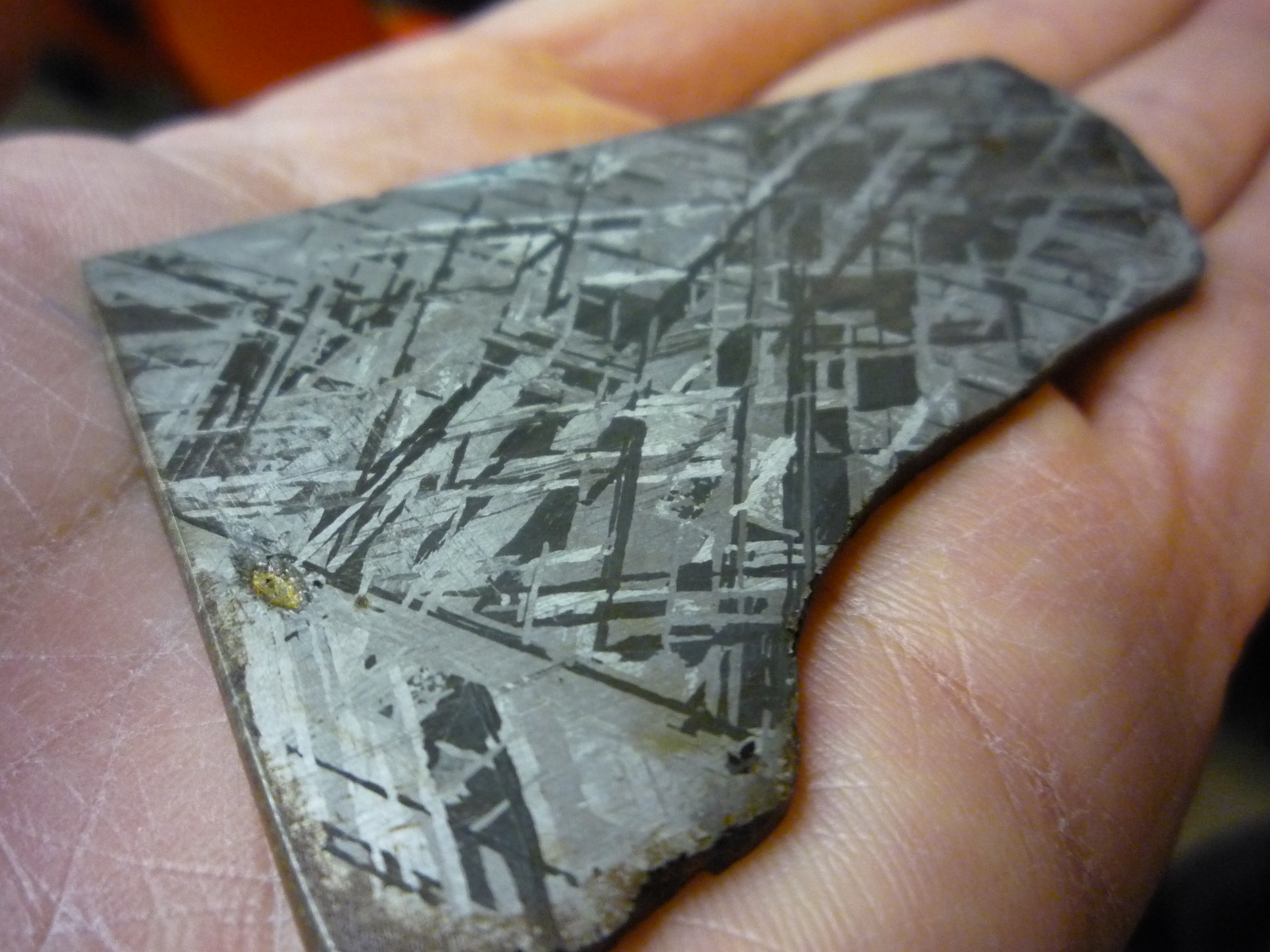
Nickel is a chemical element; it has symbol Ni and atomic number 28. It is a silvery-white lustrous metal with a slight golden tinge. Nickel is a hard and ductile transition metal. Pure nickel is chemically reactive, but large pieces are slow to react with air under standard conditions because a passivation layer of nickel oxide forms on the surface that prevents further corrosion. Even so, pure native nickel is found in Earth's crust only in tiny amounts, usually in ultramafic rocks, and in the interiors of larger nickel–iron meteorites that were not exposed to oxygen when outside Earth's atmosphere. Meteoric nickel is found in combination with iron, a reflection of the origin of those elements as major end products of supernova nucleosynthesis. An iron–nickel mixture is thought to compose Earth's outer and inner cores. Use of nickel (as natural meteoric nickel–iron alloy) has been traced as far back as 3500 BCE. Nickel was first isolated and classifie ... [...More Info...] [...Related Items...] OR: [Wikipedia] [Google] [Baidu] |
Laon (deity)
Laon (meaning "the ancient one"),From Visayan meaning "ancient" or "old." is a pre-colonial female supreme creator deity in the animist anito beliefs of the Visayan peoples in the Philippines. She is associated with creation, agriculture, the sky, and divine justice. Her domain is usually identified with the volcano KanlaonLiterally "laceof Laon" of the island of Negros, the highest peak in the Visayas Islands. She is present in the pre-colonial beliefs of the Aklanon, Capiznon, Cebuano, Hiligaynon, Karay-a, Suludnon, and Waray people, among others.Cruz-Lucero, R., Pototanon, R. M. (2018). "Capiznon". With contributions by E. Arsenio Manuel. In Our Islands, Our People: The Histories and Cultures of the Filipino Nation, edited by Cruz-Lucero, R. Her name is variously rendered as Lahon, Lalaon (or Lalahon), Lauon, Malaon, Raom, and Laonsina (or Alunsina) among the different Visayan groups. Description Although usually spoken of as female, she has both female and male ... [...More Info...] [...Related Items...] OR: [Wikipedia] [Google] [Baidu] |
Diwata
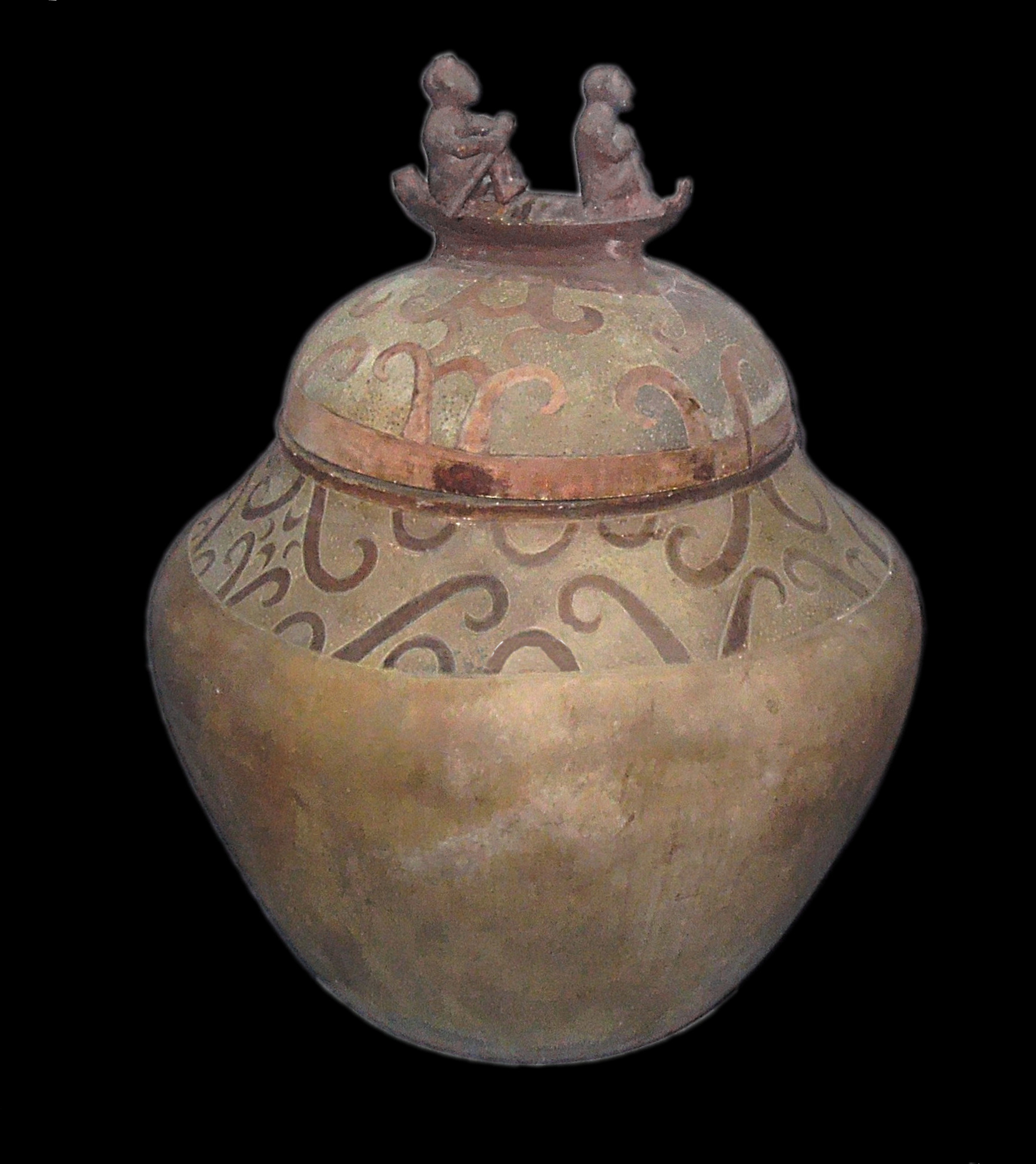
''Anito'', also spelled ''anitu'', refers to ancestor spirits, nature spirits, and deities in the Indigenous Philippine folk religions from the precolonial age to the present, although the term itself may have other meanings and associations depending on the Filipino ethnic group. It can also refer to carved humanoid figures, the ''taotao'', made of wood, stone, or ivory, that represent these spirits. ''Anito'' (a term predominantly used in Luzon) is also sometimes known as ''diwata'' in certain ethnic groups (especially among Visayans). ''Pag-anito'' refers to a séance, often accompanied by other rituals or celebrations, in which a shaman ( Visayan: ''babaylan'', Tagalog: ''katalonan'') acts as a medium to communicate directly with the dead ancestors and spirits. When a nature spirit or deity is specifically involved, the ritual is called ''pagdiwata''. The act of worship or a religious sacrifice to a spirit and deities. The belief in ''anito'' are sometimes refer ... [...More Info...] [...Related Items...] OR: [Wikipedia] [Google] [Baidu] |


