|
Hino-shi
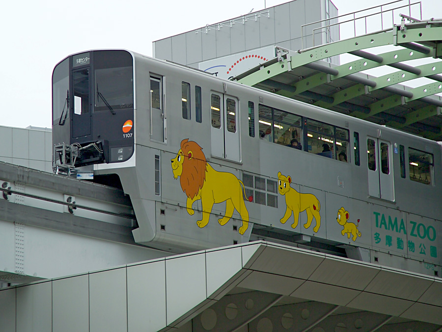
250px, Takahata Fudō in Hino is a city located in the western portion of the Tokyo Metropolis, Japan. , the city had an estimated population of 187,048, and a population density of 6,800 persons per km². The total area of the city was . History The area of present-day Hino was part of ancient Musashi Province. During the Edo period, the village of Hino developed as a post station on the Kōshū Kaidō. In the post-Meiji Restoration cadastral reform of 1871, Hino-juku became part of Kanagawa Prefecture. In the reorganization of districts in 1889, Hino-juku came under the jurisdiction of Minamitama District. The entire district was transferred to the control of Tokyo Prefecture on April 1, 1893, at which time Hino-juku was proclaimed Hino Town under the modern municipalities system. The area of the town expanded through annexation of neighboring villages in 1901 and 1958. On November 3, 1963, Hino was elevated to city status. Geography Hino is in Western Tokyo. The city has ... [...More Info...] [...Related Items...] OR: [Wikipedia] [Google] [Baidu] |
Tokyo
Tokyo, officially the Tokyo Metropolis, is the capital of Japan, capital and List of cities in Japan, most populous city in Japan. With a population of over 14 million in the city proper in 2023, it is List of largest cities, one of the most populous urban areas in the world. The Greater Tokyo Area, which includes Tokyo and parts of six neighboring Prefectures of Japan, prefectures, is the most populous metropolitan area in the world, with 41 million residents . Lying at the head of Tokyo Bay, Tokyo is part of the Kantō region, on the central coast of Honshu, Japan's largest island. It is Japan's economic center and the seat of the Government of Japan, Japanese government and the Emperor of Japan. The Tokyo Metropolitan Government administers Tokyo's central Special wards of Tokyo, 23 special wards, which formerly made up Tokyo City; various commuter towns and suburbs in Western Tokyo, its western area; and two outlying island chains, the Tokyo Islands. Although most of the w ... [...More Info...] [...Related Items...] OR: [Wikipedia] [Google] [Baidu] |
Cities Of Japan
A is a local Public administration, administrative unit in Japan. Cities are ranked on the same level as and , with the difference that they are not a component of . Like other contemporary administrative units, they are defined by the Local Autonomy Law of 1947. City status Article 8 of the Local Autonomy Law sets the following conditions for a municipality to be designated as a city: *Population must generally be 50,000 or greater (原則として人口5万人以上) *At least 60% of households must be established in a central urban area (中心市街地の戸数が全戸数の6割以上) *At least 60% of households must be employed in commerce, industry or other urban occupations (商工業等の都市的業態に従事する世帯人口が全人口の6割以上) *Any other conditions set by prefectural ordinance must be satisfied (他に当該都道府県の条例で定める要件を満たしていること) The designation is approved by the prefectural governor and t ... [...More Info...] [...Related Items...] OR: [Wikipedia] [Google] [Baidu] |
Kunitachi, Tokyo
is a city located in the western portion of the Tokyo Metropolis, Japan. , the city had an estimated population of 76,423 in 38,825 households, and a population density of 9,400 persons per km2. Approximately 41.9% of the city population is over 65 years in age. The total area of the city is . Geography Kunitachi is located in the Musashino Terrace of central Tokyo Metropolis. Kunitachi is known for its broad main avenue, Daigaku Dori (University Avenue). This cherry-tree-lined boulevard stretches from Kunitachi Station on the Chūō Main Line toward the banks of the Tama River. Surrounding municipalities Tokyo Metropolis * Fuchū * Hino * Kokubunji *Tachikawa Climate Kunitachi has a humid subtropical climate (Köppen ''Cfa'') characterized by warm summers and cool winters with light to no snowfall. The average annual temperature in Kunitachi is 13.9 °C. The average annual rainfall is 1647 mm with September as the wettest month. The temperatures are highest on ... [...More Info...] [...Related Items...] OR: [Wikipedia] [Google] [Baidu] |
Fuchū, Tokyo
file:FuchuCityHall2023091.jpg, 260px, Fuchū City Hall is a Cities of Japan, city located in the western Tokyo, western portion of the Tokyo Metropolis, Japan. Fuchū serves as a regional commercial center and a commuter town for workers in central Tokyo. The city hosts large scale manufacturing facilities for Toshiba, NEC and Suntory, as well as the Bank of Japan's main computer operations center. Local sporting attractions include the Tokyo Racecourse and the training grounds of Japan Rugby League One, Top League Rugby union, rugby teams Toshiba Brave Lupus Tokyo, Toshiba Brave Lupus and Tokyo Sungoliath, Suntory Sungoliath. , the city had an estimated population of 260,508, and a population density of 8,900 persons per square kilometer. The total area of the city is . Geography Fuchū is located about 20 km west of the centre of Tokyo. Using the Keiō Line from Shinjuku Station, Shinjuku, it is 25 minutes to Fuchū Station (Tokyo), Fuchū Station (main station). It spr ... [...More Info...] [...Related Items...] OR: [Wikipedia] [Google] [Baidu] |
Akishima, Tokyo
is a Cities of Japan, city located in the western Tokyo, western portion of the Tokyo Metropolis, Japan. , the city had an estimated population of 113,542, and a population density of 6500 persons per km2. The total area of the city is . Geography Akishima is located on the left bank of the Tama River, about 35 kilometers west of central Tokyo. The Tamagawa Aqueduct flows in the northern part of the city. The city area generally slopes gently from northwest to southeast toward the Tama River, which flows to the south of the city. The altitude of the city area is 170.72 meters above sea level at the highest point and 76.68 meters at the lowest point. With the JR East Ome Line running east to west through the city as a boundary, housing estates, industrial parks, golf courses, and the Showa Memorial Park occupy a large area in the north. In the south, residential areas occupy a large proportion of the city area. Surrounding municipalities Tokyo Metropolis *Fussa, Tokyo, Fussa *Hach ... [...More Info...] [...Related Items...] OR: [Wikipedia] [Google] [Baidu] |
Tama River
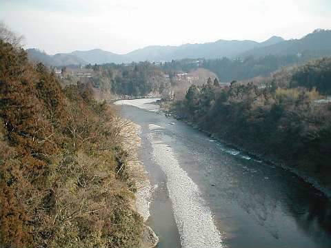
The is a major river in Yamanashi Prefecture, Yamanashi, Kanagawa Prefecture, Kanagawa and Tokyo Prefectures on Honshū, Japan. It is officially classified as a Class 1 river by the Government of Japan, Japanese government. It is long, and has a basin. The river flows through the Greater Tokyo Area, on the dividing line between Tokyo and Kanagawa Prefectures. In Tokyo, its banks are lined with parks and sports fields, making the river a popular picnic spot. Course The Tama's source is on Mt. Kasatori in Koshu, Yamanashi, Koshu in Yamanashi Prefecture. From there, it flows eastward into mountainous western Tokyo, where the Ogōchi Dam forms Lake Okutama. Below the dam, it takes the name Tama and flows eastwards through Chichibu Tama Kai National Park to the city of Ōme, Tokyo, Ōme. It then flows southeast between Tama Hills and Musashino Terrace. At Hamura, Tokyo, Hamura is the source of the historic Tamagawa Aqueduct built by the Tamagawa brothers in 1653 to supply w ... [...More Info...] [...Related Items...] OR: [Wikipedia] [Google] [Baidu] |
Alluvial Plain
An alluvial plain is a plain (an essentially flat landform) created by the deposition of sediment over a long period by one or more rivers coming from highland regions, from which alluvial soil forms. A ''floodplain'' is part of the process, being the smaller area over which the rivers flood at a particular time. In contrast, the alluvial plain is the larger area representing the region over which the floodplains have shifted over geological time. As the highlands erode due to weathering and water flow, the sediment from the hills is transported to the lower plain. Various creeks will carry the water further to a river, lake, bay, or ocean. As the sediments are deposited during flood conditions in the floodplain of a creek, the elevation of the floodplain will be raised. As this reduces the channel floodwater capacity, the creek will, over time, seek new, lower paths, forming a meander (a curved path). The leftover higher locations, typically natural levees at the margins of ... [...More Info...] [...Related Items...] OR: [Wikipedia] [Google] [Baidu] |
Tama Hills
is an area of hills stretching across southwest Tokyo and northeast Kanagawa Prefecture in the Kantō Plain on Honshū, Japan. Its total area is approximately 300 km2. The Tama River marks its northeastern boundary. The Tama Hills border the Sagamino plateau. It straddles the municipalities of Hachiōji, Hino, Tama, Inagi, and Machida cities in Tokyo, and Kawasaki and Yokohama cities in Kanagawa. The area is dotted with remains of Jōmon period hunter-gatherer settlements. The area had been developed extensively since the 1950s to support demand for housing around rapidly expanding Tokyo and Yokohama. The hills are now mostly a patchwork of new residential suburbs and low, forested hills and pockets of remaining farmland. Some fairly large areas of forests still exist in places. Most notable among the housing developments are Tama New Town and Kohoku New Town. The build-up of the area is a key plot element to the Studio Ghibli is a Japanese animation studio ... [...More Info...] [...Related Items...] OR: [Wikipedia] [Google] [Baidu] |
Sea Level
Mean sea level (MSL, often shortened to sea level) is an mean, average surface level of one or more among Earth's coastal Body of water, bodies of water from which heights such as elevation may be measured. The global MSL is a type of vertical datuma standardised geodetic datumthat is used, for example, as a chart datum in cartography and Navigation, marine navigation, or, in aviation, as the standard sea level at which atmospheric pressure is measured to Calibration, calibrate altitude and, consequently, aircraft flight levels. A common and relatively straightforward mean sea-level standard is instead a long-term average of tide gauge readings at a particular reference location. The term ''above sea level'' generally refers to the height above mean sea level (AMSL). The term APSL means above present sea level, comparing sea levels in the past with the level today. Earth's radius at sea level is 6,378.137 km (3,963.191 mi) at the equator. It is 6,356.752 km (3,94 ... [...More Info...] [...Related Items...] OR: [Wikipedia] [Google] [Baidu] |
Western Tokyo
Western Tokyo, known as the , or locally, in the Tokyo Metropolis consists of 30 ordinary municipalities ( cities (市 shi), towns (町 machi) and one village (村 mura)), unlike the eastern part which consists of 23 special wards. Before it was transferred to Tokyo in 1893, the Tama area, then also still often referred to as the (referring to the West, North and South Tama counties it consisted of) had formed the Northern part of Kanagawa Prefecture. National Archives of Japan三多摩を東京府に編入/ref> Overview Whereas in the east of Tokyo Metropolis the 23 special wards occupy the area that was formerly Tokyo City, the west consists of 30 other ordinary municipalities: cities (Nos. 1–26), towns (Nos. 27, 28, 30) and a village (No. 29). List of cities, towns and village The towns of Hinode, Mizuho, and Okutama, and the village of Hinohara make up the non-contiguous Nishitama District. The offshore islands of Tokyo (including the Bonin, Volcano, ... [...More Info...] [...Related Items...] OR: [Wikipedia] [Google] [Baidu] |


