|
Hilton Of Cadboll
Hilton of Cadboll, or simply Hilton, () is a village about southeast of Tain in Easter Ross, in the Scottish council area of Highland Highlands or uplands are areas of high elevation such as a mountainous region, elevated mountainous plateau or high hills. Generally, ''upland'' refers to a range of hills, typically from up to , while ''highland'' is usually reserved for range .... It is famous for the Hilton of Cadboll Stone. Hilton of Cadboll, Balintore, and Shandwick are known collectively as the Seaboard Villages. References External links''Seaboard History Website'' - online archive of the social history of the Seaboard Villages; Hilton, Balintore, and Shandwick * Populated places in Ross and Cromarty {{RossCromarty-geo-stub ... [...More Info...] [...Related Items...] OR: [Wikipedia] [Google] [Baidu] |
Highland (council Area)
Highland (, ; ) is a council areas of Scotland, council area in the Scottish Highlands and is the largest local government area in both Scotland and the United Kingdom. It was the 7th most populous council area in Scotland at the United Kingdom Census 2011, 2011 census. It has land borders with the council areas of Aberdeenshire, Argyll and Bute, Moray and Perth and Kinross. The wider upland area of the Scottish Highlands after which the council area is named extends beyond the Highland council area into all the neighbouring council areas plus Angus, Scotland, Angus and Stirling (council area), Stirling. The Highland Council is based in Inverness, the area's largest settlement. The area is generally sparsely populated, with much of the inland area being mountainous with numerous lochs. The area includes Ben Nevis, the highest mountain in the British Isles. Most of the area's towns lie close to the eastern coasts. Off the west coast of the mainland the council area includes some ... [...More Info...] [...Related Items...] OR: [Wikipedia] [Google] [Baidu] |
Balintore, Easter Ross
__NOTOC__ Balintore (from the meaning "The Bleaching Town") is a village near Tain in Easter Ross, Scotland. It is one of three villages on this northern stretch of the Moray Firth The Moray Firth (; , or ) is a roughly triangular inlet (or firth) of the North Sea, north and east of Inverness, which is in the Highland council area of the north of Scotland. It is the largest firth in Scotland, stretching from Duncans ... coastline: Hilton, Balintore, and Shandwick are known collectively as the Seaboard Villages. An earlier name for Balintore was ''Port an Ab'' ("Abbot's Port"), after Fearn Abbey, the local landowner. Employment was formerly based on fishing. A road was built from Hill of Fearn in 1819, after which fish were shipped from the village, and Balintore Harbour was built in 1890–1896. The three villages were connected by a road in the first decade of the 20th century; Balintore has a post office and several shops.Jessie Mcdonald and Anne Gordon, ''Down ... [...More Info...] [...Related Items...] OR: [Wikipedia] [Google] [Baidu] |
Tain
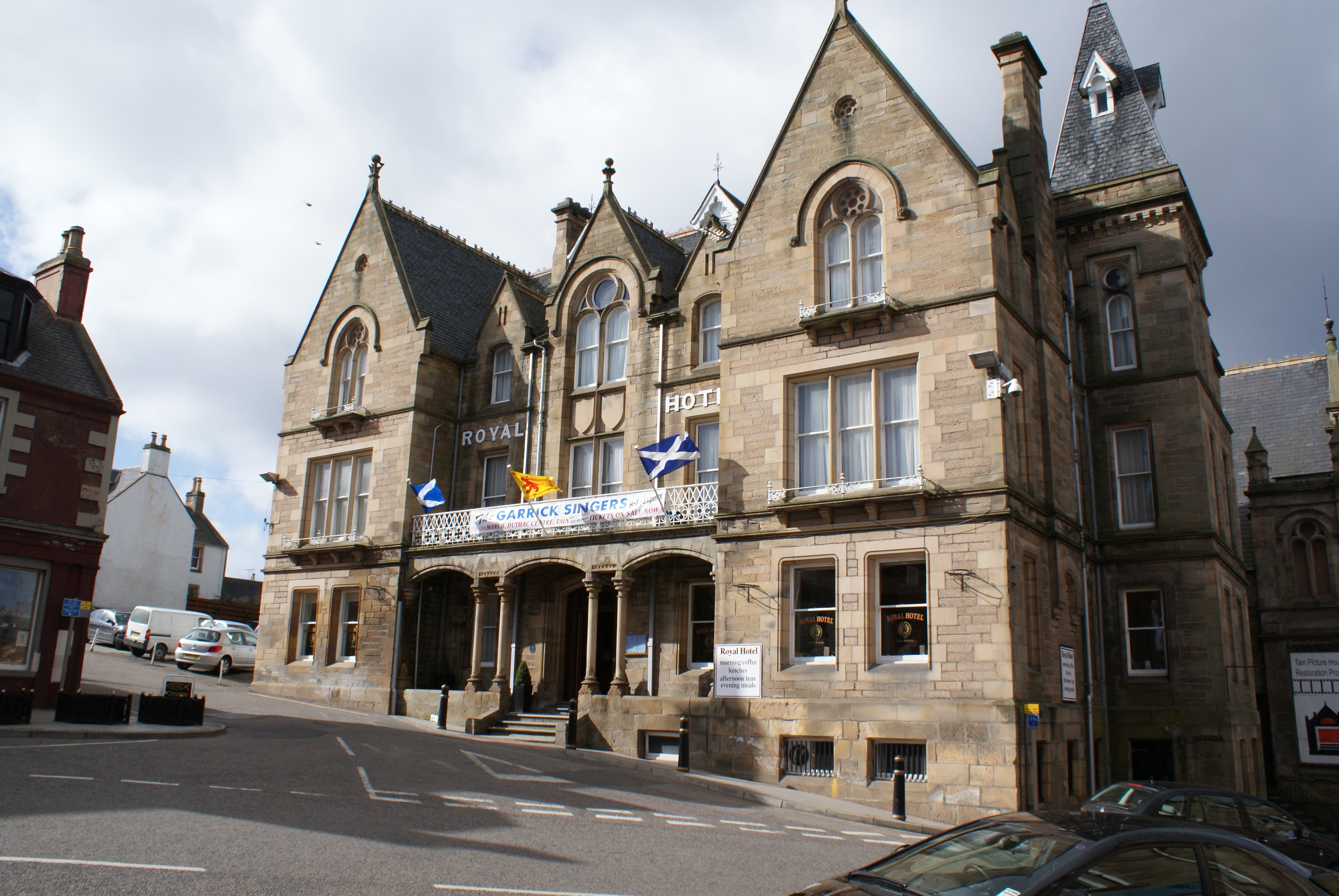
Tain ( ) is a royal burgh and parish in the County of Ross, in the Scottish Highlands, Highlands of Scotland. Etymology The name derives from the nearby River Tain, the name of which comes from an Indo-European root meaning 'flow'. The Gaelic name, ''Baile Dubhthaich'', means 'Duthac's town', after a local saint also known as Saint Duthac, Duthus. History Tain was granted its first royal charter in 1066, making it Scotland's oldest royal burgh, commemorated in 1966 with the opening of the Rose Garden by Elizabeth Bowes-Lyon, Queen Elizabeth, the Queen Mother. The 1066 charter, granted by King Malcolm III of Scotland, Malcolm III, confirmed Tain as a sanctuary, where people could claim the protection of the church, and an immunity, in which resident merchants and traders were exempt from certain taxes. Little is known of earlier history although the town owed much of its importance to Duthac. He was an early Christian figure, perhaps 8th or 9th century, whose shrine had become s ... [...More Info...] [...Related Items...] OR: [Wikipedia] [Google] [Baidu] |
Easter Ross
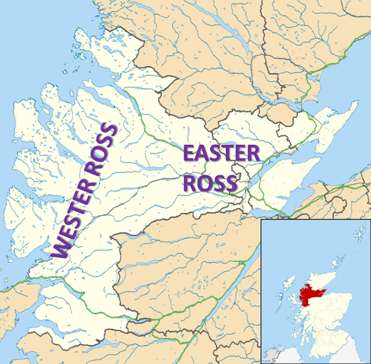
Easter Ross () is a loosely defined area in the east of Ross, Highland, Scotland. The name is used in the constituency name Caithness, Sutherland and Easter Ross, which is the name of both a British House of Commons constituency and a Scottish Parliament constituency. The two constituencies have however different boundaries. Settlements Places in Easter Ross include: * Alness * Dingwall (included in some contexts in the term ''Easter Ross'', though in some contexts it refers to the area as Mid Ross) * Evanton * Invergordon * Kildary * Milntown of Tarbat (Milton) * Portmahomack * The Seaboard villages: ** Balintore ** Hilton of Cadboll ** Shandwick * Tain Easter Ross is well known for its towns: Tain, Invergordon, Alness and Dingwall. See also * Black Isle * Ross and Cromarty * Ross-shire * Wester Ross Wester Ross () is an area of the Northwest Highlands of Scotland in the council area of Highland. The area is loosely defined, and has never been used as a fo ... [...More Info...] [...Related Items...] OR: [Wikipedia] [Google] [Baidu] |
Scotland
Scotland is a Countries of the United Kingdom, country that is part of the United Kingdom. It contains nearly one-third of the United Kingdom's land area, consisting of the northern part of the island of Great Britain and more than 790 adjacent Islands of Scotland, islands, principally in the archipelagos of the Hebrides and the Northern Isles. To the south-east, Scotland has its Anglo-Scottish border, only land border, which is long and shared with England; the country is surrounded by the Atlantic Ocean to the north and west, the North Sea to the north-east and east, and the Irish Sea to the south. The population in 2022 was 5,439,842. Edinburgh is the capital and Glasgow is the most populous of the cities of Scotland. The Kingdom of Scotland emerged as an independent sovereign state in the 9th century. In 1603, James VI succeeded to the thrones of Kingdom of England, England and Kingdom of Ireland, Ireland, forming a personal union of the Union of the Crowns, three kingdo ... [...More Info...] [...Related Items...] OR: [Wikipedia] [Google] [Baidu] |
Highland Council Area
Highland (, ; ) is a council areas of Scotland, council area in the Scottish Highlands and is the largest local government area in both Scotland and the United Kingdom. It was the 7th most populous council area in Scotland at the United Kingdom Census 2011, 2011 census. It has land borders with the council areas of Aberdeenshire, Argyll and Bute, Moray and Perth and Kinross. The wider upland area of the Scottish Highlands after which the council area is named extends beyond the Highland council area into all the neighbouring council areas plus Angus, Scotland, Angus and Stirling (council area), Stirling. The Highland Council is based in Inverness, the area's largest settlement. The area is generally sparsely populated, with much of the inland area being mountainous with numerous lochs. The area includes Ben Nevis, the highest mountain in the British Isles. Most of the area's towns lie close to the eastern coasts. Off the west coast of the mainland the council area includes some ... [...More Info...] [...Related Items...] OR: [Wikipedia] [Google] [Baidu] |
Hilton Of Cadboll Stone
The Hilton of Cadboll Stone is one of the most magnificent of all Pictish cross-slabs. It was erected on the East coast of the Tarbat Peninsula in Easter Ross, Scotland about AD 800. It seems likely that, at the time, the entire peninsula from the mouth of the Cromarty Firth to Tarbatness was the estate of the monastery at Portmahomack and that the stone was carved at its instigation. It was erected in a natural amphitheatre about 100m from the shore. In the thirteenth century the Hilton of Cadboll Chapel was erected 6m to its east; more recently the modern settlement Hilton of Cadboll has developed along the coast to its south-west. In 1674 the stone was felled in a storm, with the top three-quarters breaking off. The cross on the front face was chipped off and a memorial inscribed to Alexander Duff and his three wives. The stone appears never to have been used as a memorial and was left at Hilton, where it was shown to visiting antiquarians including Rev. Charles Cordiner, ... [...More Info...] [...Related Items...] OR: [Wikipedia] [Google] [Baidu] |
Shandwick
Shandwick (), a village near Tain in Easter Ross, and is in the Scottish council area of Highland, Scotland Scotland is a Countries of the United Kingdom, country that is part of the United Kingdom. It contains nearly one-third of the United Kingdom's land area, consisting of the northern part of the island of Great Britain and more than 790 adjac .... Hilton, Balintore, and Shandwick are known collectively as the Seaboard Villages. It is well known because of the nearby Clach a' Charridh or Shandwick Stone, a Class II Pictish stone. External links''Seaboard History Website'' - online archive of the social history of the Seaboard Villages; Hilton, Balintore, and Shandwick * Populated places in Ross and Cromarty {{RossCromarty-ge ... [...More Info...] [...Related Items...] OR: [Wikipedia] [Google] [Baidu] |
Seaboard Villages
The Seaboard Villages () are three contiguous coastal villages, situated about 10 km southeast of the town of Tain in Easter Ross, Scotland. They face east onto the Moray Firth. The villages are (from north to south): *Hilton of Cadboll - which has the pier * Balintore - which has the harbour and the community centre *Shandwick Shandwick (), a village near Tain in Easter Ross, and is in the Scottish council area of Highland, Scotland Scotland is a Countries of the United Kingdom, country that is part of the United Kingdom. It contains nearly one-third of the U ... - which has the bay External linksSeaboard Villages archived frothe originalon 15 May 2014* ttps://web.archive.org/web/20160808010552/http://www.seaboardhistory.com/about-2/ Seaboard History archived frothe originalon 8 August 2016 {{coord, 57.75657, N, 3.91069, W, region:GB_source:enwiki-osgb36(NH864757), display=title Populated places in Ross and Cromarty ... [...More Info...] [...Related Items...] OR: [Wikipedia] [Google] [Baidu] |


