|
Highway M12 (Ukraine)
M12 was a Ukrainian international highway ( M-highway) connecting Lviv Oblast to Central Ukraine, where after crossing the Dnieper it continued further as the M04. On 28 April 2021, the M12 was decommissioned and merged with the M04 to form the new M30. General overview The M12 is a major transnational corridor and along with the M04 combines into E50. The highway is also part of the Gdańsk - Odessa Transportation corridor on the segment from Ternopil to Uman. It is one of the longest routes spanning nearly . Description For the entire route from Stryi to Znamianka the M12 is part of the E50, however in Kropyvnytskyi it is also joined by the E584 that travels from Moldova to Poltava. Main Route Main route and connections to/intersections with other highways in Ukraine. Access routes The highway passes the following cities going around them, however it has spurred away access routes towards them. * Vinnytsia * Khmelnytskyi Gallery File:M12 in oblast.jpg, M12 in Vinnytsi ... [...More Info...] [...Related Items...] OR: [Wikipedia] [Google] [Baidu] |
Stryi
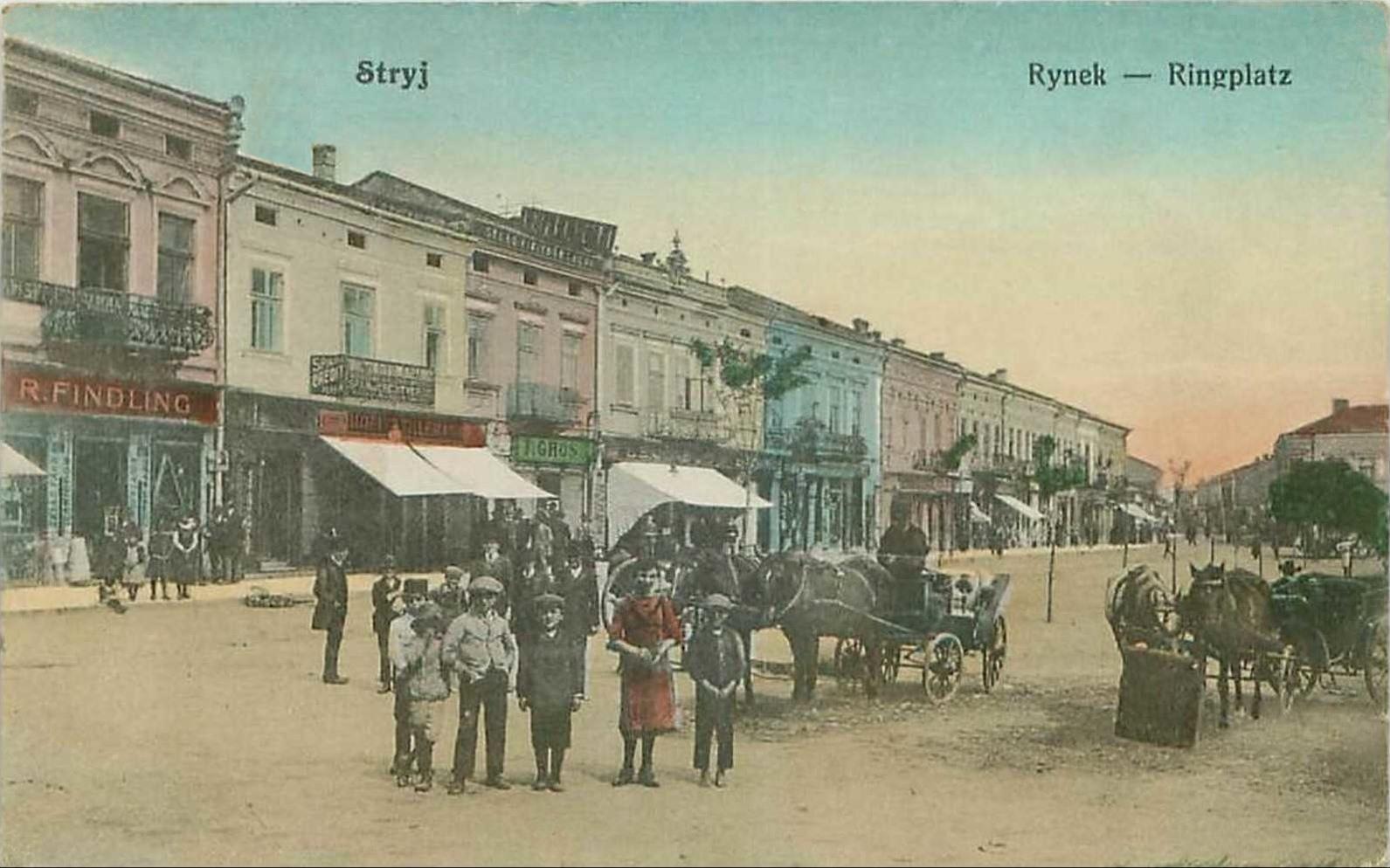
Stryi ( uk, Стрий, ; pl, Stryj) is a city located on the left bank of the river Stryi in Lviv Oblast (region) of western Ukraine 65 km to the south of Lviv (in the foothills of the Carpathian Mountains). It serves as the administrative center of Stryi Raion (district). Stryi hosts the administration of Stryi urban hromada, one of the hromadas of Ukraine. Its population is approximately . Stryi is considered to be the first city in Ukraine to bear the blue-over-yellow Ukrainian national flag when it was hoisted on the flagpole of the Town Hall on March 14, 1990, even before the fall of the Soviet Union in December 1991. Population Name The city takes its name from the name of the river Stryi, one of the tributaries of the Dniester. Stryi, as a name of river is a very old name and means "stream". Its etymology stems from an Indo-European root *sreu. Words that have the same root can be found in modern Ukrainian - струм, струя, Polish - ''struga'', ''strumi ... [...More Info...] [...Related Items...] OR: [Wikipedia] [Google] [Baidu] |
Gdańsk
Gdańsk ( , also ; ; csb, Gduńsk;Stefan Ramułt, ''Słownik języka pomorskiego, czyli kaszubskiego'', Kraków 1893, Gdańsk 2003, ISBN 83-87408-64-6. , Johann Georg Theodor Grässe, ''Orbis latinus oder Verzeichniss der lateinischen Benennungen der bekanntesten Städte etc., Meere, Seen, Berge und Flüsse in allen Theilen der Erde nebst einem deutsch-lateinischen Register derselben''. T. Ein Supplement zu jedem lateinischen und geographischen Wörterbuche. Dresden: G. Schönfeld’s Buchhandlung (C. A. Werner), 1861, p. 71, 237.); Stefan Ramułt, ''Słownik języka pomorskiego, czyli kaszubskiego'', Kraków 1893, Gdańsk 2003, ISBN 83-87408-64-6. * , )Johann Georg Theodor Grässe, ''Orbis latinus oder Verzeichniss der lateinischen Benennungen der bekanntesten Städte etc., Meere, Seen, Berge und Flüsse in allen Theilen der Erde nebst einem deutsch-lateinischen Register derselben''. T. Ein Supplement zu jedem lateinischen und geographischen Wörterbuche. Dresden: G. Schönf ... [...More Info...] [...Related Items...] OR: [Wikipedia] [Google] [Baidu] |
Roads In Vinnytsia Oblast
A road is a linear way for the conveyance of traffic that mostly has an improved surface for use by vehicles (motorized and non-motorized) and pedestrians. Unlike streets, the main function of roads is transportation. There are many types of roads, including parkways, avenues, controlled-access highways (freeways, motorways, and expressways), tollways, interstates, highways, thoroughfares, and local roads. The primary features of roads include lanes, sidewalks (pavement), roadways (carriageways), medians, shoulders, verges, bike paths (cycle paths), and shared-use paths. Definitions Historically many roads were simply recognizable routes without any formal construction or some maintenance. The Organization for Economic Co-operation and Development (OECD) defines a road as "a line of communication (travelled way) using a stabilized base other than rails or air strips open to public traffic, primarily for the use of road motor vehicles running on their own wheels", which ... [...More Info...] [...Related Items...] OR: [Wikipedia] [Google] [Baidu] |
Roads In Khmelnytskyi Oblast
A road is a linear way for the conveyance of traffic that mostly has an road surface, improved surface for use by vehicles (motorized and non-motorized) and pedestrians. Unlike streets, the main function of roads is transportation. There are road hierarchy, many types of roads, including parkways, avenue (landscape), avenues, controlled-access highways (freeways, motorways, and expressways), tollways, interstates, highways, thoroughfares, and local roads. The primary features of roads include lanes, sidewalks (pavement), roadways (carriageways), median strip, medians, shoulder (road), shoulders, road verge, verges, bike paths (cycle paths), and shared-use paths. Definitions Historically many roads were simply recognizable routes without any formal construction or some maintenance. The Organisation for Economic Co-operation and Development, Organization for Economic Co-operation and Development (OECD) defines a road as "a line of communication (travelled way) using a stabiliz ... [...More Info...] [...Related Items...] OR: [Wikipedia] [Google] [Baidu] |
Roads In Ternopil Oblast
A road is a linear way for the conveyance of traffic that mostly has an improved surface for use by vehicles (motorized and non-motorized) and pedestrians. Unlike streets, the main function of roads is transportation. There are many types of roads, including parkways, avenues, controlled-access highways (freeways, motorways, and expressways), tollways, interstates, highways, thoroughfares, and local roads. The primary features of roads include lanes, sidewalks (pavement), roadways (carriageways), medians, shoulders, verges, bike paths (cycle paths), and shared-use paths. Definitions Historically many roads were simply recognizable routes without any formal construction or some maintenance. The Organization for Economic Co-operation and Development (OECD) defines a road as "a line of communication (travelled way) using a stabilized base other than rails or air strips open to public traffic, primarily for the use of road motor vehicles running on their own wheels", which ... [...More Info...] [...Related Items...] OR: [Wikipedia] [Google] [Baidu] |
European Route E50
European route E 50 is an A-type east–west connection across the European continent. It connects the key naval port of Brest France with Makhachkala, on the Caspian Sea in the Russian republic Dagestan. Outlook Half the route is on highways and the other half is on provincial roads. The route is in estimation some long and runs fully across the European continent. On its way through Europe it crosses several major European routes, such as: * E60 Brest–Vienna * E5 Greenock-Algeciras * E15 Inverness-Algeciras * E45 Alta-Gela * E75 Vardø- Pireas It is one of the longest E roads on the continent. Due 2014 Russian aggression against Ukraine, E50 also passes through two state-like formations - Donetsk People's Republic and Luhansk People's Republic. The original Ukraine-Russia border is open, but territories controlled by the formations may be unsafe due to the Russo-Ukrainian War. Note: international border-like crossing procedure exists between the so-cal ... [...More Info...] [...Related Items...] OR: [Wikipedia] [Google] [Baidu] |
International E-road Network
The international E-road network is a numbering system for roads in Europe developed by the United Nations Economic Commission for Europe, United Nations Economic Commission for Europe (UNECE). The network is numbered from E1 up and its roads cross national borders. It also reaches Central Asian countries like Kyrgyzstan, since they are members of the UNECE. Main international traffic arteries in Europe are defined by ECE/TRANS/SC.1/2016/3/Rev.1 which consider three types of roads: motorways, Limited-access road, limited access roads, and ordinary roads. In most countries, the roads carry the European route designation alongside national designations. Belgium, Norway and Sweden have roads which only have the European route designations (examples: European route E18, E18 and European route E6, E6). The United Kingdom, Iceland and Albania only use national road designations and do not show the European designations at all. Ukraine does not number its routes at all except in int ... [...More Info...] [...Related Items...] OR: [Wikipedia] [Google] [Baidu] |
Roads In Ukraine
A road is a linear way for the conveyance of traffic that mostly has an improved surface for use by vehicles (motorized and non-motorized) and pedestrians. Unlike streets, the main function of roads is transportation. There are many types of roads, including parkways, avenues, controlled-access highways (freeways, motorways, and expressways), tollways, interstates, highways, thoroughfares, and local roads. The primary features of roads include lanes, sidewalks (pavement), roadways (carriageways), medians, shoulders, verges, bike paths (cycle paths), and shared-use paths. Definitions Historically many roads were simply recognizable routes without any formal construction or some maintenance. The Organization for Economic Co-operation and Development (OECD) defines a road as "a line of communication (travelled way) using a stabilized base other than rails or air strips open to public traffic, primarily for the use of road motor vehicles running on their own wheels", w ... [...More Info...] [...Related Items...] OR: [Wikipedia] [Google] [Baidu] |
Khmelnytskyi, Ukraine
Khmelnytskyi ( uk, Хмельни́цький, Khmelnytskyi, ), until 1954 Proskuriv ( uk, Проску́рів, links=no ), is a city in western Ukraine, the administrative center for Khmelnytskyi Oblast (region) and Khmelnytskyi Raion (district). It hosts the administration of the Khmelnytskyi urban hromada. Khmelnytskyi is located in the historic region of Podolia on the banks of the Buh River. The city received its current local government designation in 1941. The current city's population is estimated , making it the second largest city of the former, archaic Podolia region after Vinnytsia and the largest city of the western part of the region. History The city foundation date is uncertain. The territory, where Khmelnytskyi is situated, has been inhabited for a very long time. Many archaeological discoveries have been made in the city suburbs. For example, to the East of Lezneve district, there was a settlement from the Bronze Age 2000 B.C., and from Scythian times fro ... [...More Info...] [...Related Items...] OR: [Wikipedia] [Google] [Baidu] |
Rohatyn
Rohatyn ( uk, Рогатин, pl, Rohatyn) is a city located on the Hnyla Lypa River in Ivano-Frankivsk Raion, Ivano-Frankivsk Oblast, in western Ukraine. It hosts the administration of Rohatyn urban hromada, one of the hromadas of Ukraine. Population: . Prior to World War II the town was located in Poland. Name It was first mentioned in historical documents in 1184 as a part of the Kingdom of Galicia–Volhynia. Its name seems to be derived from Ruthenia, the name of the region of the location. However, the town emblem has a horn of a deer which gives the first part of the Slavic name of Rohatyn or Rogatyn – "Rog" ("Horn"). The second part "Tyn" can be connected with a word which means " Stacket". Together these two words give us "Horn Stacket". Also, there is a legend connected with the image of the deer horn of the town emblem. It is said that a wife of the Duke Jaroslav Osmomysl, being lost in a forest, met a deer. She survived by following the deer out of the fore ... [...More Info...] [...Related Items...] OR: [Wikipedia] [Google] [Baidu] |

.jpeg/1200px-Brama_Zuraw_W_Gdansku_(153003103).jpeg)


