|
High Seas
The terms international waters or transboundary waters apply where any of the following types of bodies of water (or their drainage basins) transcend international boundaries: oceans, large marine ecosystems, enclosed or semi-enclosed regional seas and estuaries, rivers, lakes, groundwater systems (aquifers), and wetlands. "International waters" is not a defined term in international law. It is an informal term, which sometimes refers to waters beyond the "territorial sea" of any country. In other words, "international waters" is sometimes used as an informal synonym for the more formal term "high seas", which under the doctrine of ''mare liberum'' (Latin for "freedom of the seas"), do not belong to any state's jurisdiction. As such, states have the right to fishing, navigation, overflight, laying cables and pipelines, as well as scientific research. The Convention on the High Seas, signed in 1958, which has 63 signatories, defined "high seas" to mean "all parts of the sea th ... [...More Info...] [...Related Items...] OR: [Wikipedia] [Google] [Baidu] |
Convention On The High Seas
The Convention on the High Seas is an international treaty which codifies the rules of international law relating to the high seas, otherwise known as international waters. The convention was one of four treaties created at the United Nations Convention on the Law of the Sea (UNCLOS I). The four treaties were signed on 29 April 1958 and entered into force on 30 September 1962, although in keeping with legal tradition, later accession was permitted. As of 2013, the treaty had been ratified by 63 states, including most NATO-bloc and Soviet-bloc nations but with the notable exceptions of most of the OPEC and Arab league nations like Syria, Egypt, Jordan, Saudi Arabia, and Iran, as well as China, North Korea, and South Korea. The convention on the High Seas was superseded by the 1982 UNCLOS III, which introduced several new concepts to the law of maritime boundaries including Exclusive Economic Zones. Provisions The treaty is divided into 37 articles: *Article 1: Definition of ... [...More Info...] [...Related Items...] OR: [Wikipedia] [Google] [Baidu] |
Exclusive Economic Zones
An exclusive economic zone (EEZ), as prescribed by the 1982 United Nations Convention on the Law of the Sea, is an area of the sea in which a sovereign state has exclusive rights regarding the exploration and use of marine resources, including energy production from water and wind. It stretches from the outer limit of the territorial sea (22.224 kilometres or 12 nautical miles from the baseline) out 370.4 kilometres (or 200 nautical miles) from the coast of the state in question. It is also referred to as a maritime continental margin and, in colloquial usage, may include the continental shelf. The term does not include either the territorial sea or the continental shelf beyond the 200 nautical mile limit. The difference between the territorial sea and the exclusive economic zone is that the first confers full sovereignty over the waters, whereas the second is merely a "sovereign right" which refers to the coastal state's rights below the surface of the sea. The surface waters ... [...More Info...] [...Related Items...] OR: [Wikipedia] [Google] [Baidu] |
Territorial Waters
Territorial waters are informally an area of water where a sovereign state has jurisdiction, including internal waters, the territorial sea, the contiguous zone, the exclusive economic zone, and potentially the extended continental shelf (these components are sometimes collectively called the maritime zones). In a narrower sense, the term is often used as a synonym for the territorial sea. Vessels have different rights and duties when passing through each area defined by the United Nations Convention on the Law of the Sea (UNCLOS), one of the most ratified treaties. States cannot exercise their jurisdiction in waters beyond the exclusive economic zone, which are known as the high seas. Baseline Normally, the baseline is the low-water line along the coast as marked on large-scale charts that the coastal state recognizes. This is either the low-water mark closest to the shore or an unlimited distance from permanently exposed land, provided that some portion of elevations ... [...More Info...] [...Related Items...] OR: [Wikipedia] [Google] [Baidu] |
Montreux Convention Regarding The Regime Of The Turkish Straits
Montreux (, ; ; ) is a Municipalities of Switzerland, Swiss municipality and List of towns in Switzerland, town on the shoreline of Lake Geneva at the foot of the Swiss Alps, Alps. It belongs to the Riviera-Pays-d'Enhaut (district), Riviera-Pays-d'Enhaut district in the Cantons of Switzerland, canton of Vaud, having a population of approximately 26,500, with about 85,000 in the Vevey-Montreux agglomeration as of 2019. Located in the centre of a region named the Vaud or Swiss Riviera (), Montreux has been an important tourist destination since the 19th century due to its mild climate. The region includes numerous Belle Époque palaces and hotels near the shores of Lake Geneva. Montreux railway station is a stop on the Simplon Railway and is a mountain railway hub. History The earliest settlement was a Late Bronze Age village at Baugy. Montreux lies on the north east shore of Lake Geneva at the fork in the Ancient Rome, Roman road from Italy over the Simplon Pass, where the roads ... [...More Info...] [...Related Items...] OR: [Wikipedia] [Google] [Baidu] |
Dardanelles
The Dardanelles ( ; ; ), also known as the Strait of Gallipoli (after the Gallipoli peninsula) and in classical antiquity as the Hellespont ( ; ), is a narrow, natural strait and internationally significant waterway in northwestern Turkey that forms part of the continental boundary between Asia and Europe and separates Asian Turkey from European Turkey. Together with the Bosporus, the Dardanelles forms the Turkish Straits. One of the world's narrowest straits used for International waterway, international navigation, the Dardanelles connects the Sea of Marmara with the Aegean Sea, Aegean and Mediterranean Sea, Mediterranean seas while also allowing passage to the Black Sea by extension via the Bosporus. The Dardanelles is long and wide. It has an average depth of with a maximum depth of at its narrowest point abreast the city of Çanakkale. The first fixed crossing across the Dardanelles opened in 2022 with the completion of the 1915 Çanakkale Bridge. Most of the northe ... [...More Info...] [...Related Items...] OR: [Wikipedia] [Google] [Baidu] |
Bosphorus
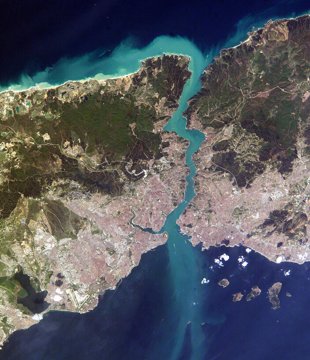
The Bosporus or Bosphorus Strait ( ; , colloquially ) is a natural strait and an internationally significant waterway located in Istanbul, Turkey. The Bosporus connects the Black Sea to the Sea of Marmara and forms one of the continental boundary between Asia and Europe, boundaries between Asia and Europe. It also divides Turkey by separating Anatolia, Asia Minor from East Thrace, Thrace. It is the world's narrowest strait used for international waterway, international navigation. Most of the shores of the Bosporus Strait, except for the area to the north, are heavily settled, with the city of Istanbul's metropolitan area, metropolitan population of 17 million inhabitants extending inland from both banks. The Bosporus Strait and the Dardanelles Strait at the opposite end of the Sea of Marmara are together known as the Turkish Straits. Sections of the shore of the Bosporus in Istanbul have been reinforced with concrete or rubble and those sections of the strait prone t ... [...More Info...] [...Related Items...] OR: [Wikipedia] [Google] [Baidu] |
Danish Straits
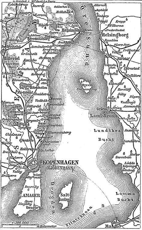
The Danish straits are the straits connecting the Baltic Sea to the North Sea through the Kattegat and Skagerrak. Historically, the Danish straits were internal waterways of Denmark; however, following territorial losses, Øresund and Fehmarn Belt are now shared with Sweden and Germany, while the Great Belt and the Little Belt have remained Danish territorial waters. The Copenhagen Convention of 1857 made all the Danish straits open to commercial shipping. The straits have generally been regarded as an international waterway. Toponymy and geography Five straits are named 'belt' (), the only ones in the world. Several other straits are named 'sound' (Danish, Swedish language, Swedish and German language, German: ). Where an island is situated between a "belt" and a "sound", typically the broader strait is called "belt" and the narrower one is the "sound": * Als Island, Als: ** separated from the continent by ** separated from Fyn by the southern part of the ''Little Belt'', a ... [...More Info...] [...Related Items...] OR: [Wikipedia] [Google] [Baidu] |
Baltic Sea
The Baltic Sea is an arm of the Atlantic Ocean that is enclosed by the countries of Denmark, Estonia, Finland, Germany, Latvia, Lithuania, Poland, Russia, Sweden, and the North European Plain, North and Central European Plain regions. It is the world's largest brackish water basin. The sea stretches from 53°N to 66°N latitude and from 10°E to 30°E longitude. It is a Continental shelf#Shelf seas, shelf sea and marginal sea of the Atlantic with limited water exchange between the two, making it an inland sea. The Baltic Sea drains through the Danish straits into the Kattegat by way of the Øresund, Great Belt and Little Belt. It includes the Gulf of Bothnia (divided into the Bothnian Bay and the Bothnian Sea), the Gulf of Finland, the Gulf of Riga and the Bay of Gdańsk. The "Baltic Proper" is bordered on its northern edge, at latitude 60°N, by Åland and the Gulf of Bothnia, on its northeastern edge by the Gulf of Finland, on its eastern edge by the Gulf of Riga, and in the ... [...More Info...] [...Related Items...] OR: [Wikipedia] [Google] [Baidu] |
Sound Dues
The Sound Dues (or Sound Tolls; ) were a toll on the use of the Øresund, or "Sound" strait separating the modern day borders of Denmark and Sweden. The tolls constituted up to two thirds of Denmark's state income in the 16th and 17th centuries. The dues were introduced by King Eric of Pomerania in 1429 and remained in effect until the Copenhagen Convention of 1857 (with the sole exception of Swedish ships between 1658 and 1720). Tolls in the Great Belt had been collected by the Danish Crown at least a century prior to the establishment of the dues by Eric of Pomerania. History All foreign ships passing through the strait, whether ''en route'' to or from Denmark or not, had to stop in Helsingør and pay a toll to the Danish Crown. If a ship refused to stop, cannons in both Helsingør and Helsingborg could open fire and sink it. In 1567, the toll was changed into a 1–2% tax on the cargo value, providing three times more revenue. To keep the captains from understating the ... [...More Info...] [...Related Items...] OR: [Wikipedia] [Google] [Baidu] |
Freedom Of The Seas
Freedom of the seas is a principle in the law of the sea. It stresses freedom to navigate the oceans. It also disapproves of war fought in water. The freedom is to be breached only in a necessary international agreement. This principle was one of President of the United States, U.S. President Woodrow Wilson's Fourteen Points proposed during the First World War. In his speech to the United States Congress, Congress, the president said: The United States' allies United Kingdom of Great Britain and Ireland, Britain and France were opposed to this point, as the United Kingdom was also a considerable naval power at the time. As with Wilson's other points, freedom of the seas was rejected by the German Empire, German government. Today, the concept of "freedom of the seas" can be found in the United Nations Convention on the Law of the Sea under Article 87(1) which states: "the international waters, high seas are open to all sovereign state, states, whether coastal or landlocked ... [...More Info...] [...Related Items...] OR: [Wikipedia] [Google] [Baidu] |


