|
Herrenberg
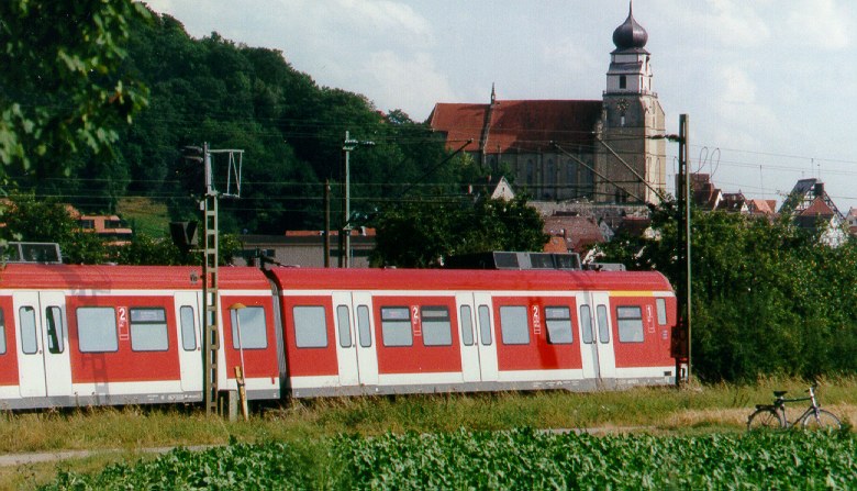
Herrenberg (; Swabian German, Swabian: ''Härrabärg'' or ''Haerebärg'') is a town in the middle of Baden-Württemberg, Germany, about 30 km south of Stuttgart and 20 km from Tübingen. After Sindelfingen, Böblingen, and Leonberg, it is the fourth largest town in the district of Böblingen (district), Böblingen. Location Herrenberg is situated on the western edge of the Schönbuch forest and is a central town within the Gäu region. The Stiftskirche, which houses the Glockenmuseum (bell museum), is a tourist attraction in the main square. The following towns and municipalities border Herrenberg. They are listed in clockwise direction beginning in the north: Deckenpfronn, Gärtringen, Nufringen, Hildrizhausen and Altdorf, Böblingen, Altdorf (all Böblingen district), Ammerbuch (Tübingen district), Gäufelden and Jettingen (both Böblingen district) as well as Wildberg, Baden-Württemberg, Wildberg (Calw district). History The once small community Herrenberg was f ... [...More Info...] [...Related Items...] OR: [Wikipedia] [Google] [Baidu] |
Glockenmuseum
The Glockenmuseum Stiftskirche Herrenberg English: Museum of Bells in the Collegiate Church of Herrenberg) is a museum in the bell tower of Herrenberg's main church. More than 35 of the bells in the collection are still in use, some of them are more than 1,000 years old. There is also a Carillon with 50 bells. It is the most extensive collection of bells that are still in use in the world. Guided tours are given, in English and German. Pictures For high quality zoomable 360°-pictures of the exposition visiwww.glockenmuseum-stiftskirche-herrenberg.de/fuehrung Herrenberg Guss-Stahlglocke 060902 P1090209.JPG, Bell "Gloria" out of steel Herrenberg-Kirche-Glocken-09-2008.jpg, The biggest bell "Maxima" (6.4 tons) is not in use at the moment HerrenbergGlockenmuseumZimbelgelaeut.JPG, Some of the smaller bells: "Benedicate", "Rogate", "Exultate" and "Laudate" HerrenbergGlockenmuseumGloriosa.JPG, "Gloriosa" in the bell tower (3.6 tons) See also * List of music museums This list o ... [...More Info...] [...Related Items...] OR: [Wikipedia] [Google] [Baidu] |
Gäufelden
Gäufelden is a municipality in the administrative district of Böblingen, in the German state of Baden-Württemberg. Geography Gäufelden is located in the upper Gäu about seven kilometres from Herrenberg and just as far from Nagold. The local subdistrict extends from 390 to 545 metres above sea level. The municipality of Gäufelden is situated in the southwestern corner of the Böblingen district, sharing its eastern border with the district of Tübingen. The highest elevation is located in the north-west, standing at 544.95 m, while the lowest point can be found to the north-east at 381.50 m.https://www.leo-bw.de/en-GB/detail-gis/-/Detail/details/ORT/labw_ortslexikon/106/ort Economy and Infrastructure Traffic Rail Gäufelden is connected to the national railway network via the Stuttgart–Horb railway. The railway station is served every two hours by regional express trains to Singen (in the opposite direction to Stuttgart Hauptbahnhof), by regional trains to Freudenstad ... [...More Info...] [...Related Items...] OR: [Wikipedia] [Google] [Baidu] |
Ammerbuch
Ammerbuch is a municipality in the district of Tübingen of Baden-Württemberg, Germany. It is situated 7 km northwest of Tübingen and between 345 and 551 meters above sea level. The name Ammerbuch is a portmanteau of the two locations between which the municipality is situated — Ammer Valley and the Schönbuch nature park. The former municipal coat of arms shows in gold (yellow) a rooted green beech, covered with a lowered blue wave beam. The tree symbolizes the Schönbuch, the blue wave beam the Ammer. The six aspiring branches and six indigenous roots of beech represent the six villages that form village Ammerbuch today. History The oldest evidence of a settlement in the Ammer Valley goes back to the Neolithic period. Tools, huts and tombs have been found on the Kirchberg in Reusten, and their age is estimated to be about 6,000 years. In Pfäffingen, Entringen and Poltringen there are foundations of Roman estates. A Roman road, which was later known as King Stree ... [...More Info...] [...Related Items...] OR: [Wikipedia] [Google] [Baidu] |
Schönbuch
Schönbuch (; ) is an almost completely wooded area southwest of Stuttgart and part of the Southern German Escarpment Landscape (German language, German: ''südwestdeutsches Schichtstufenland''). In 1972, the central zone of Schönbuch became the first nature park in Baden-Württemberg. The borders of the Schönbuch-Region are vague; however, the area of the Nature Park itself is strictly defined and is discernible from the adjacent areas. In the south, west, and east, the borders of the Nature Park and Schönbuch-Region are roughly the same; however, the region’s boundaries also include the cities and communities which lie on its edges. The southern border is defined by the Ammer and Neckar river valleys. The western boundary is generally accepted to lie within the Gäu flats, beginning east of the Filder Plateau. The features making up the northern edge of the region are the Siebenmühlental (Seven-Mill Valley), a clearing in the forest referred to as the “Schönbuchlichtu ... [...More Info...] [...Related Items...] OR: [Wikipedia] [Google] [Baidu] |
Johannes Valentinus Andreae
Johannes Valentinus Andreae (17 August 1586 – 27 June 1654), a.k.a. Johannes Valentinus Andreä or Johann Valentin Andreae, was a German theologian, who claimed to be the author of an ancient text known as the ''Chymische Hochzeit Christiani Rosencreutz anno 1459'' (published in 1616, Strasbourg; in English ''Chymical Wedding of Christian Rosenkreutz in 1459''). This became one of the three founding works of Rosicrucianism, which was both a legend and a fashionable cultural phenomenon across Europe in this period. Andreae was a prominent member of the Protestant utopian movement which began in Germany and spread across northern Europe and into Britain under the mentorship of Samuel Hartlib and John Amos Comenius. The focus of this movement was the need for education and the encouragement of sciences as the key to national prosperity. But like many vaguely-religious Renaissance movements at this time, the scientific ideas being promoted were often tinged with hermeticism, occu ... [...More Info...] [...Related Items...] OR: [Wikipedia] [Google] [Baidu] |
Sindelfingen
Sindelfingen ( Swabian: ''Sendlfenga'') is a city in Baden-Württemberg in south Germany. It lies near Stuttgart at the headwaters of the Schwippe (a tributary of the river Würm), and is home to a Mercedes-Benz assembly plant. The current mayor of the city of Sindelfingen is Dr. Bernd Vöhringer. History * 1155 – First documented mention of Sindelfingen * 1263 – Sindelfingen was founded by Count Rudolf Scherer of Tübingen-Herrenberg * 1351 – The city was sold to Württemberg * Middle Ages – Notable weaving industry * 1535 – Entrance of the Protestant Reformation * 1944 – Stuttgart/Sindelfingen oil refinery bombed by the Oil Campaign of World War II * 1962 – Sindelfingen became a "Große Kreisstadt" (city with special governmental responsibilities within the larger county) * 1971 – Municipal annexation of the neighbouring villages Maichingen and Darmsheim * 1987 – The final traditional Sindelfinger Volksfest was held (the site was later required for a state-l ... [...More Info...] [...Related Items...] OR: [Wikipedia] [Google] [Baidu] |
Böblingen
Böblingen (; ) is a town in Baden-Württemberg, Germany, seat of Böblingen (district), Böblingen District. Sindelfingen and Böblingen are Geographic contiguity, contiguous. History Böblingen was founded by Count Wilhelm von Tübingen-Böblingen in 1253. Württemberg acquired the town in 1357, and on 12 May 1525 one of the bloodiest battles of the German Peasants' War took place in Böblingen. Jörg Truchsess von Waldburg attacked a force of 15,000 armed peasants; 3,000 were killed. By the end of the Thirty Years' War in 1648, the population of Böblingen had been reduced to 600. After the establishment of the Kingdom of Württemberg, Böblingen became the seat of an ''Oberamt'' (administrative unit) in 1818. The town was connected to the railroad network in 1879, allowing industrialization to take place. In the context of administrative reform in 1938, Böblingen ''Oberamt'' became Böblingen ''Landkreis'' (district). During World War I, an airbase was established. It ... [...More Info...] [...Related Items...] OR: [Wikipedia] [Google] [Baidu] |
Nufringen
Nufringen is a municipality ("Gemeinde (Germany), Gemeinde") in the district of Böblingen (district), Böblingen in Baden-Württemberg in Germany. Location Nufringen is situated in the Gäu region, of Herrenberg and of Böblingen at the Bundesstraße, Bundesstraße 14 and at the Stuttgart–Horb railway. History Nufringen was mentioned documentarily first time in the year 1182. In the 13th and 14th century the Pfalzgrafschaft Tübingen, Pfalzgrafen von Tübingen have had impact on Nufringen until it was sold to Württemberg in 1382. The population was cut drastically because of the Thirty Years' War and the Black Death and did not become as big as before those events happened until the 18th century. Nufringen belongs to the Oberamt Herrenberg since 1806. When the Stuttgart–Horb railway was opened, Nufringen was connected to the main transport networks. Nufringen became part of the Landkreis Böblingen because of administrative reform in 1938. In the World War II 40% of ... [...More Info...] [...Related Items...] OR: [Wikipedia] [Google] [Baidu] |
Böblingen (district)
Böblingen is a ''Landkreis'' (district) in the middle of Baden-Württemberg, Germany. Neighboring districts are (from west clockwise) Calw, Enz, Ludwigsburg, (district) Stuttgart, and the districts Esslingen, Reutlingen and Tübingen. History The district was created in 1937 as the successor of the ''Oberamt Böblingen'', which dates back to the Duchy of Württemberg, from the late 15th to the early 19th centuries. In 1973 the majority of the district Leonberg, as well as a few municipalities of the district Calw, were added to the district. A few municipalities were reassigned to the district Ludwigsburg. Geography A part of the district is located in the Black Forest, other landscapes covered are the ''Oberes Gäu'' and the ''Schönbuch Schönbuch (; ) is an almost completely wooded area southwest of Stuttgart and part of the Southern German Escarpment Landscape (German language, German: ''südwestdeutsches Schichtstufenland''). In 1972, the central zone of Schönbu ... [...More Info...] [...Related Items...] OR: [Wikipedia] [Google] [Baidu] |
Stuttgart
Stuttgart (; ; Swabian German, Swabian: ; Alemannic German, Alemannic: ; Italian language, Italian: ; ) is the capital city, capital and List of cities in Baden-Württemberg by population, largest city of the States of Germany, German state of Baden-Württemberg. It is located on the Neckar river in a fertile valley known as the ''Stuttgarter Kessel'' (Stuttgart Cauldron) and lies an hour from the Swabian Jura and the Black Forest. Stuttgart has a population of 632,865 as of 2022, making it the list of cities in Germany by population, sixth largest city in Germany, while over 2.8 million people live in the city's administrative region and nearly 5.5 million people in Stuttgart Metropolitan Region, its metropolitan area, making it the metropolitan regions in Germany, fourth largest metropolitan area in Germany. The city and metropolitan area are consistently ranked among the List of EU metropolitan regions by GDP#2021 ranking of top four German metropolitan regions, top 5 Europea ... [...More Info...] [...Related Items...] OR: [Wikipedia] [Google] [Baidu] |
Tübingen
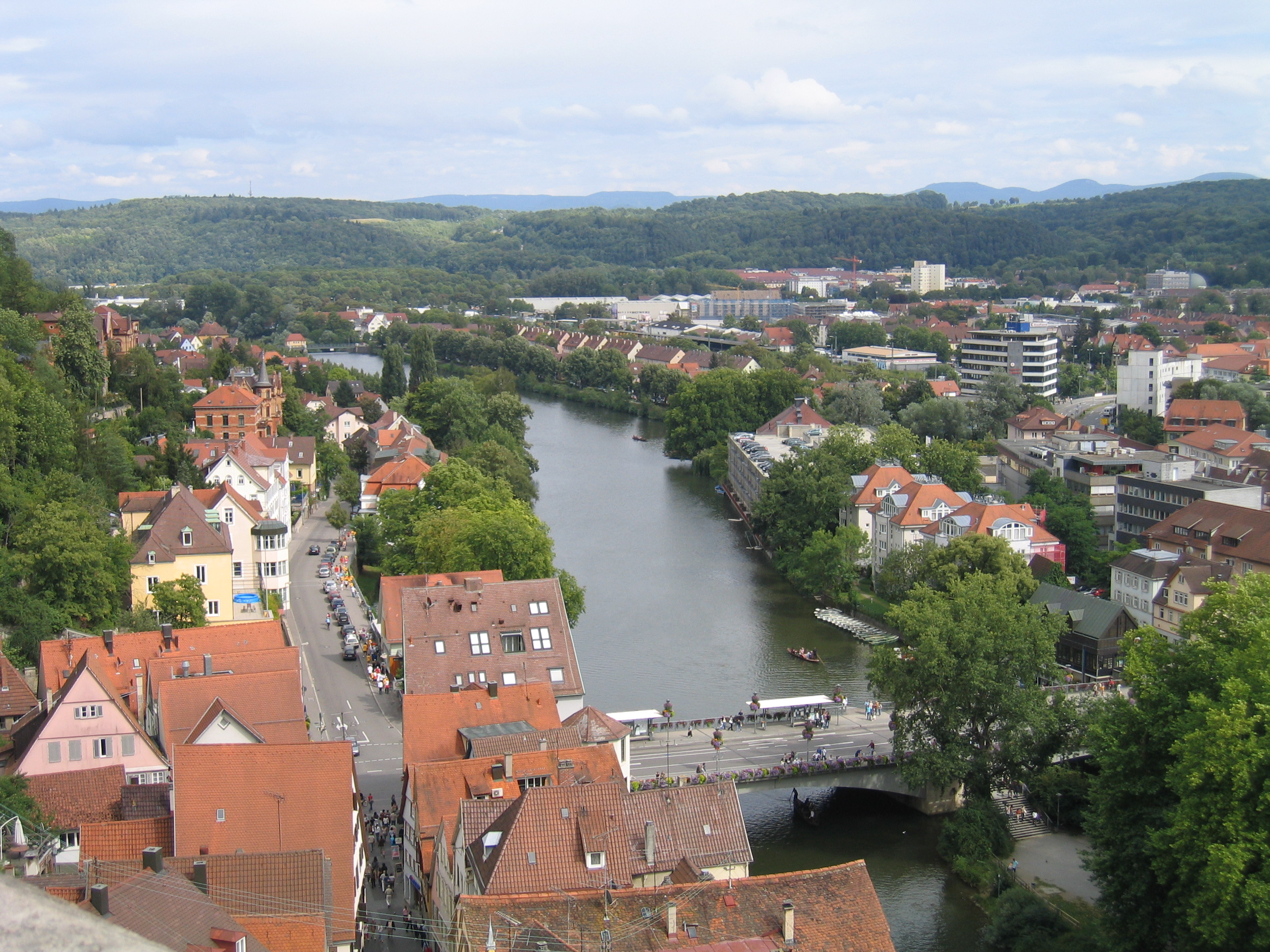
Tübingen (; ) is a traditional college town, university city in central Baden-Württemberg, Germany. It is situated south of the state capital, Stuttgart, and developed on both sides of the Neckar and Ammer (Neckar), Ammer rivers. about one in three of the 90,000 people living in Tübingen is a student. As of the 2018/2019 winter semester, 27,665 students attend the University of Tübingen, Eberhard Karl University of Tübingen. The city has the lowest median age in Germany, in part due to its status as a university city. As of December 31, 2015, the average age of a citizen of Tübingen is 39.1 years. Immediately north of the city lies the Schönbuch, a densely wooded nature park. The Swabian Alb mountains rise about (beeline Tübingen City to Roßberg - 869 m) to the southeast of Tübingen. The Ammer and Steinlach rivers are Tributary, tributaries of the Neckar river, which flows in an easterly direction through the city, just south of the Middle Ages, medieval old town. La ... [...More Info...] [...Related Items...] OR: [Wikipedia] [Google] [Baidu] |
Calw
Calw (; previously pronounced and sometimes spelled Kalb accordingly; ) is a Landstadt, town in the middle of Baden-Württemberg in the south of Germany, capital and largest town of the Calw (district), district Calw. It is located in the Northern Black Forest and is approximately south of Pforzheim and west of Stuttgart. It has the status of a ''große Kreisstadt.'' Geography Location Calw is located in the valley of the Nagold (river), Nagold in the Northern Black Forest at an altitude between above sea level. The historic centre lies west of the river. The newer parts of town have developed on the surrounding slopes. The following streams also exist within the town: the Tälesbach, Ziegelbach, Wurstbrunnenbach, Schießbach (Nagold), Schießbach, Schlittenbach und Schweinbach. In the northern part of the town, on the western slope of the Nagold valley is the cave known as the Bruderhöhle. Neighbouring Communities The following towns and communities (''Gemeinde (Germany), ... [...More Info...] [...Related Items...] OR: [Wikipedia] [Google] [Baidu] |


