|
Helmstedt
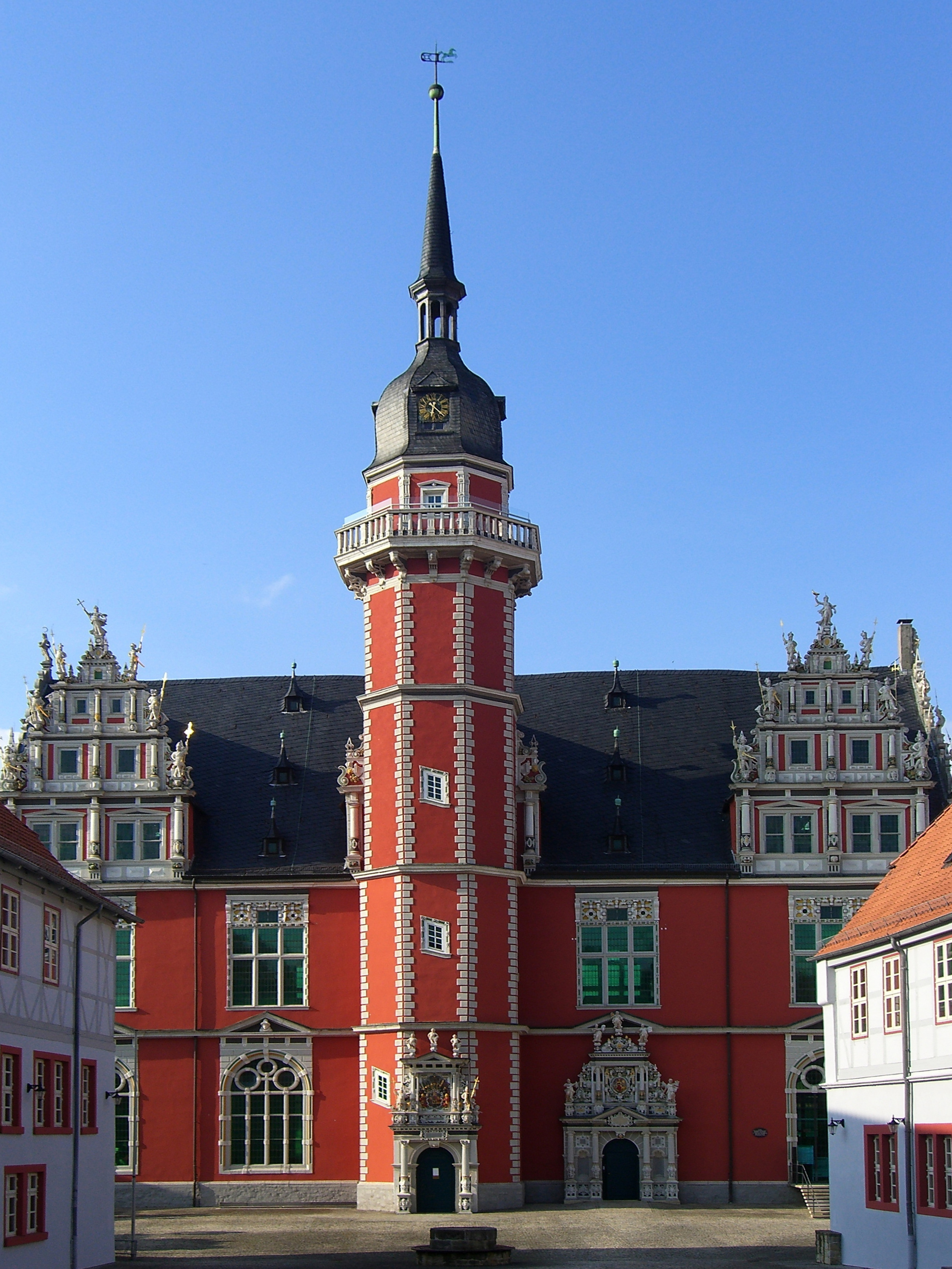
Helmstedt (; Eastphalian: ''Helmstidde'') is a town on the eastern edge of the German state of Lower Saxony. It is the capital of the District of Helmstedt. The historic university and Hanseatic city conserves an important monumental heritage of Romanesque and Renaissance buildings, as well as numerous timber framed houses. During the German partition the nearby Bundesautobahn 2 was the site of the Helmstedt–Marienborn border crossing, the most important on the former inner German border as starting point of the shortest land route between West Germany and West Berlin. Geography Helmstedt is situated in a basin between the Elm and Lappwald hill ranges, at the transition area between the northern foothills of the Harz mountains and the North German Plain. It is surrounded by the Elm-Lappwald Nature Park. The town centre is located about east of Braunschweig, west of Magdeburg, and east of the state capital Hanover. The municipal area includes the localities of Barmke ... [...More Info...] [...Related Items...] OR: [Wikipedia] [Google] [Baidu] |
University Of Helmstedt
The University of Helmstedt (; official Latin name: ''Academia Julia'', "Julius University") was a university in Helmstedt in the Duchy of Brunswick-Wolfenbüttel that existed from 1576 until 1810. History Founded by and named after Duke Julius of Brunswick-Wolfenbüttel on 15 October 1576, the first university of the duchy and the first Protestant university of the northern Holy Roman Empire quickly became one of the largest German universities. In order to train pastors and administrators for work in the Lutheran churches, the duchy needed a university of its own. In 1575, Julius obtained the Emperor's permission to open a university in Helmstedt. One year later the first lectures started. The princes of Wolfenbüttel held the office of the rector, starting with Julius' 12-year-old son John Henry. Tilemann Heshusius was an important early Lutheran theologian at Helmstedt. He developed a clergy network in the region that supported other Helmstedt professors, including Danie ... [...More Info...] [...Related Items...] OR: [Wikipedia] [Google] [Baidu] |
Helmstedt–Marienborn Border Crossing
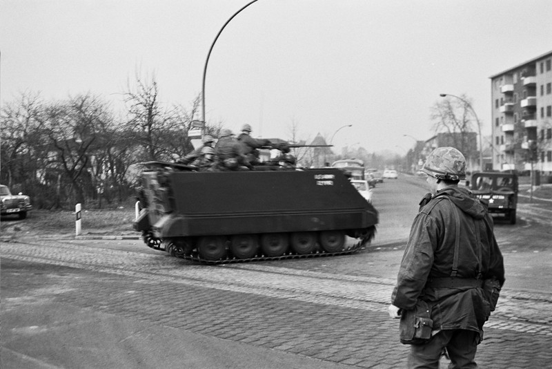
The Helmstedt–Marienborn border crossing (), named ''Grenzübergangsstelle Marienborn'' (GÜSt) (''border crossing Marienborn'') by the German Democratic Republic (GDR), was the largest and most important border crossing on the Inner German border during the division of Germany. Due to its geographical location, allowing for the shortest land route between West Germany and West Berlin, most transit traffic to and from West Berlin used the Helmstedt-Marienborn crossing. Most travel routes from West Germany to East Germany and Poland also used this crossing. The border crossing existed from 1945 to 1990 and was situated near the East German village of Marienborn at the edge of the Lappwald. The crossing interrupted the Bundesautobahn 2 (A 2) between the junctions ''Helmstedt-Ost'' and ''Ostingersleben''. History First checkpoints A checkpoint was established on the site on 1 July 1945, which was on the demarcation line between the British and Soviet occupation zones. ... [...More Info...] [...Related Items...] OR: [Wikipedia] [Google] [Baidu] |
Helmstedt (district)
Helmstedt is a district in Lower Saxony, Germany. It is bounded by (from the west and clockwise) the district of Wolfenbüttel, the City of Braunschweig, the District of Gifhorn, the City of Wolfsburg and the State of Saxony-Anhalt (districts of Börde and Harz). Geography The district is bounded by the Elm (a hill chain) in the west and the Lappwald (a riparian forest) in the east. Large parts of the district are part of the ''Elm-Lappwald Nature Park''. History In the Elm, limestone was mined in medieval times; limestone from the region was used for the tomb of Henry the Lion as well as for the imperial cathedral of Königslutter. In the Middle Ages, Königslutter was among the wealthiest cities of the Holy Roman Empire. In 1576, the University of Helmstedt was founded, which was the largest university of protestant Germany. The Duchy of Brunswick (deriving from Brunswick-Lüneburg) created administrative districts (''Kreise'') in 1833; the District of Helmstedt was one of t ... [...More Info...] [...Related Items...] OR: [Wikipedia] [Google] [Baidu] |
Elm-Lappwald Nature Park
The Elm-Lappwald Nature Park () is a nature park in southwest Lower Saxony, east of Brunswick in central Germany. It is dominated by the forested hill ranges of the Elm, Lappwald and Dorm as well as the region known as the Helmstedt Bowl (''Helmstedter Mulde''). Geography Location The nature park has an area of about and lies within the districts of Helmstedt and Wolfenbüttel. It is bordered to the west by the city of Brunswick and to the north by Wolfsburg. The A 2 motorway from Hanover to Berlin cuts through the northern part of the park. Within the nature park are the following hill ranges, landscapes and forests: * Elm * Lappwald * Dorm *Elz *Eiz * Helmstedt Bowl * Rieseberg and Rieseberg Moor *Kampstüh Forest near Lehre From a landscape point of view the nature park belongs to the Eastphalian Uplands. It is located between the highlands of the Harz to the south and the Lüneburg Heath on the North German Plain to the north. Climatically the park lies in t ... [...More Info...] [...Related Items...] OR: [Wikipedia] [Google] [Baidu] |
Lappwald
The Lappwald is a heavily wooded range of hills, 20 km long and up to 5 km wide, in central Germany. It stretches northwards from the town of Helmstedt. The border between Lower Saxony and Saxony-Anhalt runs through the woods, of which about three quarters is on Lower Saxon terrain. The Lappwald is part of the Elm-Lappwald Nature Park. Location The Lappwald runs from north-west to south-east parallel to the Elm hills, which lie about 10 km further west. The forests of the Lappwald are almost entirely uninhabited. The only settlements are the Helmstedt hamlet of Bad Helmstedt and the Harbke sector of ''Autobahn'' in the south, and the installations of the old airbase of Mariental in the north. History The first records describe the Lappwald as the ''Lapvualt'' in the year 1147.Hans-Ehrhard Müller: ''Helmstedt - die Geschichte einer deutschen Stadt'', 2. Aufl. 2004, S. 184 There is no clear derivation for the name "Lappwald". The most likely theory is t ... [...More Info...] [...Related Items...] OR: [Wikipedia] [Google] [Baidu] |
Inner German Border
The inner German border ( or ''deutsch–deutsche Grenze''; initially also , zonal boundary) was the frontier between the East Germany, German Democratic Republic (GDR, East Germany) and the West Germany, Federal Republic of Germany (FRG, West Germany) from 1949 to 1990. ''De jure'' not including the similar but physically separate Berlin Wall, the border was an irregular L-shaped line, long. It ran south from the Baltic Sea and then east to the border of Protection of Czechoslovak borders during the Cold War, Czechoslovakia. It was formally established by the Potsdam Agreement on 1 August 1945 as the boundary between the Allied-occupied Germany, Western and Soviet occupation zones of Germany. On the Eastern side, it was made one of the world's most heavily fortified frontiers, defined by a continuous line of high metal fences and walls, barbed wire, alarms, anti-vehicle ditches, watchtowers, automatic booby traps and minefields. It was patrolled by 50,000 armed GDR borde ... [...More Info...] [...Related Items...] OR: [Wikipedia] [Google] [Baidu] |
Lower Saxony
Lower Saxony is a States of Germany, German state (') in Northern Germany, northwestern Germany. It is the second-largest state by land area, with , and fourth-largest in population (8 million in 2021) among the 16 ' of the Germany, Federal Republic of Germany. In rural areas, Northern Low Saxon and Saterland Frisian language, Saterland Frisian are still spoken, though by declining numbers of people. Lower Saxony borders on (from north and clockwise) the North Sea, the states of Schleswig-Holstein, Hamburg, , Brandenburg, Saxony-Anhalt, Thuringia, Hesse and North Rhine-Westphalia, and the Netherlands. Furthermore, the Bremen (state), state of Bremen forms two enclaves within Lower Saxony, one being the city of Bremen, the other its seaport, Bremerhaven (which is a semi-exclave, as it has a coastline). Lower Saxony thus borders more neighbours than any other single '. The state's largest cities are the state capital Hanover, Braunschweig (Brunswick), Oldenburg (city), Oldenburg, ... [...More Info...] [...Related Items...] OR: [Wikipedia] [Google] [Baidu] |
Bundesautobahn 2
is an autobahn in Germany that connects the Ruhr area in the west to Berlin in the east. The A 2 starts at the junction with the Bundesautobahn 3, A3 near the western city of Oberhausen, passes through the north of the Ruhr valley, through the Münsterland and into Ostwestfalen, crossing the former inner German border and continuing through the Magdeburger Börde to merge into the Berliner Ring shortly before reaching Berlin. Major cities such as Magdeburg, Braunschweig, Hannover and Dortmund are situated very close to the A 2. The A 2 is one of the most important autobahns, connecting several large industrial areas with each other. The A 2 was modified in the late 1990s, and completely rebuilt in the former East Germany. All of the A 2 has 3 travel lanes and a hard shoulder, breakdown lane in each direction. History The highway was planned between September 1933 and December 1934 by the construction departments of the company Reichsautobahn in Düsseld ... [...More Info...] [...Related Items...] OR: [Wikipedia] [Google] [Baidu] |
Büddenstedt
Büddenstedt is a former municipality in the district of Helmstedt, in Lower Saxony, Germany. It is situated approximately 6 km (4 miles) south of the town of Helmstedt Helmstedt (; Eastphalian: ''Helmstidde'') is a town on the eastern edge of the German state of Lower Saxony. It is the capital of the District of Helmstedt. The historic university and Hanseatic city conserves an important monumental heritage o ... into which it was incorporated on 1 July 2017 as a quarter. History Büddenstedt was formed 1 March 1974 by combining the municipalities Neu Büddenstedt, Offleben, and Reinsdorf/Hohnsleben. Neu Büddenstedt was settled in 1935 between a prior municipality named Büddenstedt and Wulfersdorf, both of which were slated for demolition due to coal mining. The previous Büddensted was finally fully evacuated in 1947 while Neu Büddensted became a municipality in 1950. Neu Büddenstedt Ortsschild.JPG, Büddenstedt Neu Büddenstedt Kirche ev.JPG, The Lutheran chu ... [...More Info...] [...Related Items...] OR: [Wikipedia] [Google] [Baidu] |
Renaissance Architecture
Renaissance architecture is the European architecture of the period between the early 15th and early 16th centuries in different regions, demonstrating a conscious revival and development of certain elements of Ancient Greece, ancient Greek and Ancient Rome, Roman thought and material culture. Stylistically, Renaissance architecture followed Gothic architecture and was succeeded by Baroque architecture and neoclassical architecture. Developed first in Florence, with Filippo Brunelleschi as one of its innovators, the Renaissance style quickly spread to other Italian cities. The style was carried to other parts of Europe at different dates and with varying degrees of impact. It began in Florence in the early 15th century and reflected a revival of classical Greek and Roman principles such as symmetry, proportion, and geometry. This movement was supported by wealthy patrons, including the Medici family and the Catholic Church, who commissioned works to display both religious devot ... [...More Info...] [...Related Items...] OR: [Wikipedia] [Google] [Baidu] |
West Berlin
West Berlin ( or , ) was a political enclave which comprised the western part of Berlin from 1948 until 1990, during the Cold War. Although West Berlin lacked any sovereignty and was under military occupation until German reunification in 1990, the territory was claimed by the West Germany, Federal Republic of Germany (FRG or West Germany), despite being entirely surrounded by the East Germany, German Democratic Republic (GDR or East Germany). The legality of this claim was contested by the Soviet Union and other Eastern Bloc countries. However, West Berlin de facto aligned itself politically with the FRG from May 1949 and was thereafter treated as a ''de facto'' city-state of that country. After 1949, it was directly or indirectly represented in the institutions of the FRG, and most of its residents were citizens of the FRG. West Berlin was formally controlled by the Western Allies and entirely surrounded by East Berlin and East Germany. West Berlin had great symbolic signi ... [...More Info...] [...Related Items...] OR: [Wikipedia] [Google] [Baidu] |
Duchy Of Saxony
The Duchy of Saxony () was originally the area settled by the Saxons in the late Early Middle Ages, when they were subdued by Charlemagne during the Saxon Wars from 772 CE and incorporated into the Carolingian Empire (Francia) by 804. Upon the 843 Treaty of Verdun, Saxony was one of the five German stem duchies of East Francia; Duke Henry the Fowler was elected List of German monarchs, German king in 919. Upon the deposition of the House of Welf, Welf duke Henry the Lion in 1180, the ducal title fell to the House of Ascania, while numerous territories split from Saxony, such as the Principality of Anhalt in 1218 and the Welf Duchy of Brunswick-Lüneburg in 1235. In 1296, the remaining lands were divided between the Ascanian dukes of Saxe-Lauenburg and Duchy of Saxe-Wittenberg, Saxe-Wittenberg, the latter obtaining the title of Electorate of Saxony, Electors of Saxony by the Golden Bull of 1356. Geography The Saxon stem duchy covered the greater part of present-day Northern Germ ... [...More Info...] [...Related Items...] OR: [Wikipedia] [Google] [Baidu] |


