|
Hazara Tribal Agency
During colonial rule, agencies were administrative sub-divisions of British India. The Hazara Tribal Agency was one of these. Hazara The Hazara region was split into the following four parts: # Hazara Division (Abbottabad and Mansehra) # Hazara Tribal Area (Battagram and Torghar District, A area under tribal Swati Khans) # Kohistan Tribal Area # Princely State of Amb The northernmost part was the Kohistan Tribal Area, whilst the southernmost part was the Hazara Division. Hazara Tribal Agency was located between the Hazara Division and the Kohistan Tribal Area. Location The Hazara Tribal Area, was located in the northwest of British India, it bordered the following areas. # Kohistan Tribal Area (to the northwest) # Gilgit Agency (to the North and North East) # Hazara Division (to the south) # Amb (to the south east) The Hazara Division lay along the route to Kashmir and Punjab. The State of Amb formed an enclave An enclave is a territory that is entirely surrounded ... [...More Info...] [...Related Items...] OR: [Wikipedia] [Google] [Baidu] |
Hazara
Hazara may refer to: Places and ethnic groups Afghanistan * Hazaras, an ethnic group and a principal component of the population of Afghanistan ** Hazarajat, or Hazaristan, a historic region of Afghanistan ** List of Hazara tribes Pakistan * Hazara region in northern Pakistan, administratively in Hazara Division of the Khyber Pakhtunkhwa province ** Hazarewal, the multi-ethnic community inhabitants of the Hazara region ** Hazara Division, of the Khyber Pakhtunkhwa province ** Hazara District, a former district of Peshawar Division in the North-West Frontier Province ** Hazara University * Hazara, Swat, Khyber Pakhtunkhwa * Hazara Town, Quetta, Balochistan * Takht Hazara, a village in Punjab India * Hazara, Punjab * Hazara, Sultanpur Lodhi, Punjab People with the name * List of Hazara people * Abdul Khaliq Hazara (assassin) (1916–1933), assassinated the King of Afghanistan in 1933 * Abdul Khaliq Hazara (politician) (fl. from 2010), Pakistani politician * Haji Sayed Hussai ... [...More Info...] [...Related Items...] OR: [Wikipedia] [Google] [Baidu] |
British India
The provinces of India, earlier presidencies of British India and still earlier, presidency towns, were the administrative divisions of British governance in South Asia. Collectively, they have been called British India. In one form or another, they existed between 1612 and 1947, conventionally divided into three historical periods: *Between 1612 and 1757, the East India Company set up "factories" (trading posts) in several locations, mostly in coastal India, with the consent of the Mughal emperors, Maratha Empire or local rulers. Its rivals were the merchant trading companies of Portugal, Denmark, the Netherlands, and France. By the mid-18th century three ''Presidency towns'': Madras, Bombay and Calcutta, had grown in size. *During the period of Company rule in India, 1757–1858, the Company gradually acquired sovereignty over large parts of India, now called "Presidencies". However, it also increasingly came under British government oversight, in effect sharing sovereig ... [...More Info...] [...Related Items...] OR: [Wikipedia] [Google] [Baidu] |
Hazara Region
Hazara (Hindko: هزاره; Urdu: ), historically known as Pakhli, is a region in northern Pakistan, falling administratively within the Hazara Division of the Khyber Pakhtunkhwa province. It forms the northernmost portion of Sindh Sagar Doab, and is mainly populated by the indigenous Hindko-speaking Hindkowans and Kohistani people, with a significant Pashto-speaking population. The inhabitants of Hazara are collectively called the Hazarewal. Etymology The origin of the name Hazara has been identified with Abisāra, the country of Abisares, the monarch of the region at the time of Alexander's invasion. The British archaeologist Aurel Stein regards it as derived from the Sanskrit name Urasā, or 'Urasha'. However, the region only came to be known as Hazara after Timur held control of it in 1399, and assigned it to his local chieftains, namely the Hazara-i-Karlugh. History Ancient period Alexander the Great, after conquering parts of northern Punjab, established his rule ... [...More Info...] [...Related Items...] OR: [Wikipedia] [Google] [Baidu] |
Hazara Division
Hazara Division is an administrative Divisions of Pakistan, division of the Khyber Pakhtunkhwa province of Pakistan. It is located along the Indus River and comprises eight districts: Abbottabad District, Abbottabad, Mansehra District, Mansehra, Haripur District, Haripur, Battagram District, Battagram, Upper Kohistan District, Upper Kohistan, Kolai-Palas District, Kolai-Palas, Lower Kohistan District, Lower Kohistan, Torghar District, Torghar and most recently created Allai District. Location Hazara Division is bordered by Malakand Division, Malakand and Mardan Division, Mardan Divisions to the west, Rawalpindi Division (Punjab, Pakistan, Punjab) and Islamabad Capital Territory to the south, Azad Kashmir to the east, and Gilgit-Baltistan to the north. History On the dissolution of One Unit Scheme, West Pakistan in 1970, Hazara District and the two tribal agencies were merged to form the new Hazara Division with its capital at Abbottabad. The division was initially composed ... [...More Info...] [...Related Items...] OR: [Wikipedia] [Google] [Baidu] |
Amb (princely State)
Amb () or the State of Amb was a princely state in the present-day Khyber Pakhtunkhwa region of Pakistan. Together with Phulra, it was known as Jagir, Feudal Tanawal ruled by Tanoli tribe. A Ruling class, Royal Tenure start from Timurid Empire and end on Last Muhammad Farid Khan, Nawab Muhammad Farid Khan Tanoli. Amb was only powerful state incorporated in Pakistan with armed civilized military of 12,000 men, 300 Howitzer with their own manufacturing arms factory, today part of the Pakistan Army.Syed Murad Ali,"Tarikh-e-Tanawaliyan"(Urdu), Pub. Lahore, 1975, pp.84Ghulam Nabi Khan"Alafghan Tanoli"(Urdu), Pub. Rawalpindi, 2001, pp.244 Amb had a influence control roots in Swat (princely state), Swat, Dir (princely state), Dir and Chitral (princely state), Chitral. A gaining of powerful roots of Amb military start from Second Anglo-Sikh War when East India Company provide military equipment to Mir Jehandad Khan, Jehandad Khan Tanoli to fight against Sikh, and then next British Empire ... [...More Info...] [...Related Items...] OR: [Wikipedia] [Google] [Baidu] |
Gilgit Agency
The Gilgit Agency () was an agency within the British Indian Empire. It encompassed Hunza, Nagar and the governorships of Yasin, Koh Ghizer, Ishkoman, Punial and the tribal areas of Gor, Darel, Tangir, the district of Chilas and the Gilgit tehsil of the princely state of Jammu and Kashmir.The primary objective of establishing the Gilgit Agency was to bolster and fortify these regions, particularly in the context of concerns about Russian encroachment in the area. The agency headquarters was based in the town of Gilgit, within the Gilgit tehsil of Jammu and Kashmir. Gilgit Agency was bounded in the west by the Chitral State, in the northwest by Afghanistan's Wakhan corridor, in the east by Chinese Turkestan, in the south by the Kashmir province, and in the southeast by the Ladakh ''wazarat'' of Jammu and Kashmir (which included Baltistan). An Officer on Special Duty was established in 1877 in the town of Gilgit till 1882 to monitor the Baroghil and Ishkoman passes. After ... [...More Info...] [...Related Items...] OR: [Wikipedia] [Google] [Baidu] |
Kashmir
Kashmir ( or ) is the Northwestern Indian subcontinent, northernmost geographical region of the Indian subcontinent. Until the mid-19th century, the term ''Kashmir'' denoted only the Kashmir Valley between the Great Himalayas and the Pir Panjal Range. The term has since also come to encompass a larger area that includes the Indian-administered territories of Jammu and Kashmir (union territory), Jammu and Kashmir and Ladakh, the Pakistani-administered territories of Azad Kashmir and Gilgit-Baltistan, and the Chinese-administered territories of Aksai Chin and the Trans-Karakoram Tract. Quote: "Kashmir, region of the northwestern Indian subcontinent. It is bounded by the Uygur Autonomous Region of Xinjiang to the northeast and the Tibet Autonomous Region to the east (both parts of China), by the Indian states of Himachal Pradesh and Punjab to the south, by Pakistan to the west, and by Afghanistan to the northwest. The northern and western portions are administered by Pakistan a ... [...More Info...] [...Related Items...] OR: [Wikipedia] [Google] [Baidu] |
Punjab (British India)
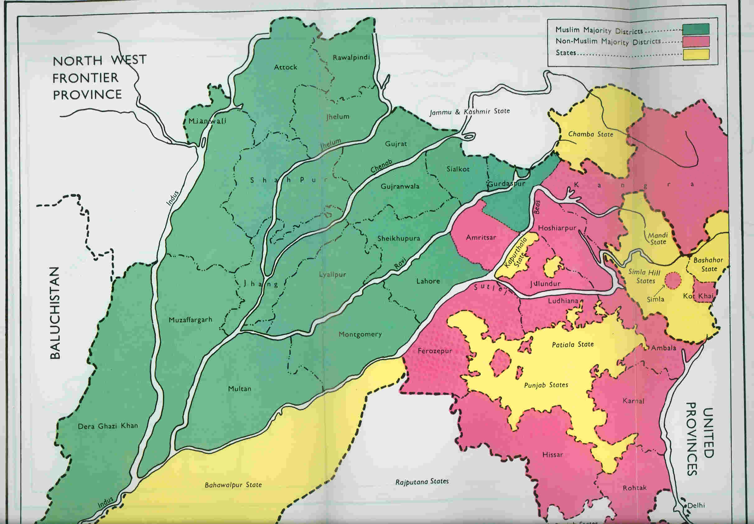
The Punjab Province, officially the Province of the Punjab, was a province of British India, with its capital in Lahore and summer capitals in Murree and Simla. At its greatest extent, it stretched from the Khyber Pass to Delhi; and from the Babusar Pass and the borders of Tibet to the borders of Sind. Established in 1849 following Punjab's annexation, the province was partitioned in 1947 into West and East Punjab; and incorporated into Pakistan and India, respectively. Most of the Punjab region was annexed by the East India Company on 29 March 1849 following the company's victory at the battle of Gujrat in northern Punjab, a month prior. The Punjab was the last major region of the Indian subcontinent to fall to British imperialism. Immediately following its annexation, the Punjab was annexed into the Bengal Presidency and administered separately by a board of administration led by the head of province. After 1853, the board was replaced by a chief commissioner a ... [...More Info...] [...Related Items...] OR: [Wikipedia] [Google] [Baidu] |
Enclave
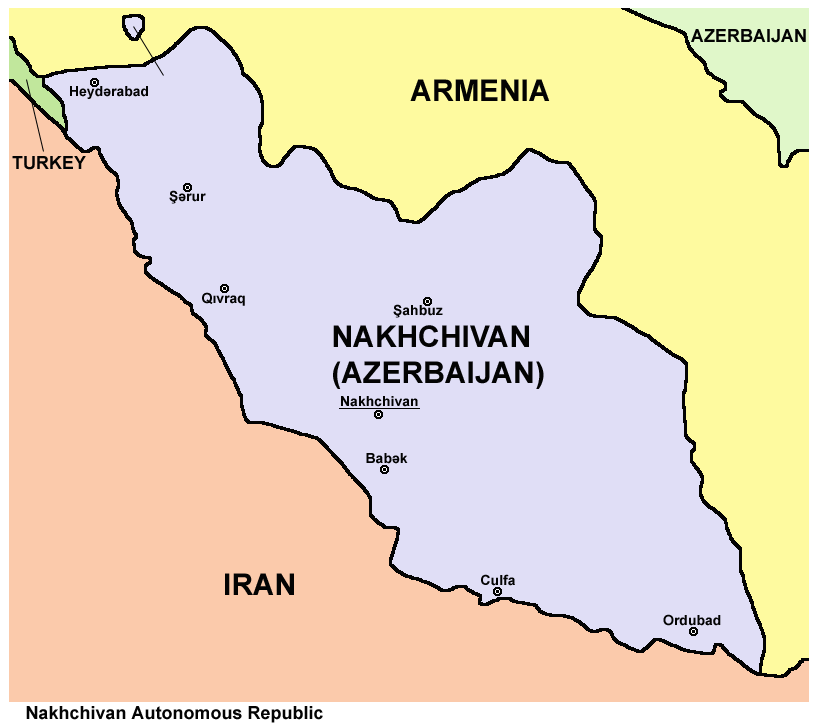
An enclave is a territory that is entirely surrounded by the territory of only one other state or entity. An enclave can be an independent territory or part of a larger one. Enclaves may also exist within territorial waters. ''Enclave'' is sometimes used improperly to denote a territory that is only partly surrounded by another state. Enclaves that are not part of a larger territory are not exclaves, for example Lesotho (enclaved by South Africa), and San Marino and Vatican City (both enclaved by Italy) are enclaved sovereign states. An exclave is a portion of a state or district geographically separated from the main part, by some surrounding alien territory. Many exclaves are also enclaves, but an exclave surrounded by the territory of more than one state is not an enclave. The Azerbaijani exclave of Nakhchivan is an example of an exclave that is not an enclave, as it borders Armenia, Iran, and Turkey. Semi-enclaves and semi-exclaves are areas that, except for possessing ... [...More Info...] [...Related Items...] OR: [Wikipedia] [Google] [Baidu] |


